State ID: CA
3 letter designator: KRN
Fire name: Rancho
Location: Comanche rd & west of horsethief mtn
Reported acres:2600
Rate of spread: moderate
Report on Conditions:
Structure threat: yes
Resources:
Hazards:
Weather:
Radio channels:
Scanner link:
Webcam link:
Agency Website:
3 Likes
3:48am
The fire is now 5500 acres w/0% containment & moderate rate of spread per Incident Command.
5 Likes
KRN-Rancho extended frequencies assigned:
Air Tactics FM: 164.0125
Air/Ground: 159.390 t192.8 (CDF A/G 11)
AM Victors: 127.225, 133.025
4 Likes
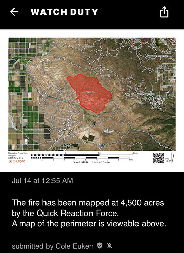
The fire has been mapped at 9,590 acres by FIRIS Intel 24. Their perimeter can be viewed on the Watch Duty map.
6 Likes
Combine update from IMT1
3 Likes
Up to 9,950 acres and 98% contained, with 4 crews and 120 folks total on it per this evening’s update
4 Likes
Still at 9,950 acres, but fully contained
https://www.fire.ca.gov/incidents/2024/7/13/rancho-fire/updates/1bfbdf3e-7e6a-41ee-82d7-a7307b0bd6cb
4 Likes
