State ID: CA
3 letter designator: LAC
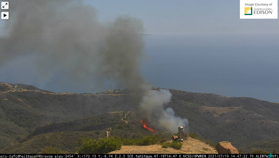
Fire name: Flores
Location: Tuna Canyon Road x Las Flores Heights Road; Topanga, CA
Reported acres: 5
Rate of spread: moderate
Report on Conditions: large flames and big header seen on webcam. LA County copter reports 3-5 acres running in medium fuels.
Structure threat: yes
Resources: LAC 2nd alarm, AA12, T01, T72, T131
Hazards: difficult access
Weather:
Radio channels:
Scanner link: Los Angeles County Fire - Blue 12 and V-5 Live Audio Feed
Webcam link: Helibase 69 Bravo
Saddle Peak 2
Green Peak South
Live video: https://abc7.com/watch/23340/
https://ktla.com/news/local-news/firefighters-battling-brush-fire-threatening-structures-in-topanga/
Agency Website:
4 Likes
2nd alarm started for this incident.
3 Likes
A post was merged into an existing topic: CA-LAC-Flores???
At time of dispatch I looked out and could see the fire 20 miles away. Very heavy fuels in this area.
3 Likes
2 Likes
LA County has a Firehawk working it now
1 Like
69 Bravo is very close by. Helicopter turn around should be very fast. It can support 4 copters easily.
3 Likes
Live video: https://ktla.com/news/local-news/firefighters-battling-brush-fire-threatening-structures-in-topanga/
1 Like
3 Likes
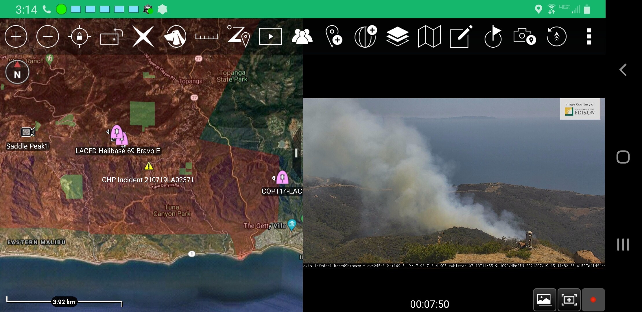
Maps for discussion and area orientation. Not for tactical decision making.
2 Likes
Tanker 131 (Fox) and Tanker 72 (Hemet) inbound and couldn’t catch the Air Attack…
4 Likes
Holding at 20 acres per AA.
4 Likes
It is most likely air attack 12 out of San Bernadino.
2 Likes