Approx. 140 acres now.
4 Likes
3 Likes
V-2 just went offline, Los Angeles County Sheriff, Fire and Aircraft - Santa Clarita Valley Live Audio Feed also has traffic for the incident.
Edit: V-2 is back online as of 16:38.
3 Likes
276 acres according to FIRIS
5 Likes
NBC4 ended feed, any others live currently?
1 Like
KTLA 5 has one: https://ktla.com/news/local-news/fast-moving-hawk-fire-erupts-in-angeles-national-forest-threatening-structures/
and @anvilhead posted one a while back
3 Likes
Thanks, Anvils was NBC4.
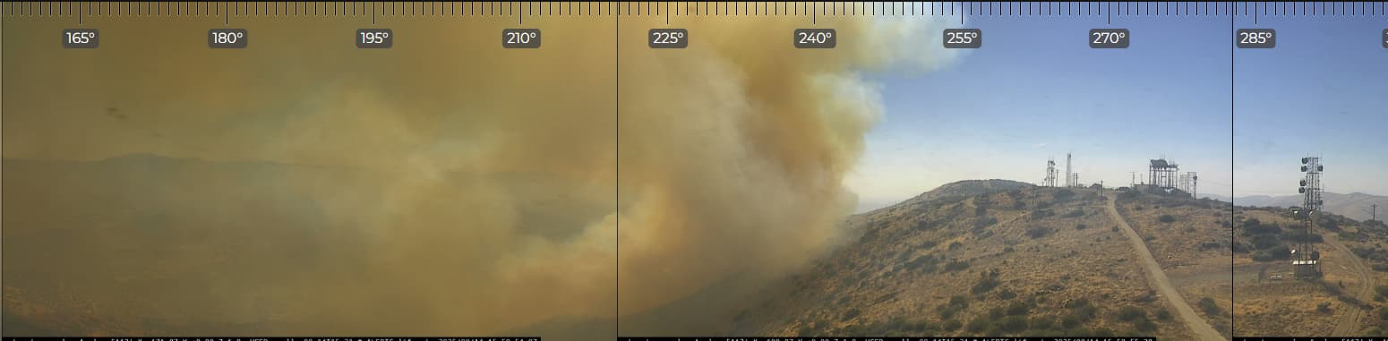
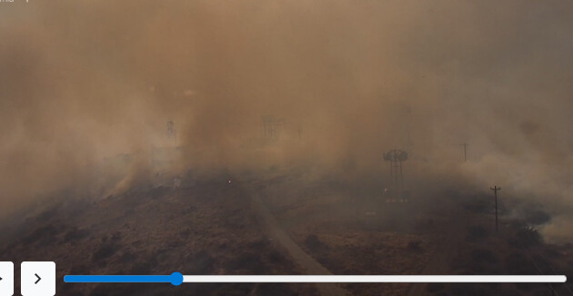
KTLA showing radio site took a hammering
4 Likes
You’re welcome. I believe ABC 7 and KCAL 9 are also over the fire, although I am unsure if they have a separate stream for the fire.
4 Likes
Here’s a quick and dirty fire history of the areal, inspired by @pyrogeography: (Do not use for tactics; I am not involved in the fire service in any way)
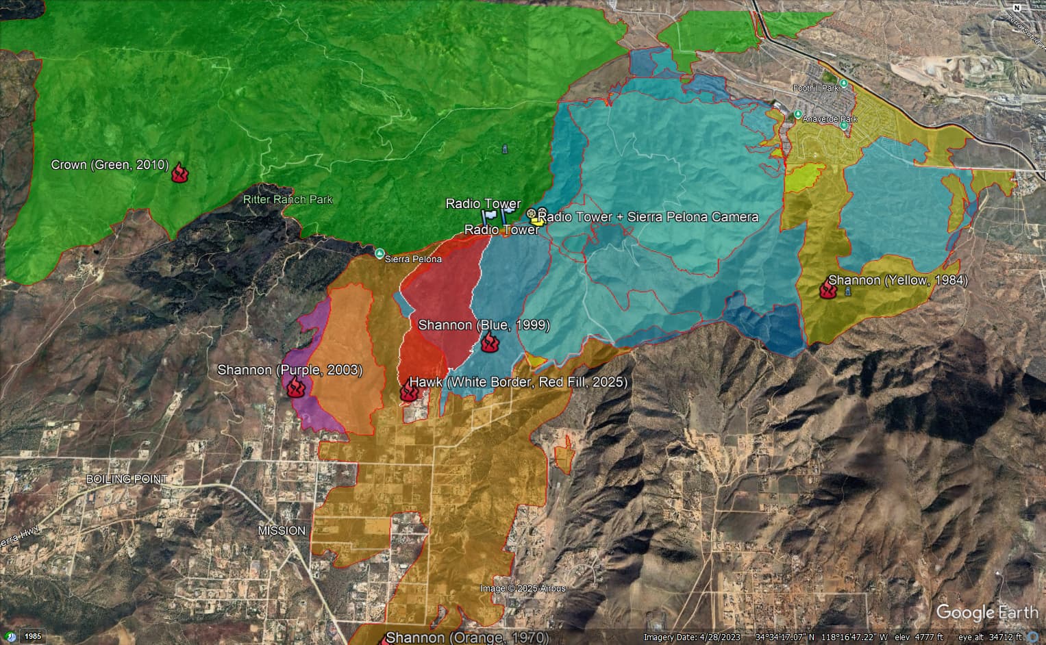
History is back to 1970, with a fire occurring around once a decade in the area. (I guess the ICP for most of these fires is along Shannon Valley Rd.)
4 Likes
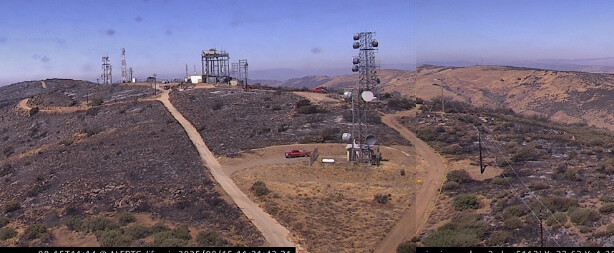
Per LAC BC47, all radio towers survived. Great news!
6 Likes
Anyone hear what units are filling the strike team orders?
3 Likes
I’ve heard 9421C & 9351C check in and 9370C is on scene.
LAC put 1103A units in the SCV as fill ins.
6 Likes
MMU must have been south already for some time.
4 Likes
3 Charlies have been out for a week or better
Also 2 Golfs and a Lima
4 Likes
Straight from the King incident.
Canyon incident prior.
Also covering SLU before that.
40 acre slop over the ridge in Div M priority, Div A checked up in retardant, Div Z planning hoselay.
Approximately 400 acres per AA
7 Likes
Emergency Demob from Gifford. Not sure if headed that way
5 Likes
Coulson QRF will fly tonight with HELCO.
5 Likes
Forward progress stopped at 2030.
9 Likes
Great news. Many in its path can begin to be relived.
3 Likes