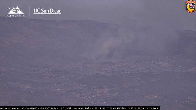
New start showing near 35900 Trenmar Drive in Acton
3 Likes
1.5 acres with structures threatened. Moderate rate of spread. Wildcad has it as Hawk Incident.
5 Likes
3 acres, light fuels, moderate rate of spread, with some structures threatened, per radio traffic.
Now 5 acres, mod to rapid ROS, winds are around 10 mph, with 15 mph gusts.
5 Likes
So because I’m not real familiar with the area, what are the chances of this impacting the 14?
2 Likes
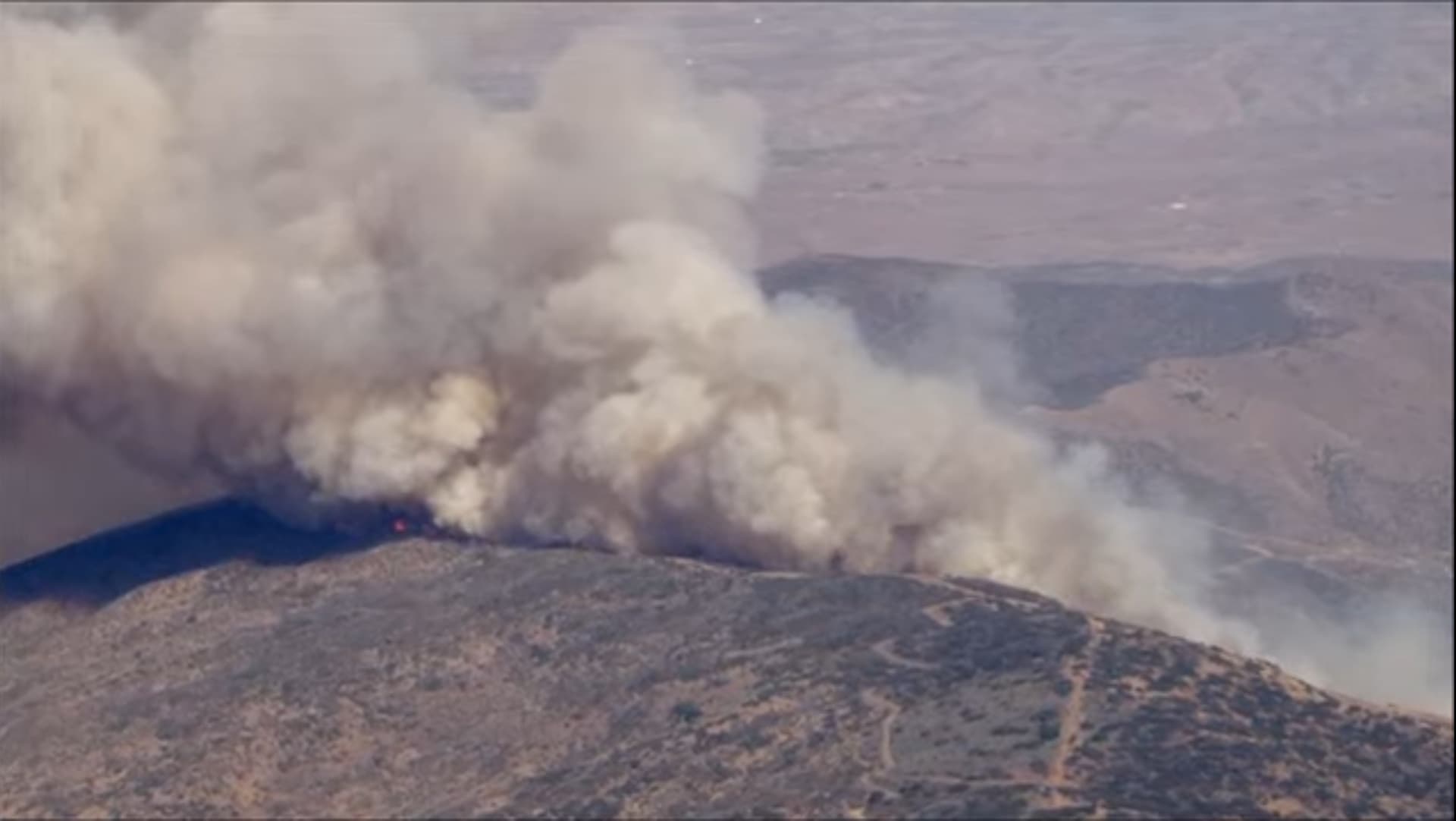
I believe it is burning upslope and away from the 14 at the moment. In @anvilhead’s above post, the 14 is out of view below the bottom of the frame.
5 Likes
Will want to run to the ridge and be driven by the onshore winds on the Palmdale side. Shouldn’t go towards the 14.
Maybe way out towards the east if the fire makes it there. I don’t think there’s been a big fire in this area for awhile. Last big fire should be the Crown fire in 2010
6 Likes
Updated acreage of 30 to 35 acres, with a second alarm.
Now 40 to 50 acres, with a potential for additional 100 acres in next 45 minutes.
2 Likes
Hawk AA requesting 2 LAT’s and 2 S2’s with lead plane.
Additionally, closest 2 T1 helicopters
4 Likes
Updated acreage is 80 acres, still with potential for 100.
4 Likes
LAFD has deployed:
- One Type 2 Helicopter: Fire 5
- One Type 1 Helitanker: 5HX (Seasonal Contract / Helicopter Express nee Erickson)
4 Likes
VCFD copter 5 assigned as well
4 Likes
Sierra Pelona cam looks to be in direct alignment
6 Likes
Tileset:
3 Likes
Mountain McDill camera shows the fire is almost at the ridge.
3 Likes
Anyone know the comm plan? Or broadcasify link ? Thanks!
1 Like
broadcastify:
4 Likes
8 Likes
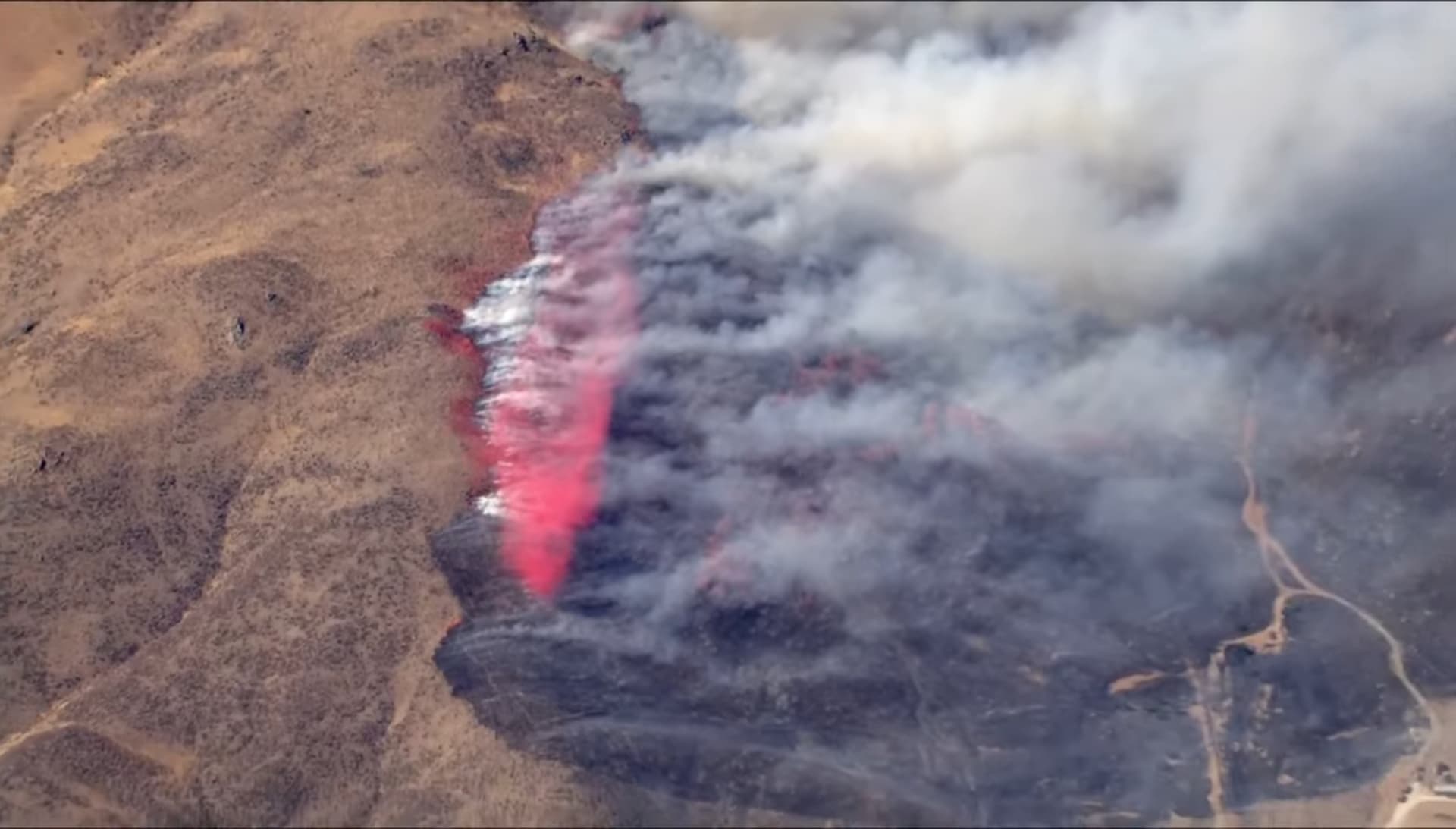
The wind shear on the column is impressive.
5 Likes