Glad it was helpful, thanks.
Calls are now being made for hired vendor resources. Conversing with the Sacramento command center caller, they’re trying to fill the 209 needs.
Hate to be that guy but is there an IAP available? Asking for a friend
I have not seen one yet, although there is now posted IAPs for other incidents. Keep the faith and patience, we should see one soon
Thank you everyone for your patience. The IAP and Maps are now posted. Here is the link to the current documents
TAK data package posted for the palisades for 010925 at http://maps.takserver.us
Is this technically a local jurisdiction fire? Or was it on state or fed land? If it’s local there on the hook for all the resources correct?
Don’t have the DPA map in front of me but it is a mix of jurisdictions i believe. Local and State protected lands. I am sure it will be cost apportionment with FMAG and Federal disaster Declaration mixed in with available reimbursement
Update from OPS…crew are experiencing extreme fire behavior with 60 mph gusts on the east side of the fire. Fire has made its way into Sullivan Canyon and they are sending resources in the Mandeville area
Fire is backing into the 500 block of Topanga Canyon and in only 1/4 mile from impacting the Topanga Lumber and Hardware CO. This is on the NE side of the fire
Thank you I didn’t think there was going to be one at the time but some other friends in fire wanted me to ask anyways (I do see the current one thank you again)
Live coverage on the news stations shows it blowing up on the east side of the fire. Winds on the live shot do not look to terrible at this time. Gusty for sure but not in the 50’s or 60’s
New Lookout Livestream is up with satellite imagery of destruction in Altadena, and a summary of yesterday’s fire activity.
https://www.youtube.com/live/4IvFMi_5VUs?si=nEZmGImpZ3FRxpcQ
The fire started in the LRA area of Los Angeles(LFD). It is currently burning in a majority of State Parks Land and State Responsibility Area. The fire is well over 65% in the SRA when you combine State Parks and SRA.
Morning Dozer Keith,
Thanks for the link to the IAP report for 1/9/24,
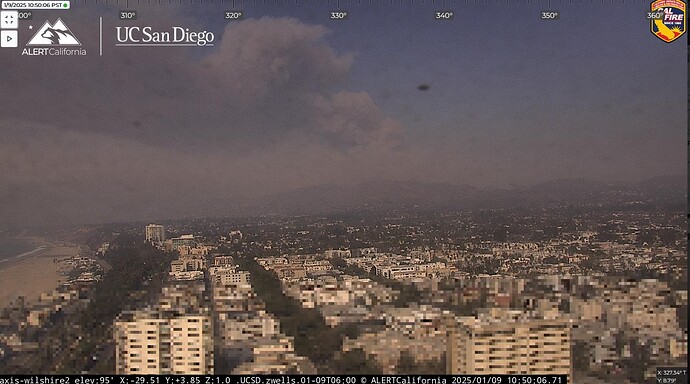
Not too many choices when it comes to cams for the east side of the fire that is extremely active. This is about the only look…
Yeah, it’s really picking up.
Wind is currently ripping through Calabasas, Agoura, oak park. I’d say about 35-40mph.
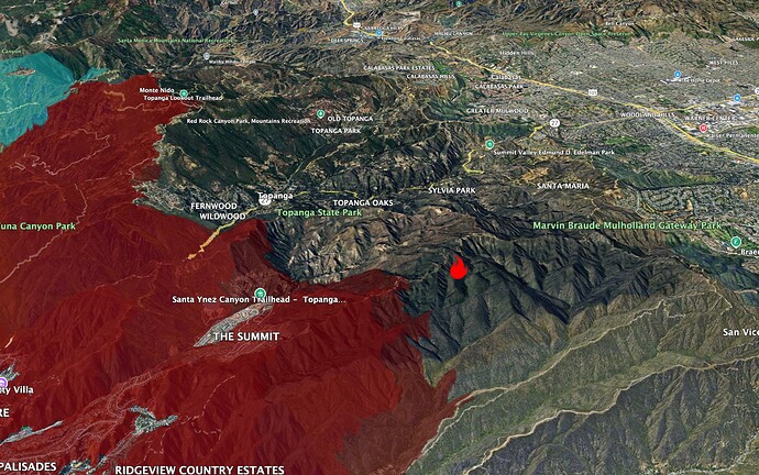
Webcam crosses put the biggest smoke on Palisades webcams about here (flame icon)
Red shading is last night’s FIRIS flight, about 2300.
Tanker 914 just lifted off from San Bernardino base headed west. unknown which fire its headed to

