New perimeter

5 Likes
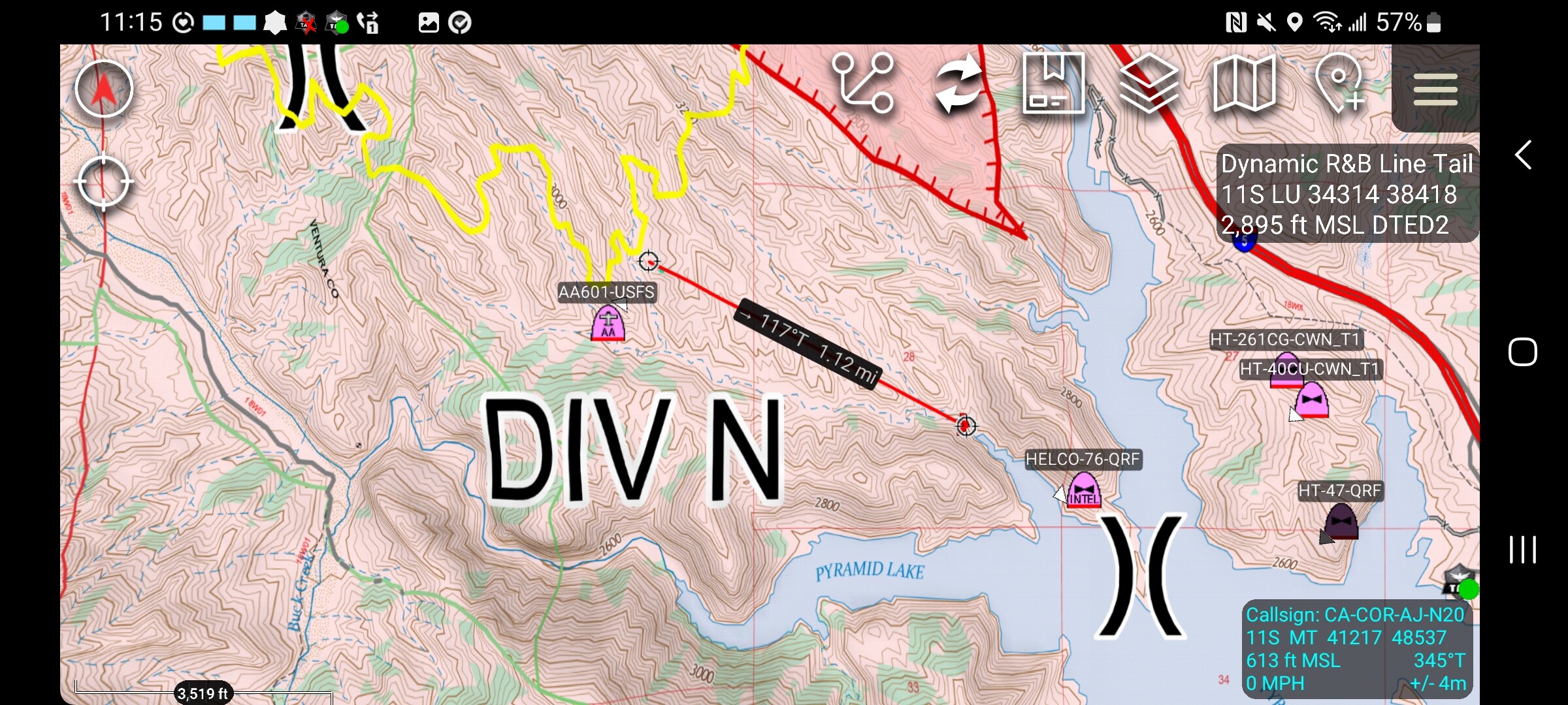
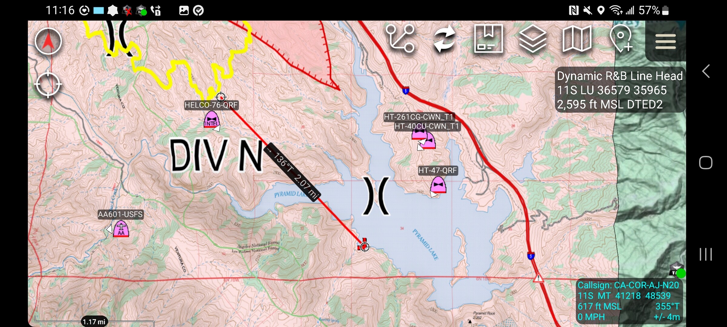
Operations stated to AA that if the fire reaches the southern edge of Pyramid Lake, that’s his trigger point for certain evacs. That map has it looking like it’ll be sooner than later.
6 Likes
AJ, What was the source of the NWCG standard “I contained” red, barbed perimeter. Was that the Ops Map estimate?
Thanks
2 Likes
@Ballofire lets take this over to Q&A? Or i can DM you.
8 Likes
The fire has crossed Piru Creek drainage
6 Likes
Per operations heel going up the flanks looking better all the way to the shoulders, shoulders are most active intel 24 will fly it at around 1700 right shoulder though is pretty active, right flank is the most active flank.
3 Likes
AA requesting additional overhead: 4 T1 and 3 T2 helo’s
3 Likes
80BH, 83BH, 600HX of FOX headed to POST.
3 Likes
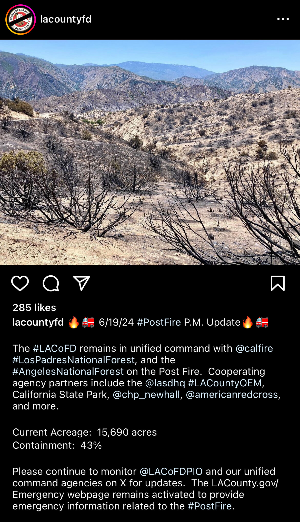
INTEL 24 reports 14,625 acres now
7 Likes
SB I-5 now closed at Gorman due to the fire per Cal Trans (11 minutes ago.)
6 Likes
Freeway was reopened not too long after it was closed do to reduced fire activity.
6 Likes
Data Package up for TAK users at http://maps.takserver.us
I could not find a digital IAP but put all the maps in there for todays shift. Sorry for the delay.
2 Likes
Acreage updated to 15,610
5 Likes
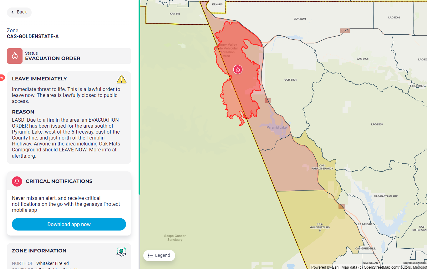
Current evacuation status from Zonehaven (Genasys Protect) a.m. of June 17, 2024
Red is Order level, Yellow is Warning level
3 Likes
TAK data package posted for 061824 at http://maps.takserver.us
2 Likes
3 Likes
data package for the post has been made.
Ops map, ir topo map, transpo map, ir overlay kmz and the IAP.
3 Likes
DP posted at http://maps.takserver.us
3 Likes