State ID: CA
3 letter designator: LAC
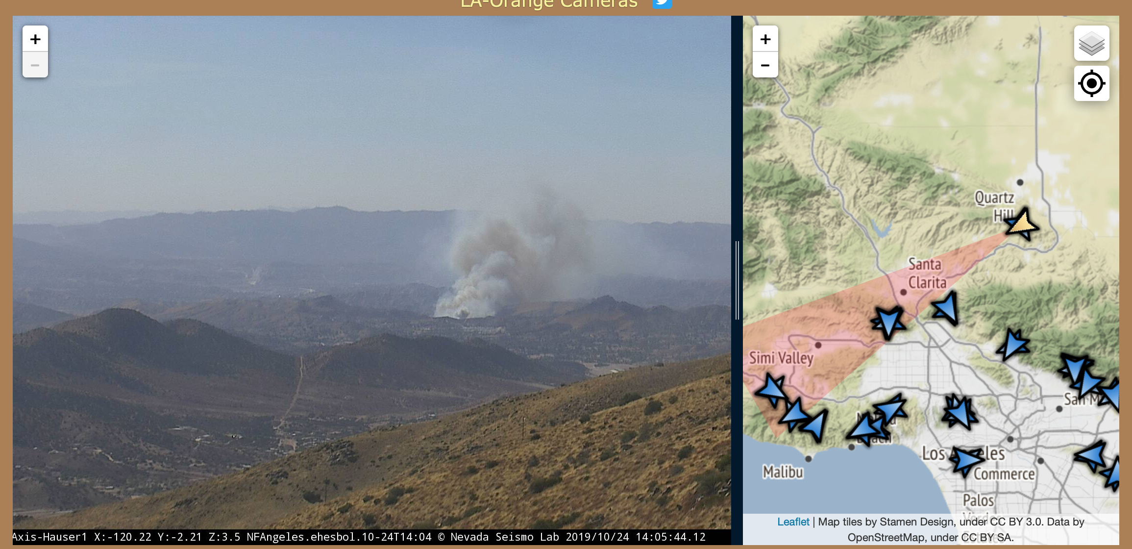
Fire name: Tick
Location: Tick Canyon
Reported acres:
Rate of spread: Moderate-Rapid
Report on Conditions: reported heavy fire running uphill with structures threatened. 2nd alarm pulled by LAC
Structure threat: Immediate
Resources: 2nd alarm from LACoFD, 1st alarm assignment from ANF responding
Hazards:
Weather:
Radio channels: LAC Blue 12, V11
Scanner link: https://www.broadcastify.com/listen/feed/14462/web
Webcam link: http://www.alertwildfire.org/orangecoca/index.html
Agency Website:
200 acres RROS with structures threatened. N/E winds about 30 mph.
200 acres, running downhill, heavy fuels, 30 mph plus winds, immediate structure threat
1 Like
Starting Evacs along Soledad Canyon and also Firecrest Rd.
Channel changed to Blue 11.
This is all SRA with threat to LRA.
LAC helicopters 15, 16, 17, 19, with ANF 532
Both Super scoopers from LAC
Tanker 76, 78 from Porterville. Tanker 107 diverted from the Old Waterman
AA 8SA off Fox.
HT 95B
Now a 3rd alarm from LAC
IC requesting 3rd alarm
Requesting HT735 from LAFD
KTLA has a live feed
KTLA is showing structures fully involved
AA overhead calling it 100 acres RROS
LAC dispatch just put out a notification to staff all reserve engines.
LAC dispatch just requested ALL LAC reserve engines to be staffed immediately and advise Dispatch when staffed!
1 Like
17V is coming from ORC per request from the IC. I believe for it’s intelligence gathering abilities.
LACoFD is dispatching a fire in the mutual threat zone with LAFD, Interstate 5 and the 210 freeway.
Would be down canyon from this incident.
LACo V2
Edit: this was canceled.
More live helicopter footage.
300-500 acres, many structure on fire and threatened in Shadow Pines. Asking for as many engines as they can get.
From the Live helicopter shots, Fire is throwing occasional spots ahead of itself, half to a full mile.