State ID: CA
3 letter designator: LAC
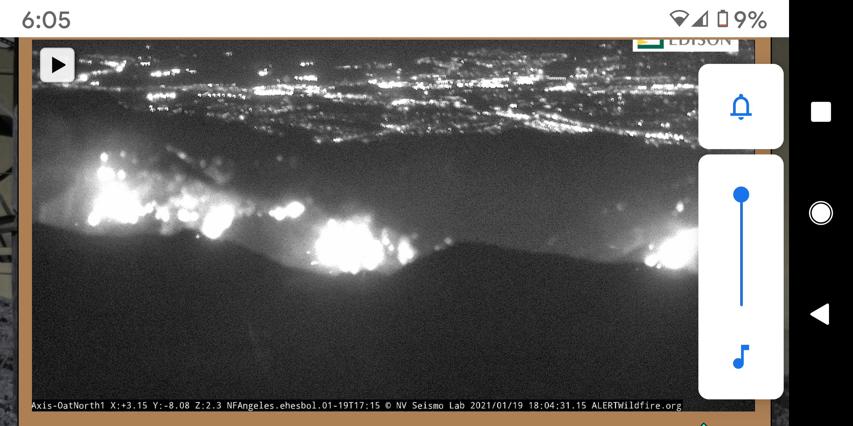
Fire name: Towsley
Location: Towsley Canyon Road x The Old Road; Santa Clarita, CA
Reported acres: 50
Rate of spread: rapid
Report on Conditions: originally still alarmed on Oat Mountain webcam.
Fire is in Towsley Canyon Open Space in medium to heavy brush. No access for ground units. Wind driven under a Santa Ana condition. Potential for 500+ acres
Structure threat: not currently
Resources:
Hazards:
Weather: Winds NE 35 G 60 MPH.
Radio channels:
Scanner link: https://www.broadcastify.com/webPlayer/829
https://www.broadcastify.com/webPlayer/22924
Webcam link: http://www.alertwildfire.org/orangecoca/index.html?camera=Axis-OatNorth1&v=7a7f1cd
http://www.alertwildfire.org/orangecoca/index.html?camera=Axis-Loop1&v=7a7f1cd
http://www.alertwildfire.org/orangecoca/index.html?camera=Axis-Loop2&v=7a7f1cd
http://www.alertwildfire.org/orangecoca/index.html?camera=Axis-SagePeak1&v=7a7f1cd
Live video: https://www.facebook.com/austindave/videos/513335929629929/
Agency Website:
Requesting fixed wing
CMD: LAC V5
Requesting 1 AA, 2 AT, 1 Type 2 copter
Copter 14, 19, 22 at scene
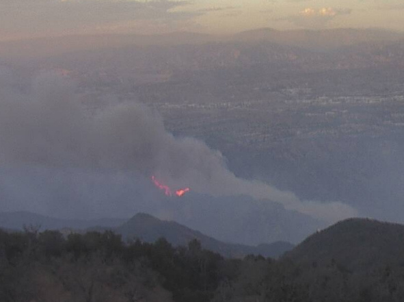
Another view…http://www.alertwildfire.org/orangecoca/index.html?camera=Axis-Loop1&v=7a7f1cd
Looks like some substantial potential.
A little competition for LAC resources due to Kellogg Incident, 10 Fwy at Kellogg in San Dimas. 50 acres, running with the wind, but sounds like they are getting a handle on it. Hopefully can divert resources toward this incident instead.
50 acres running in light to medium fuels with 60 mph winds.
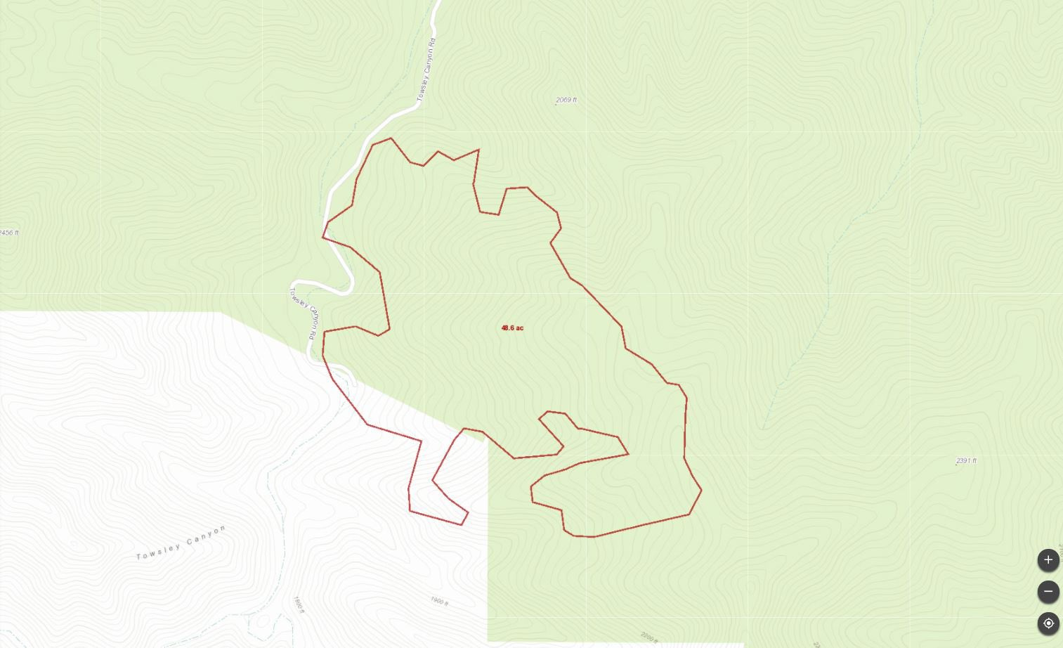
https://caltopo.com/p/013D
Very rough map of the fire area. Cannot get a good look at the fire from cams or from air, will update if I get a better view. As always for discussion and for area orientation, not for tactical decision making.
619 you able to edit the link? The link posted is the main page.
The feed went down, Ill repost if i can. It is an LA area guy named Austin Dave.
From AA. Fire is stuck in the drainage. The airtankers are taking a beating from the wind and have been placed on load and hold.
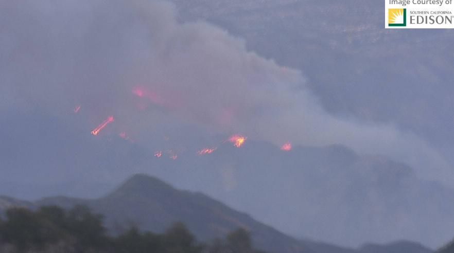
Recon video:
The fire is hung up in steep terrain, pumpkin time is approaching, and AA wants a structure group formed up for the SE side of the fire + night AA
The fire is approximately 64 acres. All fixed wing (air tankers) have been put on a hold due to high winds. Additionally AA is suggesting to create a structure group for structures South East of the fire and has also requested a night air attack.

request for a AA over fire and two AT’s ready for 0700 tomorrow.
forgot to mention the request for night AT and IR for tonight
these are the LFM’s they are dealing with:
All critical. Good news is winds in many areas have not been as intense as forecast. Not to say the 93 MPH on a mountain top nearby is small, by any means. But, winds not making it into all areas as was originally predicted. Will take the small bit of good news. All basin areas downgraded to Wind Advisory from Warning and a little precip forecast for Fri/Sat.
crazy weather for sure. we just got an inch of snow here in Wrightwood. wish we could share it
update @ 1812 hrs
Per IC: 167 acres, 10% containment, and 100% SRA
Winds are very strong 15 miles west of this fire, I don’t remember winds this strong since 2006. The canyon that the fire is burning in may be a little wind sheltered. But if it gets some stronger ground winds or if it moves up slope it will be off to the races.
The area it’s burning in has ungodly terrain, and the wind is chaotic… If it runs up to the Palo Sola Truck trail it will be in alignment with the downsloping winds.