State ID: CA
3 letter designator: LAC
Fire name: West
Location: 245th St W x Highway 138; Holiday Valley, CA
Reported acres: 20+
Rate of spread: moderate
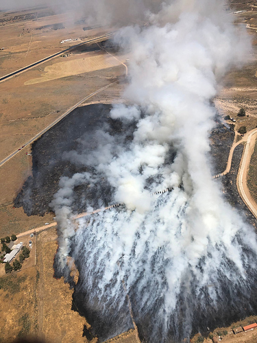
Report on Conditions: large smoke column showing; fire in light grass. Fire is transitioning from the flats to the hills… about to make an uphill run.
Structure threat: 1 structure threatened @ west end of the fire.
Resources: LAC 1st alarm brush
Hazards:
Weather: Winds W 10-15 mph
Radio channels:
Scanner link: https://www.broadcastify.com/webPlayer/22924
Webcam link: http://www.alertwildfire.org/orangecoca/index.html?camera=Axis-CummingsMtn1&v=81e002f
Agency Website:
LAC requesting a 2nd alarm
The IC is holding off the 2nd alarm, IC thinks they may be able to hold it on a road.
ANF just dispatched a ST to this fire
There was some conversation about whether this was or was not in the mutual threat zone for an ANF response. The LAC BC was pretty sure it wasn’t. At some point an ANF engine arrived in the area and determined that it was and started the full response.
LAC BC is confirming the fire is in the IAZ and that they are going to put the ANF resources to work. H532 is off Fox for the fire. LFD Copter 4 should just about be at scene.
20 acres, 15 MPH wind out of the west, all in the flats still.
Cummings Mountain cam shows the fire.
Forward progress stopped @ 20 acres. 3 acres of mulch will continue to produce smoke for several hours.
Fire mapped at 47 acres. 1 outbuilding destroyed.
Was flown and marked @47 acres

