Verizon Communications are beginning to re-establish in the valley. Main landline and comm. lines remain down.
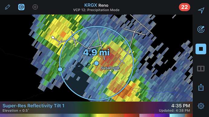
Thunderstorm capable of 40 MPH gusts 5 miles east of the column. Hold on to your hard hats
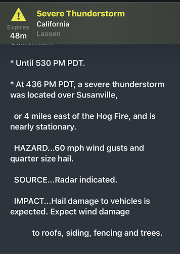
UPDATE: severe thunderstorm warning issued, 60 mph gusts
They just made a safety announcement on this very storm.
Suspending Air Ops now due to 50+ MPH winds on the way.
Also due to lightning in the column and in div Oscar
Plenty of lightning, hope it comes with some big rain.
https://www.weather.gov/zse/SatRad?speed=0.4&mins=10&count=7<=40.2747&ln=-120.2822&zm=9&rad=1<g=1&vis=1&ir=0&fc=1&hover=1&size=0&mobile&
Did the fire get rain??
Dumped on and hail
West end got a ton of wind not sure about rain.
Awesome. I hope it was enough.
Judging from the camera views, those cells certainly knocked the stuffing out of it for today anyway. Hopefully, this reduction in fire behavior will allow the ground resources to accomplish some good headway on line construction.
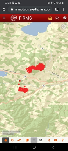
Latest scans clearly show it lost a lot of heat. I think the image posted may be slightly underdone as clouds were obscuring some of the fire as the polar orbiting satellites were passing over (i.e. VIIRS)
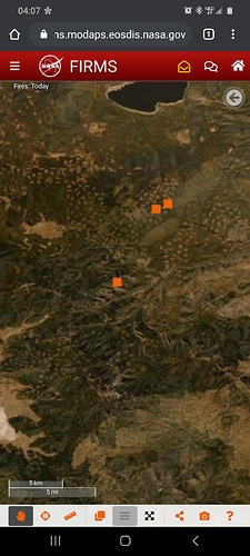
looks like a lot of activity
zoom in on No CA and Nevada
Looks to have gotten more rain, not
Much smoke on the cameras
might want to check here
http://www.alertwildfire.org/shastamodoc/index.html?camera=Axis-HamiltonMtn1&v=81e003f
Like Smokie was saying, that’s not much smoke. The fork might be stuck in this one.
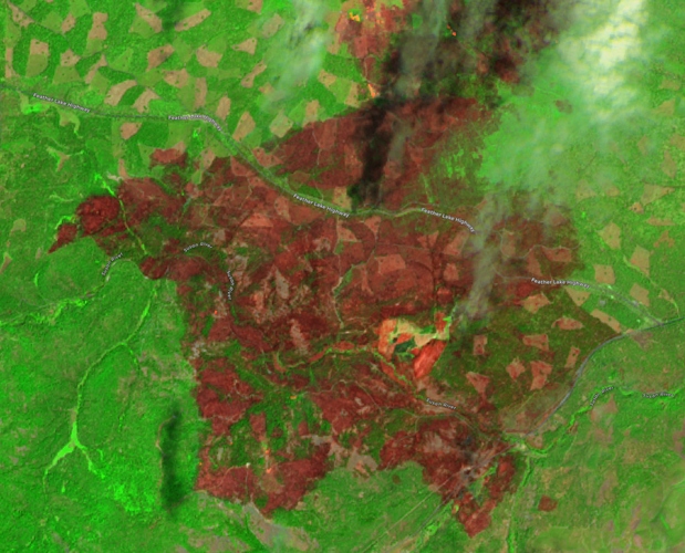
Here is a satellite image of the burn severity on the Hog - this image was captured on 7/23/2020.
Green areas still have foliage on the trees.
It looks like the fire burned hot across a lot of the plantations/clearcuts and stands between them. A lot of the plantations looked like they were thinned about 6 years ago. You can see a belt of green where a fuelbreak thinning was done along Highway 44. Also, the canopy looks pretty intact in areas that were fired out near the intersection of Hwy 44 and Hwy 36.
I talked to a dozer operator who spent some time chasing the spots that crossed Highway 44. He said that while the fire intensity is lower in the plantations, allowing him to go direct, the stumps from the previous logging are hard/time-consuming to work thru, and the slash from plantation thinning is messy along his line, and can cause spotting unless another dozer comes behind him and grabs another blade width. He said these obstacles balanced out the reduced fire intensity, keeping him from being able to keep up with the fire.
Accurate on all. The odd shape of intact canopy at 44x36 is because the burn show, “cut the corner out”, short of the intersection. No fire was introduced into that block.
Where the fuels were closed canopy, only toothpicks remain. WAG, 80% of the intact timber was consumed, surface to crown.
Unfortunately in the 4’-20’ reprod, the carrier was the unconsumed 1000 hr fuels and scattered grass, right up to the drip edge of reprod, complete with needlecast and low limb whirls. Mortality damaging a high percentage of those as well.
The observation relative to the fuel break is wholly accurate. Fire did drop out of the canopies, but carried with high BTU and significant spotting issues within the red slash surface component that remained.

