Tanker 914 just south of fire now
Should put a dent in the 260 ac fire for sure
Probably not at this time. It is burning on State DPA and heading towards State lands. InciWeb is, most of the time, only used on Federal incidents. CalFire does not use InciWeb as a rule.
True. Thanks
Winds at Bogard are coming a little more from the WNW (294 deg) now.
Sources says it’s all fra
Looking at the DPA maps it is all on the Lassen NF but all on State DPA at this time. If it crosses 44 it will be on state land.
NOPS has it as an LMU incident.
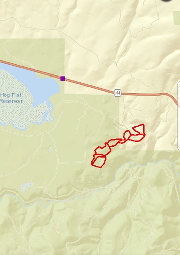
What’s the source for those red lines?
From the Lassen-Modoc Unit Facebook page:
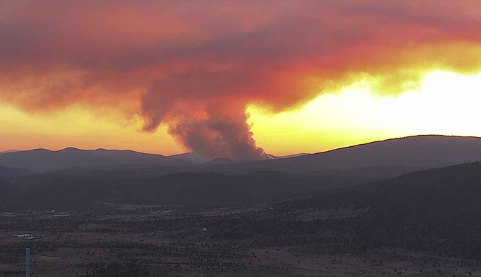
“ Hog Fire Update: The Hog Fire is currently at 261 acres. The fire is burning in timber. The work being done by the air tankers and ground resources is making a difference and the fire is now 5% contained. There are no road closures or threats to structures and no evacuations with the exception of the Goumaz Campground which was evacuated for precautionary purposes. Resources on hand include: 25 engines, 4 helicopters, 3 air tankers, 7 hand crews and 6 dozers. Additional resources are enroute. Agencies on the fire include CALFIRE, USFS, BLM, Susan River, Standish-Litchfield, Janesville, the Redding Hotshots and a Folsom Lake Handcrew. Please check back later for more updates.”
Secret Squirrel…
When was it captured?
Have you got any idea how accurate they are?
How close have they been on other incidents?
Check out the 15 minute time lapse on Antelope Mtn, it really started
to push more southerly in last 30 min. http://www.alertwildfire.org/shastamodoc/index.html?camera=Axis-AntelopeMtn&v=81e002fBogard winds are solidly NW, now.
The squirrels do it my eye not by instrument. This is not by photogrammetry.
Depends on which squirrel it is. Sometimes excellent.
You beat me to saying that…
The same evolution of the wind that made the Badger go side-hill has arrived at the Hog. Looks like it is trying to grow two heads.
CAZ271-191530-
Western Lassen, Eastern Plumas, Eastern Sierra, and Eastern Nevada
Counties-
200 PM PDT Sat Jul 18 2020
.TONIGHT…
- Sky/Weather…Mostly clear. Slight chance of thunderstorms in the
evening. - Min Temperature…
- Valleys…44-54.
- Mid Slope…51-61.
- 24 hr trend…Little change.
- Max Humidity…
- Valleys…54-64%.
- Mid Slope…39-49%.
- 24 hr trend…Little change.
- 20-Foot Winds…
- Valleys/Slope…West winds 8 to 13 mph in the evening becoming
downslope 2 to 5 mph. - Ridge Top…Light winds.
- Haines Index…5.
- LAL…2.
- Chc Wetting Rain…5%.
- Mixing Height…4900-5900 ft agl decreasing to 600 ft agl
after midnight. - Transport Winds…West 10 to 15 mph in the evening becoming
light. - Ventilation…Excellent decreasing to poor after midnight.
Captured every 15 minutes and been pretty close
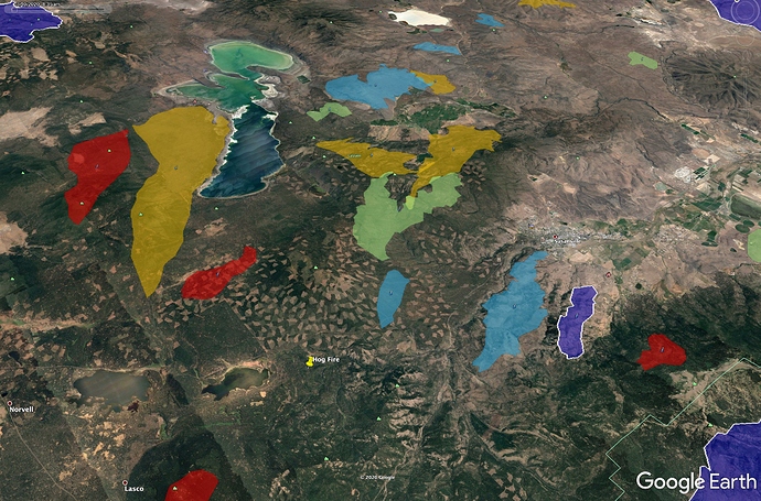
Here is a fire history map going back as long as large fires have been mapped. This view looks along the prevailing winds - SW to NE.
In the past 20 years, we have picked up most of these fires within the first 2 days. The Goat Fire, in blue, to the right of Hog Fire, burned in 2000 and got picked up when it got to a recently thinned area. The Eagle Fire, upscreen from Hog in green, burned in 1977.
Any word on a team?


