

The private timberland tree farms on the west side of Highway 44 look like they were pre-commercial thinned about 6 years ago. Pre-commercial thinning usually takes place between 5-15 years after planting, depending on the productivity of the site. Unless an area is thinned using mastication (industrial mowing), the thinned trees are often just lopped and left onsite. The fact this area has had 6 years since thinning for the slash to break down a little bit is good news in some ways - the first year or two after thinning can have a pretty extreme fire hazard, because all of that red slash is just laying out in the sun. Still, this area is basically a desert, and thinning slash takes a long time to break down.
Here is a photo taken just after thinning.
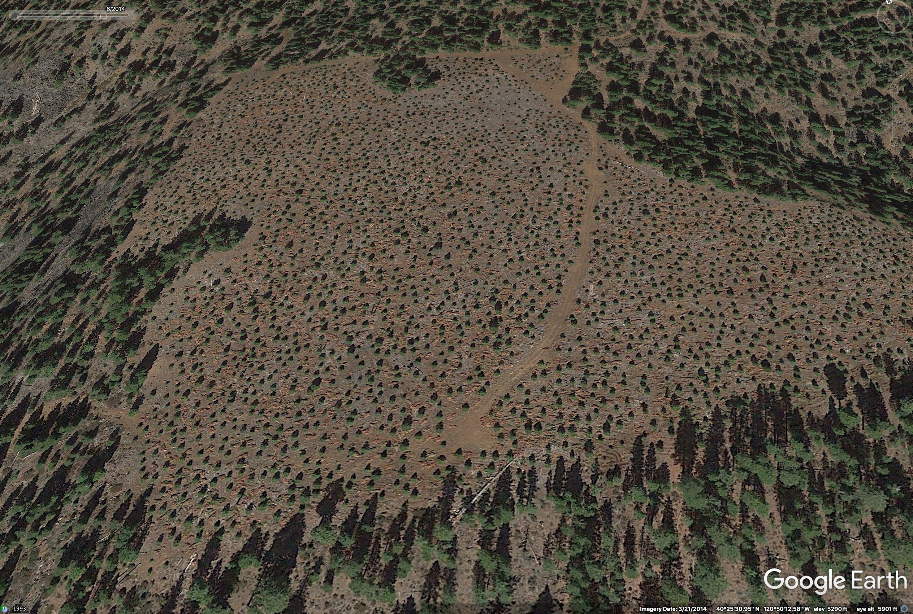
Up until very recently, the State forest practice rules (stocking standards) anticipated high levels of mortality in reforestation, and required landowners to plant 300 trees per acre (about 12 foot spacing) on harvested lands, making this kind of thinning necessary. Recently, [the stocking standards have been revised] down to 125 trees per acre on higher-site timberland (https://bof.fire.ca.gov/media/9335/2-rule-text-ada.docx), and this will reduce the amount of thinning slash fuel loading in the coming decades, but we’ll still have to deal with elevated flammability in large areas of thinned plantations for another decade while all of the stands planted in the past 10 years come into thinning age.
Also, it used to be standard practice to burn clearcuts after harvest, reducing slash loads to zero, but liability concerns and air quality regulations have pretty much shut down burning on industrial timberlands.
10 Likes
The lid is coming off the pot.
A lot of the settled smoke has lifted out in the past hour and SW flow is back in charge.
http://www.alertwildfire.org/shastamodoc/index.html?camera=Axis-DyerMtn1&v=81e002f
5 Likes
650 Acres 5% Contained.
1 Like
The 15 min loop is pretty telling
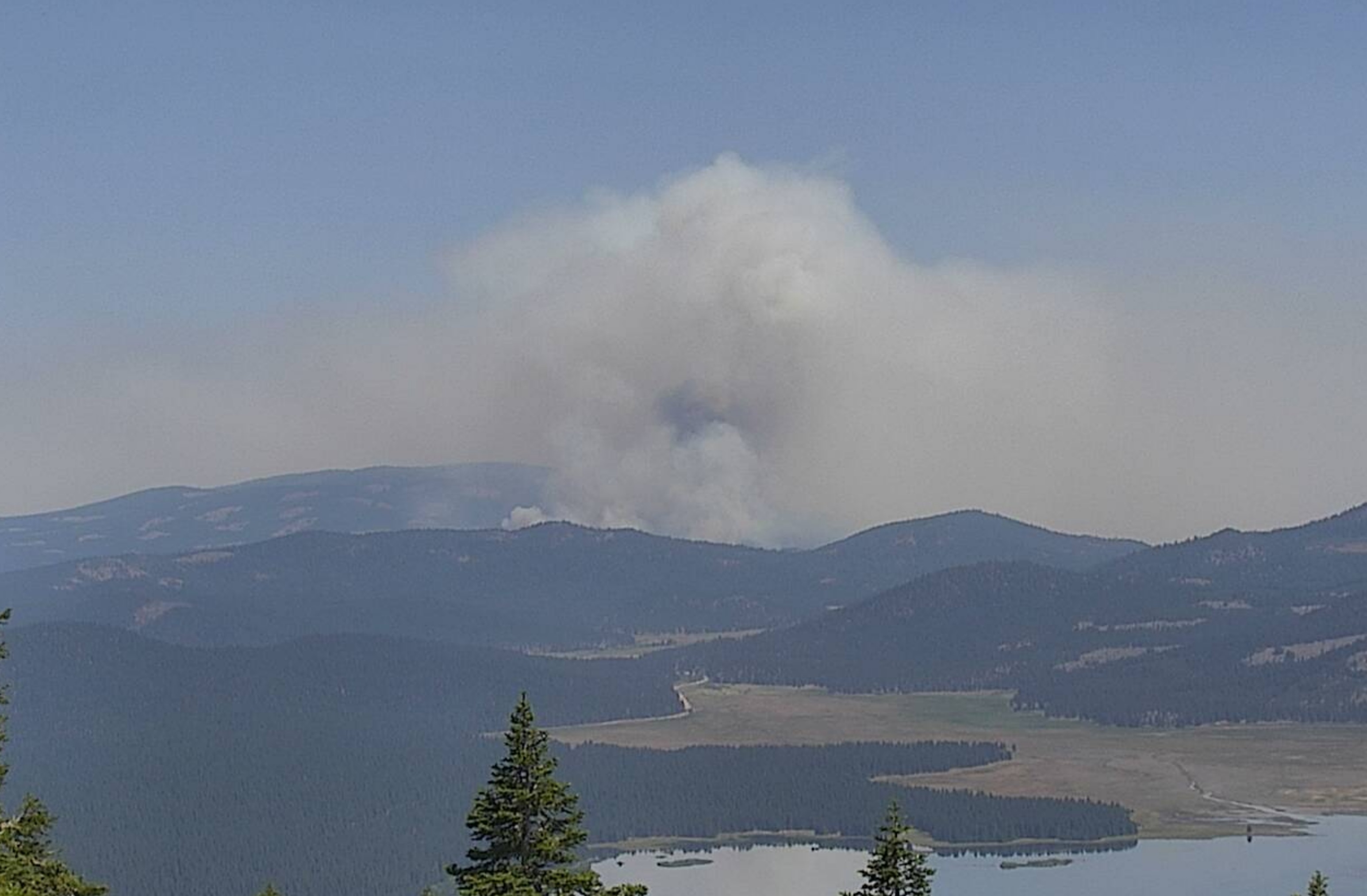
View From Westwood 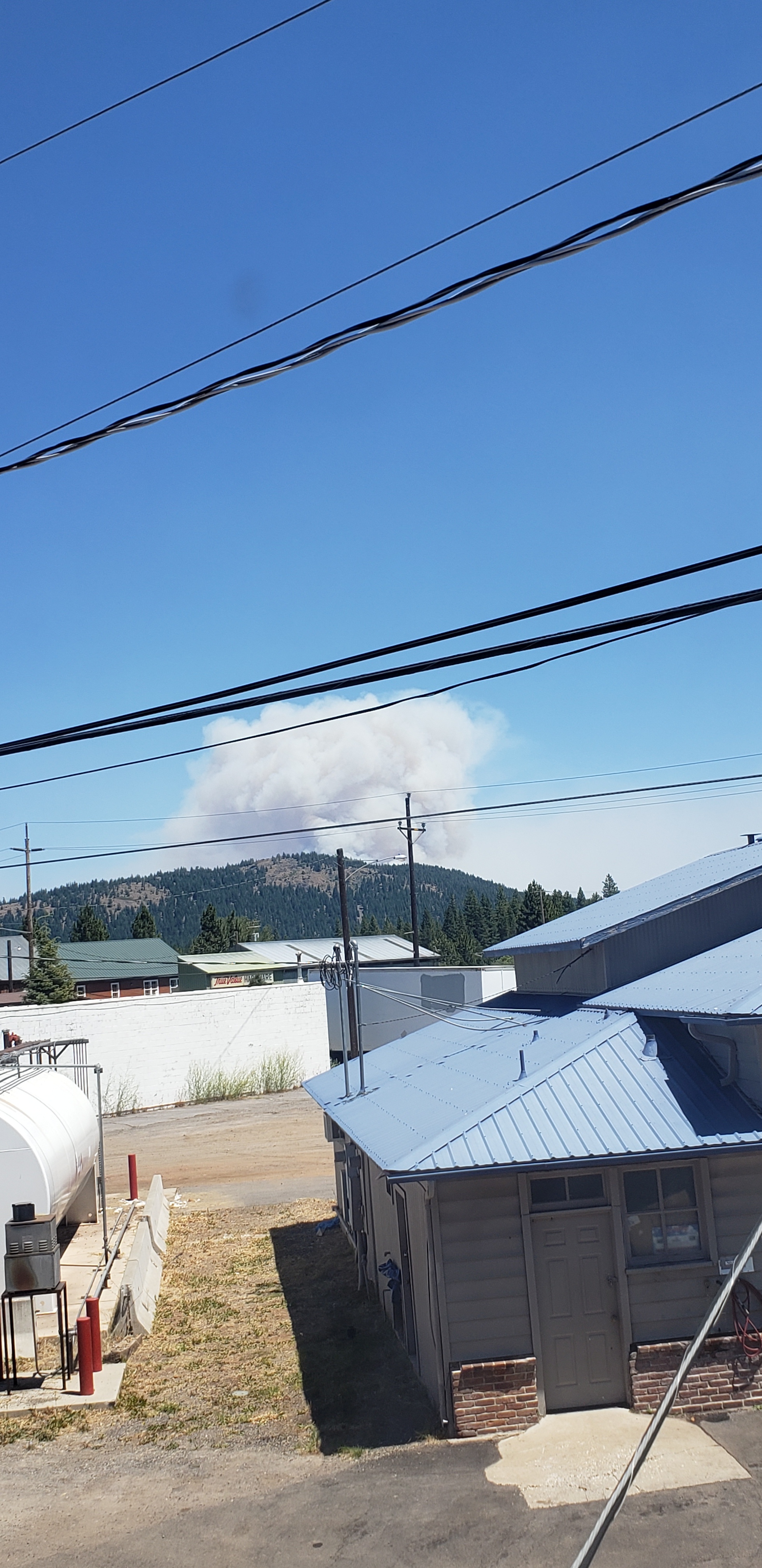
5 Likes
Fire jumped 44 making a heavy push.
2 Likes
Can you tell me which direction from the 44? Have property up there but not there right now.
Good scanner link? Lassen Susanville doesn’t have much
1 Like
It probably jumped ‘the 44’ just east of Hog Lake. Look at the smoke column and that’s the way it’s headed. I’m not sure anybody on this page can give you a definitive answer on the true direction.
1 Like
There are updates here:
1 Like
Still no decent feeds for this?
I’m sure a team will be ordered
I’ve hunted and can’t find any.
2 Likes
This guy has some good photos from last night and has tried a couple live streams today. Those videos are super short but his content might get better.
2 Likes
4 Likes
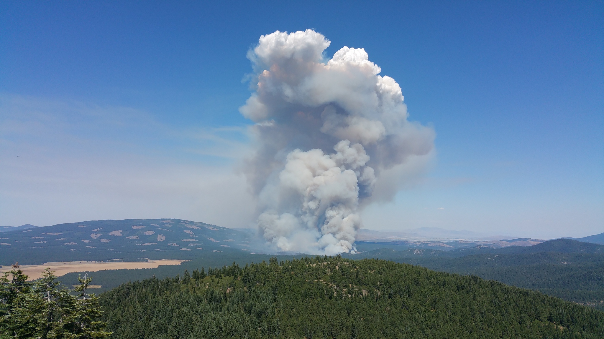
Current view from Pegleg Lookout.
Multiple spots across Highway 44 on north side of fire, unable to drop fixed wing due to smoke.
9 Likes
Haines index of 5 today, with 500mb temps warmer than yesterday. Multiple large storms building south of the area, unstable atmosphere conducive to large column development…
11 Likes
AA reports Highway 44 is ‘all lost’. Told relief AA ‘we’ve been getting our butts kicked all day’. Tankers are going to focus on west flank/heel near Susan River. North flank is lost, headed up Roop Mtn.
3 Likes
Scanner link?
1 Like