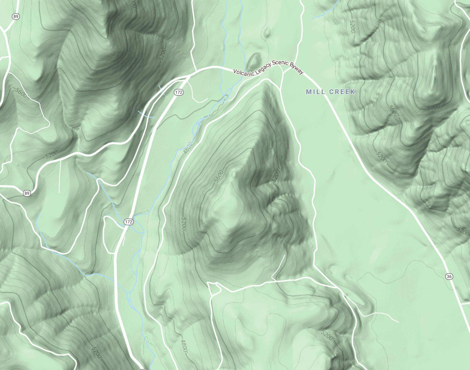
Hwy 36E at Childs Meadows, on Doe Mtn across from Camp Tehama. Sec 26, 29N R4E. (google map here)
2-3 acres midslope west side of Doe Mtn.
Hwy 36E at Childs Meadows, on Doe Mtn across from Camp Tehama. Sec 26, 29N R4E. (google map here)
2-3 acres midslope west side of Doe Mtn.
I think this is the “Dump” fire
I believe it is “Stump” per radio traffic
could be, kind of hard to tell, they sound the same on my scanner.
Stump - the original lookout shots were putting it near Stump Ranch, but it was top smoke only so didn’t have a tight ground location. Proper location and map links in top post.
Copy, thanks!
Is there another one on or near Turner Mtn?
Inskip Lookout would have anything on Turner in a matter of minutes, as well as any incoming valley aircraft. I have not heard any second starts in the area…
ok. I thought I heard a dispatch for a fire on or near Turner. they were probably sending more units to the Stump fire. Wish I still lived over that way.
1510: approx 10 acres, has ran to the top of Doe Mtn. Working on keeping it in check with retardant. Two S2’s two SEAT, two T1 tankers, two T2 rotor and two T1 rotor (PJ hawk and PGE hawk).
Scancal live scanner has LNF Fire, and air tactics. It will be behind TGU and SHU local though on priority (in the middle of moving and RX is at old house, new house doesn’t have 10 antennas launched…yet.)
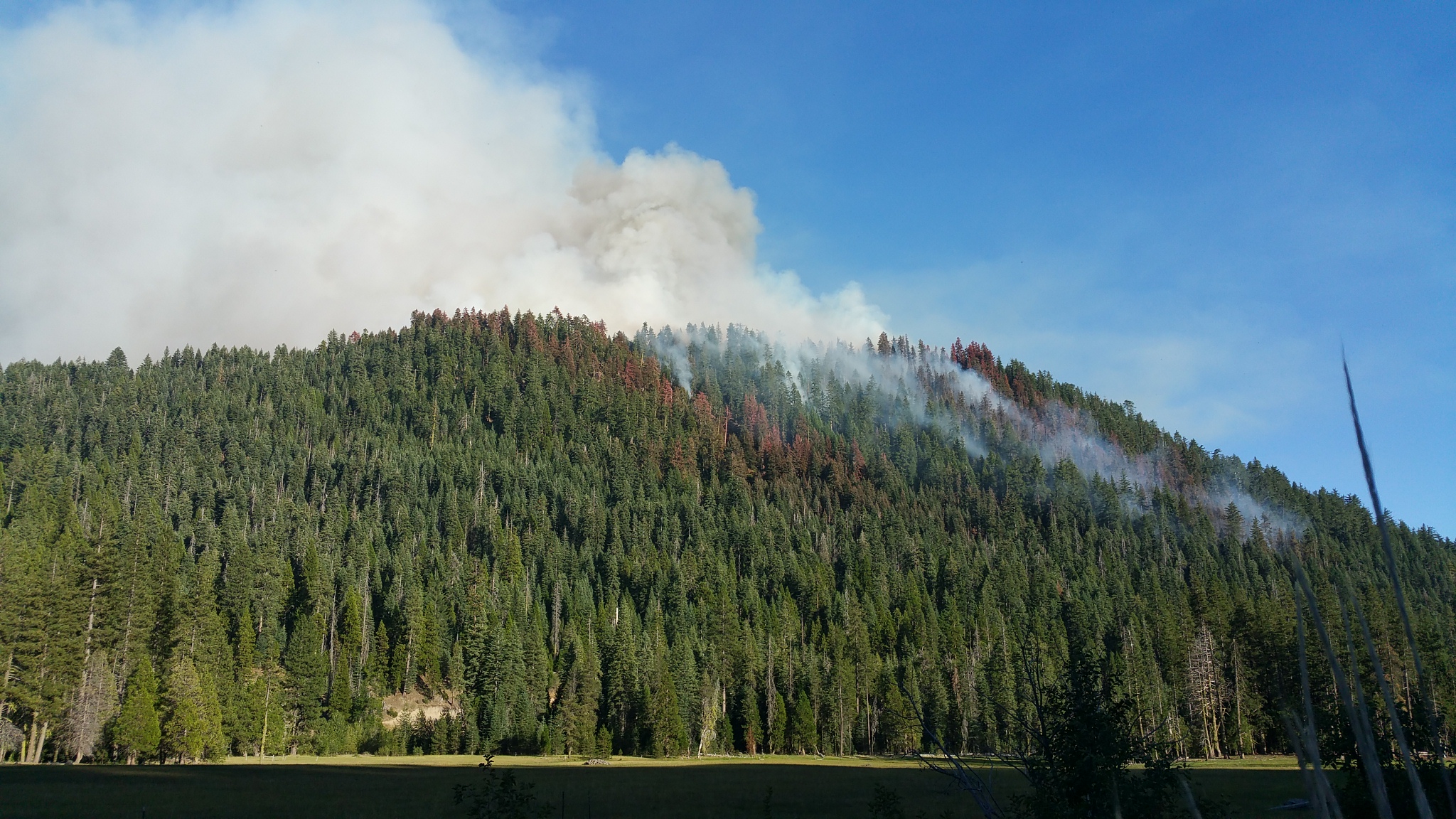
Per the camera feed, it looks like it has some wind on it and is expanding…
looks like it may have spotted looking at the Alertwildfire cameras
1610: It has spotted over the ridge ahead of itself, on the eastern slope of Doe Mtn (the Childs Meadows side). Air Attack has upped the air game to a 3rd large air tanker and a 3rd smaller air tanker out of Chester (total of 8 tankers). It is still contained within the Doe Mtn area, inside Mill and Gurnsey Creeks from actual civilization. However even without wind, fire behavior in the area is drought-driven this year, not wind driven. So the timber is unfortunately receptive to fire brands spread from the smoke column. Heads on a swivel up there.
#LassenNF Fire resources are at scene of a vegetation fire on Doe Mountain on the #AlmanorRD. The Fire is currently reported at 40 acres and moderate rate of spread by air attack. Fire is burning in heavy timber near Hwy 36 and Hwy 172. Currently there is no structure threat. Per Deputy Forest Fire Chief Dustan Mueller there are 7 air tankers, 4 helicopters, 10 engines, 5 crews, 3 water tenders, and 3 dozers. Please help out Fire Fighters and remain out of the area.
Can someone start an I/A thread for this incident
Heavy tanker traffic continues from Chester. Doe Mtn. has heavy fuels, and the FS acreage hasn’t had any vegetation treatment in at least two decades.
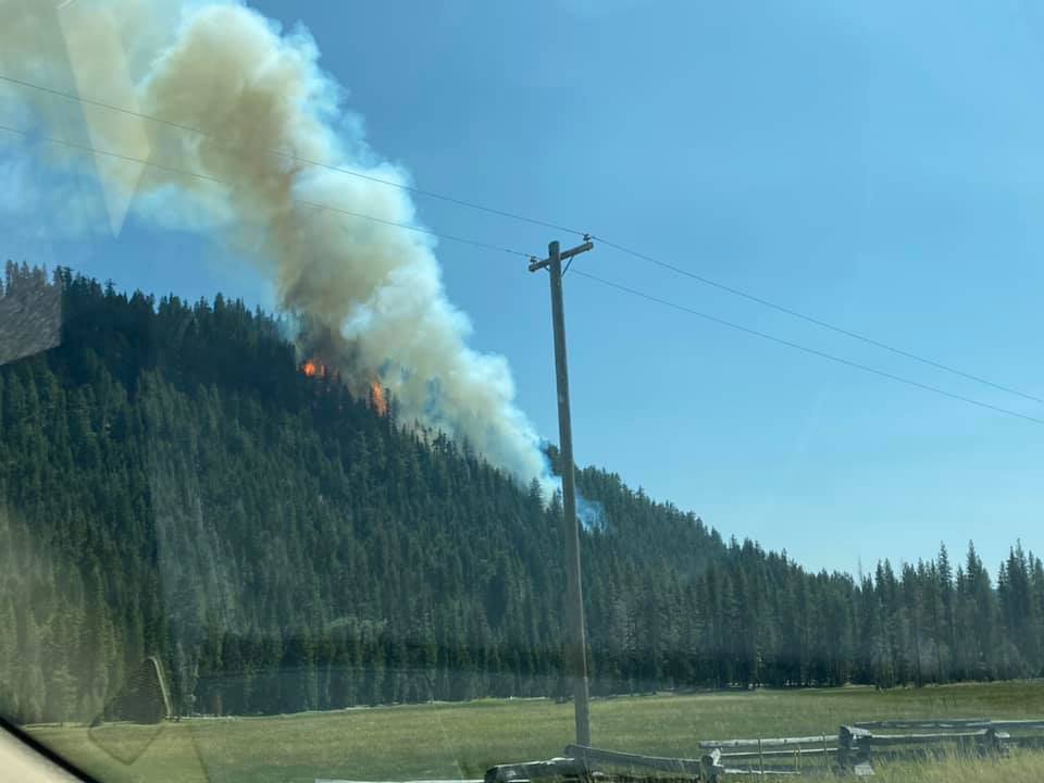
We watched the fire for a few minutes around 18:30 from Hwy 172, right off of Highway 36. The initial run up the west side of Doe Mtn was showing minimal activity. It looks like going indirect on the west slope (if that’s the plan) will likely achieve some resource benefits.
The fire was burning well at the top of the East slope, with maybe a couple small spots lower on the east slope. Doe Mtn (center of map) is pretty much an island, and unless it spots across the flats, it is hard to see it having much potential. The column was laying to the north, and it looked like they were able to hit the south flank pretty well with retardant.
One thing I noticed that could make tonight a little squirrelly is that from way up by Lake Helen, at 8,000’, you have a direct view of the fire (photo below). All the cold air sinking down Mill Creek off the east face of Lassen Peak tonight has a straight shot to the heel and right flank of the fire.
New Smoke or Current Fire on Butte Cam