State ID: CA
3 letter designator: LNF
Fire name: Stump
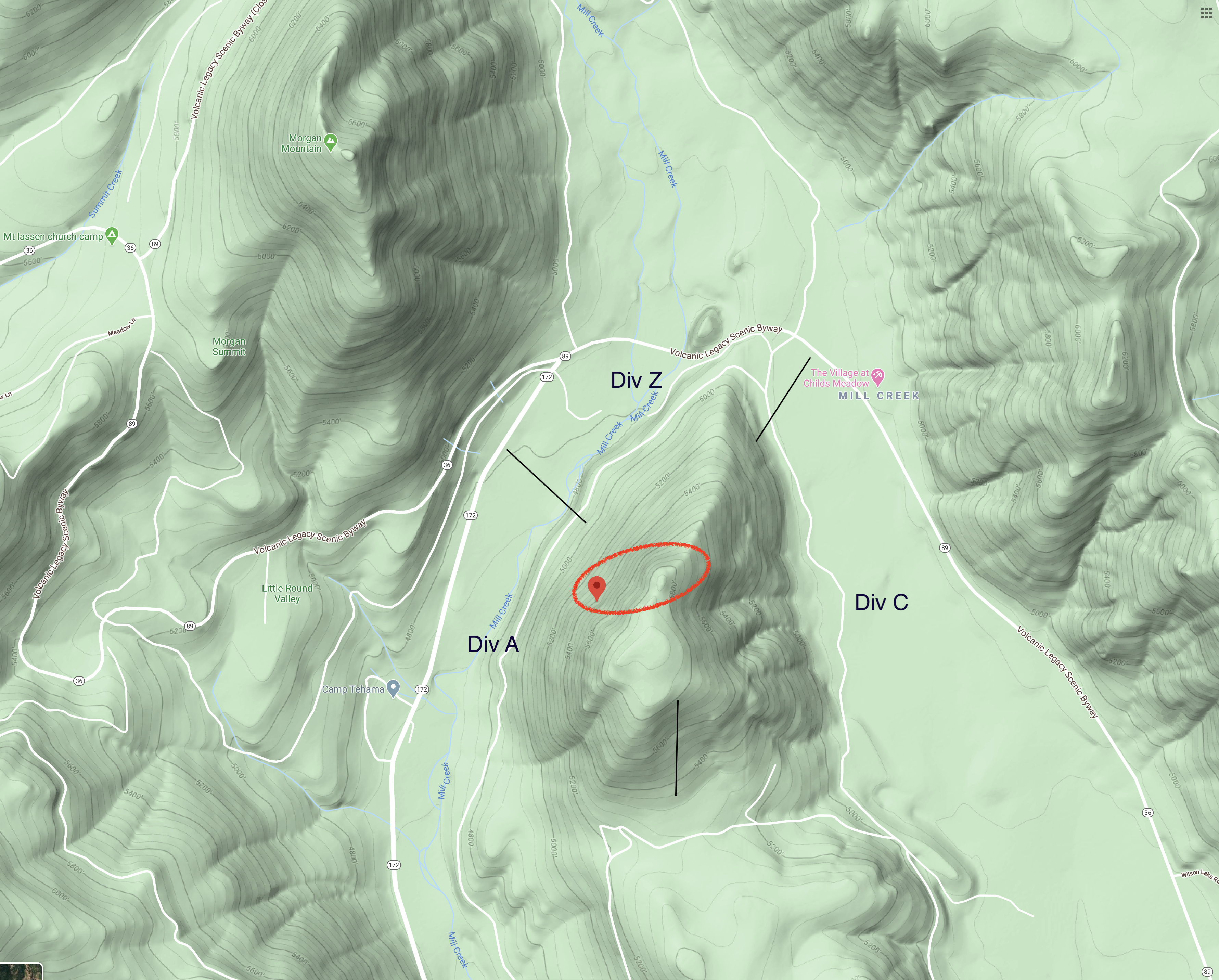
Location: Doe Mtn, hwy36 at Hwy 172. (Google) (Sec26 on CalTopo)
Reported acres: 65
Rate of spread: MROS
Report on Conditions: fuel and terrain driven, ran up to the top of Doe, spotted over a bit on to the eastern aspect of Doe Mtn towards Childs Meadows
Structure threat: none
Resources: LNF full wildland, with TGU assist
Alpha division is pulling all resources off being too dangerous rocks falling and tankers dropped on the trees right on top of a LPF engine crew no injuries just a very very close call
Lots of debris came out of the treetops right on top of the firefighters
Div Zulu pulling out also
2005: Ops talking with AA, they’re calling it 200 acres for the evening. All resources pulled off the direct line, going in direct with the road system and dozer improvements, due to the steep terrain, rock rollout and heavy dead snags on the direct line.
The scancal live scanner is in LNF incident mode tonight. I’ll have tomorrow’s extended AA and A/G in the scanner, however I’ll be out of cell service for the next few days (yes, I know where to find no cell service still), so will likely put TGU/SHU local priority back on tomorrow morning as well. We’ll see how things go in the morning.
Rough Division Breaks for today. GOES IR showed plenty of heat throughout the evening. One of the Tuscan Buttes cams has a great western vantage of the column and how it’s behaving with the inversion, not as impacted by drift smoke like Butt and Dyer.
The Scancal live scanner is focused on LNF for priority, with today’s extended AirFM, A/G, A/G CMD, and rotor vic. I’ll be off the grid and below radar coverage late morning till late Tue so radio will stay this way.