Watching the winds which look like west winds until 22:00 hours tonight when they will switch to northwest. If the winds stay west through the burn period today that would help firefighters on Div J. Hopefully when it does switch the winds stay under 10mph. Attached are maps from last nights Terra/Modis. https://drive.google.com/drive/folders/1tF5Kxfyh35jgdgIbXbGkYcxQXAaQesfy?usp=sharing
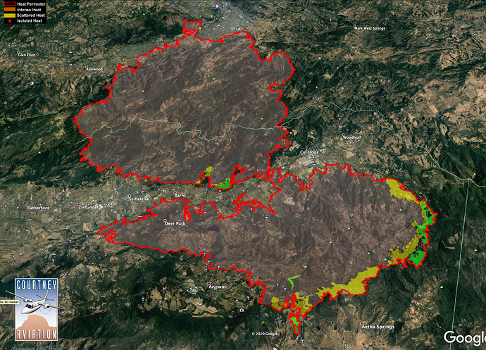
IR progression last two days of “Scattered Heat” - Green shaded is from last night, Yellow shaded is from night of 10/2. Not much “Intense Heat”. (The map was turned around in Google Earth for a better view of the hot flank above Pope Valley & Mt. St. Helena.)
I’m not too sure about the IR interpretation on that one… there’s definitely plenty of intense heat showing on the 12 hour loop on the St. Helen South cam  .
.
True! IR snapshot in time, it’s all relative. If your on the line in the hot DIV, it’s all intense. 
New mandatory evac orders from the Napa County Sheriff’s office
Fire spotted across primary dozer line in div H,
Livermore ranch Rd Area.
66,840 acres - No increase overnight
50% containment - Up 9% overnight from 41
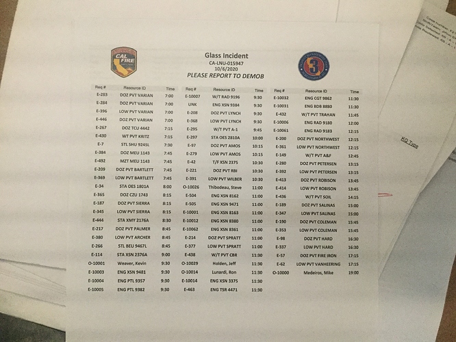
Anyone have today’s demob list?
Alot of initial attack resources from Sonoma County demobing today.
Cold and foggy on most of the fire today. IMT 3 handing back to the unit on Monday leaving mostly LNU resources. Last demob push tomorrow and some stragglers on Monday. Stands at 82% containment.

