West of geyserville, Sonoma County
Gathering Intel.
3 Likes
I’m assuming it is called Point because it is off Stewart’s Point Road. The cross referencing on the cameras seem to support this. I’ve hiked in the that area a little bit and worked a couple of endurance races as a ham. The area is rugged and rough, and it can be deceptive and dry you out very quickly. Anyone heading into that area be sure to stay hydrated.
3 Likes
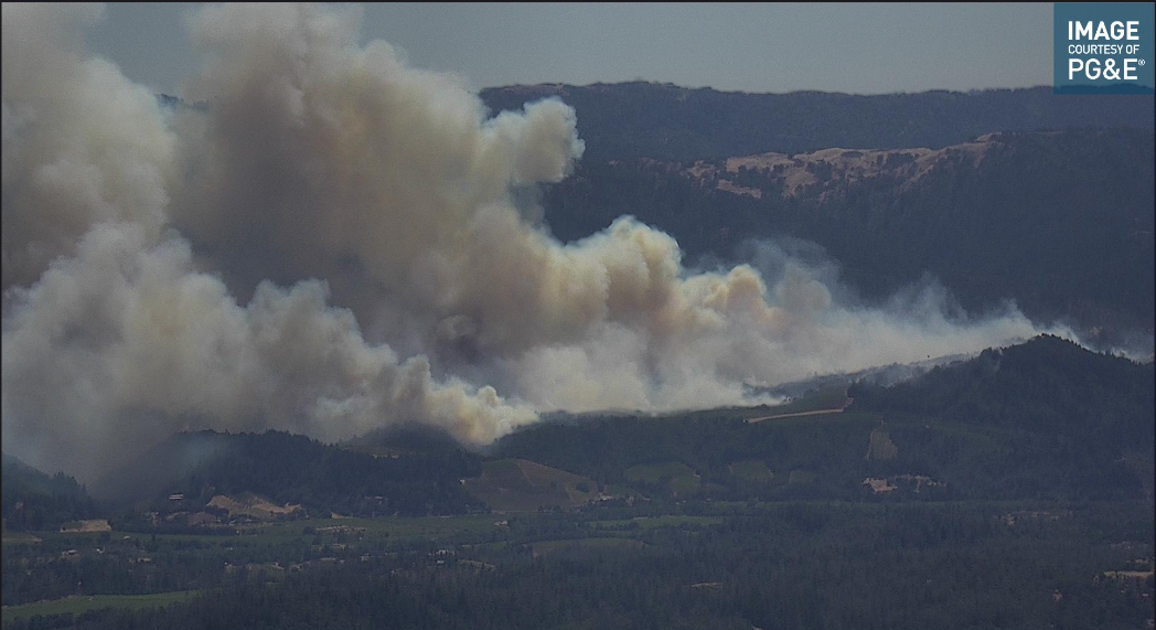
Per AA, 10-15 acres with short range spotting, no structures at the head
5 Likes
Heard part of a resource request, 4 Crews, 1 dozer, 5 engines, and some modules
2 Likes
IA thread is posting updated orders
2 Likes
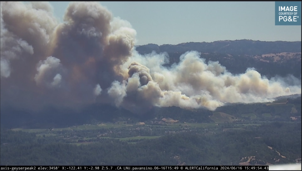
Yeah looking angry on the time lapse
2 Likes
Multi-camera view for anyone who finds it useful— ALERTCalifornia - Tile Display
6 Likes
Structures actively being impacted, no acreage update .
2 Likes
Do you have a good scanner link ?
1 Like
I’m listening to LNU West on Broadcastify.
3 Likes
Cmon FIRIS!!! Where are you now? Just kidding.
It would be beneficial to get good acres.
2 Likes
Resources from Solano County are now responding. Immediate need.
2 Likes
Only single aircraft and busy to the max now.
2 Likes
They should get Intel12 out of North Ops/McCullen
2 Likes
Where are they stagging? and where is the CP? Dry Creek Rd has a lot of vineyards that should slow the fire some. From what I saw of the map on Watch Duty the fire was still up in the hills west of Healdsburg and South West of Dry Creek Rd. Damn thing seems to be Bi-Polar the way it gets angry, then calms down, then makes another run… There is a creek that runs N-S between the Wallbridge burn scar and Dry creek that looks like it was in part used for the Wallbridge line. I suspect it is beyond that point now, be nice to know.
2 Likes
Enroute to the SHU-Hidden fire
2 Likes
They had some staging up by the dam. All the structure protection resources were going to Yoakum Bridge and West Dry Creek.
They had a good sized spot on the right flank burning off to the west.
2 Likes
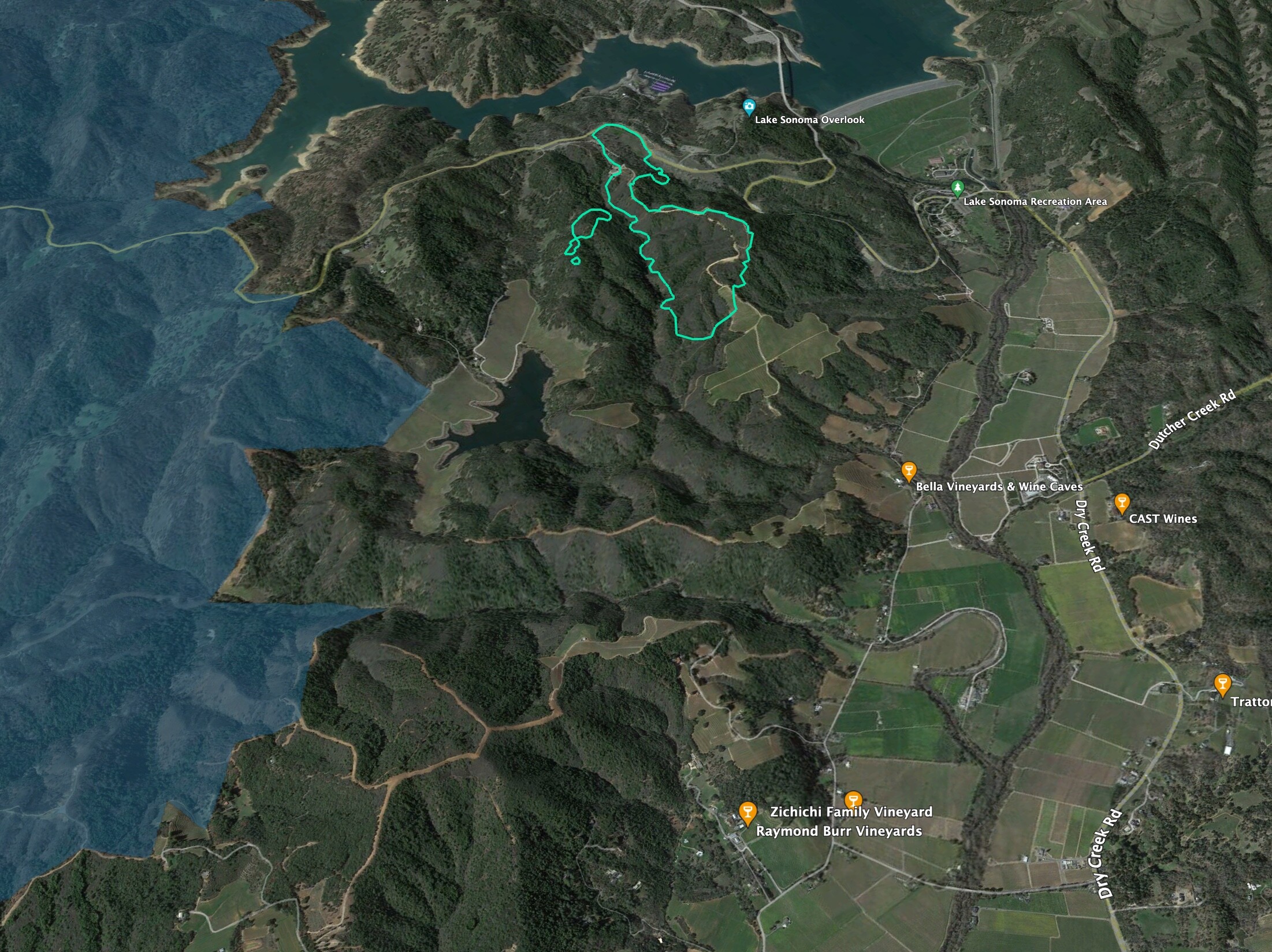
Here’s a view looking NW with the FIRIS perimeter in light blue.
2020 Wallbridge Fire is in blue fill.
Wallbridge dozer lines show up well on the aerial.
I’ve been working mapping fuels in the 2017 Tubbs Fire scar near Mark West Springs. Areas that burned hot there have 12’ tall bay and madrone sprouts, and thick ceanothus, but little in the way of dead fuels or grass in the understory. Live fuel moistures are still up in the brush/sprouts, I’d guess this fire probably won’t push very hard on the flanks, and mainly run with topo and winds.
15 Likes