State ID: CA
3 letter designator: LNU
Fire name: Sand
Location: CR 41 near the Colusa Yolo Co Line (Sand Creek Rd)
Reported acres: 30
Rate of spread: Fast
Report on Conditions: “This thing has got a head on it and running hard. Good possibility of it going extended”
Structure threat: Unk
Resources: CAL FIRE & LG with request for additional STEN, 2 more tankers, 4 crews, and type I helo
Hazards:
Weather:
Radio channels: LNU East
Scanner link: https://www.broadcastify.com/listen/feed/865
Webcam link: http://www.alertwildfire.org/northbay/
Agency Website:
Air Attack just ordered 6 S2’s, 1 LAT, and additional Type II Copter with Crew
Cams: http://www.alertwildfire.org/northbay/
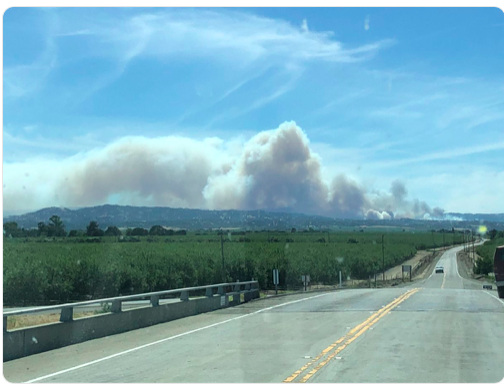
See Lake Berryessa Cam, Good column showing.
100 acre
fast rate of spread
Update per Air Attack:
Fast rate of spread in the brush
Approx 100 acres but cant see through the column
Per Capay Valley Chief 2200:
Crested the ridge into the Capay Valley headed towards the town of Rumsey
order 2 additional type 1 tankers, and 1 Vlat
Yolo County LG resources responding to the Capay Valley side of the fire up Hwy 16
From I-5 and County Line Rd.

MEU 9110C punched out immediate need to the Sand.
AA reporting spot across Cache Creek with structures threatened.
Spotted across Cache creek, Structures threatened
Per air attack
Rapid Rate of spread.
125 acres.
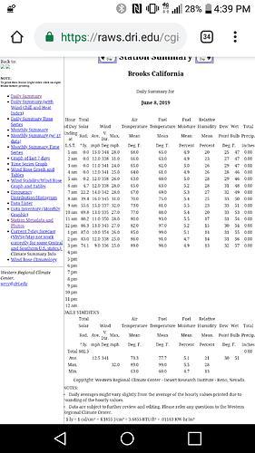
The RAWs station out in Brooks, approximately 20-30mins south of the fire incident
AA ordering 2 type 2 copters with crew and 2 type 1 copters
Evacuation map:
https://yolo.maps.arcgis.com/apps/webappviewer/index.html?id=ea03deb166f849a7acb9153779001c98
XSA sending immediate need T3… ST-4151C
STEN-SCR
E318, E343-SCR
E372, E374-CSM
E363-SAC
XSO 2350C enroute from Solano
no fill on the type 1 copters ordered tonight.
