
MEU 9110C punched out immediate need to the Sand.
3 Likes
AA reporting spot across Cache Creek with structures threatened.
2 Likes
Spotted across Cache creek, Structures threatened
1 Like
Per air attack
Rapid Rate of spread.
125 acres.
1 Like
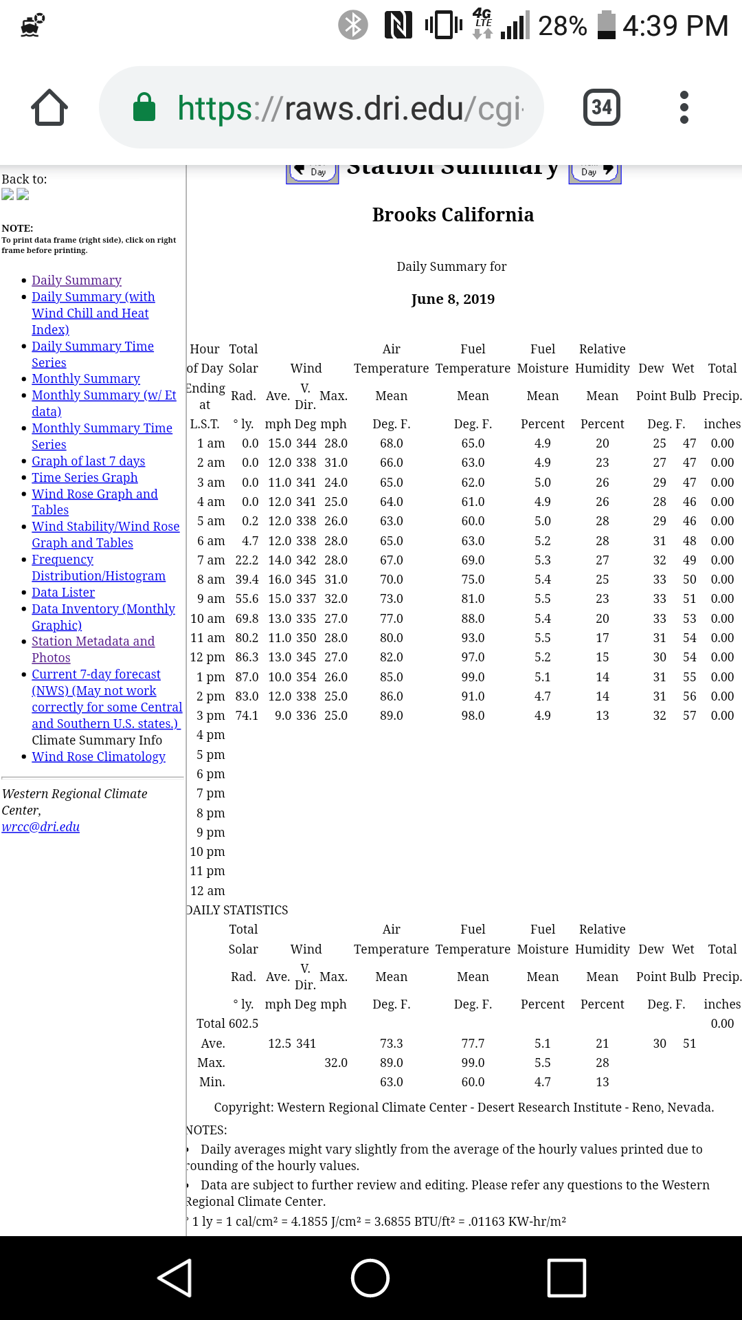
The RAWs station out in Brooks, approximately 20-30mins south of the fire incident
2 Likes
AA ordering 2 type 2 copters with crew and 2 type 1 copters
2 Likes
Evacuation map:
https://yolo.maps.arcgis.com/apps/webappviewer/index.html?id=ea03deb166f849a7acb9153779001c98
1 Like
XSA sending immediate need T3… ST-4151C
STEN-SCR
E318, E343-SCR
E372, E374-CSM
E363-SAC
3 Likes
XSO 2350C enroute from Solano
1 Like
no fill on the type 1 copters ordered tonight.
1 Like
ICP now Rumsey Fire Station 23 at 3794 CA-16.
1 Like
XSA is now spooling up the T3 OES strike team…
3 Likes
Command channel changing to CDF Command 2
1 Like
Looks like the Type 3 North Bay IMT has been activated for this fire.
2 Likes
CBS 13 has it at 600 acres as of a 6:50 pm update. https://sacramento.cbslocal.com/2019/06/08/yolo-county-sand-fire-guinda/
1 Like
AA has fire mapped at 1045 acres
scanner traffic was broken
2 Likes
Acreage from C104 was 1645
50 acres on the West side of Cache Creek running parallel with blue ridge along the burn scar from the County Fire
2 Likes
Dedicated online scanner for the incident here
3 Likes