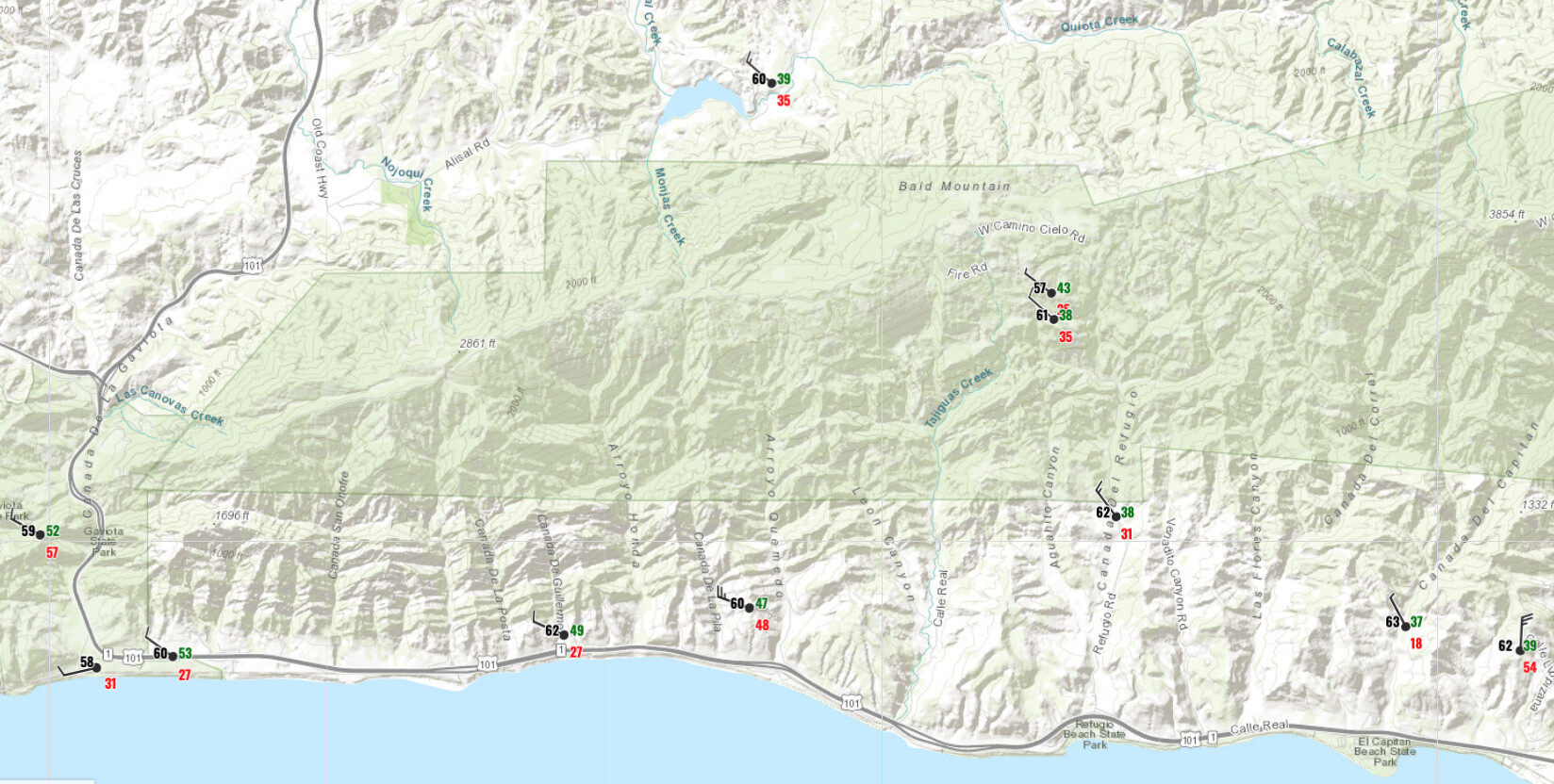
Fire history map shows it burning straight into the 2004 (edit) Gaviota? footprint. Given the winds at my house right now (I can see it from here) I’d say it’s probably ripe for a repeat.
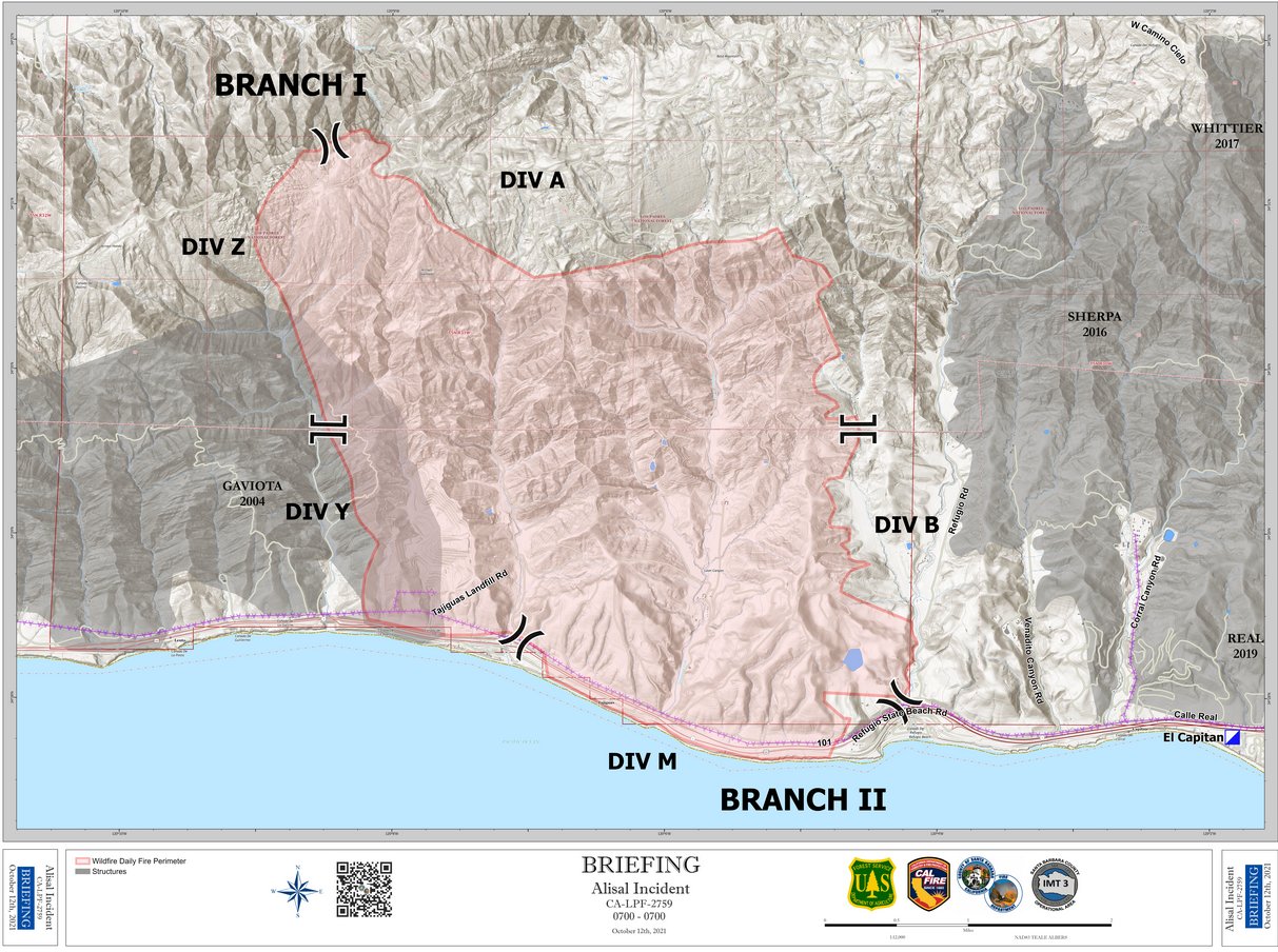
Looks bounded on the east by the Sherpa and the Whitier (ah, memories of the Whitier) but has plenty of room to run west. The wind seems to be cheating just west of north right now.
So oddly enough, not to hijack, but I logged in to EGP and checked and the fire history data is very different from CalTopo. I would have thought they would pull from the same data.
At any rate, I friend just drove through and said that flames are visible from the 101. Thought I heard one of the local hams say that it was either at or near the Refugio landfill, but that seems pretty far down. Guess we’ll just have to wait for the IR data.
INTEL-24 turned back home due to weather. This is a good example for when the fire guard program is so good. The sensor is not as high spatial resolution as the aircraft but still pretty good.
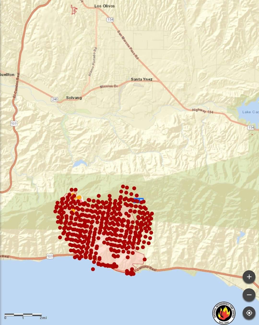
AA reported pretty extreme fire activity about 20 minutes ago. The fire did impact US-101 and is also staring to move laterally. 101 is closed at Refugio.
Initiating a 1st alarm commercial structure response to the land fill, to include a Haz/Mat team, air/lighting unit, and to notify the Air Pollution Control District (APCD).