State ID: CA
3 letter designator: LPF
Fire name: Casitas
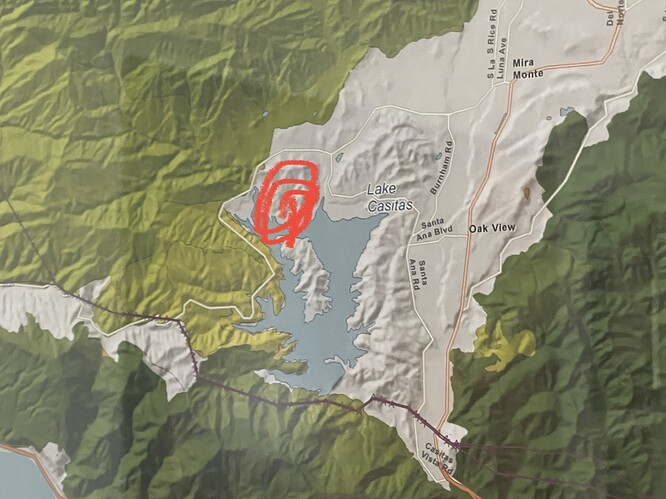
Location: Casitas Pass Road x Santa Ana Road; Ojai, CA
Reported acres: 15
Rate of spread: moderate
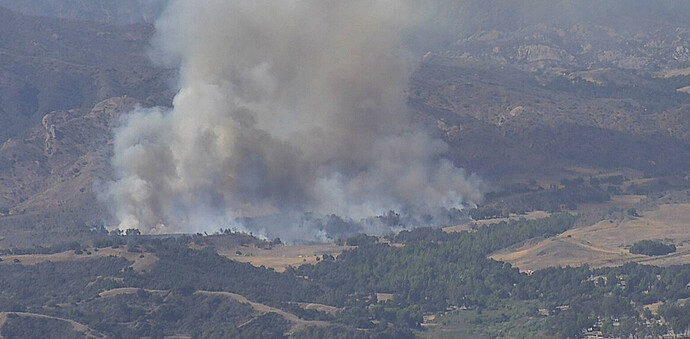
Report on Conditions: smoke showing 8 miles out. Best access off of North Santa Ana road. 10-20 acres in grass pushing to the north on both sides of the road. SRA with threat to FRA. Now transitioning into medium to heavy brush, short range spotting, potential for 500 acres.
Structure threat: yes
Resources: VNC 2nd alarm, LPF 1st alarm, AA12, T74, T91, VNC COPT2, VNC COPT7
Hazards:
Weather:
Radio channels:
Scanner link: Ventura County Fire - Ch 1,2,5,8 Live Audio Feed
Webcam link: Red Mountain
Topatopa
Cross 1
Rincon 1
Live video: https://abc7.com/watch/23340/
Agency Website: Los Padres National Forest - Home
Reported as on BOR land which means it’ll be Fed Fire Lot’s of smoke visible already.
Never heard of BOR…
Bureau of Reclamation.
Bureau Of Reclamation
Bureau of Reclamation - water peoples land
The fire is getting into medium to heavy brush. Potential for 500 acres.
Looking at the Thomas Fire progression map in my office, and this is just to the SSE of the 2017 burn scar. However winds appear to be onshore and pushing it towards pockets that didn’t burn in 17. Hopefully the can corral the blaze to the north into younger fuels. Plenty of single tree torching clearly visible already on Alert Wildfire cams.
Considering that BOR is a Federal agency, it does not necessarily mean it will be a Fed Fire. DPA is not always determined that way. It looks like all SRA until you get well beyond the lake and get up towards Matillija.
Last I knew LPF had the DPA for all that area but SRA is of course weaved n there too. I worked for LPF for a period of time. It really doesn’t matter who takes the lead. It’s gonna be unified for quite a while.
IC states that the control objective is to keep the fire south of De La Garrigue Road, deep into LPF.
Media copter almost onscene.
AA ordering 2 additional LAT’s or VLAT’s with lead, whichever is available.
LPF is ordering point.
That will make this a Fed Fire.
Live video: https://abc7.com/watch/23340/
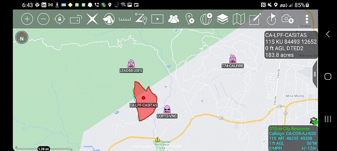
A rough map from looking ABC7 helicopter. For reference and discussion not for tactical decision making. Looks like 130-150 acres. Lots of good spots to dip from and good dozer country. Fire is just east of the Heat/Wind Warning “WIND ADVISORY IN EFFECT FROM 6 PM THIS EVENING TO 9 AM PDT TUESDAY… …EXCESSIVE HEAT WATCH REMAINS IN EFFECT FROM TUESDAY MORNING THROUGH WEDNESDAY EVENING”
https://caltopo.com/p/5Q5U updated map 1749hrs


