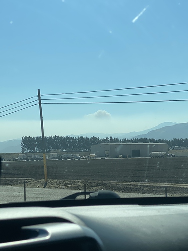
CA-LPF-Coleman

State ID:CA
3 letter designator:LPF
Fire name:Coleman
Location:Coleman Cyn/Bear Cyn Area
Reported acres:100
Rate of spread: Rapid
Report on Conditions: Limited access for ground resources
Structure threat:yes
Resources:LPF and multiple units from the Dolan fire
Hazards:
Weather:
Radio channels:LPF 1(170.4625),LPF 2(171.550), tac. LPF 4 (163.7125),A/G 41(167.475), air 127.020

Scanner link:
Webcam link:
Agency Website:

1 Like

http://www.alertwildfire.org/centralcoast/index.html?camera=Axis-Helen2&v=7a7f1a6

Starting to come into screen on Helen 2 cam

1 Like

From Airtac “150 to 200 acres, to much smoke to work the head right now”
Additional from Airtac “ Lots of potential for the head to run”

2 Likes

It seems to be showing on the GOES satellite. Can also see the Creek Fire to East, they have a firing ops underway.

https://rammb-slider.cira.colostate.edu/?sat=goes-17&z=4&im=18&ts=1&st=0&et=0&speed=130&motion=loop&map=1&lat=0&opacity[0]=1&hidden[0]=0&pause=0&slider=-1&hide_controls=0&mouse_draw=0&follow_feature=0&follow_hide=0&s=rammb-slider&sec=conus&p[0]=geocolor&x=7907.02001953125&y=3906.31982421875

3 Likes

2 Likes

Air Attack just stated “It blew out. We’re starting a new project”.

7 Likes

showing up on heat detection:

https://rammb-slider.cira.colostate.edu/?sat=goes-17&z=5&im=18&ts=1&st=0&et=0&speed=230&motion=loop&map=1&lat=0&opacity[0]=1&hidden[0]=0&pause=0&slider=-1&hide_controls=0&mouse_draw=0&follow_feature=0&follow_hide=0&s=rammb-slider&sec=full_disk&p[0]=cira_natural_fire_color&x=13774&y=3730

3 Likes

Just checked GOES17 and its gone away. Must have had some success this afternoon and evening. Just the Creek Fire shows @ 2200.

2 Likes

On national flight following I heard T160 and another Tanker lift off enroute to the incident.

4 Likes