State ID: CA LPF
3 letter designator:
Fire name:DERRY
Location:
Reported acres:
Rate of spread:
Report on Conditions:
Structure threat:
Resources:
Hazards:
Weather:
Radio channels:
Scanner link:
Webcam link:
Agency Website:
1/2 acre steep slope slow rate of spread
2 Likes
Can we please have more information. At the very least some geographic specifics. Fuel type maybe?
1 Like
Forward progress has been stopped, did not here of new acreage estimate
1 Like
They also canceled the crews
1 Like
I agree belongs in Question/Discussion until more is known. Been a lot of these this year.
Good thing about this forum is most any member can click the pencil icon and move it to the correct section… It’s in Q and D now.
2 Likes
Thanks Brush.
I would still like to know where this little fire is.
1 Like
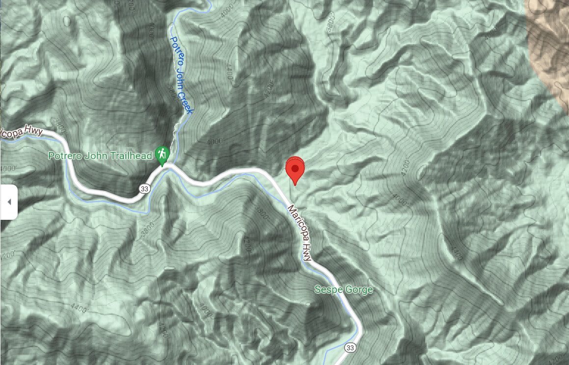
LPF Wildcad shows this to be Hwy 33 & the Derrydale Cyn overcross. Lat/Long: 34 35.046, -119 15.660
Mod Note: This is a good example of what occurs when there is far too little information provided whether it be a I/A thread or a Q&D thread. This is not a speed race to see who can open an I/A thread first. Try to think of it being more of a First On-Scene providing an accurate picture for the incoming resources.
17 Likes
Highway 33 at derrydale creek. Lots of brush there.
3 Likes
Per: WCCALPF (the Los Padres National Forest)
Date Inc # Name Type Location WebComment Resources IC Fuels Acres Lat/Lon TRS Status
10/05/2021 14:42 LPF-2717
P5EK1Y (0507) DERRY Wildfire MM 33 32.00 DERRYDALE CYN O . BC51LPF BC73LPF E353LPF E354LPF E51LPF HT-404AJ PAT44LPF Q Mark Gerwe Effective 1515 . 1 34 35.046, -119 15.660 6N R23W Sec 25 .
Comes back to: Google Maps
and also
https://caltopo.com/map.html#ll=34.57904,-119.27991&z=13&b=mbt
along the stretch of CA 33 between Ojai and the intersection with Lockwood Valley Rd.
Current acreage listed as one (1). No hot spots on MODIS / VIIRS.
5 Likes