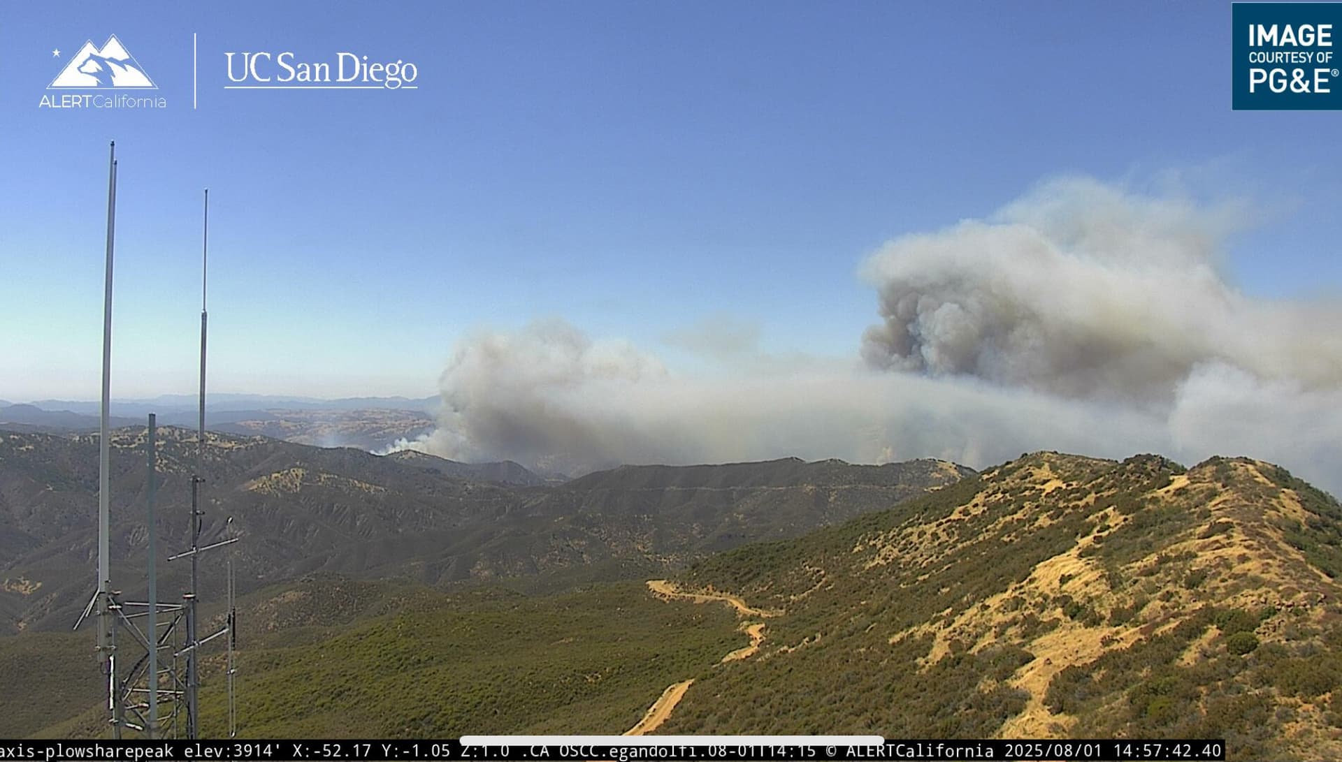
Highway 166 west of the Madre burn scar.
Reported as 4 fires largest 5-10 in brush and grass 4 additional tankers on order.
Cam link: ALERTWest - La Panza 2 ALERTWest - Plowshare Peak
ALERTWest - Black Mtn SLO
Highway 166 west of the Madre burn scar.
Reported as 4 fires largest 5-10 in brush and grass 4 additional tankers on order.
Cam link: ALERTWest - La Panza 2 ALERTWest - Plowshare Peak
ALERTWest - Black Mtn SLO
5 additional type 3s and 2 additional crews requested. The air order above was 4 tankers and 2 type 1 helicopters
Scanner Linkage? Been trying several SLO feeds, but no love ![]()
(please)
Thanks
Not sure but when I find I’ll post
I’m listening to “San Luis Obispo County Public Safety” using the Scanner Radio app. You can listen to it by going to San Luis Obispo County Public Safety
This one’s a hodgepodge scanner Santa Barbara County Sheriff, Fire, Aircraft and Marine, Lompoc Police / Fire
Finding some traffic here
Thank you all for the link, additionally ordering a lead aircraft coming from Fresno and Sac
Any size ups or updated acreage?
May have luck with this one, too:
or
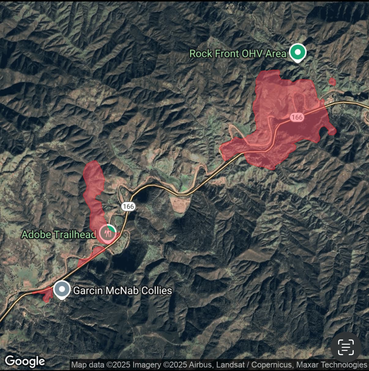
Fire has reached outbuildings at Rock Front per CHP. Reports that it was started by a vehicle traveling on its rim.
Looks like it may run into the Madre Black.
Assuming it’s on both sides of the highway?
Looks like watch duty just uploaded the map. Appears to be both sides
818.8 Acres
sheeeeeeet, here we go again
It’s almost set up to be another Logan Fire, just a little further east.
4 Charlie’s for a state mission. Unified command with SBC.
Conversation corps are still rolling hose from the Madre fire. Looks like it will go right back out.