Thank you the updated spot fire location. We WERE planning on putting up a portable repeater at Fig lookout…well there goes that idea.
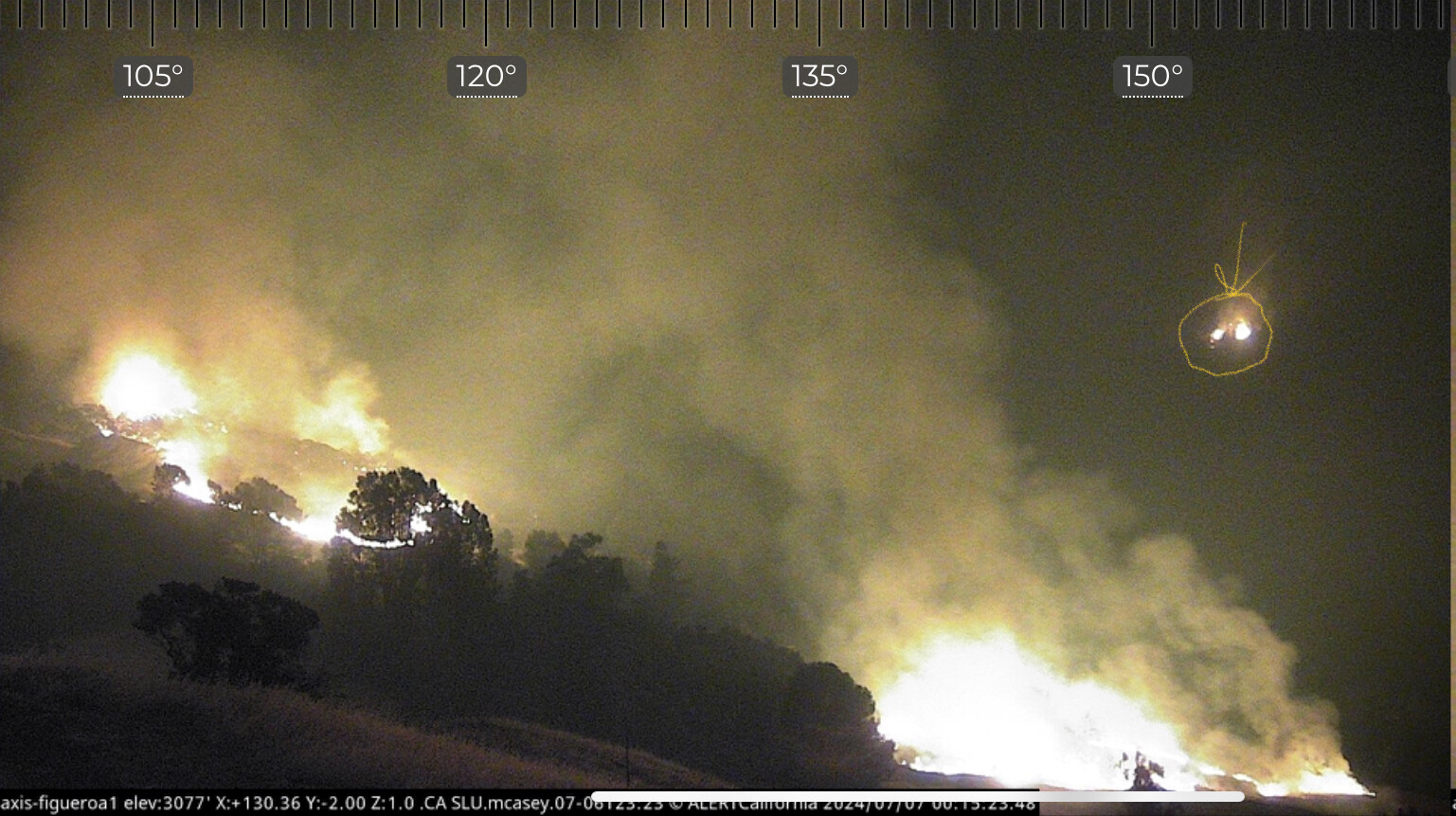
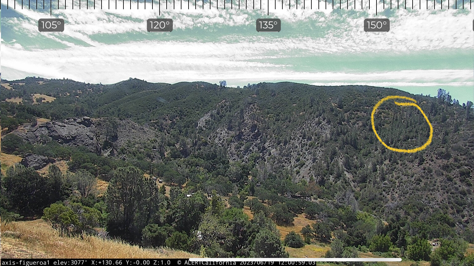
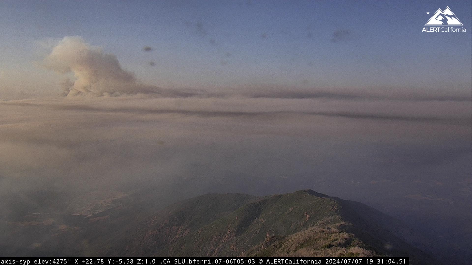
Now these cameras are offline  So hopefully they just lost power.
Fig lookout has me concerned since that is a structure on that site.
Evacuation warning for upper Happy Canyon going out.
TAK data package posted - just the ops and trans maps.
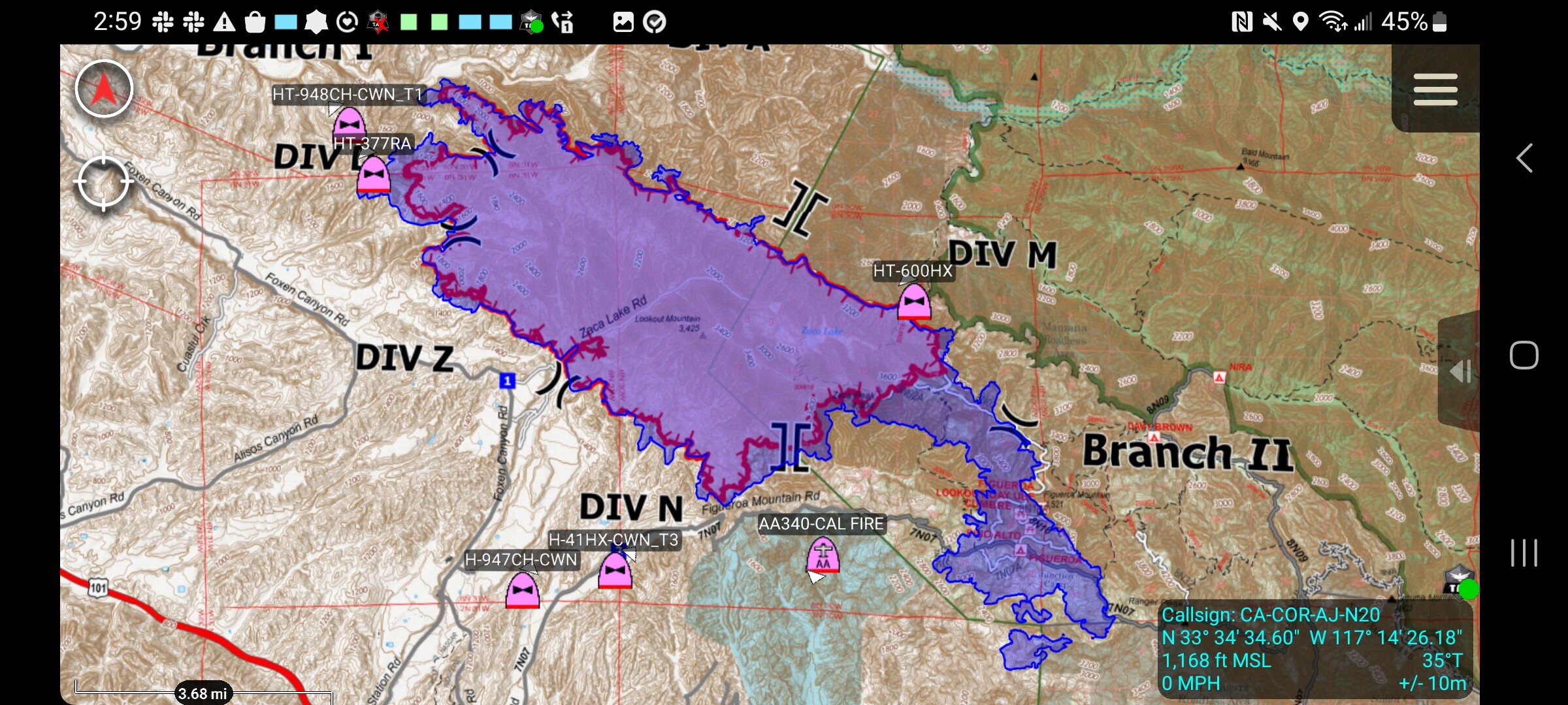
CAL FIRE intelligence aircraft has mapped the fire at 16,452 acres per Watch Duty
The fire crossed Alamo Pintado Creek and is making a small run back toward Division Alpha
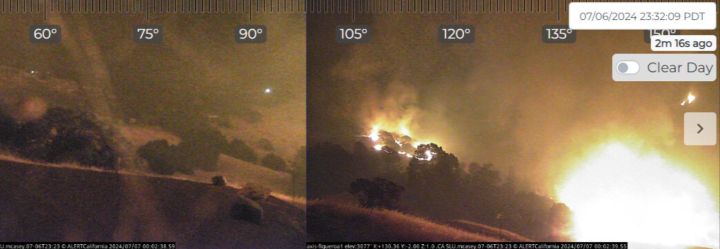
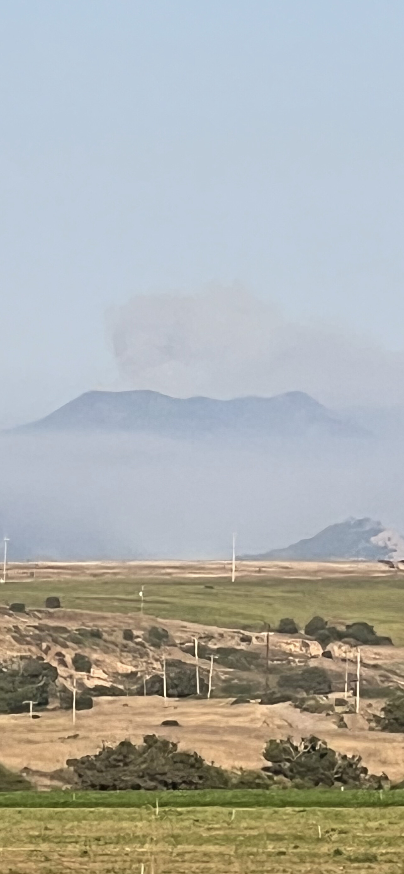
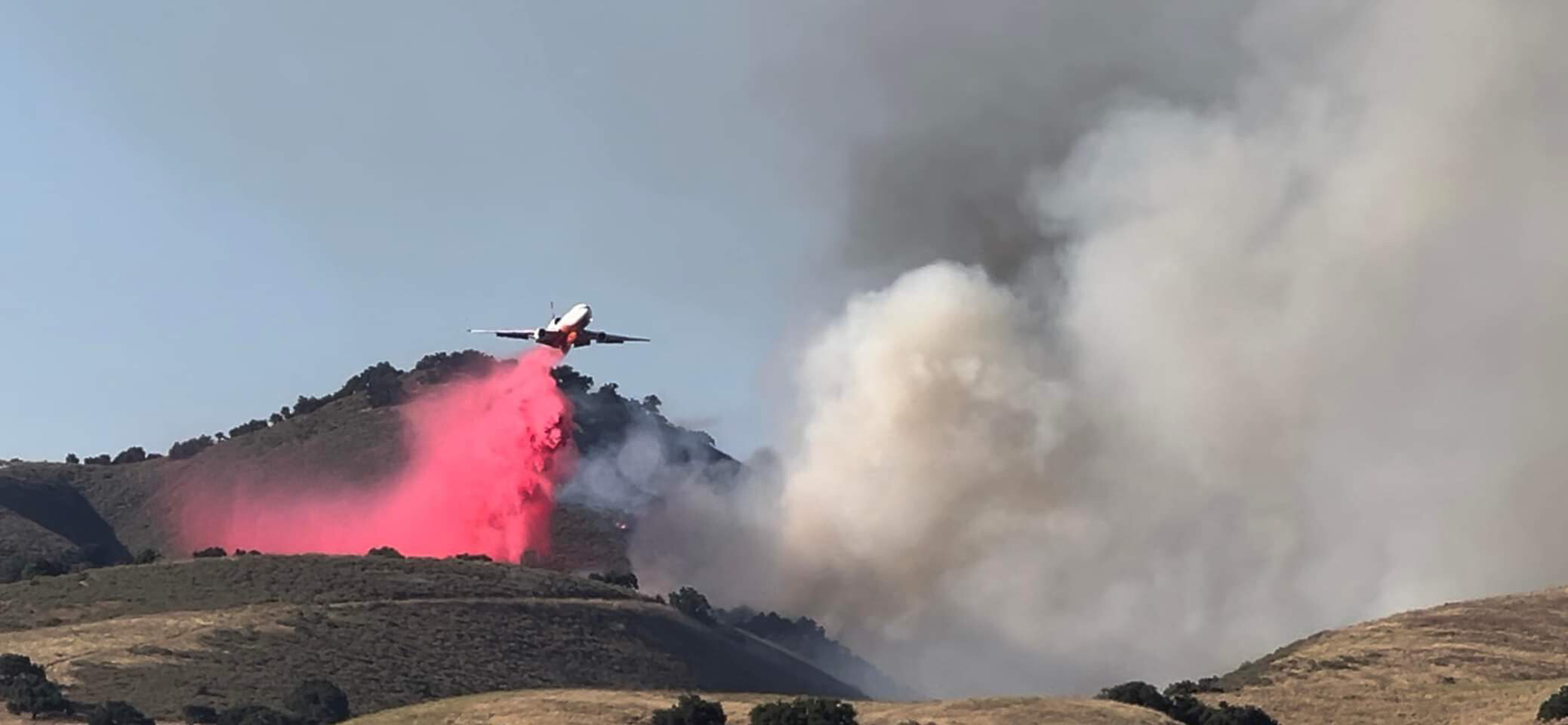
The fire is making some significant runs between the grass mountain trailhead and the USFS Fig Station. The smoke inversion is starting to lift and fire activity is increasing. If this continues we are in for a long night with more significant runs. Currently there are a lot of shot and T2IA Crews prepping figeroua mountain rd for a burn to try and hold it north of it. Several strike teams holding the fig station and some buildings up here.
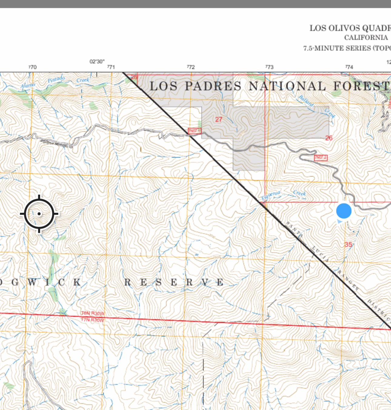
The Fire just crossed Fig Mountain Rd. It has become very established within drainages and making large uphill and wind aligned runs.
See here: ALERTCalifornia
INTEL24 onscene mapping the fire.
Mapped at 18,996 acres by FIRIS this evening.
TAK data package uploaded. http://maps.takserver.us
Timelapse UCSD video