As of about 30 min ago she’s still vertical with fire burned up against the north side of the station and just down hill from the station.
11 Likes
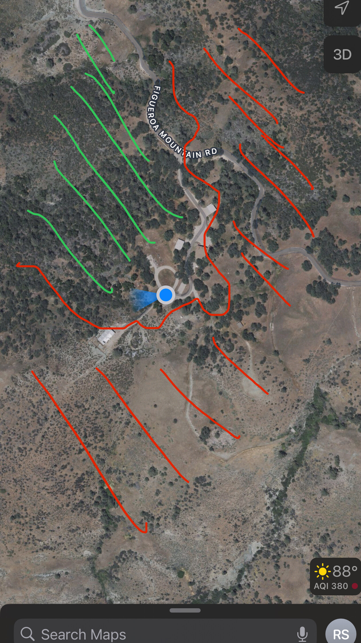
The Figueroa Alert Calif. Cam went off the air… was that mounted at that station? Visible was some siding of a building and a few ground mounted radio antennas in the view too.
4 Likes
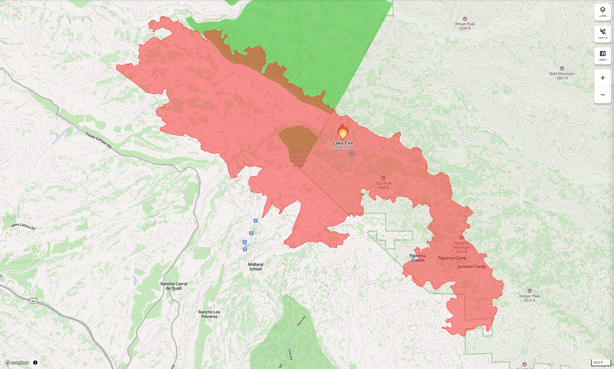
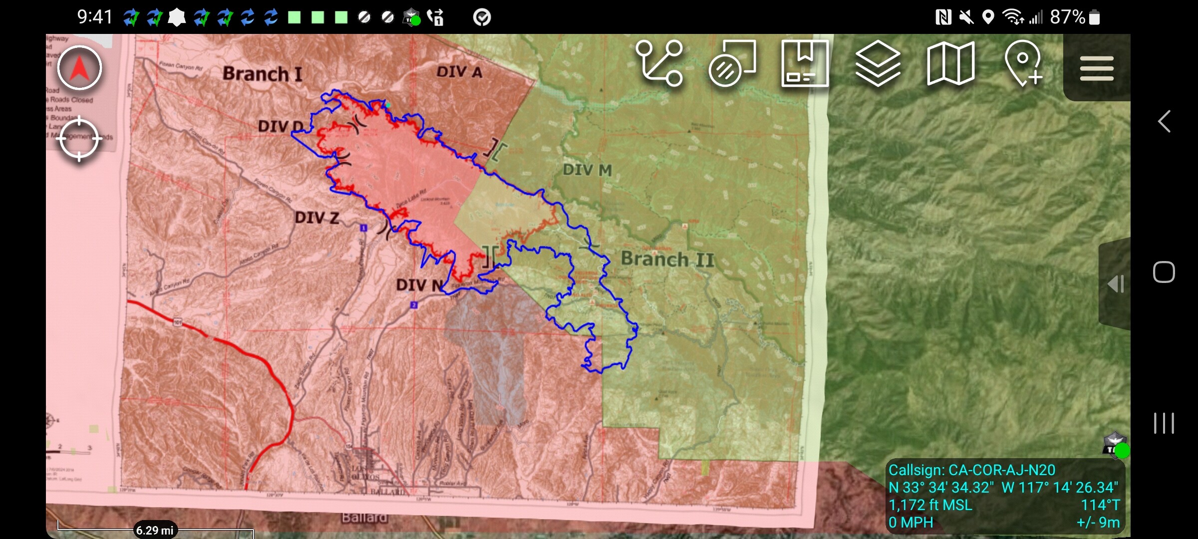
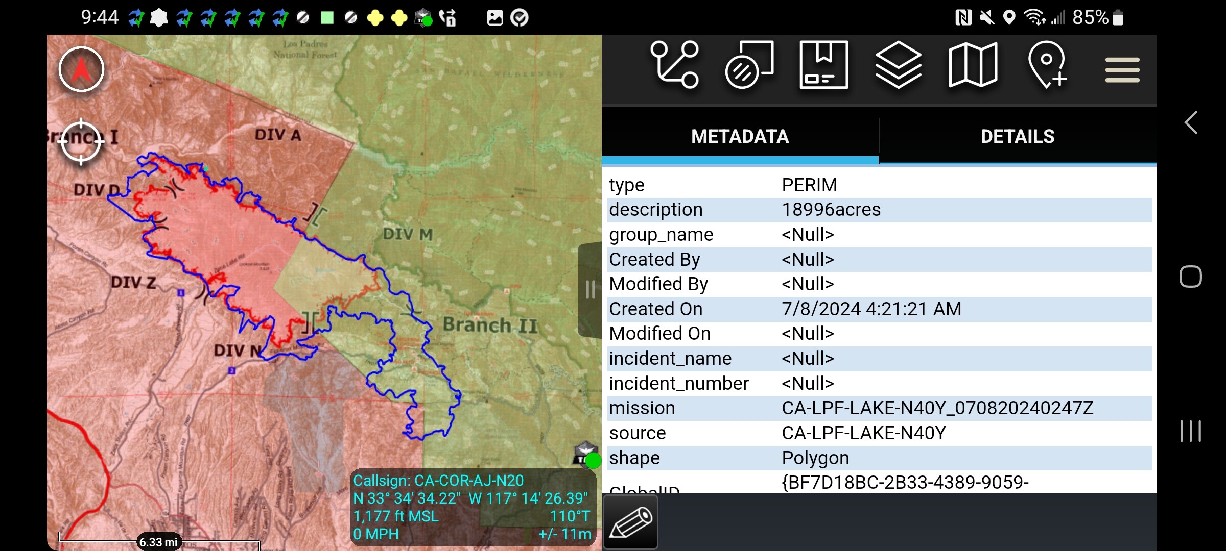
Cant help but find it interesting how much the Lake Fire’s footprint basically runs parallel with Zaca’s infamous footprint.
8 Likes
I spent 3 days in the Wheeler Gorge years ago on a LPF fire. We saw spectacular fire behavior. Spent one shift looking out for our own safety. Let’s hop this fire doesn’t head that way.
2 Likes
Yes they are very similar, but the Lake fire is running east in the front country South of Figueroa mountain, and the Zaca ran north of Figueroa mountain.
4 Likes
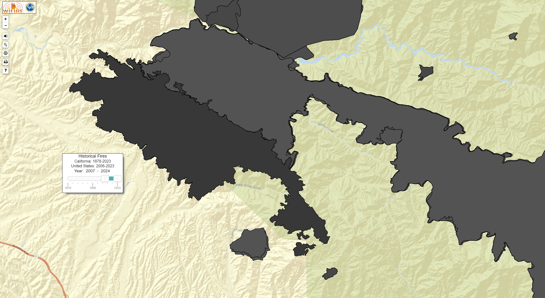
Take a peek at the Marre Fire footprint.
And perhaps the burnover report.
9 Likes
Let us hope they remember lessons learned from before.
4 Likes
You got a link to that report?
1 Like
11 Likes
The camera was on a private building. Not the station.
6 Likes
Natural alignment.
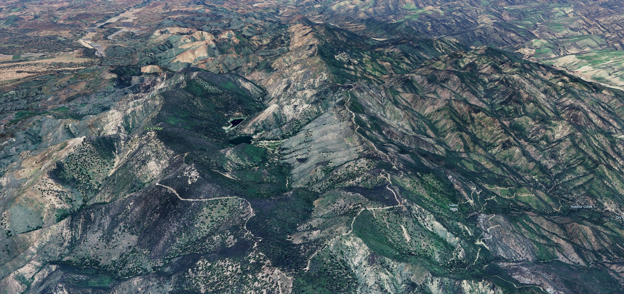
This ridgeline to the right of the lakes is a pretty forceful feature of the area. Lake Fire has progressed through the lake’s watershed, slopped over the sides and has boiled right over the v-portion at the bottom of the image.
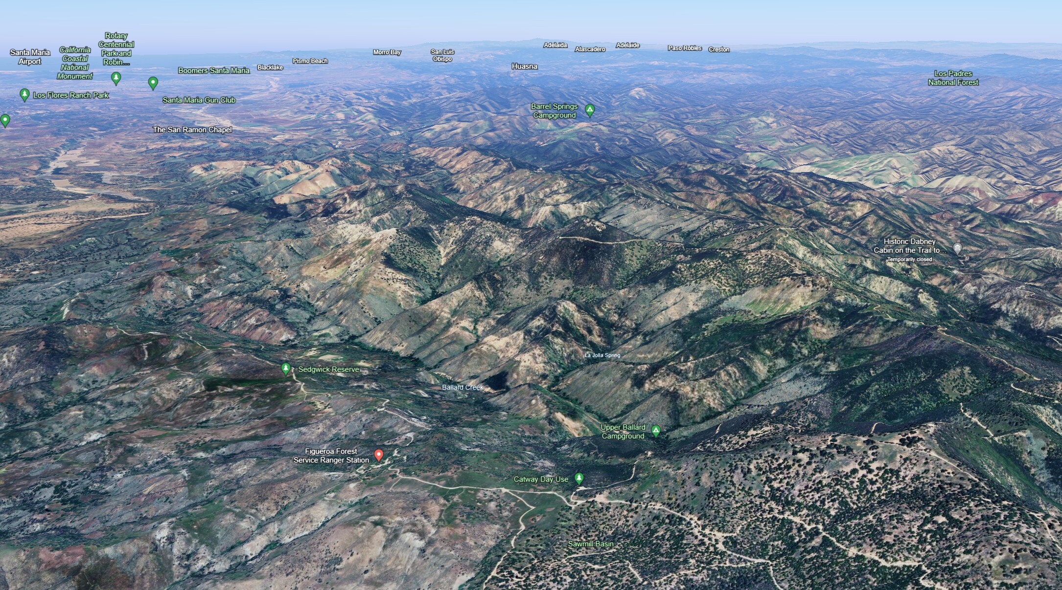
Take a big, giant step back and to the left. Wind spotted fire down and across Ballard Creek and up towards the Figueroa USFS station. While one can cross one’s fingers and hope and pray that it can be contained in this backyard canyon (aka front range) I don’t think there is an epic humble anything in the world that’s going to make that happen.
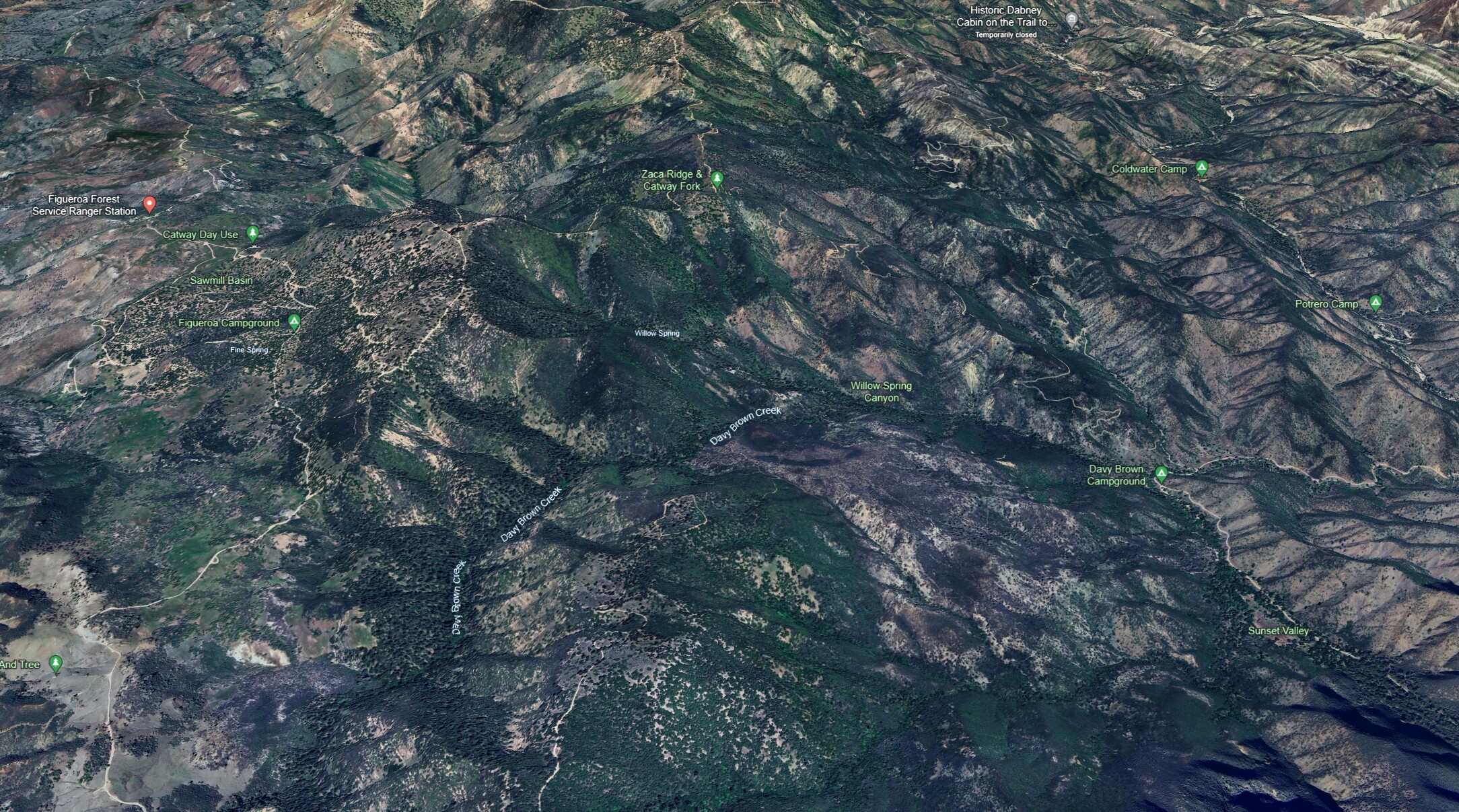
Another giant step back. If fire is not already in Sawmill Basin, it probably will soon be. The next major features are Zaca Ridge and Davey Brown Creek, which, to my knowledge is dry, but I could be wrong about that. Winds are likely to be somewhat north by northeasterly, with a brief northwesterly, through Tuesday. But, with potentially complex interactions of marine layer, humidity, diurnals and generally how winds channel through there, definitely a place to keep your head on a swivel.
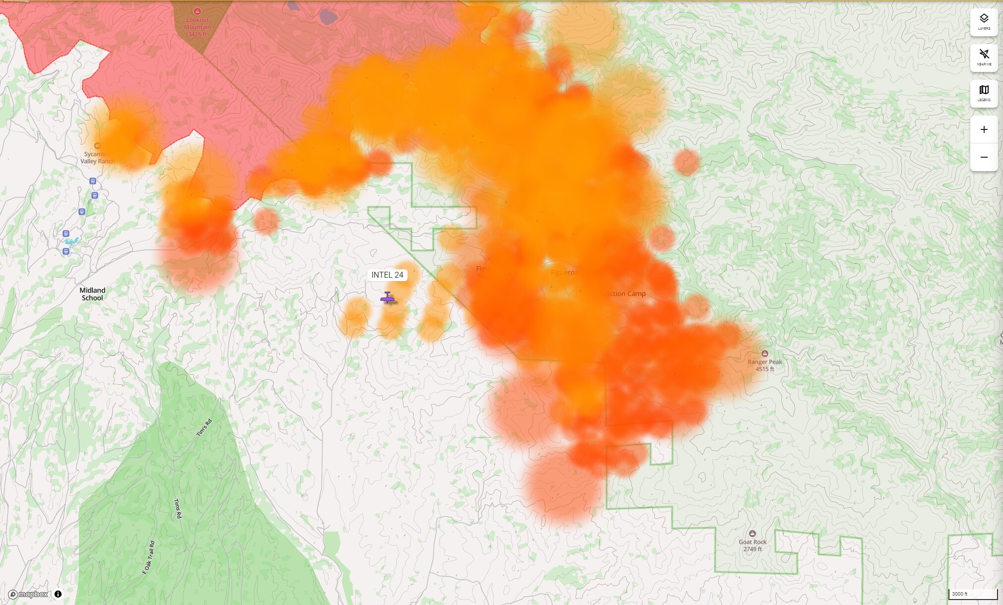
I’m not quite sure how to read modis and viirs, like, what’s fire and what’s smoke?, but it looks like its already passing Ranger Peak.
At some point, the aircraft are also going to be approaching condor country, 25 lb birds with 19 ft wingspans, and just another reason to LTFO.
13 Likes
I don’t know if it’s true, but I’ve heard that condors are sorta like cats in how they are want to come prowl over the black for small animals and fresh kill from a fire. Maybe, some of the FS people know more about that, if it’s a real factor.
3 Likes
CAL FIRE Team 5 activated. State taking over.
16,000 Acres.
6 Likes
Sounds like Zaca to Zaca 2 in reverse.
2 Likes
State taking over what?
3 Likes
Interesting!
2 Likes
Yes. I’m sure unified with SB and LP.
5 Likes
8 Likes
Statement was a op little miss leading
3 Likes