Cal Fire Sacramento is calling for immediate need water tenders from SLU. I got a call and know of another company.
4 Likes
Cal Fire Team 5 isn’t up, CF Team 1 is.
1 Like
CAL FIRE team 5 C&G was activated yesterday to the Lake.
5 Likes
Team 5 took it.
5 Likes
Past Figueroa and Ranger Peak, comes Happy Canyon…
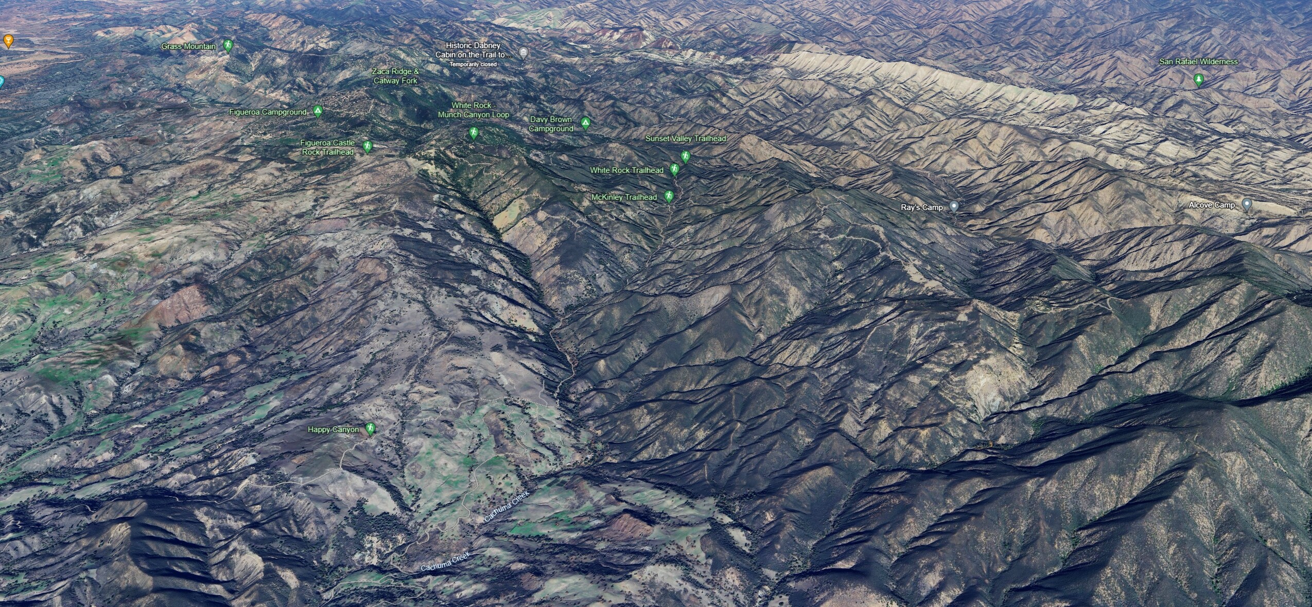
…running to the base of San Rafael Mountain, 6593 ft.
4 Likes
This is technically team 5’s week. With team 6 activated, team 1 was on hard cover. Team 5 cleared the FKU incident and was back in rotation.
C & G were sent yesterday.
7 Likes
2 Likes
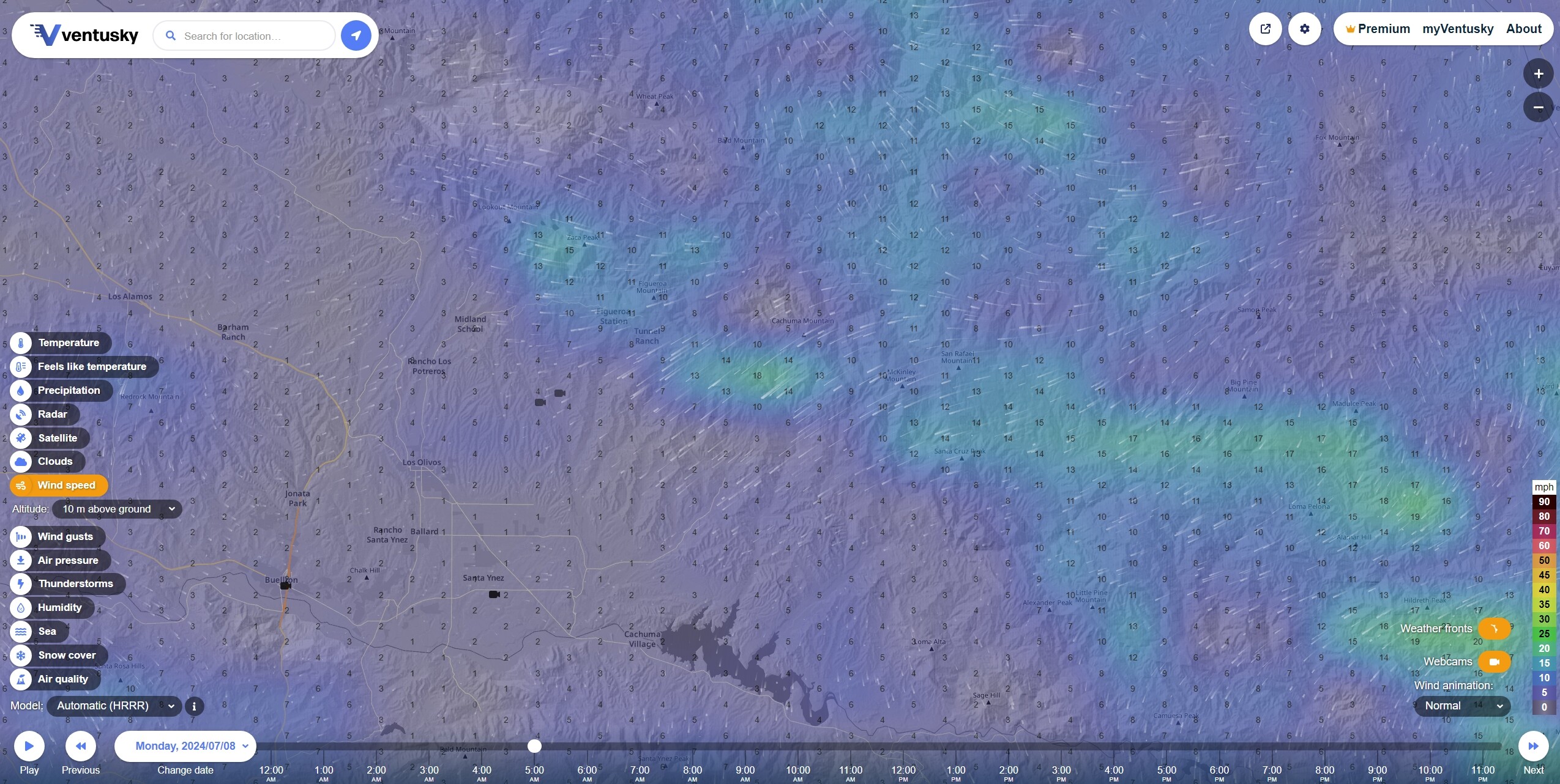
Forecast for MON JUL 7 5AM Wind Speeds
Forecast for MON JUL 7 2PM Wind Speeds HRRR
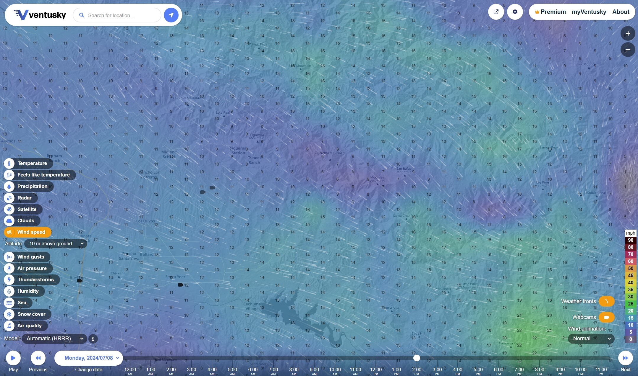
Topography and fuels may favor growth towards San Rafael Mountain tomorrow, but tomorrow’s winds may favor Lake Cachuma. ECMWF and ICON forecast a somewhat more west by southwesterly wind in the afternoon than HRRR.
Forecast for MON JUL 7 2PM Wind Speeds ECMWF
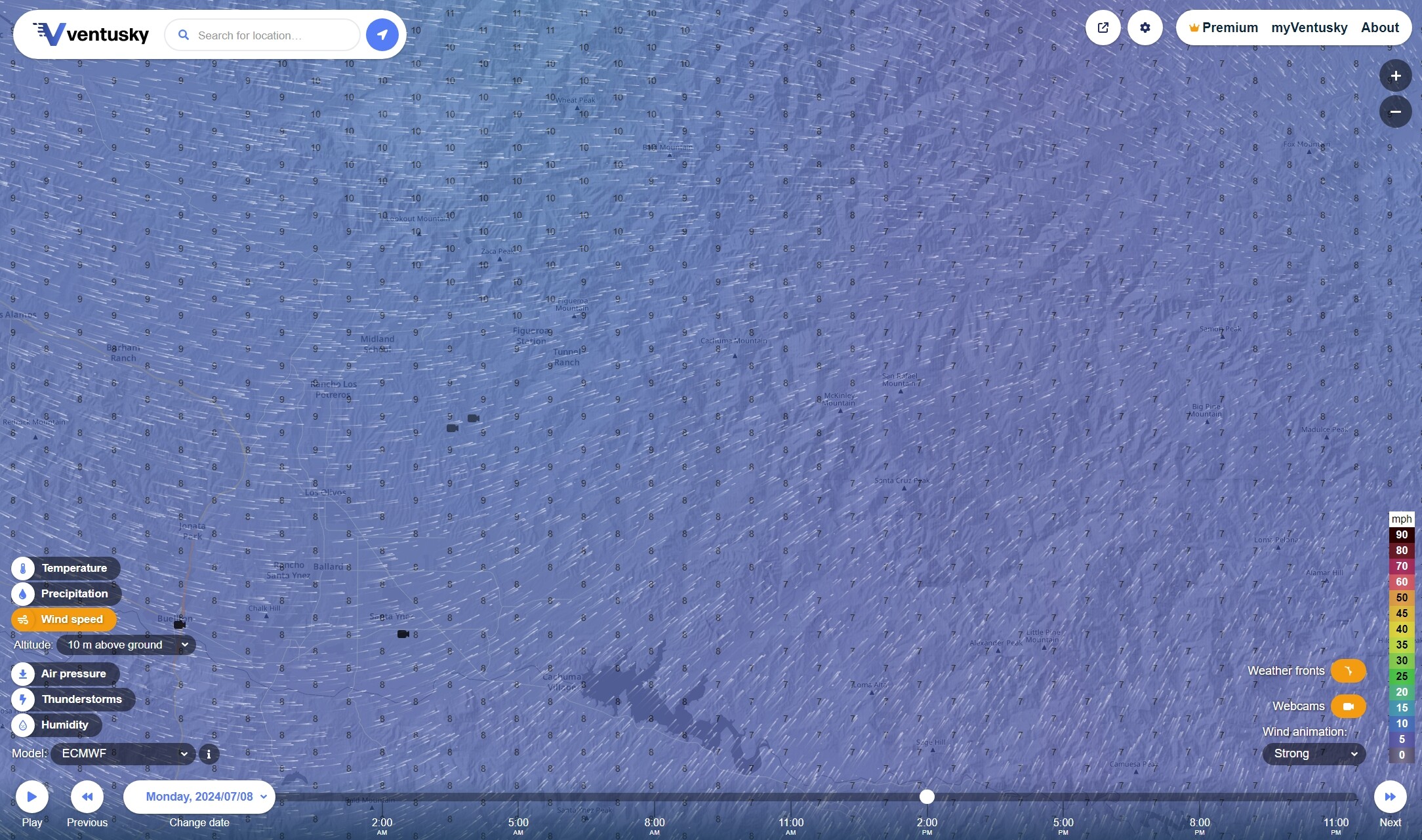
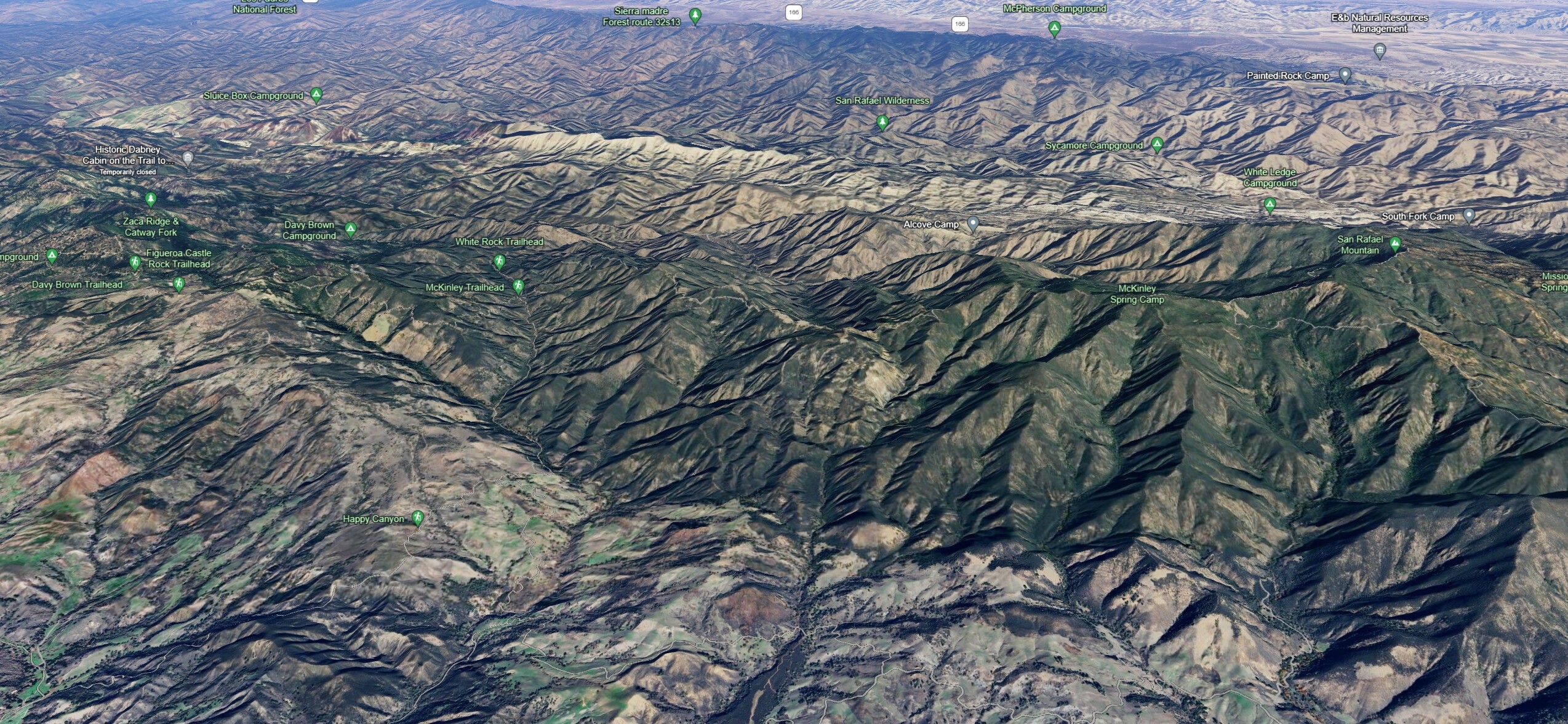
The good news and bad news may be that north of Lake Cachuma are some values at risk, winelands and ranches, however, the ground between Cachuma, Happy Canyon and Rafael may be easier to access and get at with dozers and HEQ than has been the case, so far.
5 Likes
4 Likes
Can anyone post today’s Op map and updated map from last nights flight?
2 Likes
2 Likes
Fire Weather Watch issued July 8 at 9:30AM PDT until July 9 at 9:00PM PDT by NWS Los Angeles/Oxnard CA
…FIRE WEATHER WATCH IN EFFECT FROM NOON TO 9 PM TUESDAY FOR THE
SANTA BARBARA COUNTY INTERIOR MOUNTAINS INCLUDING HIGHER
ELEVATIONS OF THE LAKE FIRE DUE TO GUSTY NORTHWEST WINDS AND VERY
LOW HUMIDITY……FIRE WEATHER WATCH IN EFFECT FROM 3 PM TUESDAY TO 3 AM
WEDNESDAY FOR THE WESTERN SANTA YNEZ RANGE AND ADJACENT FOOTHILLS DUE TO GUSTY SUNDOWNER WINDS AND VERY LOW HUMIDITY…The National Weather Service in Los Angeles/Oxnard has issued a
Fire Weather Watch for wind and low relative humidity, which is
in effect from Tuesday afternoon through Tuesday evening.
WINDS…Northwest winds gusting to 25 to 35 mph.
RELATIVE HUMIDITY…Minimum relative humidity 5 to 15 percent.
Little to no overnight recovery expected.IMPACTS…Conditions will be favorable for rapid fire spread
and extreme fire behavior which could threaten life and
property. The hot temperatures will bring the potential for
large vertical plume growth.
Forecast for MON JUL 8 2PM Wind Gusts, Temperature and Humidity

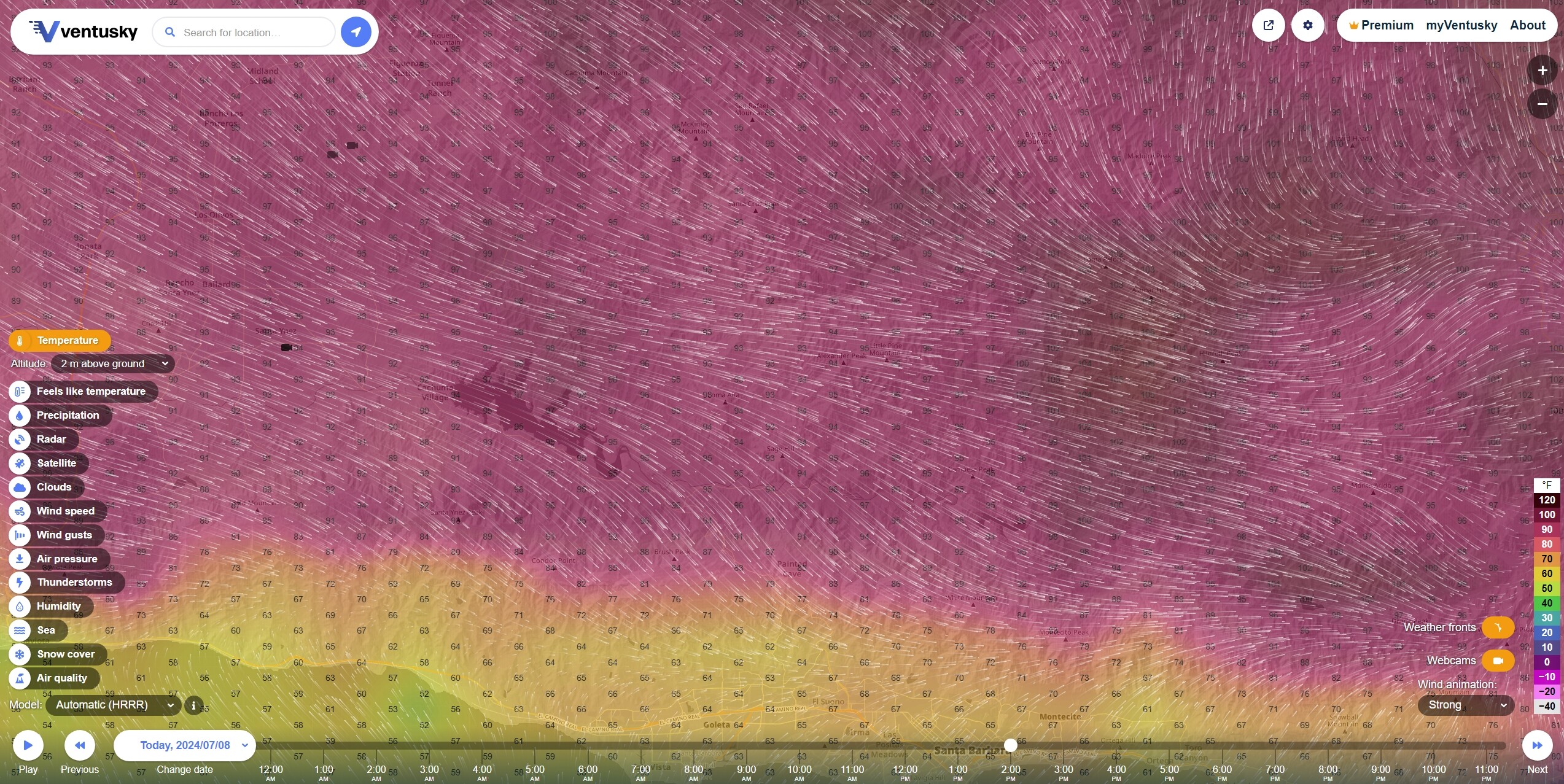
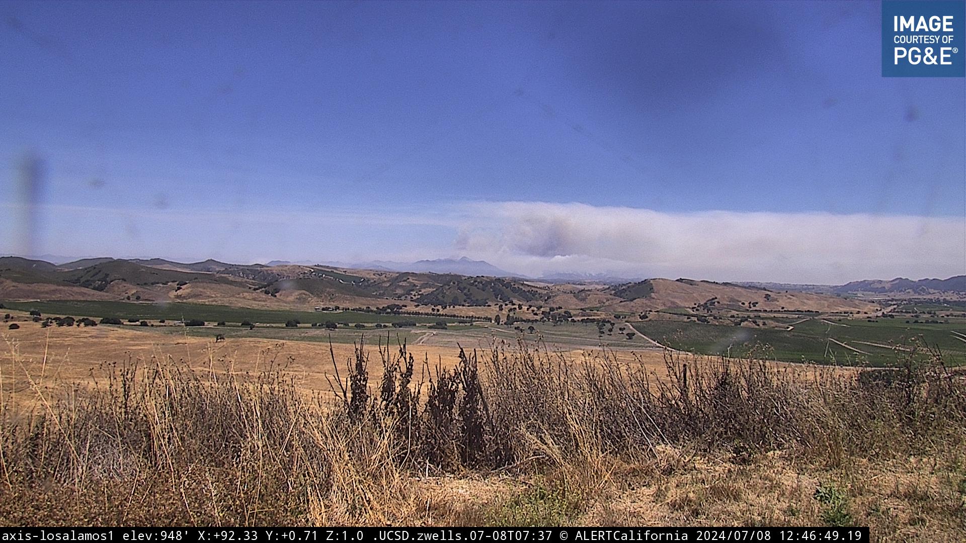
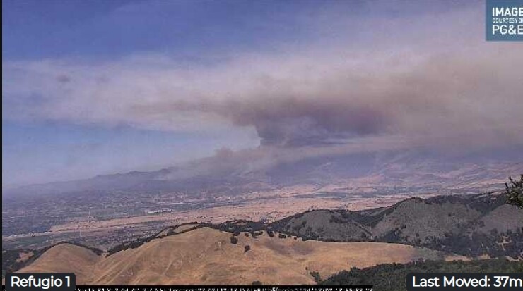
Stronger westerlies today but somewhat better marine layer at higher altitudes. Potential for sundowner type winds to the east of the fire and north of Santa Barbara in the Santa Ynez Range (a bit southeast of the Rafael Range, where the fire is currently located).
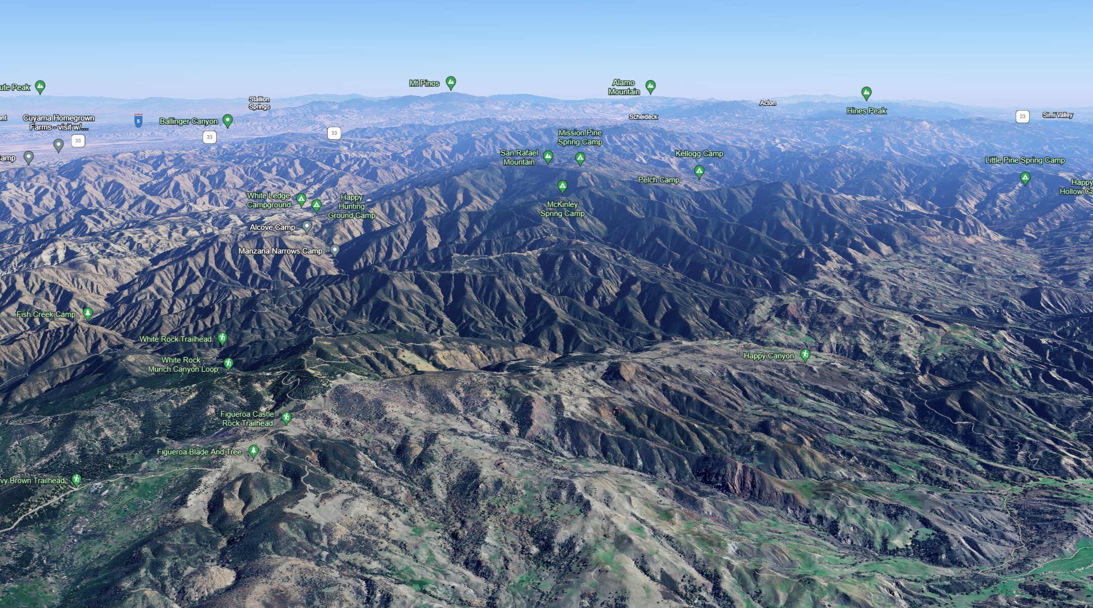
Looking to the east, roughly downwind, today’s winds are mainly blowing the fire into higher and more difficult terrain, through Happy Canyon and up towards San Rafael Mountain.
5 Likes
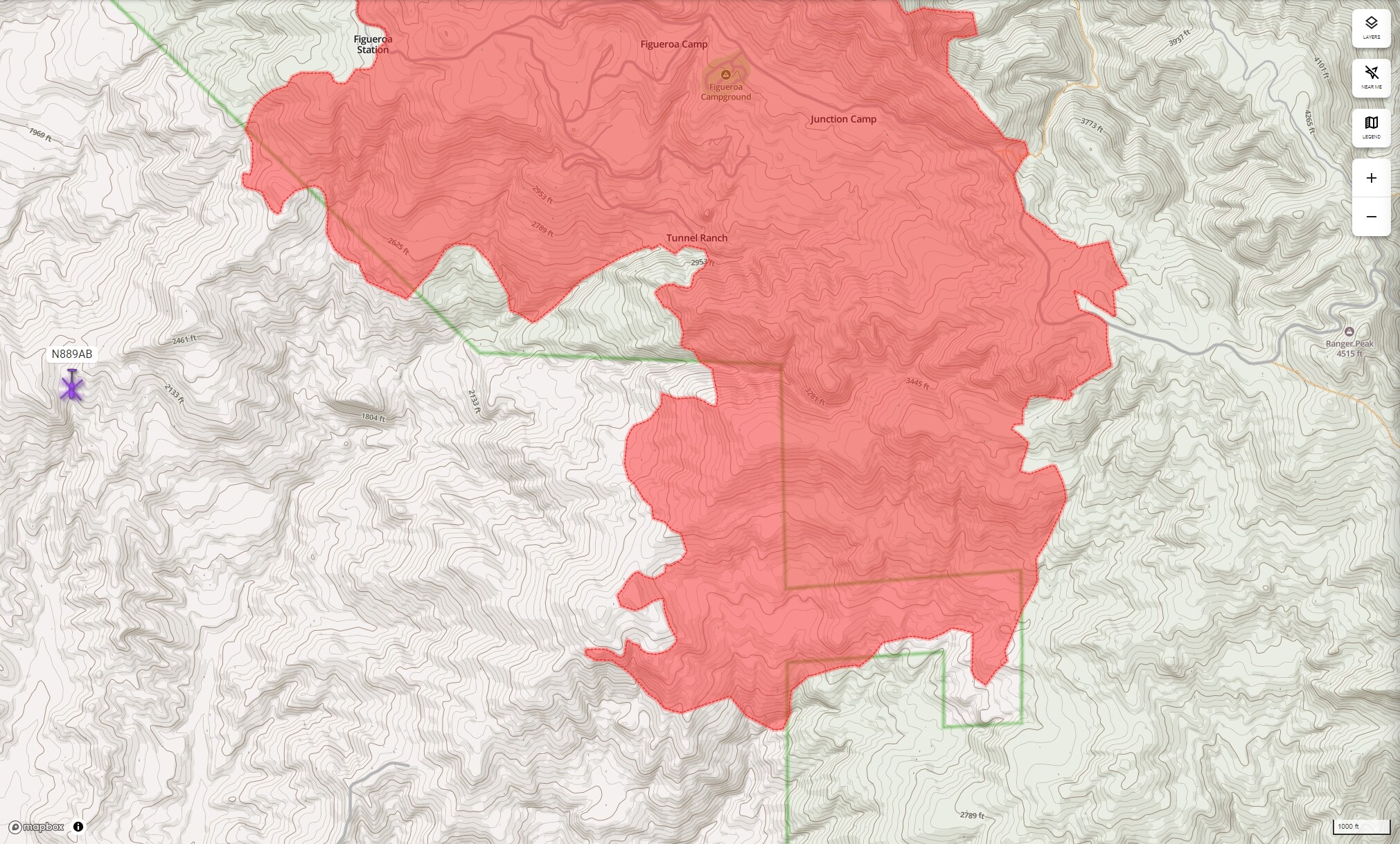
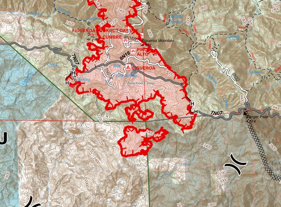
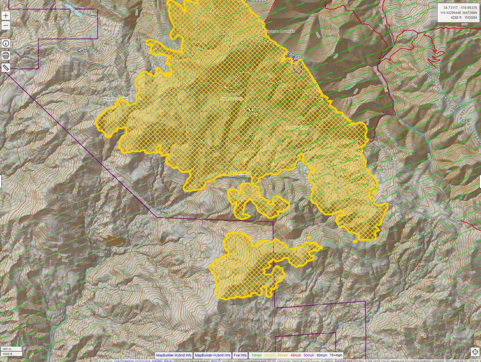
Just a touch of discrepancy between various maps. WD and AlertWest are showing more progression south of Junction Camp and down in the bottoms.
When all else fails, ensure your safety and the safety of your crew and use your Mark I Mod 0 eyeballs to observe and report conditions on the ground as appropriate.
4 Likes
Looks like type 6 country. Think those orders will start coming out?
6 Likes
Not unless you can swing tools and hike
16 Likes
During the Zaca, in those forest areas, it almost entirely turned in to crew and helicopter work. The state areas, toward Sisquoc, Los Olivos, Santa Ynez, Cachuma were/are far more wheeled-vehicles friendly. This fire has a ton of potential to grow. It could technically burn to Tepusquet, Highway 33 or beyond, and even to the Thomas scar. I’m not suggesting it will, only that it can.
6 Likes
…base camp was also at Live Oak Campground.
3 Likes
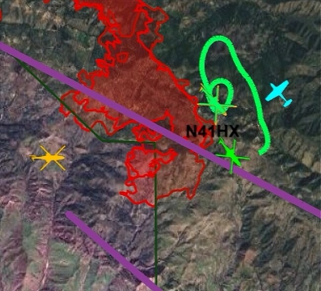
Not certain of accuracy of fire activity, but find the maps informative. CalTopo - Backcountry Mapping Evolved
1 Like