They are. As an example of why those details are important (remembering that old adage that a little knowledge can be dangerous): one of the things that hand crews want to be careful of in the chapparal vegetation ecosystem, per se, is fire that gets down into drainages below them. The fuel types, largely oak scrub, manzanita and friends, are prone to sudden and unexpected fire behavior due to the uneven ways that oak scrub and manzanita burn.
There’s plenty of video of crews, for instance, doing a firing operation on a ridge, to suddenly have a sheet of flame rise up over the ridge line, as it’s not uncommon for drainages full of old oak to have pockets of manzanita within them, difficult to see in a thicket. When those pockets burn, they burn very hot because they are a high energy plant species full of sugars. You really, really, need to know if fire is getting into that stuff in the drainage bottoms below you.
Live Oak CG… spent two months being the COML for both state and NIMO teams.
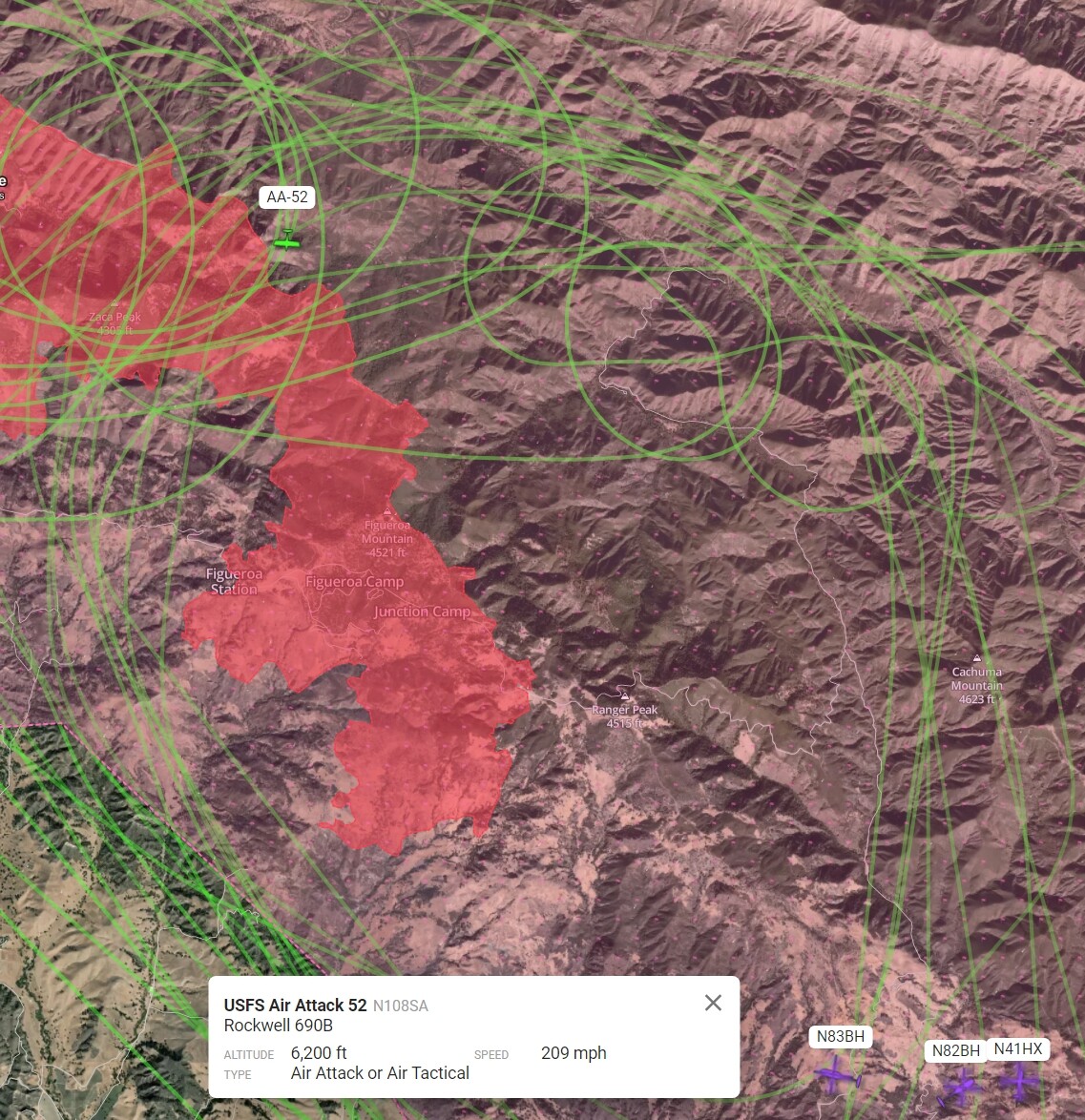
30 personnel in the Comm Unit alone! It was shuffle board with command repeaters and explaining why I needed 6 command repeaters. Why don’t they believe you know your job… I build and turn key conventional repeater infrastructure.
The techs loved me and had great staff assembled.
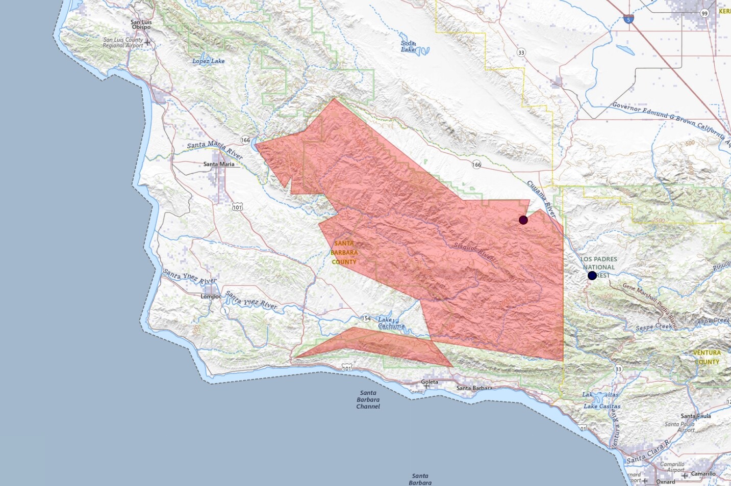
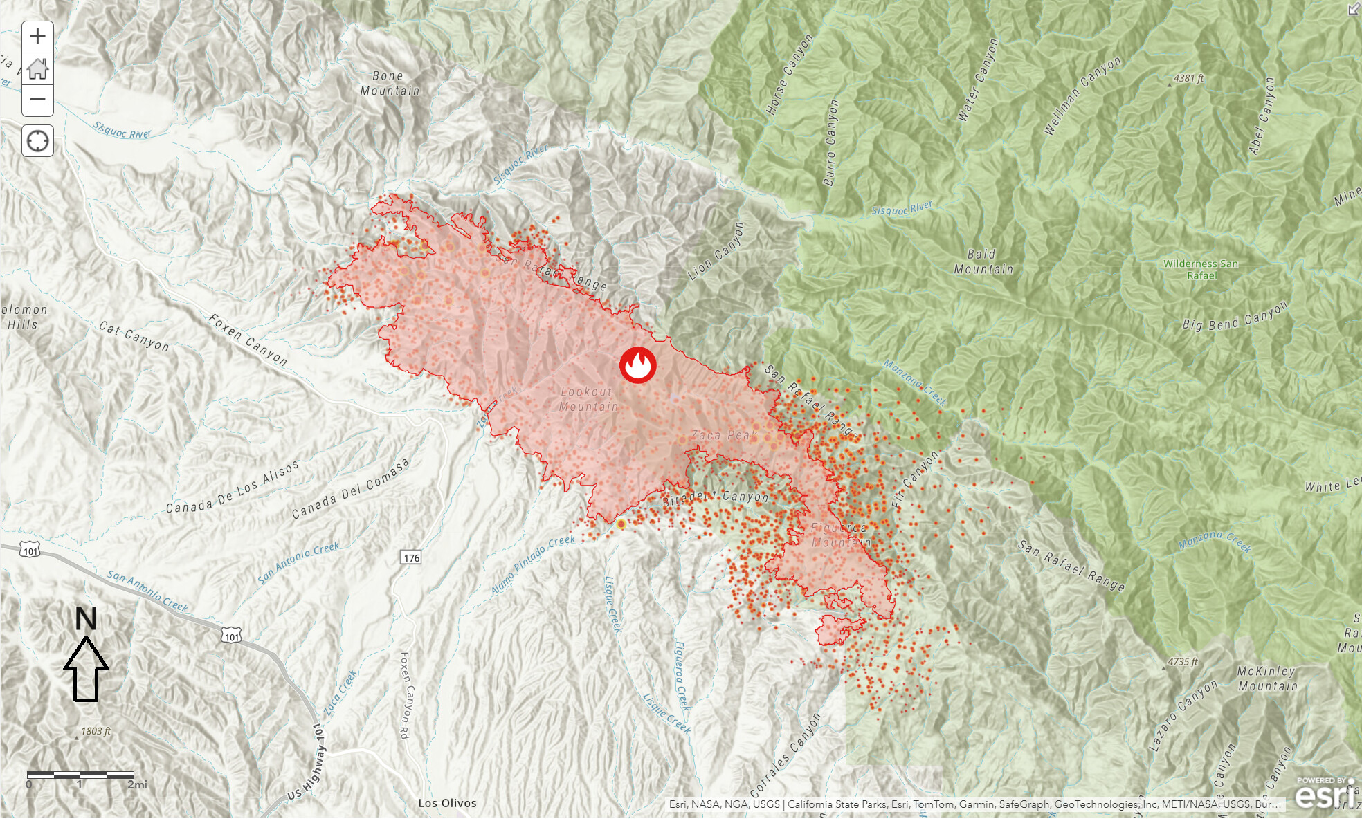
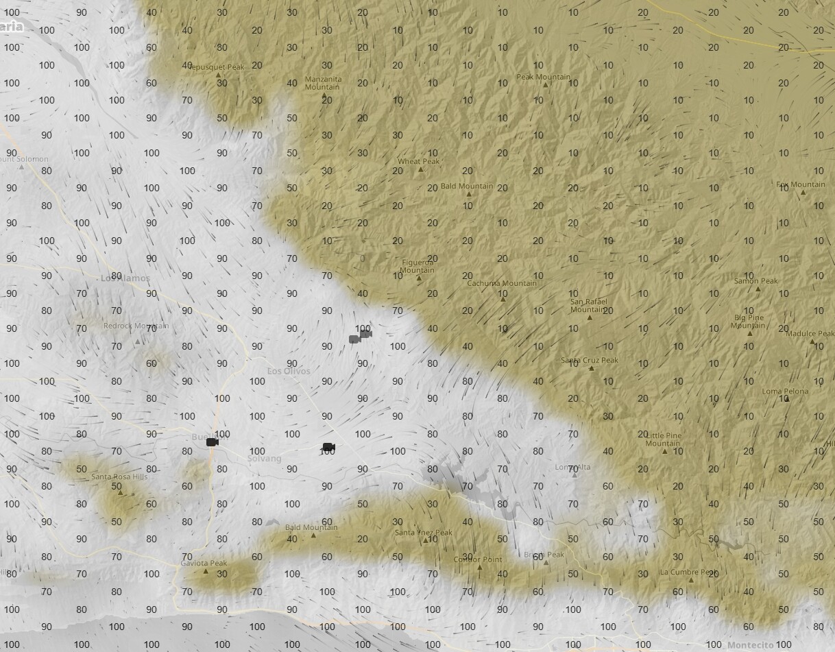
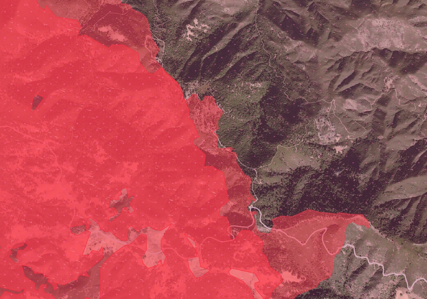
Hoping MODIS and VIIRS is a little off with this one. The data doesn’t look right and the confidence says “n” along that eastern section. It has that uniform spatial pattern that looks suspect. The Biradent Canyon looks correct and from what I saw on camera this afternoon, I think it filled in and up to Fig Mt Rd. .
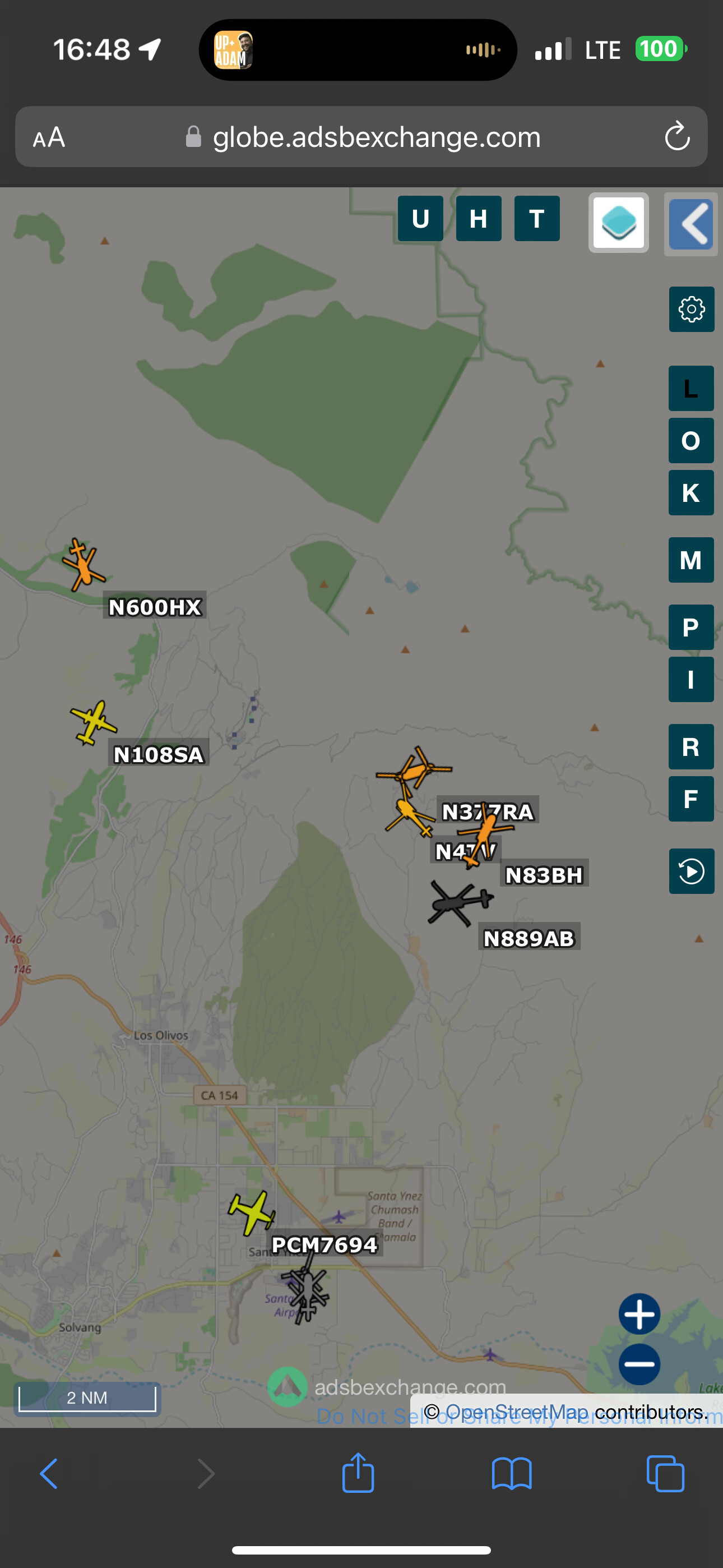
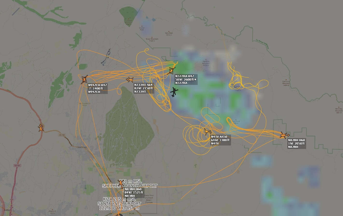
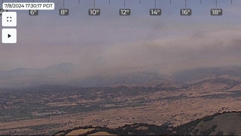
Looking east. One of the hoppy-chopters was out this way for a minute, they may have been trying to do something there out on the White Rock - Munch Canyon Loop. Will have to wait for the next Intel flight to see how the day went for Forest Service Road 8N32.
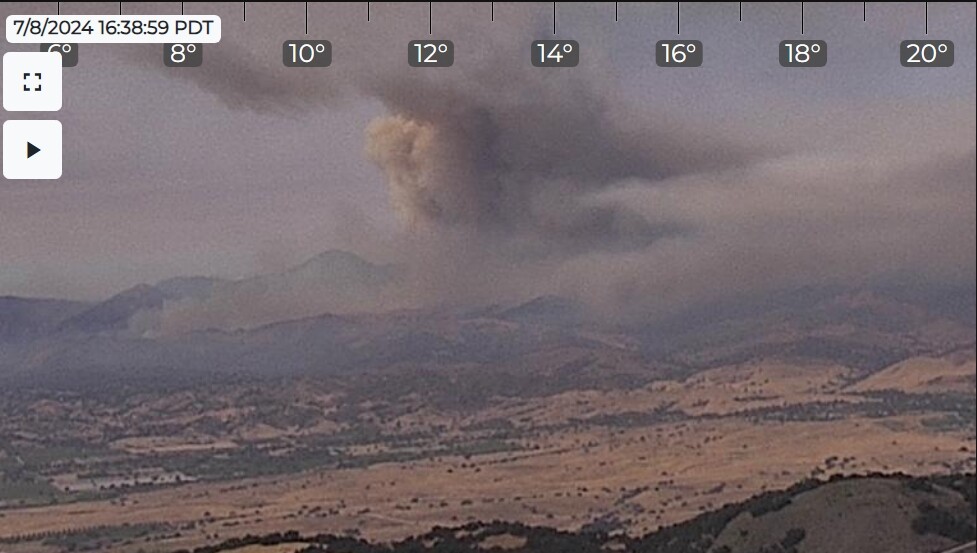
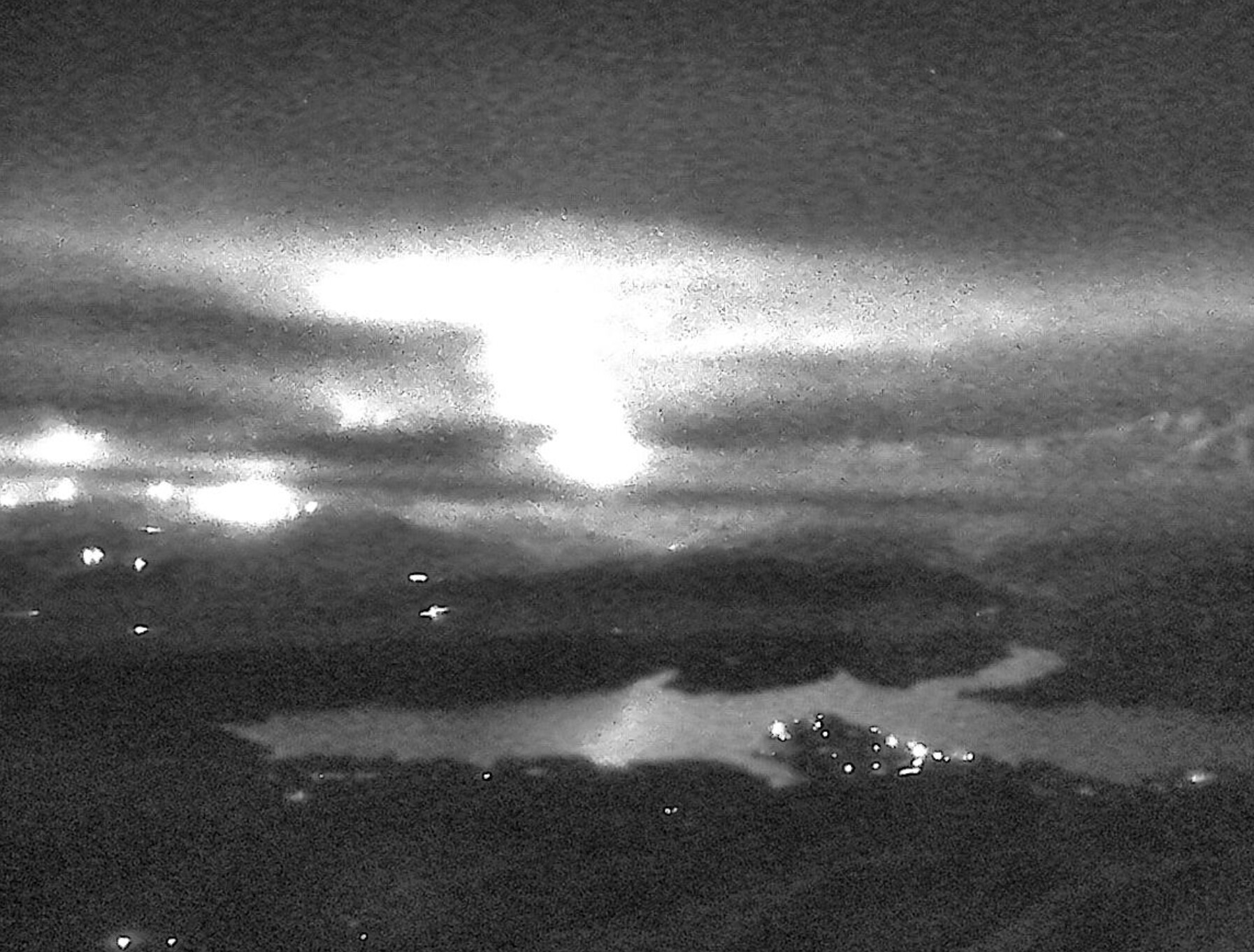
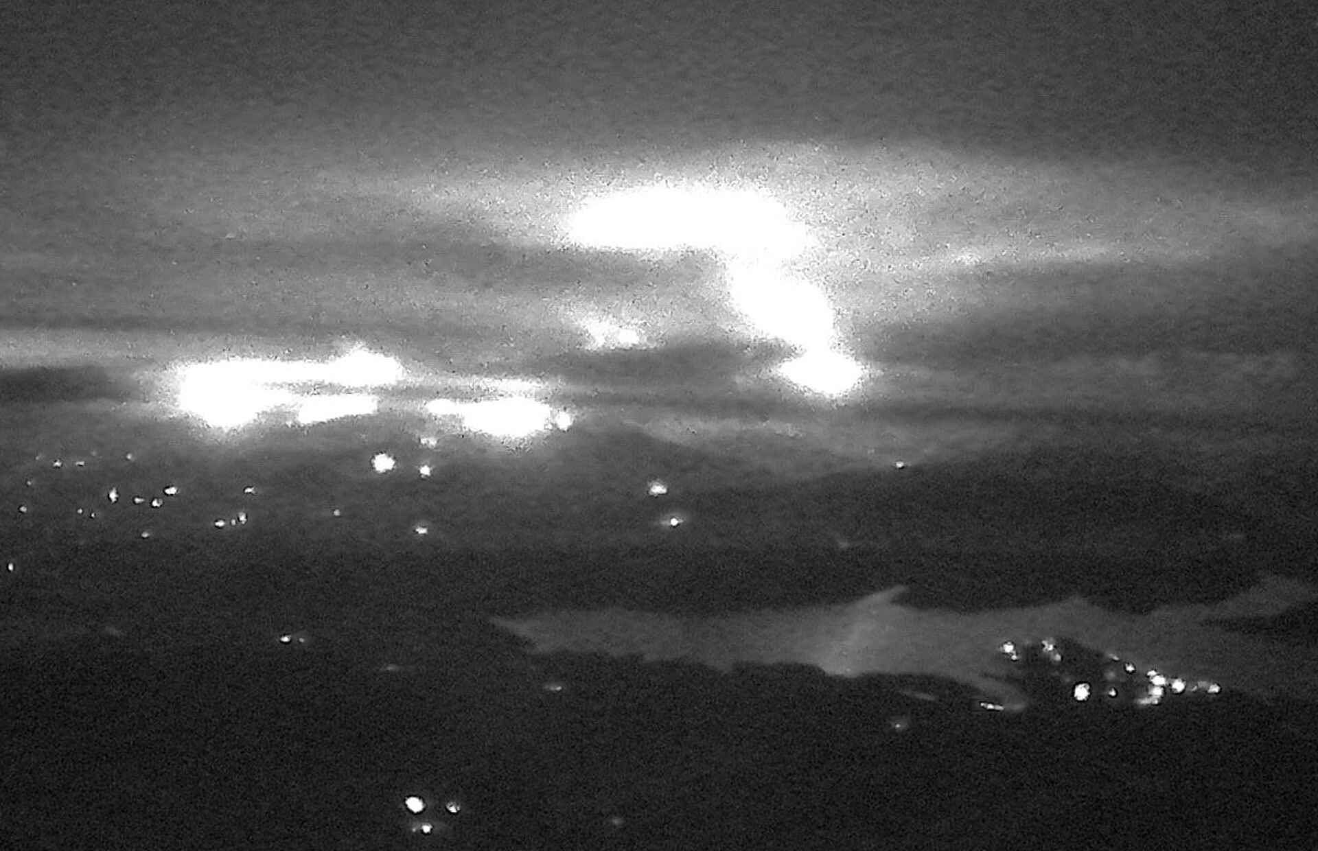
Tonight you can see the fire reflected off Lake Cachuma, from the Santa Ynez Peak camera approximately 17 air miles to the south of the actual fire. Appears to be very active. Same story from the Refugio camera. Screenshots from Alert CA website.
Good news and bad news. With wind and slope alignment, there just isn’t a lot that can be done on that mountain. Bad news, is the trail got burned over. Good news, is the land will return to something looking healthy and green to the public a bit faster than it does in timber country, so to speak.
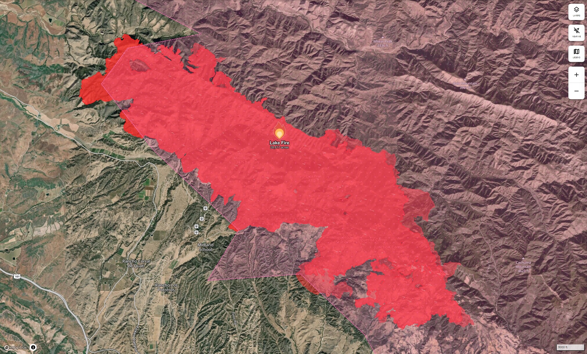
Talked with DivP tonight. Sounds like Team 5 will take part of the fire (west) and Team 13 will hang onto east. AA said fire was at Davy Brown as he was turning back to the base for the night and thought it would be at Nira by morning. They are worried about explosive fire behavior (large runs and long range spotting), which thus far they haven’t seen. Based on the IR I studied (attribute point data), a lot of the eastward push on VIIRS looks legit. I asked why they haven’t used more tankers (obviously I know visibility is major factor) in the afternoon and he couldn’t say why. He was tired so we didn’t talk too much fire. I still think that we may see some big pushes yet to come.