Out of state crews offloading at Goleta Airport. I hear 20 crews were ordered.
10 Likes
5 Likes
Cautionary tale about show business (and really foul mouths) included at no cost to all arriving out-of-state firefighters.
6 Likes
Sounds like wiilderness anticipation and firing ops.
5 Likes
3 Likes
Just got eyeballs on the beaches, little to no marine layer penetration across the shore line. I would not be expecting miracles on Lake Fire, today.
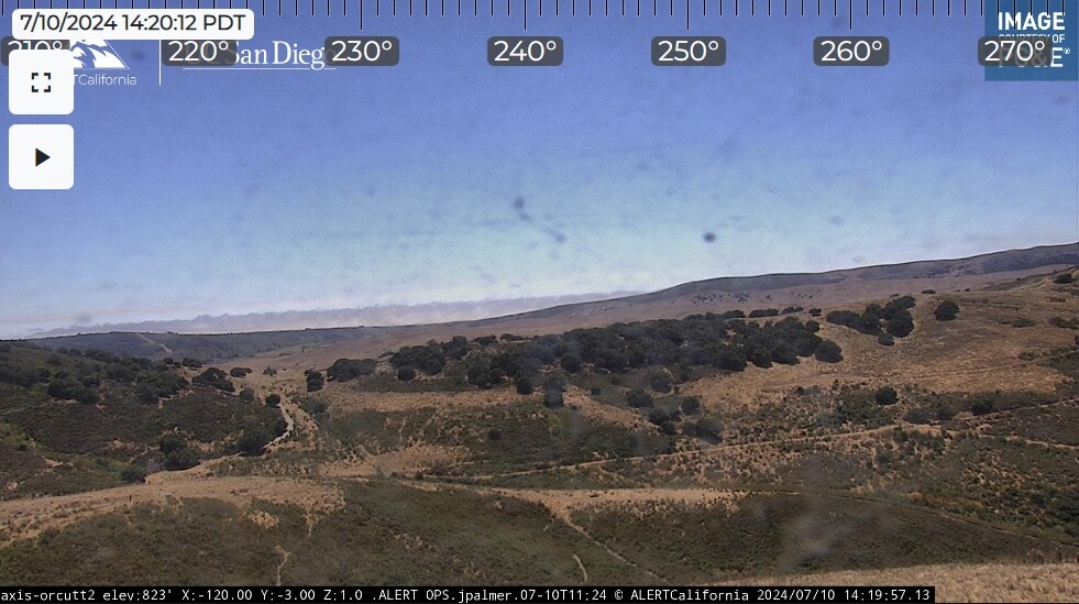
This is looking west from Orcutt. In the center-left, that isn’t a ridge, or smoke. That is humidity condensate getting squeezed up and away into the sky as it passes through the temperature and pressure gradient between the sun heated dunes and cooler waters.
5 Likes
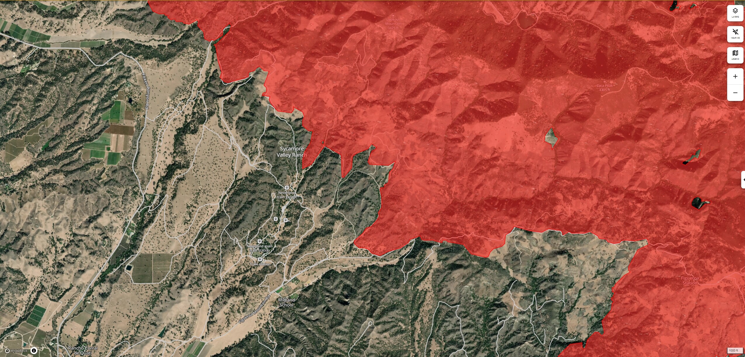
I suppose more fire up there may have a medium-term impact on the Lake Cachuma watershed water quality for a while, but it’s not worth the risk of futile attempts to get in front of it for things that would ‘just be nice’.
In the long term, once the fire is out, Burned Area Emergency Response (BAER) teams, or the like, will be able to do some things to mitigate water quality issues in the Lake Cachuma watershed.
4 Likes
Where this fire is currently burning it would not impact lake cachuma. It’s burning in the Sisquoc and Santa Maria River drainages. For the most part.
3 Likes
Ah. Thank you. Same thing applies. USGS Water Dashboard provisions this easy-to-read map of the watersheds and may be a good entry point for people wanting to start looking at long-term impacts and planning issues.
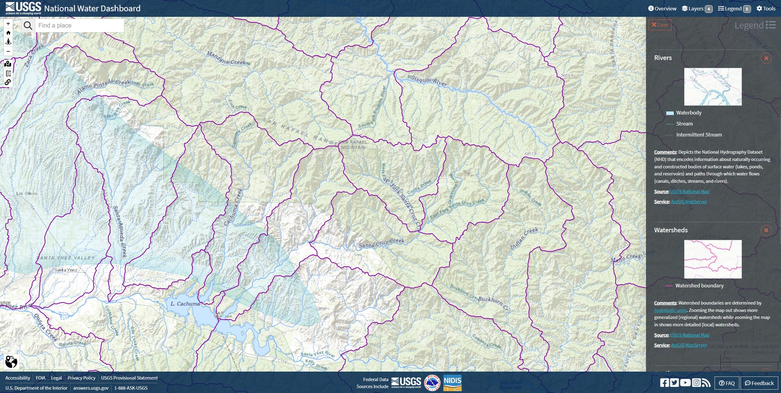
USGS | National Water Dashboard
4 Likes
If your on Lake Fire tonight, there may be a chance to see a Falcon 9 launch out of Vandenberg sometime between 7pm and midnight. Look towards VSB and watch for it to arc up and out over the channel. The Heavies and the old Delta Vs are/were much easier to see and hear, but you might be able to get eyeballs on the tail plume.
SpaceX planning Thursday evening launch out of Vandenberg Space Force Base (ksby.com)
UPDATE (Wednesday, July 10) - The planned launch of a Falcon 9 rocket from Vandenberg Space Force Base has been moved to Thursday, July 11.
The rocket is scheduled to launch at 7:39 p.m. with backup opportunities available until 11:37 p.m.
8 Likes
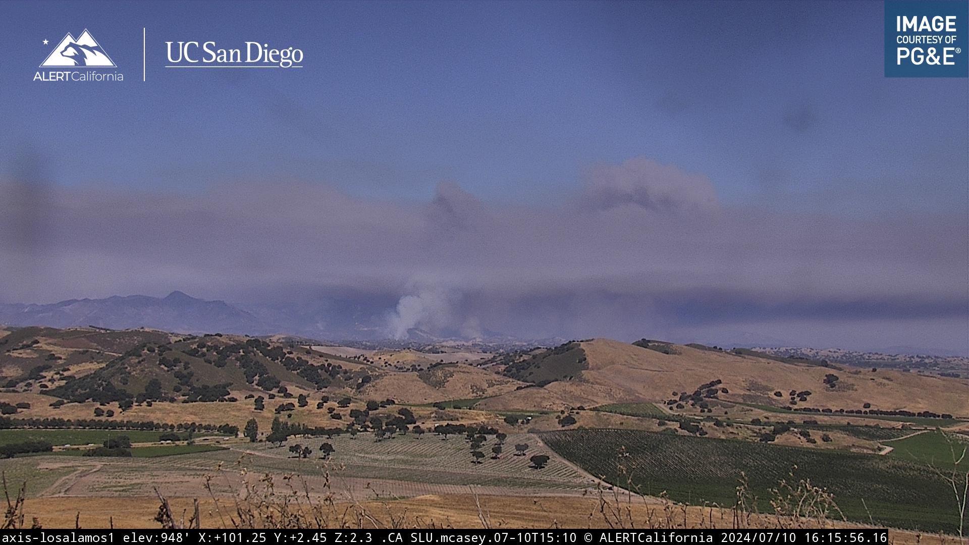
Current view from the Los Alamos Cam. Looks like they had a flare up on DivU/W, still cooking to the east though as well.
4 Likes
3 Likes
Be advised, the headline for this article is for TNF-ROYAL. Though the article covers the LPF-LAKE as well.
5 Likes
Marine layer is starting to press in a bit more, rH under 2500 ft may be a bit better tonight.
5 Likes
Yes, and they have the Modoc county NOD fire “west” of Mt Shasta. 
3 Likes
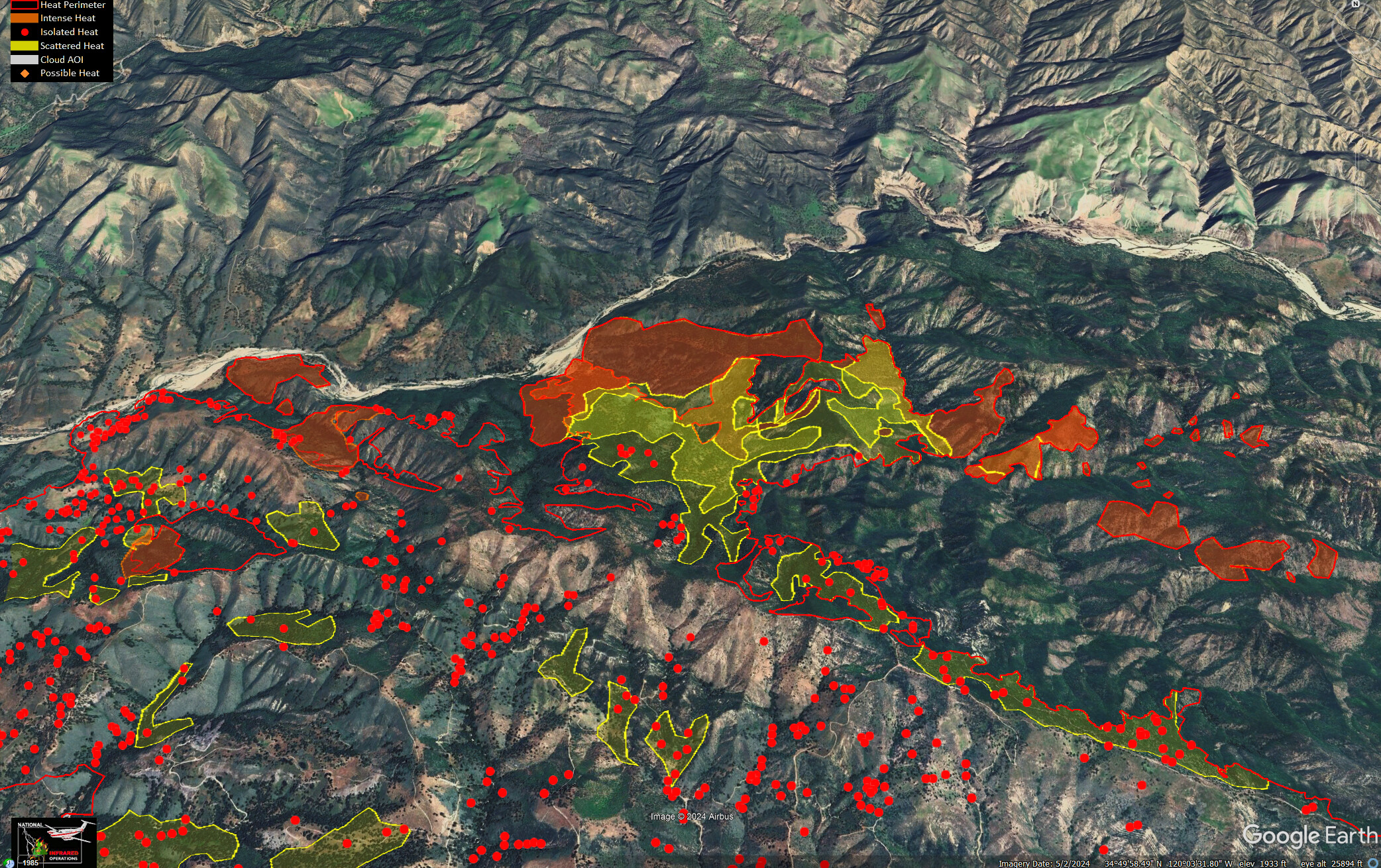
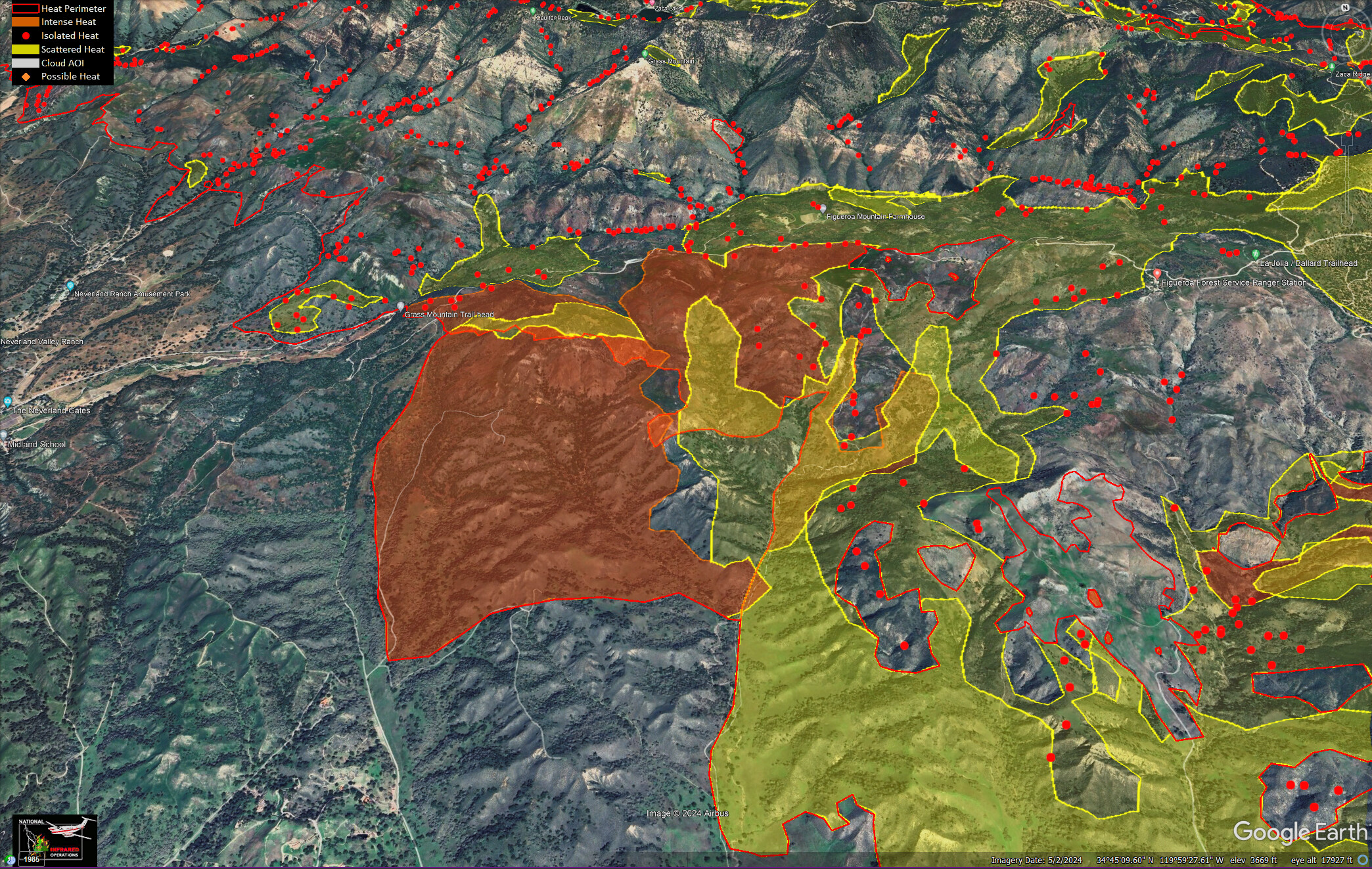
IR for 7/12. Darker colored, filled in, areas are basically progression for the past couple days.
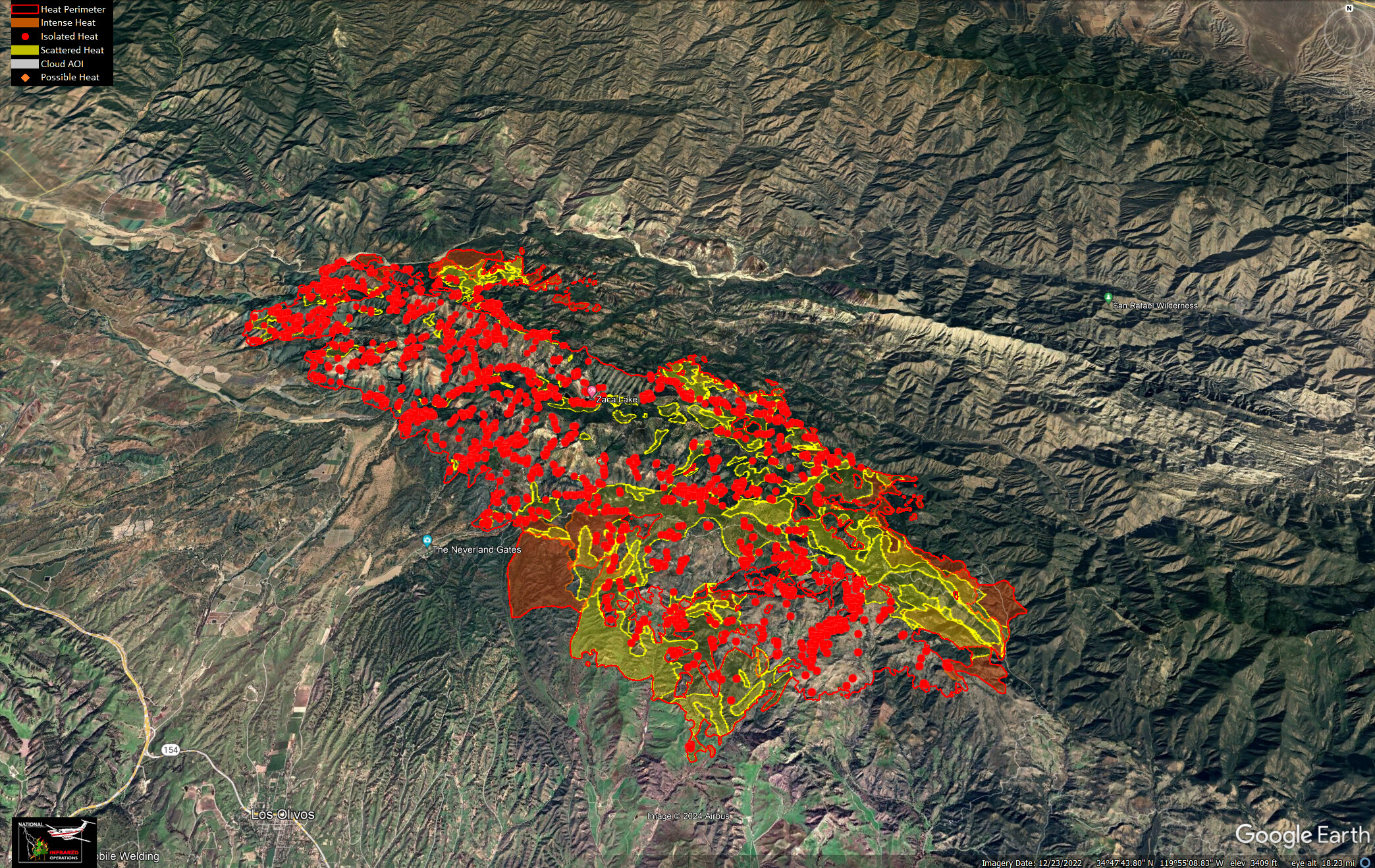
Branch I. North side, south of Rattlesnake Canyon.
Branch III and V. East side, McKinley Trail.
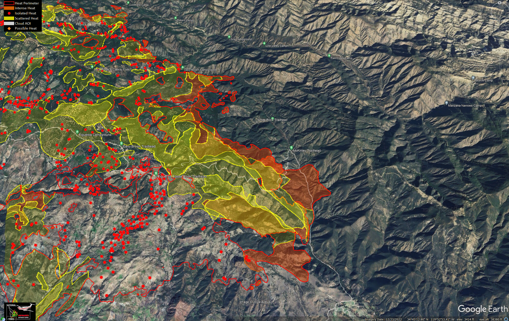
Branch X. South side, Santa Ynez.
Probably, the most dramatic. The winds have been blowing from the northeast for the last 48 hours, slowing growth on the northern and eastern sides of the fire and driving it downslope towards prepared dozer lines.
10 Likes
4 Likes
can you share a link to your data ? Thanks!
3 Likes
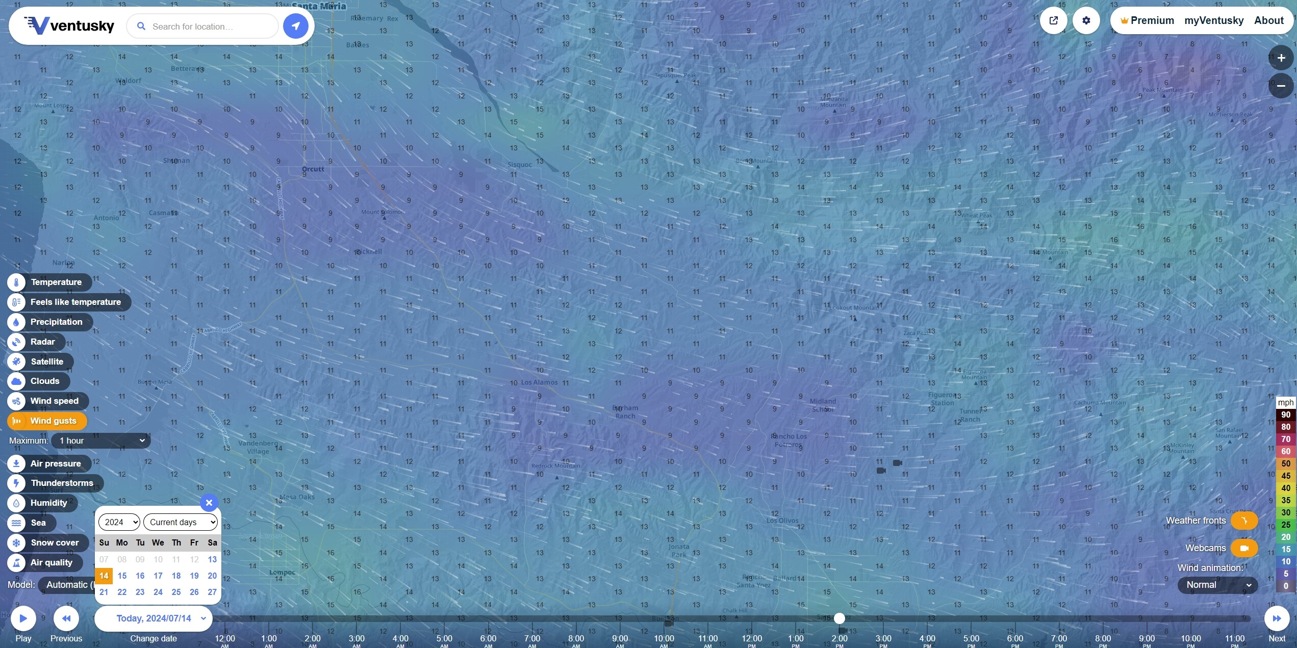
Both the IR and the Ops map are from the public FTP site hosted at ftp.wildfire.gov. Comments on the wind are based on observations made with ventusky.com. I recommend watching @pyrogeography’s channels for how to put the maps together on Google Earth.
9 Likes
Ventusky Forecast for JUL 14 2PM Wind Gusts
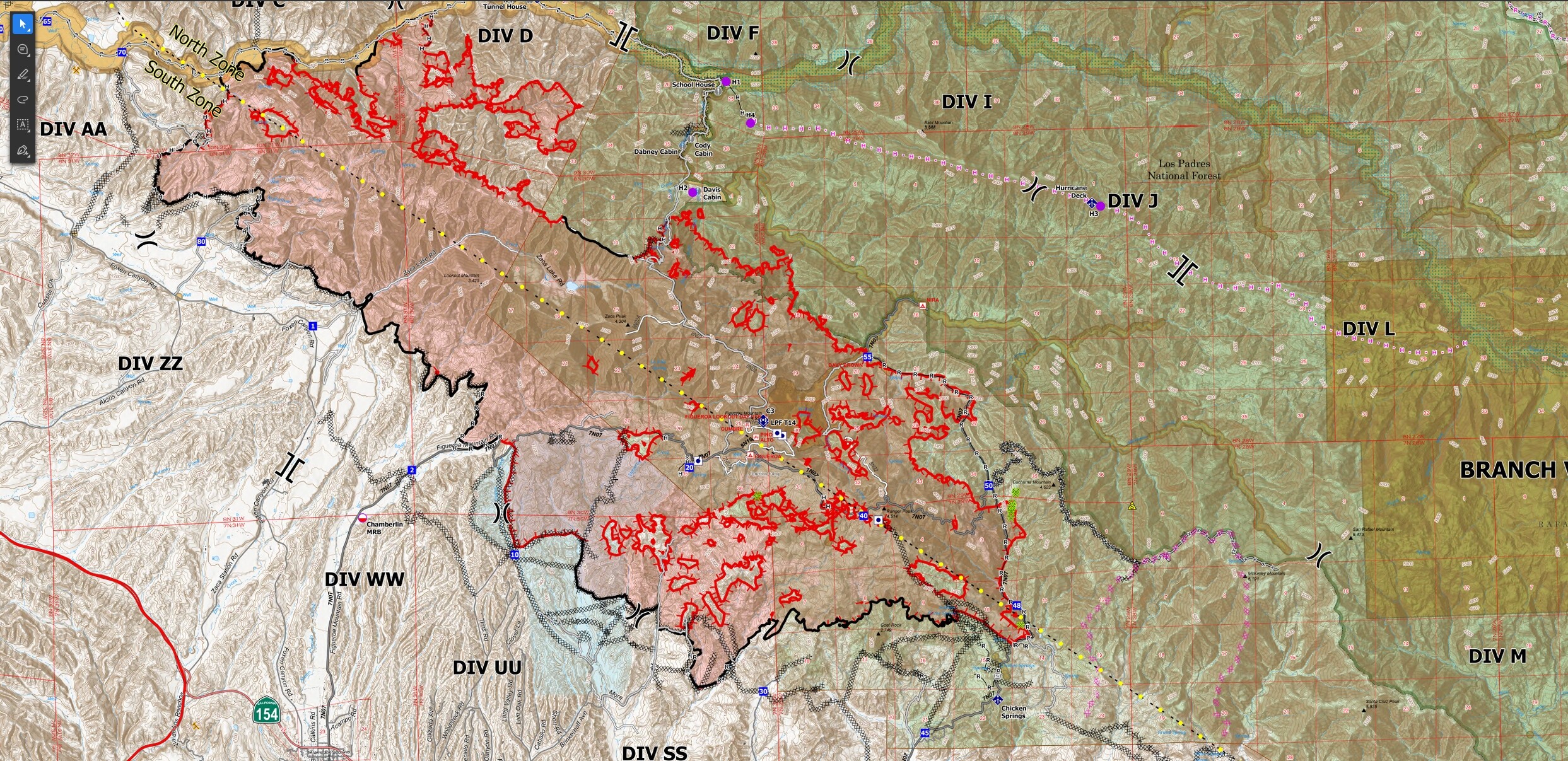
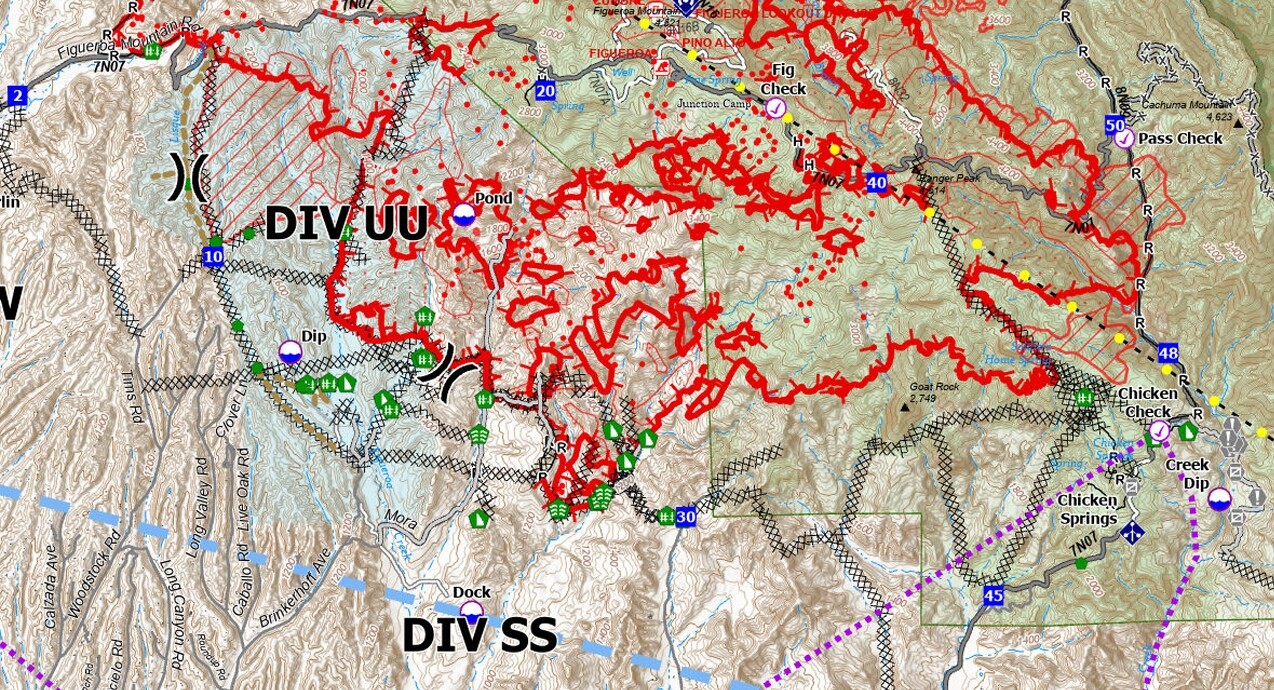
The onshore is back with prevailing northwesterlies, milder temperatures and improved humidity. Lots of black line (solid containment) added to today’s Ops map. The south zone is nearly complete except for Div WW and UU. Additional contingency dozer lines around Divs WW and UU. Likely to see additional wrapping of black line on the western and eastern ends by tomorrow, with maybe some more containment in the north zone where feasible.
6 Likes