
State ID: CA
3 letter designator: LPF
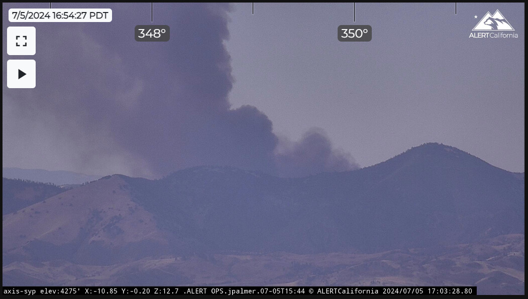
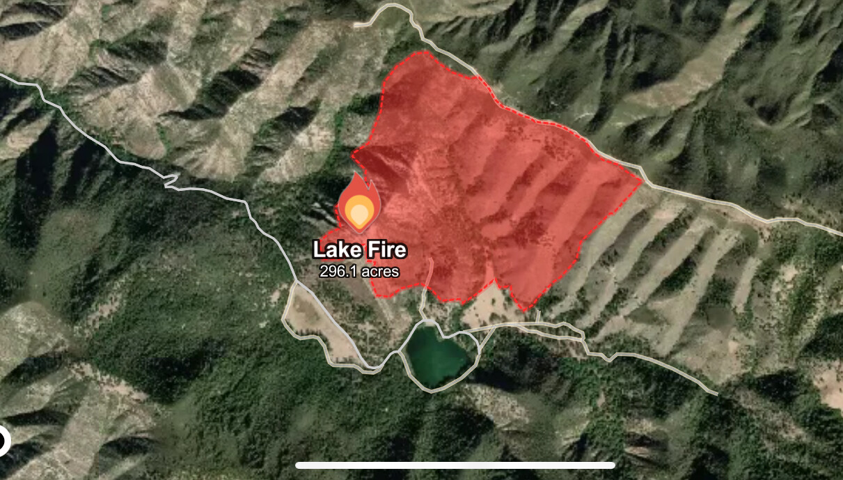
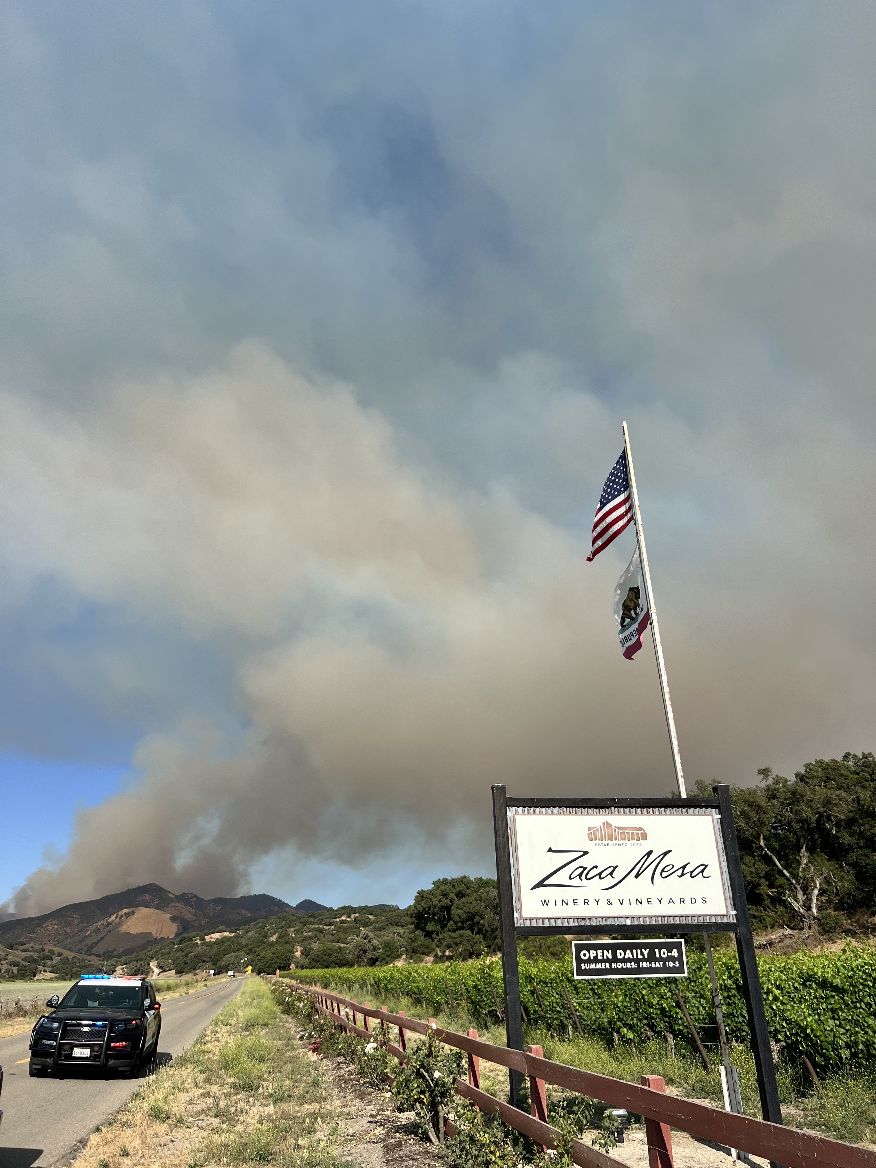
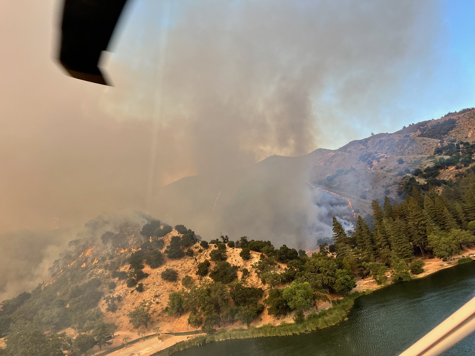
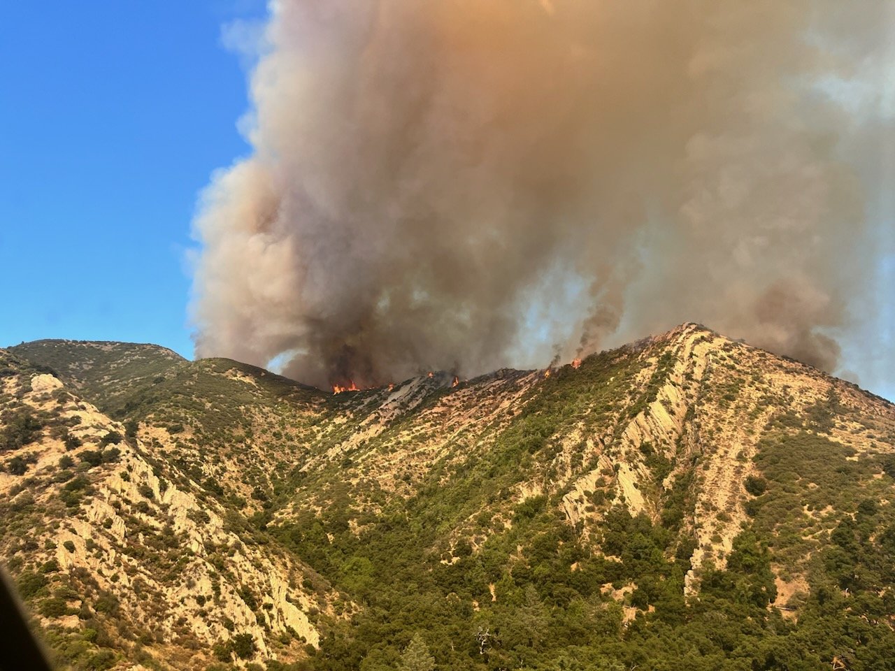
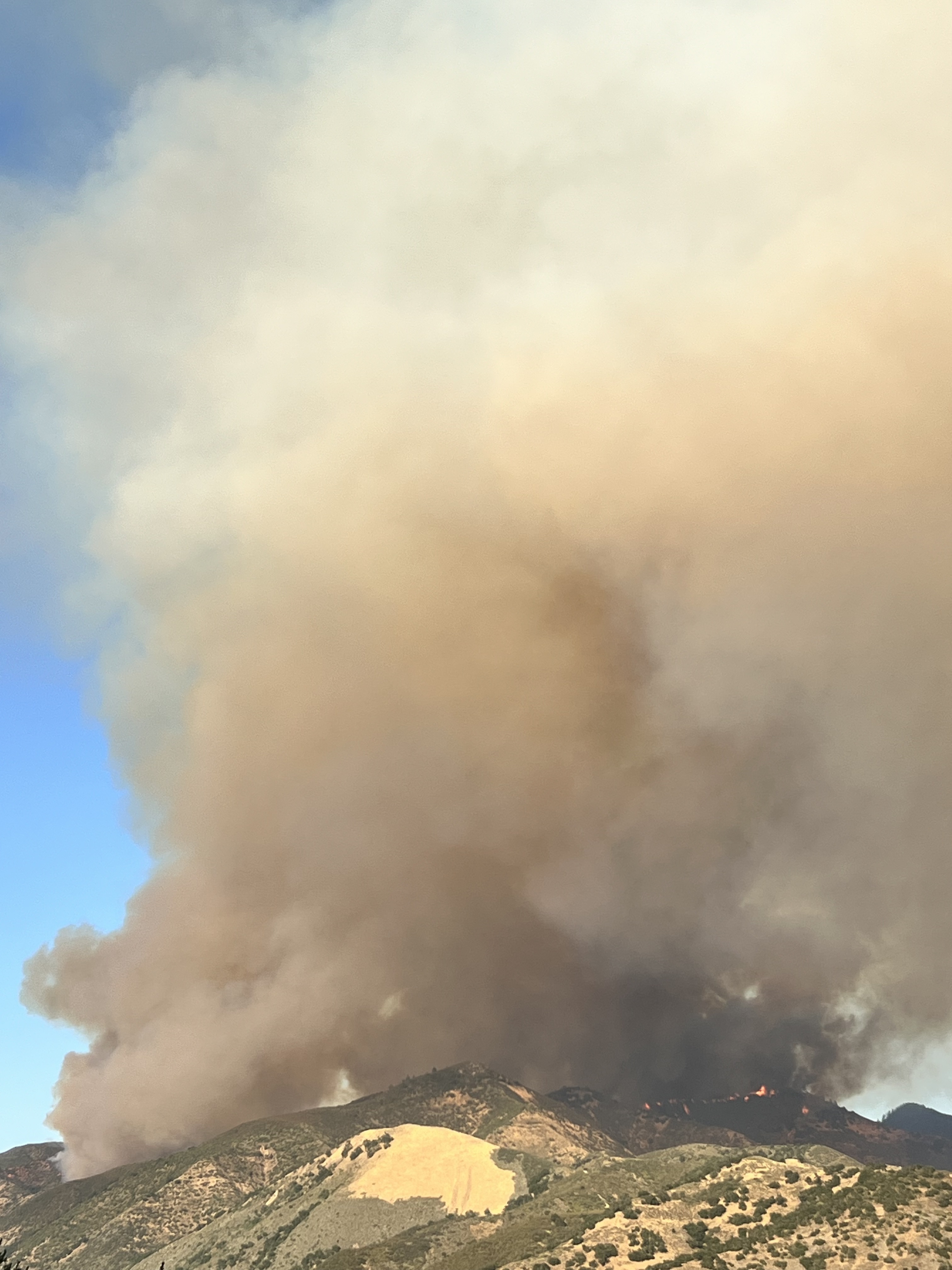
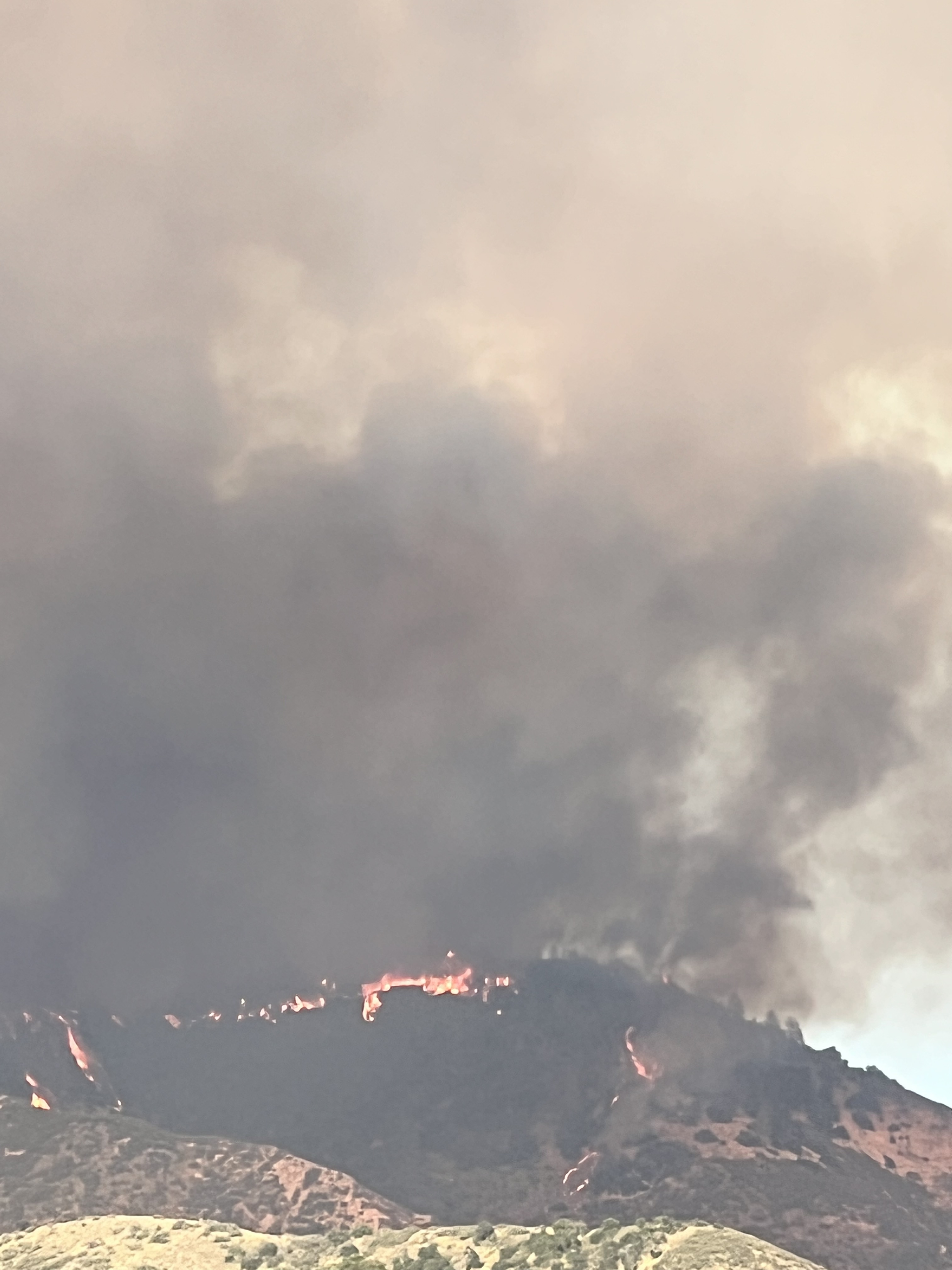
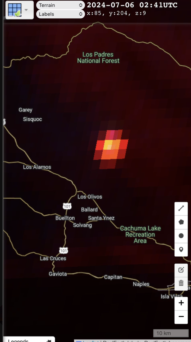
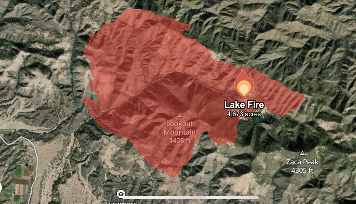
Fire name: Lake
Location: near Zaca Lake, CA
Reported acres: 20
Rate of spread: rapid
Report on Conditions: AA07 onscene reporting 20 acres in the forest on the north side of Zaca Lake. Potential for extended attack.
Structure threat: are threatened
Resources: AA07, 1 LEAD, T03, T15, T74, T75, T79, T101, T107, T137, T138, T167, HT1CH, HT25M, HC408, HC964.
Hazards: steep terrain
Weather: Figueroa RAWS WX
SEDGWICK RAWS WX
excessive heat warning and red flag warning
Radio channels:
Scanner link:
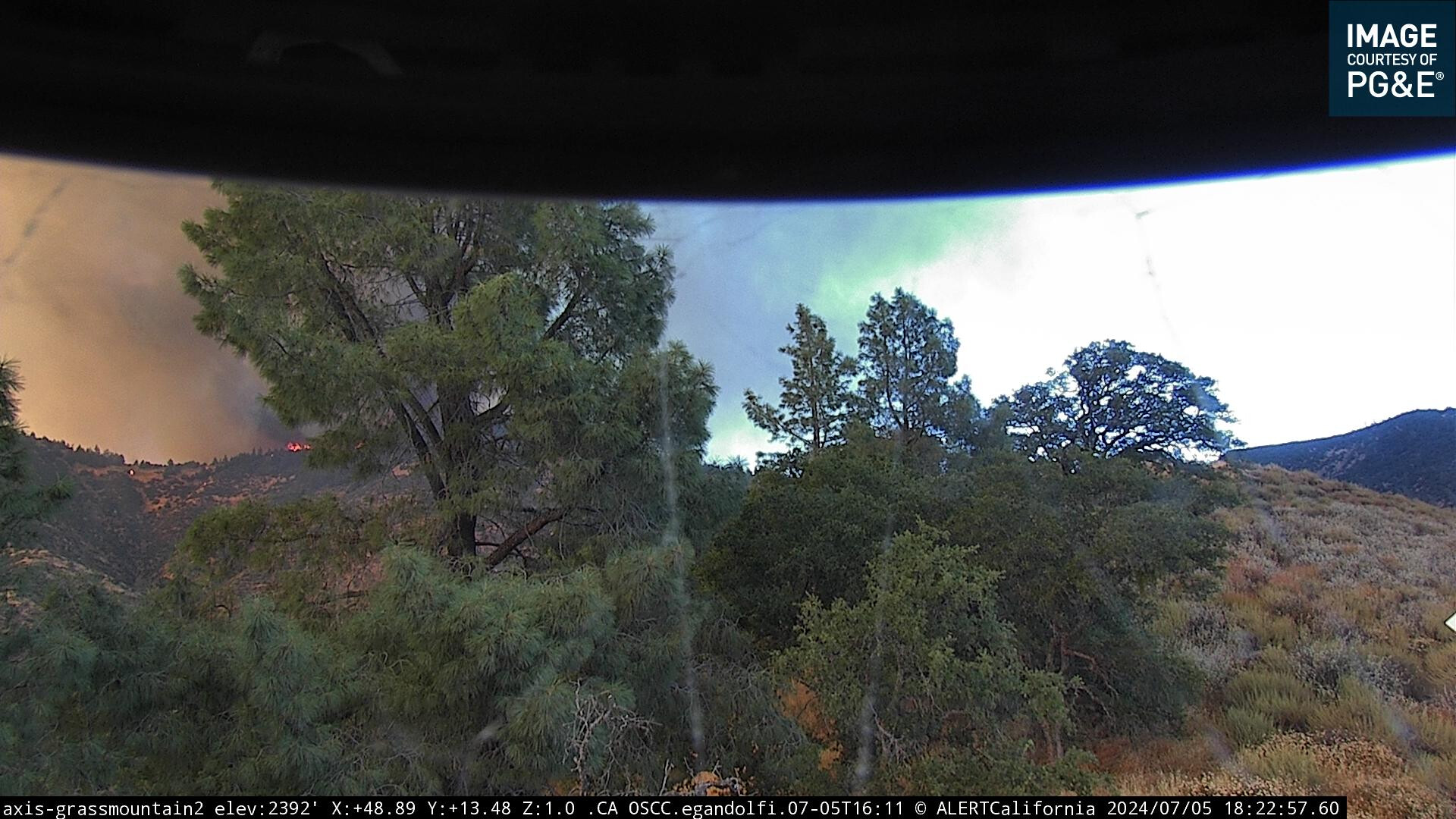
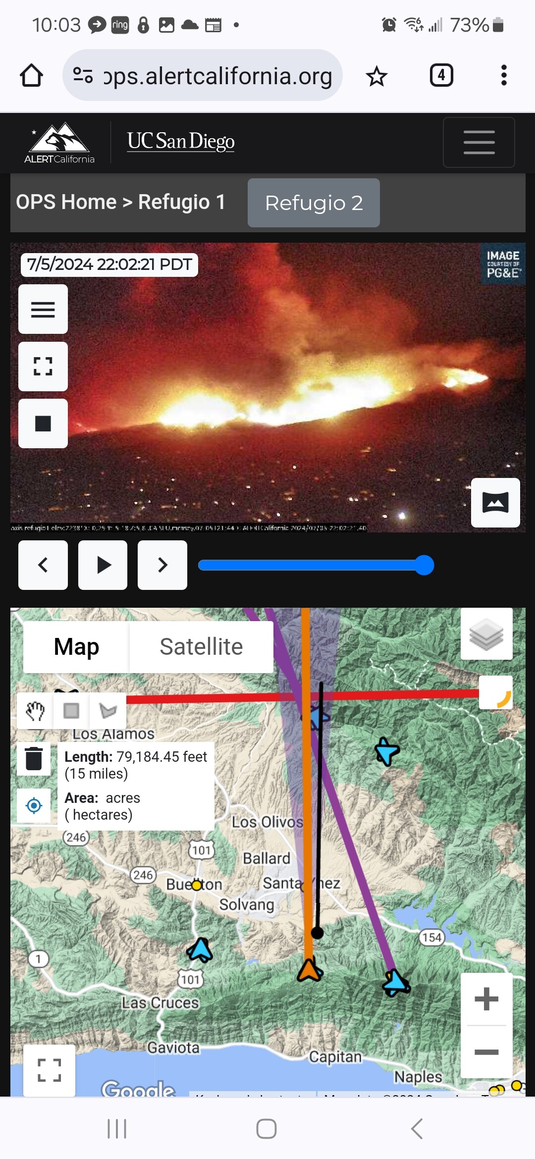
Webcam link: Grass Mountain 2
Refugio 1
Santa Ynez Peak
Los Alamos 1
Orcutt 1
Agency Website: LosPadresNF on X
9 Likes
LPF Div 4 Taking Command under Unified. Command on FSNET Tone 14. Tacs FS 3 and 4. 4 Engines on scene doing structure protection. Several dozers engaging as well. A developed column is visable from area cameras and the column appears be leaning to south west. Before BC21 transferred command to Div4 he relayed to his dispatch that all residents had been evacuated from the Zaca Lake area. My guess is that this one won’t be out any time soon.
7 Likes
300 + acreas
4 Likes
now 400 per AA
4 Likes
LPF Chief 1 and IC seem to have agreed on ordering a team, based on activity and growth potential.
20 Likes
INTEL12 taking off from Sacramento for a mapping mission
INTEL24 also taking off from Chino, not sure which will be mapping the incident.
7 Likes
Evacuation Warning for Figueroa Mountain Road and Forest Station to Chamberlin Ranch.
6 Likes
OES Intel 24 has mapped the fire at 4,673 acres.
10 Likes
Burning approximately 11 acres a minute since start.
10 Likes
Watched Grass Mountain Camera from 2200-2400. Came up north facing, hit ridge and blew south east towards Figueroa Station (my station in 2002). Fig still shows light off in the distance but satellite heat shows fire in Figueroa drainage. That concerns me because that whole canyon is a box canyon with Fig station towards the top south side of the ridge. To me, it looks like the fire has hit Neverland Ranch based on CalTopo’s Terra Satellite at 11pm. This fire is branching out in many directions. Tomorrow will be interesting.
5 Likes