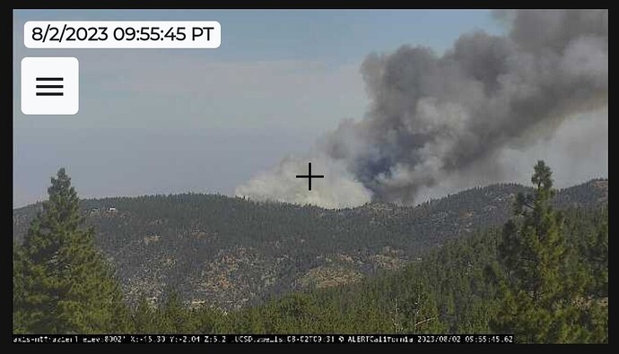
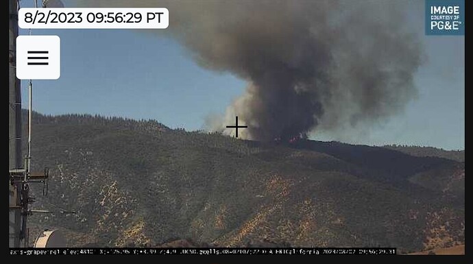
Compilation of the eight best cameras on the fire right now: ALERTCalifornia - Tile Display
she does not look happy. no acre update.
hitting the left flank hard… they said that’s their biggest concern.
Tecuya Fire @ Tecuya Mountain, Lake of the Woods, CA - #TecuyaFire https://share.watchduty.org/i/9166
The nearest weather station that is similar to the fires elevation: Digier Hill wx
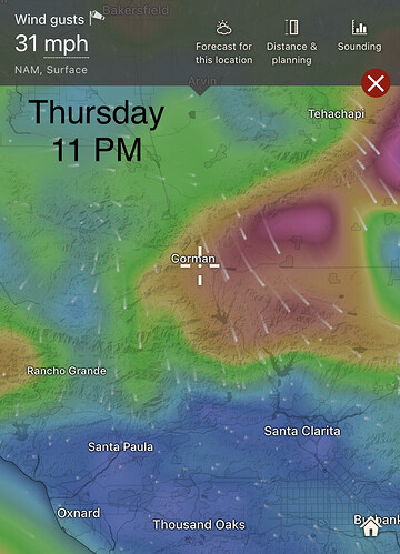
It is awhile away, but tomorrow evening a moderate sundowner wind event is expected over the I-5 corridor. Probably low end wind advisory type event.
IC is requesting four Type 3 strike teams as they’re released from the York Fire, plus four DIVS, and a Type 2 Safety.
Currently have 5 S-2’s and 4 type 1 tankers on the incident
Helicopters 407, 522, 530, 305 and 73U
Trying to get use of 1 or 2 of the QRF helicopters from LA/VNC. Sounds like working through some red tape.
Wanting to use the LACoFd Dip site behind Flying J, if they are able to use QRF ships.
AA released one of the S-2’s.
Still asking for 1 or 2 type 1 copters.
At least 3 of the original 5 S-2s have been released.
From the cameras it looks like they are making good progress on the fire.
Still flying type 1 tankers, along with tanker 73, 100
2 type 1 copters from Porterville assigned.
Tanker 107 diverted to a new start
Tanker 107 reassigned.
Appears to be a wind shift occurring. It is difficult to gauge from the Digier wx station the exact conditions at the ridge and southern slope, but conditions in Cuddy valley are much different
AA is releasing tanker 73.
BDF sending a S/T
LPFs official release says in excess of 35 acres.
requesting copter for tomorrow 2 type 1’s, 2 type 2’s.
Requesting AA51 at 1930 for night firewatch.
https://twitter.com/lospadresnf/status/1686903716010754050?s=61&t=cM8YhxChqoBLjWVWGfwlQw
Per LPF 50 acres, 10% contained
Drove the Hwy 5 corridor today between 1100 and 1300 today, watching this fire.
First, the fire is up on top a ridge. Yes, in a saddle on the ridge, but high up there. Don’t know the area well, but I would suspect lightning.
Second, little wind on the fire, so burning slowly off the ridge, backing down, for the most part. Guessing little access, so ground troops having difficulty accessing the fire. Not thinking too many engines getting close.
A bit of a problem, but without a good wind, not a long term problem.
Used to work up there. There’s a handful of houses up on that hill and have discovered illegal grows, too. Motorcycles and ATV’s find their way up there. I wouldn’t rule human caused.
There’s a drainage off the north side that funnels down into Pine Mtn Club so it can cause problems with an aligned wind.
Per intel flight 73 acres
Any shot crews on scene?


