That is the ranch fire.
2 Likes
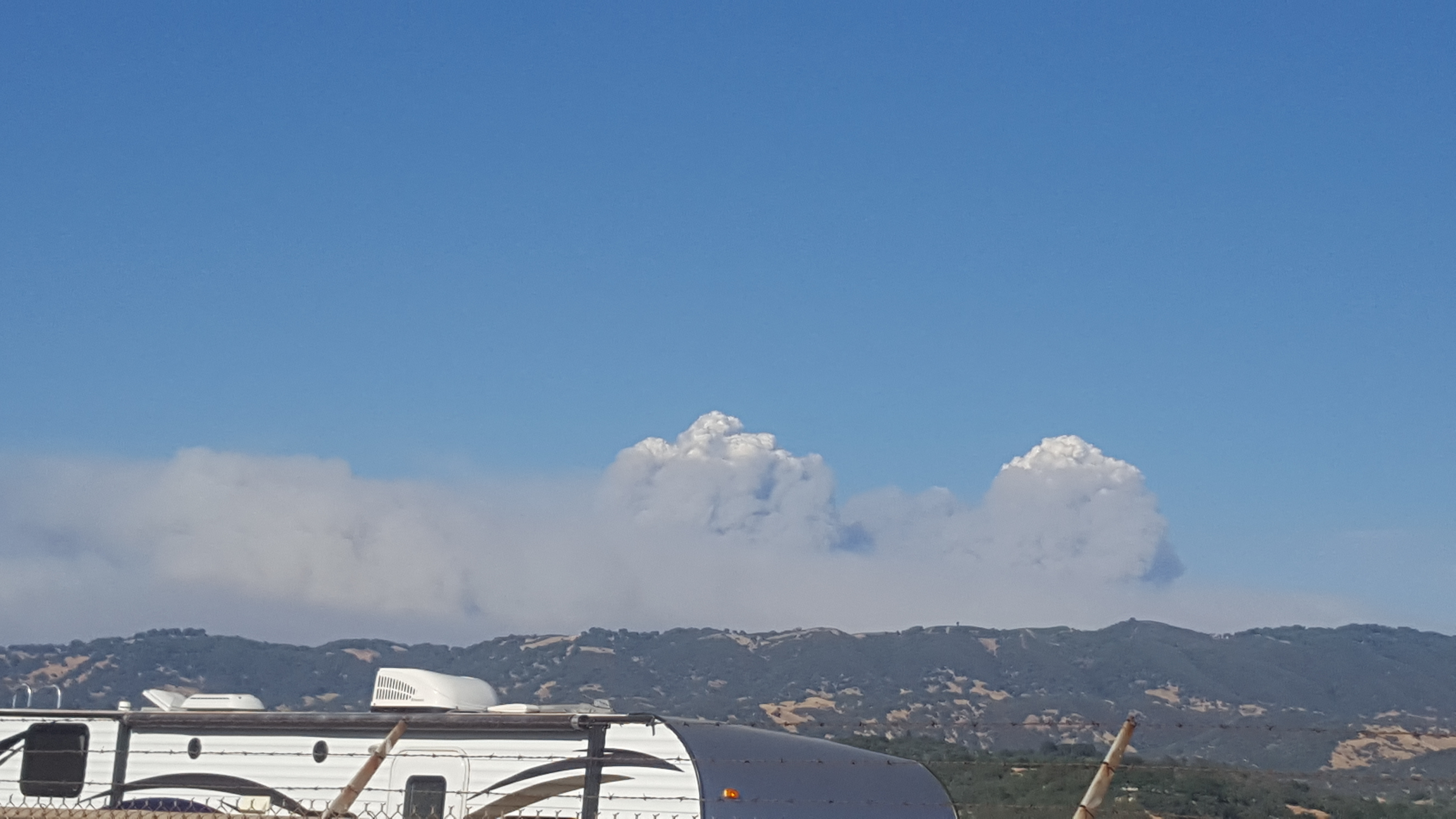
Good column showing from Clear Lake: www.rntl.net/clearlake.htm
1 Like
Sounds like branch II is pulling out and regrouping. “It’s going through our lines like they aren’t even there”
3 Likes
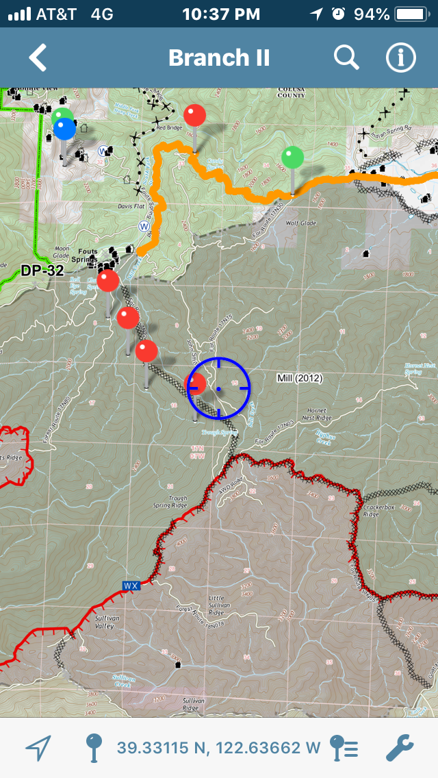
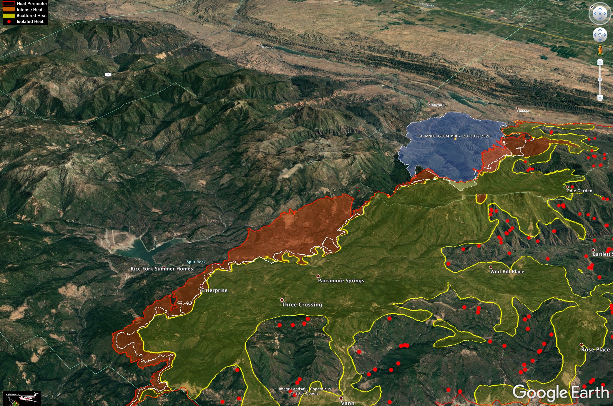
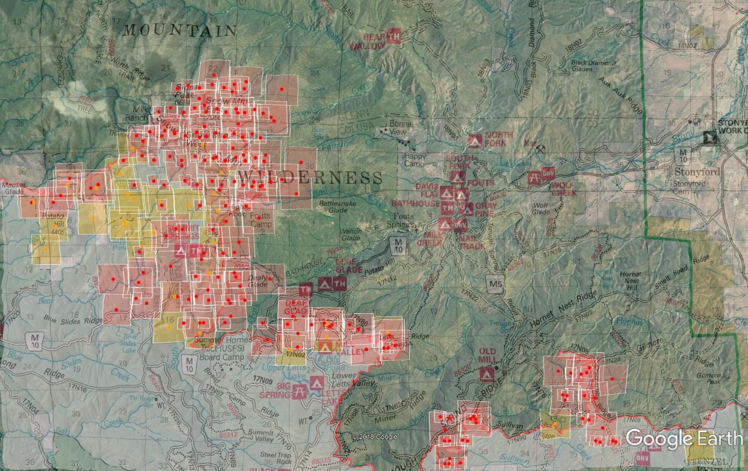
Here is a map of yesterday’s spread. White line is 24hr growth.
The big blob in the middle is about 9,000 acres.
It did a little chewing into the Mill Fire scar.
3 Likes
There’s some talk about Lake Pillsbury over on the Q/A thread so don’t miss that. Plenty of structure protection happening there today and tonight.
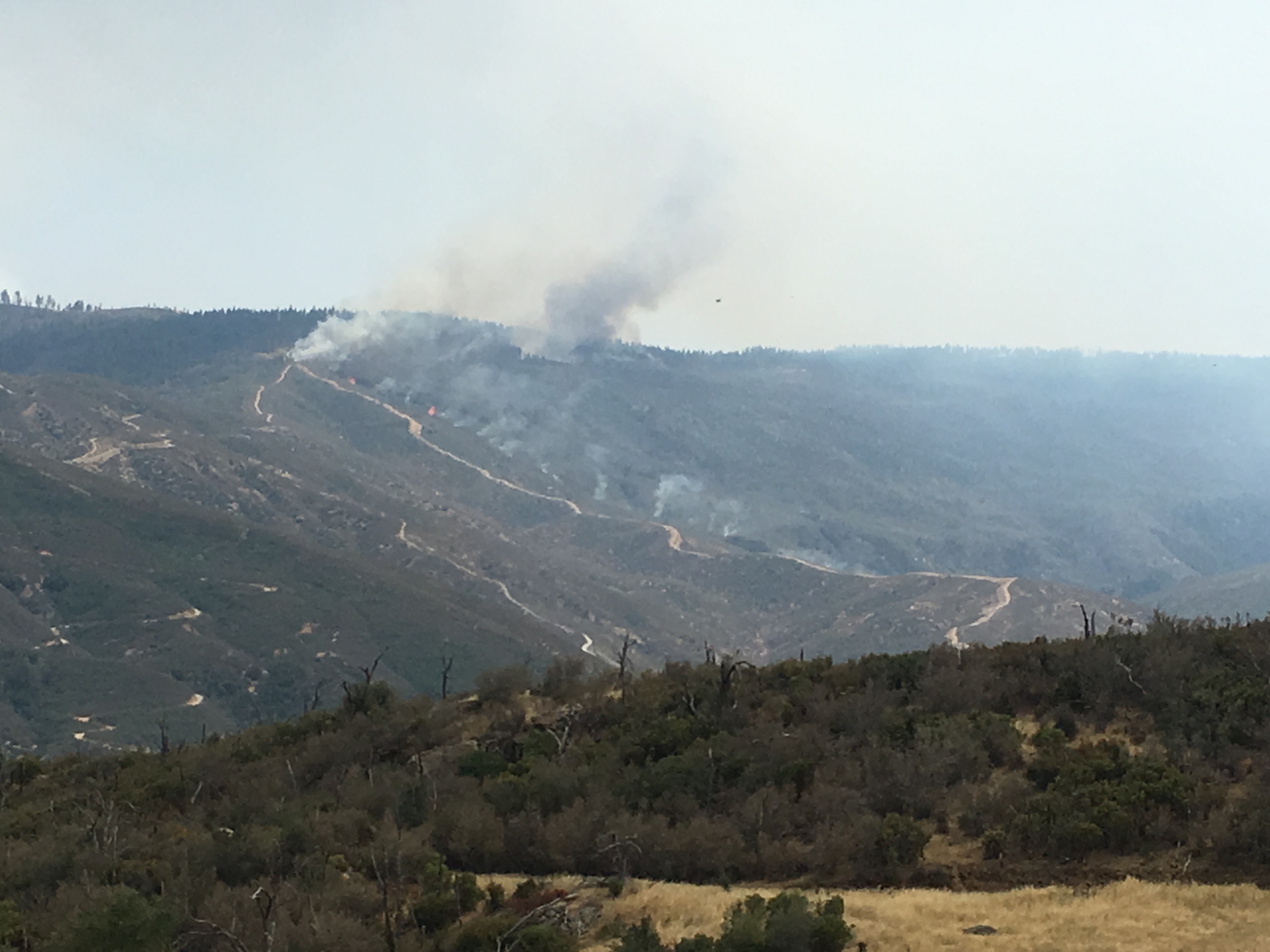
MODIS is showing a significant run up to the top of Snow Mtn, well into the wilderness. This will be an interesting variable to watch as it can go nearly anywhere, including back into Fouts Springs and Stonyford. The 9000acre IR blob @pyrogeography mentioned above happened within the 1987 Fouts fire, no history since. The MODIS hits stop at the top, although the data is pretty old today. On the back (north) side of Snow Mtn is the southern edge of the 2001 Trough Fire. There’s been a lot of good discussion in another thread here about the trends we’re seeing in brush and timber for when a given area is ready for another major fire since the last fire history. I’m impressed with some of the push into the 2012 Mill Fire but it’s definitely slow. I haven’t been on the M10 since the Mill Fire, but some of the south end off Goat Mtn Rd and Sullivan Ridge was pretty sparse still this year. It burned hot.
4 Likes
Plenty of ash fall in Red Bluff this evening from the Ranch Fire here at the National Guard base camp for the Carr fire. Must be eating up some ground,heaviest ash since we got here 12 days ago.
1 Like
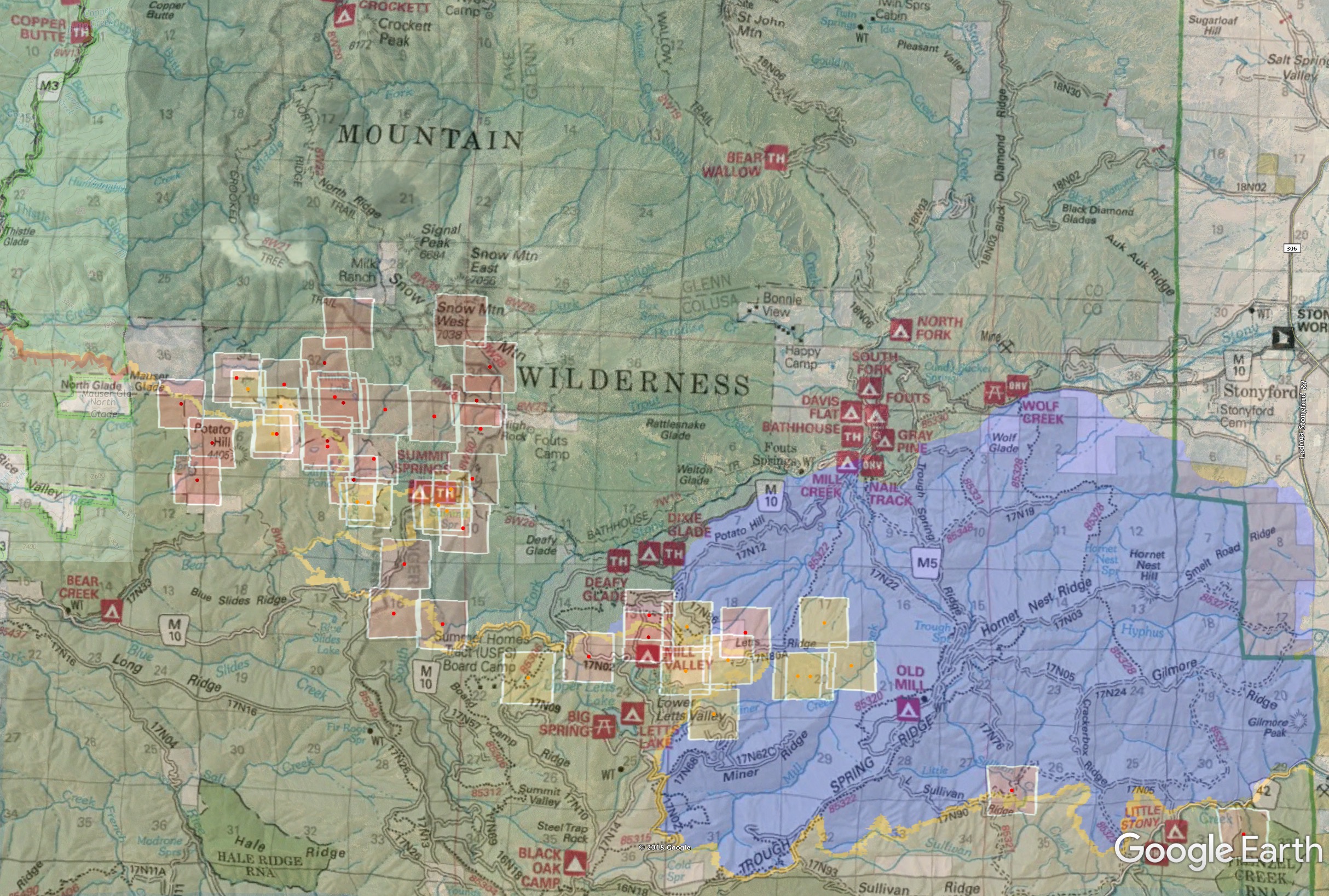
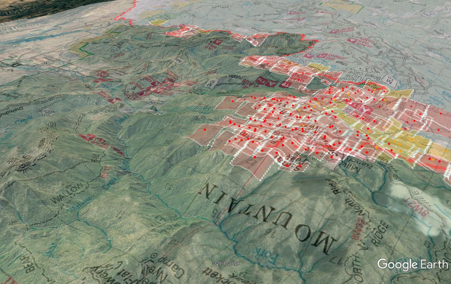
Some map views for this morning with IR perimeter and MODIS from overnight. I’m focusing here on Snow Mtn burning over yesterday and last night. Lake Pillsbury discussion I’ll post over on the Q/A thread since that’s where interest/discussion was yesterday.
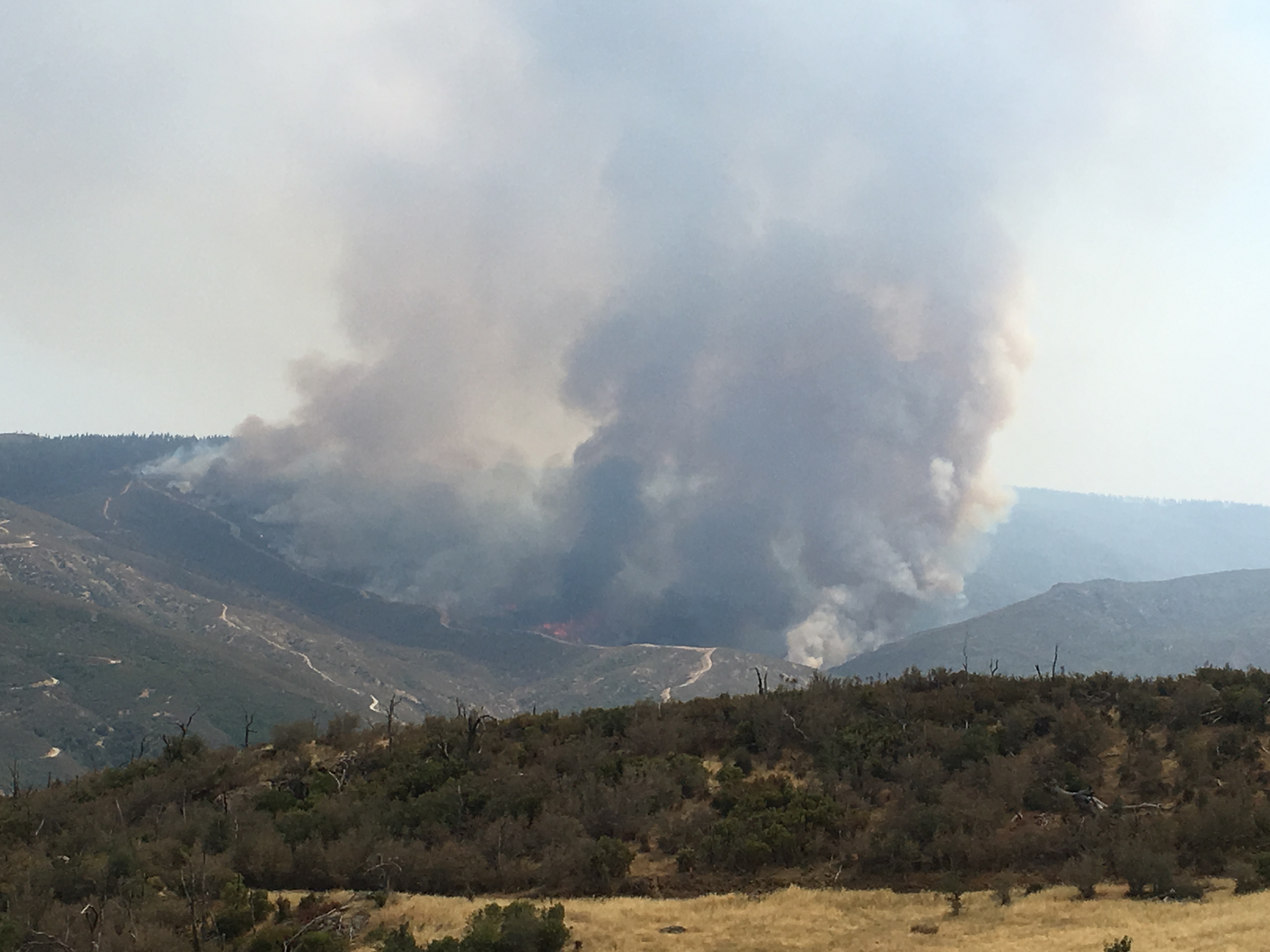
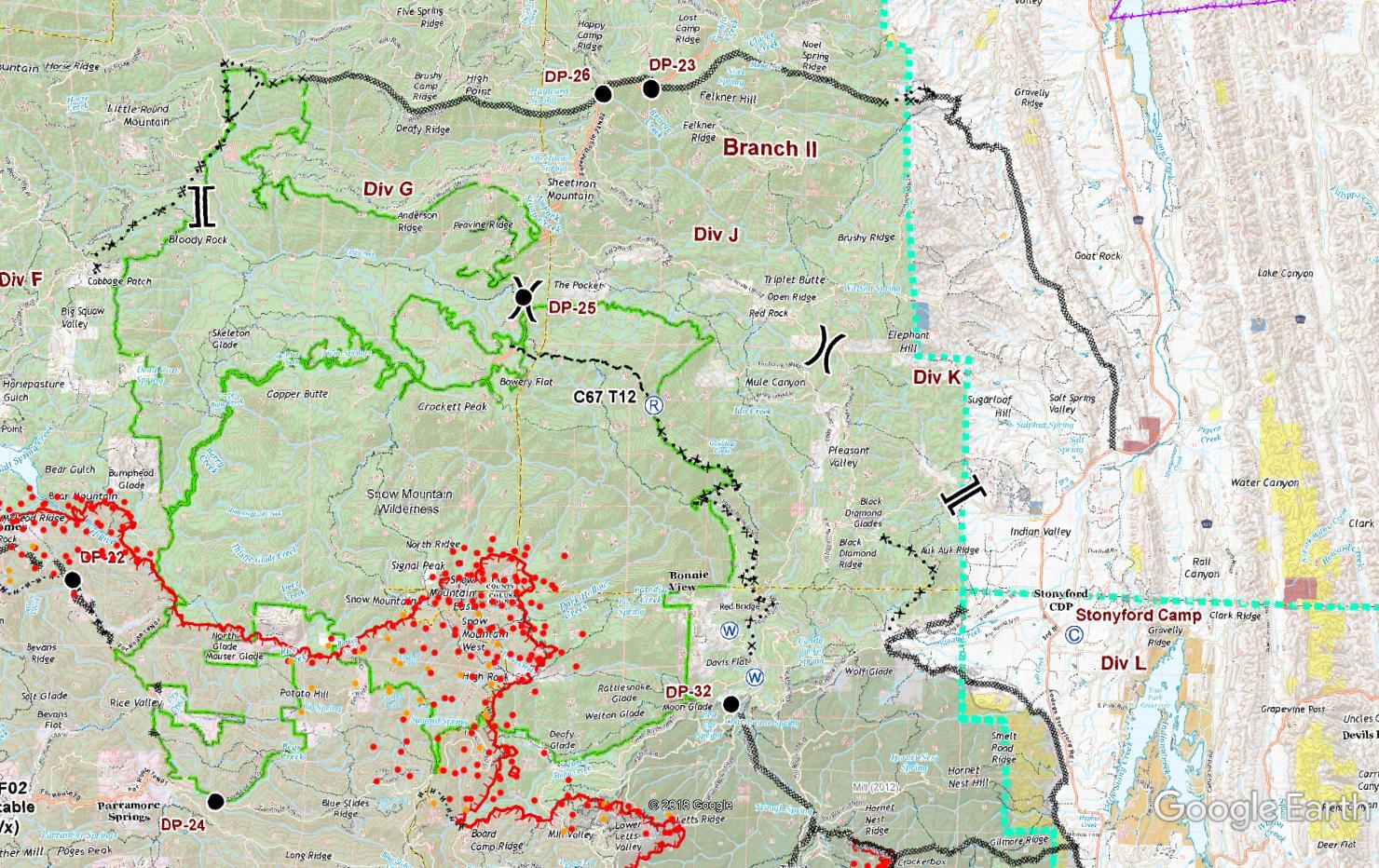
Some significant westerly winds yesterday that lasted through the night into this morning up on top of Snow Mtn pushed it up and over. Quite the impressive show on the new Konocti Fire Cam last night. This is in the Snow Mtn Wilderness, which means little to no action will be taken. Dozer line is proposed up the eastern border along the road to St. John radio site down by DP-32. Then handline off the radio site over to Windy Point trailhead, using a portion of the Bear Wallow trail. After that, you can see the next dozer line is way up north along Brushy Camp Ridge and Noel Spring Ridge into the SRA down the west side of Gravelly RIdge south of Elk Creek. A big box.
St. John radio site is very significant for the forest, as well as public safety for Butte County, and other commercial users. The fire appears to be close to or in the middle fork stony creek drainage, below St. John.
They also did a firing op down in the Mill Fire scar off Crackerbox Ridge over to Trough Springs Ridge.
Looking SE down middle fork stony creek into Stonyford
6 Likes
Not again…Cal Fire just issued a press release announcing a firefighter fatality on the Mendocino Complex. A press conference has been scheduled for 10pm tonight 
4 Likes
Just saw this thread a few minutes ago. Sad.
1 Like
Tonight’s press conference confirmed that it was a firefighter from Utah that was injured, airlifted to a hospital where he succumbed to his injuries. No other details given at this time.
1 Like
Sad. Do we know the condition of the other firefighters?
1 Like
Watched the press conference
1 Like
Even if this is the cause I think posts like this are inappropriate until it’s officially announced. Please consider removing it until the cause is officially announced. Thank you
14 Likes
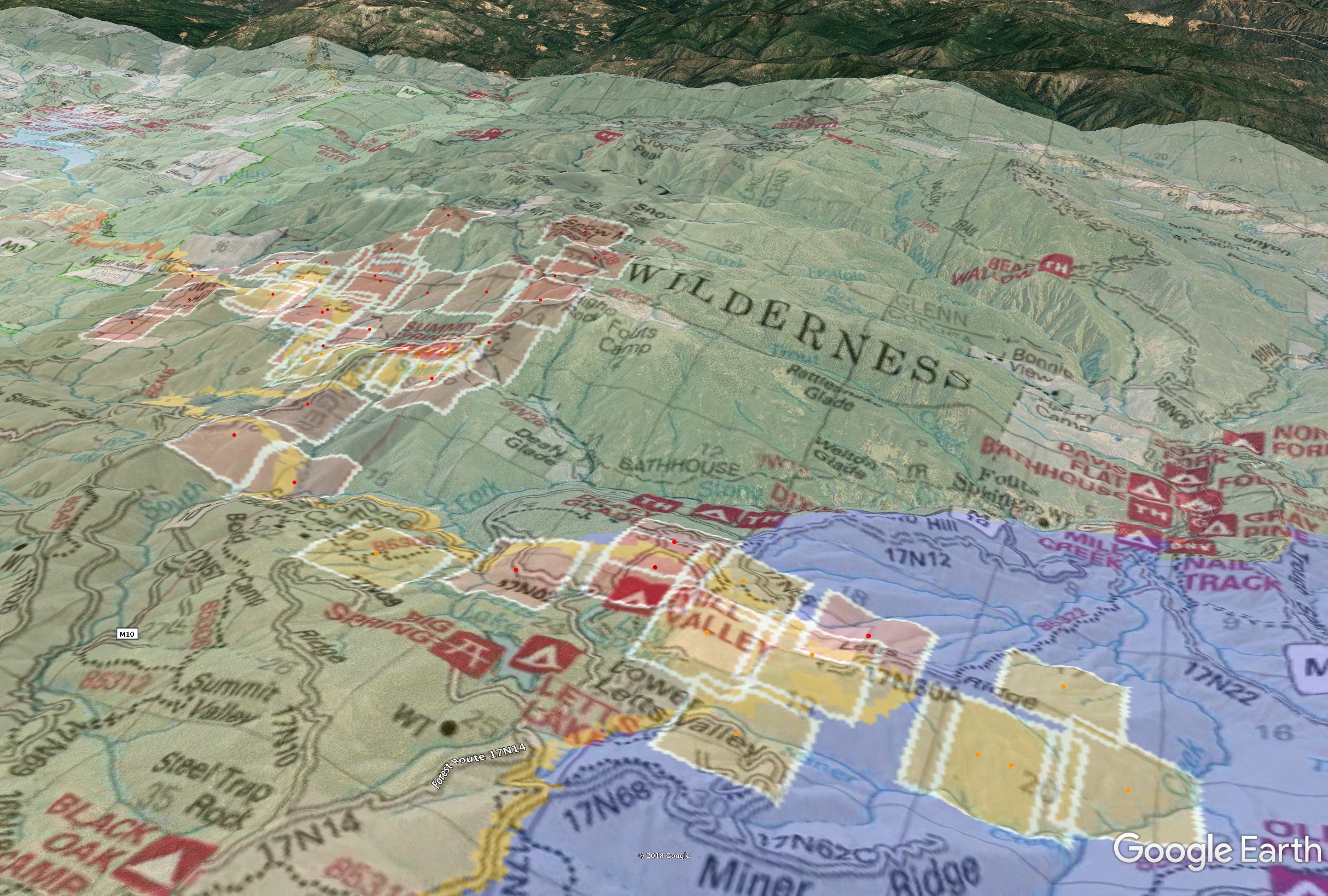
Thankfully at sundown the fire activity moderated through the night and while there was growth on the entire north side, there weren’t any large runs anywhere, just the general creeping forward. The Konocti alert fire cam showed the convection slowing right at sundown and moderate fire through the night. The GOES Shortwave IR also shows a MUCH smaller footprint through the night than before. @pyrogeography does a great job with the IR progression maps so those will show what’s happening. (edit: he posted it over on the Q/A forum)
The firing operations between Trough Spring Ridge and Crackerbox Ridge looks like it completed and was successful last night. Should put to sleep any threat from the south into Stonyford through the 2012 Mill Fire scar. It is coming around from the top though and slowly moving east towards Fouts Springs and could waltz into Stonyford from the west with any westerly wind event. Not much progression from the Snow Mtn peaks over onto the north side and into the middle fork of stony creek. Still appears upper to mid slope. These slopes will be generally shaded in the afternoon so short of a wind event, hopefully the fire stays moderated in there and they can complete line up the 18N06 road to St. John.
A sad night indeed on the fire. Took the sails out of many on the line. Many Divisions were lightly staffed and thankfully the fire behavior was appropriately matched.
11 Likes
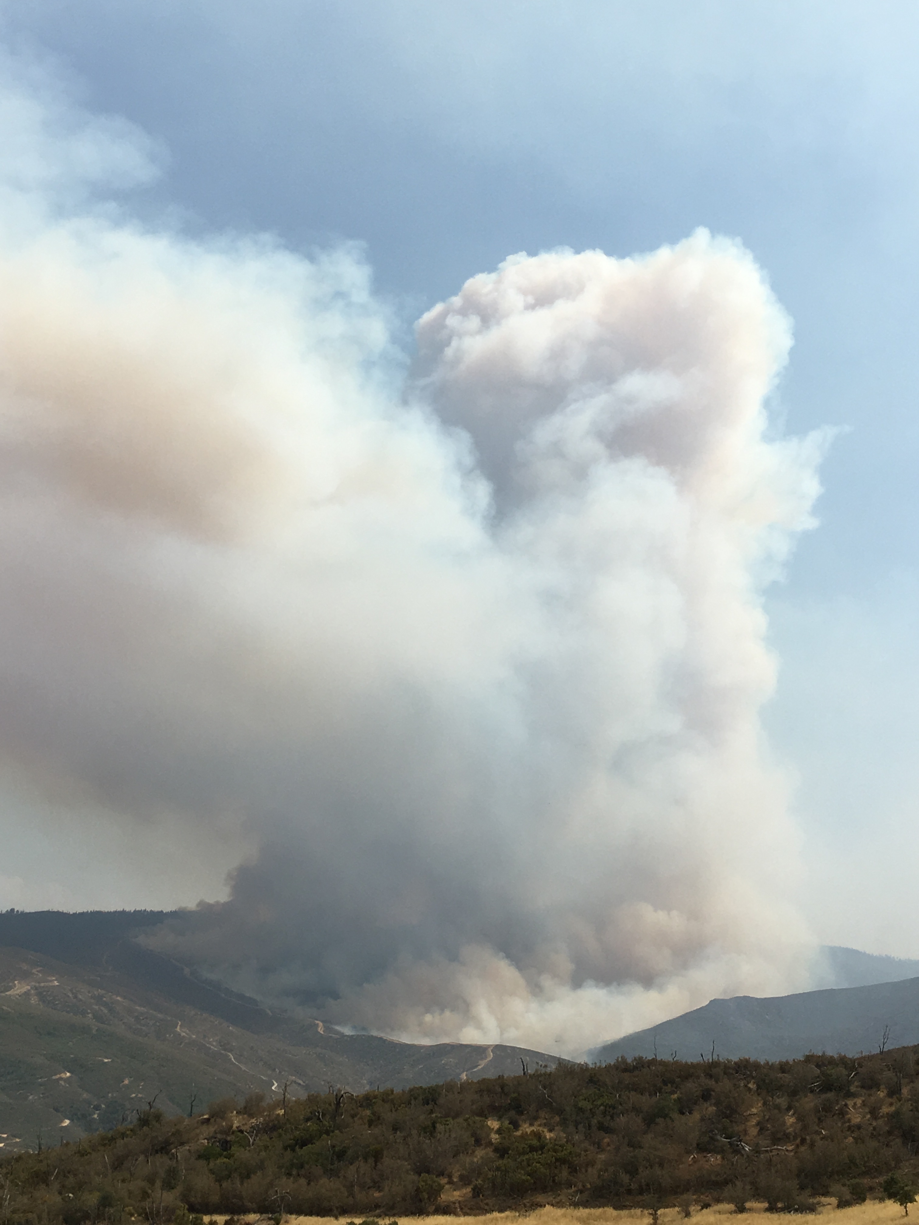
Update 1600: The “NE head” of the fire, what went over the Snow Mtns, just kicked into high gear. Konocti Alert Cam shows a very active column on the far east side, further east than I’ve seen the last two nights. GOES Shortwave IR shows a lot of heat and Visible shows a WSW and a SE wind pattern colliding over the fire.
High Glade RAWS showing good South winds 13G22.
MNF portable RAWS on the west side of fire, setup for the fire shows a WSW influence.
Stonyford RAWS on the east side of fire had an easterly to a now SE wind influence.
Butte County got the alert the radio site on St. John is now in immediate threat. This site handles a lot of MNF radio traffic, some commercial, CHP primary for quite a bit of the I5 corridor in Colusa and Glenn Co, and Butte County Sheriff and BTU CalFire.
4 Likes
St. John is also Med 2. Glenn & Colusa Co. Ambulance dispatch and Coms.
1 Like
The burn show down to fouts spring from the south is probably the cause of that
3 Likes
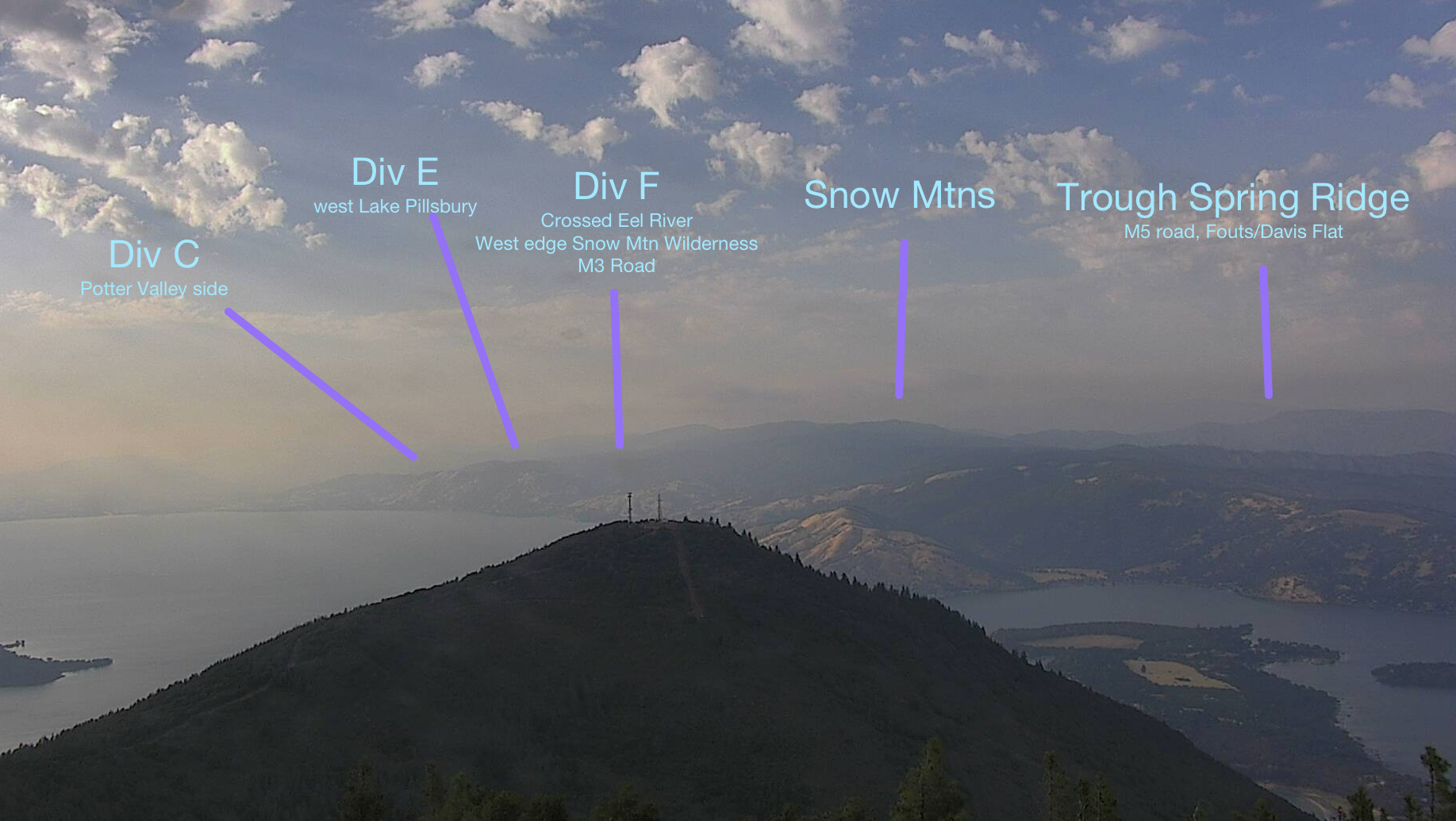
To help reference the various columns and glows seen on the Konocti fire cam, I made a rough cheat sheet to reference what we see.
15 Likes