Thank you for your work
Pyrogeography and Norcalscan, thank you for your fantastic input. You both provide exactly the kind of info I am looking for as a firefighter mom at the southern end of the Central Valley, keeping tabs on my No Cal son.
3 Likes
Great website! How often is it updated with the latest modis data? And is there a reason the Donnell incident isn’t showing?
Donnell is in Initial Attack section.
My IR map only shows large fires that have been scanned by NIROPS, which operates out of NIFC, in Boise. This often doesn’t happen for first day or two of a large fire. Once they start ordering IR flights, it’s one if the best Intel sources we have.
4 Likes
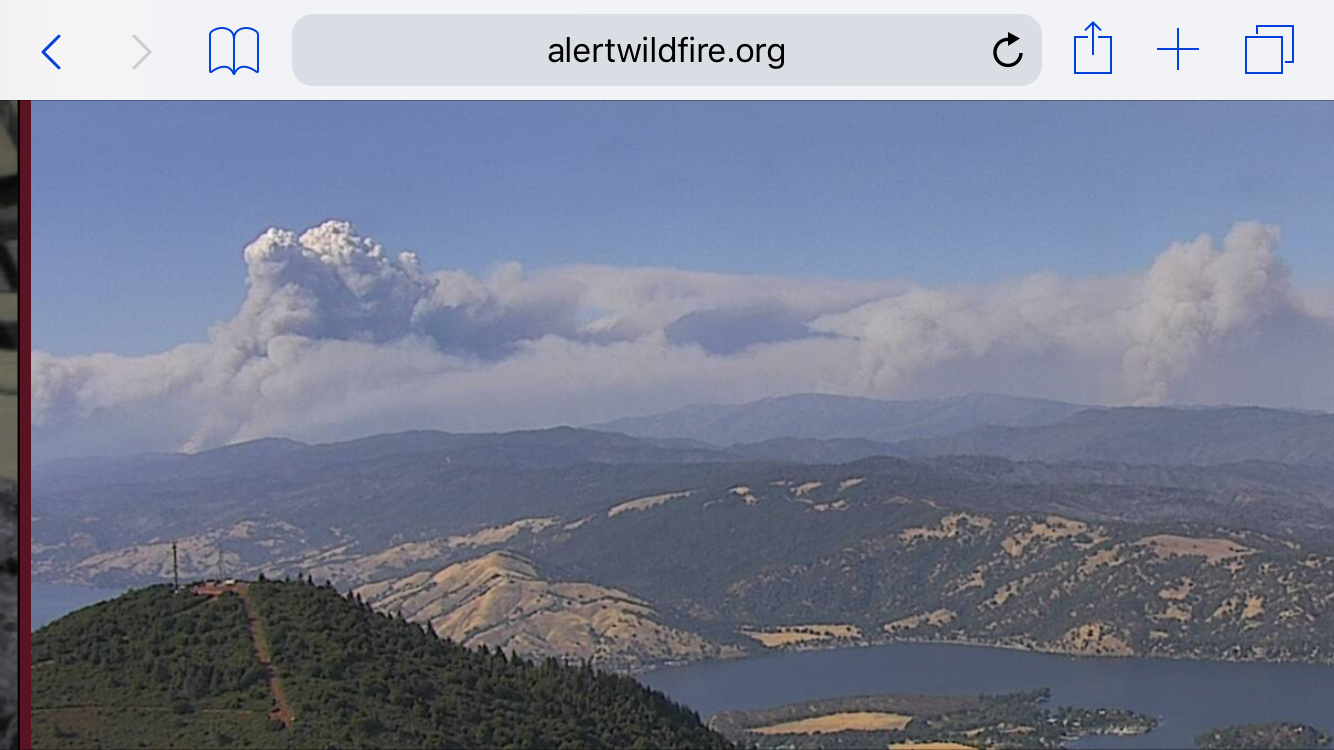
New cam viewing Mendo
http://www.alertwildfire.org/northbay/
4 Likes
Briefly watched a live community meeting with the IC’s of both teams…Calfire IC said they hope to have the River Fire contained in the next few days…on the Ranch, there is more than 50 air miles of open line…lots of work ahead
MODIS and VIIRS are good indicators in the first couple of cycles, before NIROPS gets ordered. It’s not perfect, but can give at least an estimate if you can work with the data. When GOES-S/GOES-17 goes operational, better data will come down sooner.
There’s also Military UAVs flying over the various fires doing some real-time mapping, but it’s not getting sent to the public sites in real time.
2 Likes
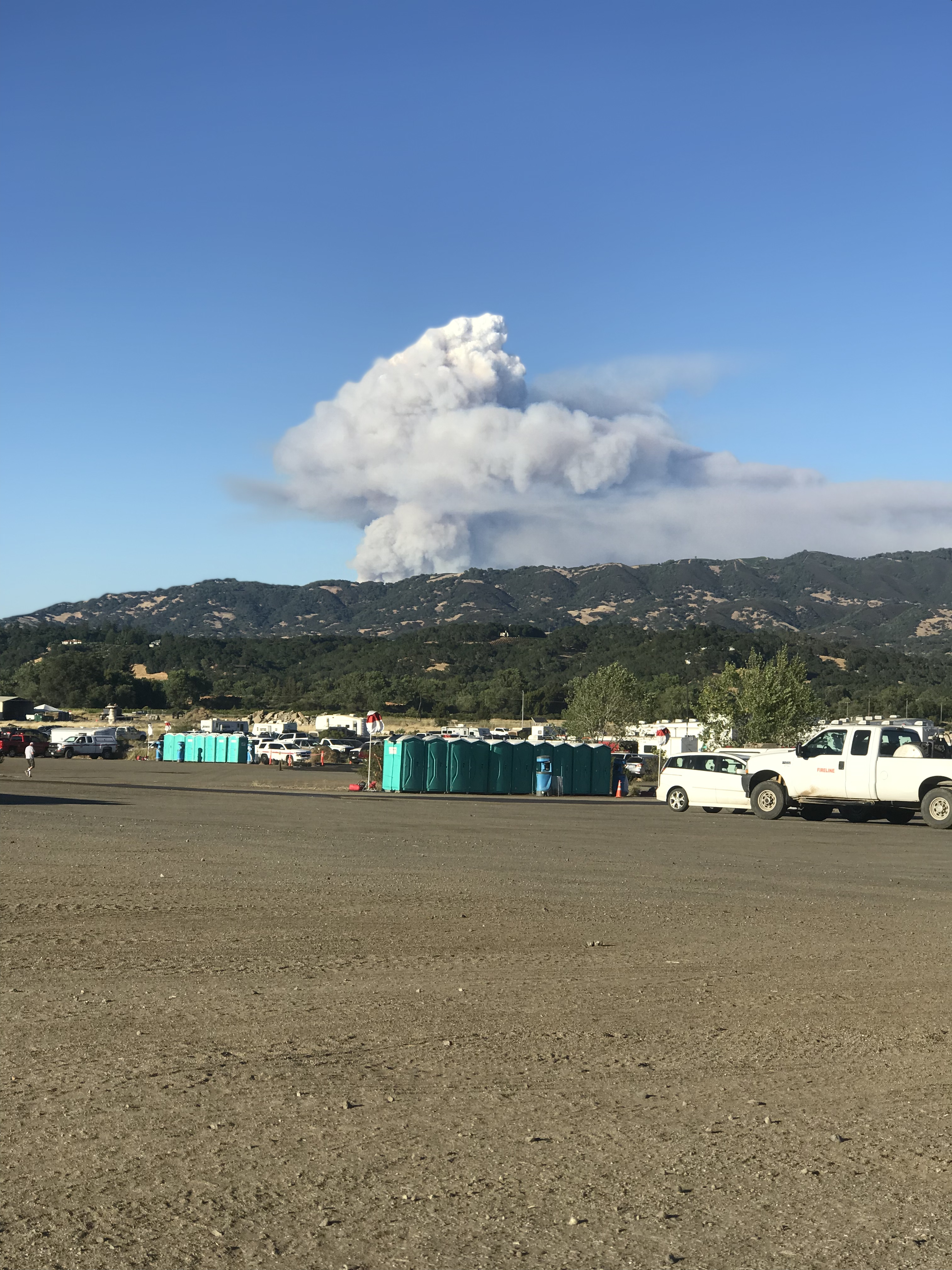
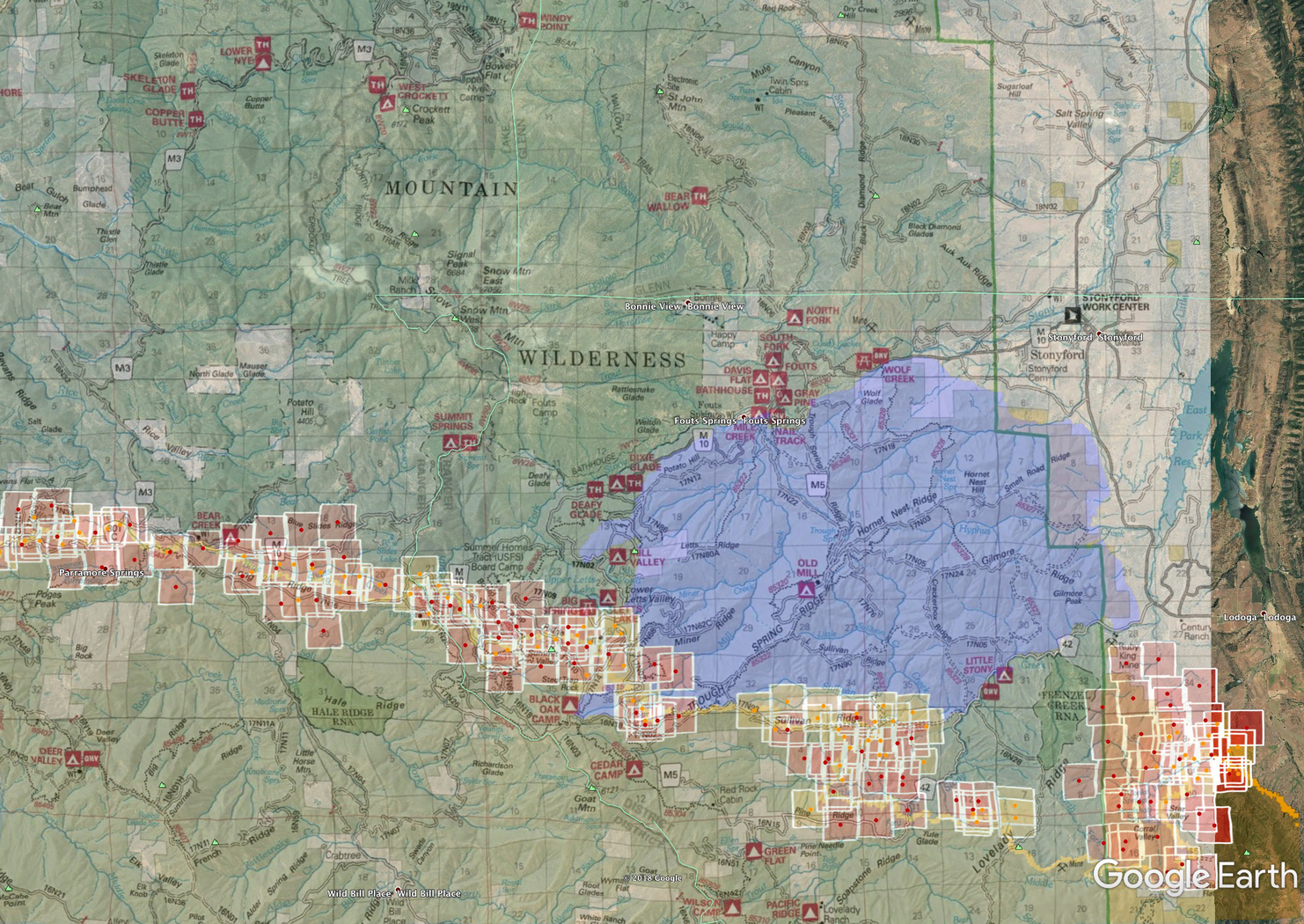
1845 Update: I’ve been focusing on the Branch 2 area of this fire, the area accessible through the Stonyford. Winds in Stonyford have been out of the south for the day, below 10 but gusting to 18 in afternoon. This has pushed some fire up towards Lodoga-Stonyford Road and the lower half of Goat Mountain Road. Street View of fuel in this area.
Down the M10 road where it meets the M3, fire as of midday has stayed below the M10 with a slop over on the north side of the M10 along Long Ridge into the Blue Sides Creek area. They had some copters in there to help keep it cool to try and catch the slop, they were concerned it would get established in afternoon. Have not heard evening update on this area. Their goal was definitely trying to keep it south of the M10, and especially out of the Wilderness.
A good column has been coming out of the Board Camp Ridge area just west of Letts Lake. They put good fire down below the camp and structures so there’s black around most of the structures, but it’s starting to get hot so they’ll be pulling out shortly for the night. Fire has been working its way slowly into some of the 2012 Mill Fire. The two MODIS hot spots between Miner Ridge and Trough Spring Ridge has worked its way further down Mill Creek 1/4 to 1/2 mile in the last hour (per eyeballs on scene.) Strong NW winds currently across Trough Spring Ridge.
Firestorm had half a module up on St. John radio site prepping the site all day. While the site itself is 8-9 miles away from the fire, the access to the site is only about 4 miles and can currently be compromised by a wind event in just half an operational period so someone was thinking very proactively (I appreciate that as a radio guy who’s been up there.)
Scoopers have been working out of Lake Pillsbury and hitting the heat in Branch 1 east of Potter Valley, along the M1 and 17N45 road.
11 Likes
Great update norcalscan. All of us wilderness hunters in lake county are optimistic that M10 is this fires end to the north. We shall see. To everyone that has been on the lines battling these fires in lake county and all of CA throughout the years- THANK YOU.
3 Likes
2000 update: PNF Engine 35 and MNF Engine 45 are going to stay into the night at the structures they prepped around Board Camp in Div G to keep an eye on them. Not cleared with Branch II Night Ops yet, but hopefully will be okay. Will need to keep an eye on the main road out to make sure their egress is not compromised.
2 Likes
Thank you for all that you post!
thank you for your posts, the are very informative and give more info than any other sites…what is your take on the fire this morning and the back burn operation they did on the south end last night? Any information would be greatly appreciated as I want to return home to Stonyford…
Not able to get much intel this morning. Away from radio and not much access to any ground truth yet. Best bet would be the inciweb updates that are coming out. A nice one this morning can be found here https://inciweb.nwcg.gov/incident/article/6073/45221/
It appears the heat seen earlier closer to Lodoga-Stonyford road at the Century Ranch estates has cooled down and the heat is more focused up Goat Mtn Rd just before the forest boundary. Once that piece gets contained that appears to be the only direct threat to Stonyford (arm-chair quarterbacking.) There is still plenty of fire hung up near Letts Lake, but depending on fire behavior and the weather, doesn’t really pose a 24hr threat to Stonyford. However if they lose any ground past Letts Lake towards Fouts Springs up and around the Mill scar, it would put Stonyford back into alert. So they’re probably considering waiting it out a bit to see what that piece of the fire does, vs opening it back up and risking having to re-evacuate it all again.
Remember, you only get one chance at evacuating an area. Once you re-populate, the logistics and clear communicated needed to re-evacuate the area so soon would be insurmountable. Think about the confusion, miss-understandings, and frustration and exhaustion many residents would face.
13 Likes
Thank you…
1 Like
Well said norcalscan.
1 Like
This fire is waking up agian. We got wind on it.
Is that the new LNU Fire? Or Mendo?