Currently the fire is in a Red Flag warning until 11PM Saturday for increasing W to NW winds over the fire 15-20mph gusts up to 35mph, and low humidity. Gonna be a long 24hrs coming up.
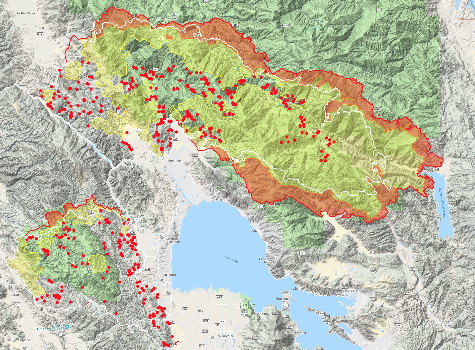
The IR map today, along with MODIS/VIIRS shows it pushing up against the Lake/Colusa county lines just east of Goat Mtn and the radio site last night into morning. It does show a little slop over right below Horse Rock. An MNF task force is assessing the structures today through that area of the M5, Pacific Ridge and Lovelady. With the forecasted winds, any establishment on that north side, or if it wraps around near Black Oak Campground and Trough Springs Ridge, won’t be good for Little Stony drainage, Lovelady and potentially Pine Ridges.
On the south side of the ridge it’s getting well established into the mouth between Indian and Hough Ridges. The Hough Ridge side has plenty of black from the Pawnee Fire and earlier fire dozer lines, but the Indian Ridge side doesn’t have much of anything except a couple hundred acres on a southern aspect slope last year (15N 6W S7) if I recall.
As I predicted, it’s made its way back into the SRA on the Colusa side into the Leesville area. I was 24hrs off my prediction. With the limited resources available and so many WUI fronts being protected, this just upped the complexity of this incident quite a bit.
Stonyford winds have been NW 3-10, gusts 5-24 through the evening and last night. Refer to the Stonyford RAWS for what the winds are doing in that area. IR map shows quite a bit of spotting with MODIS filling in the gaps so it must have blew in with some significant wind.
I’m trying out some new ways to push out daily IR map data.
Here is a link to a single IR map with IR for all of the current major fires in Ca. http://www.firemaps.us/files/IR.html
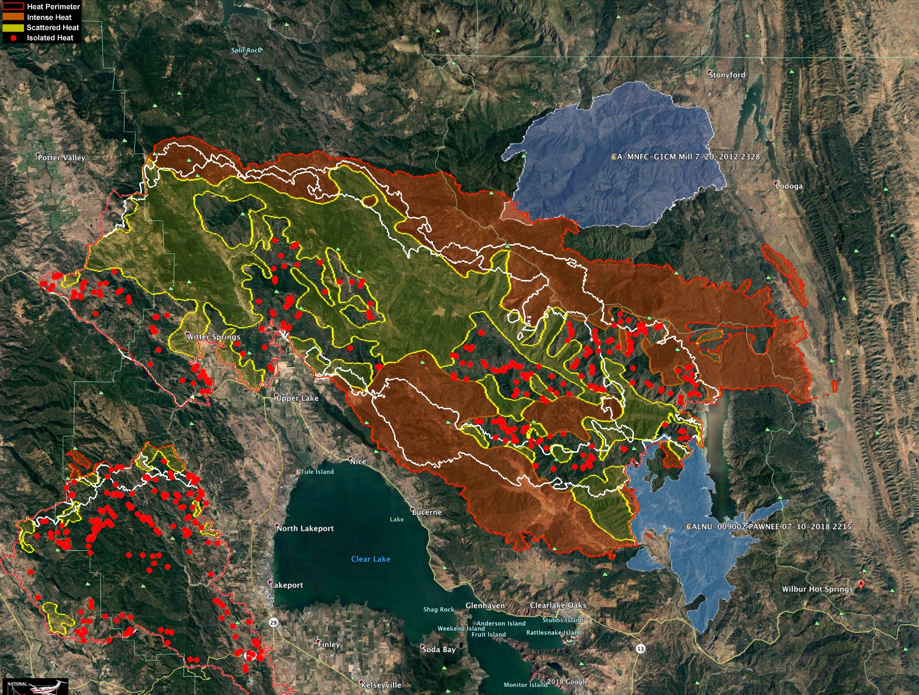
Portions of the Ranch Fire ran over 9 miles yesterday toward the East. The NE flank is starting to hit the 2012 Mill Fire, shown here in Blue.
2018 Pawnee Fire also shown in Blue - lower left.
The white lines are the 24 and 48hr growth at time IR was captured last night.
 )
)