IR maps for last night about 9pm.
3 Likes
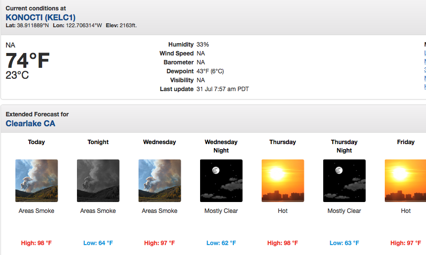
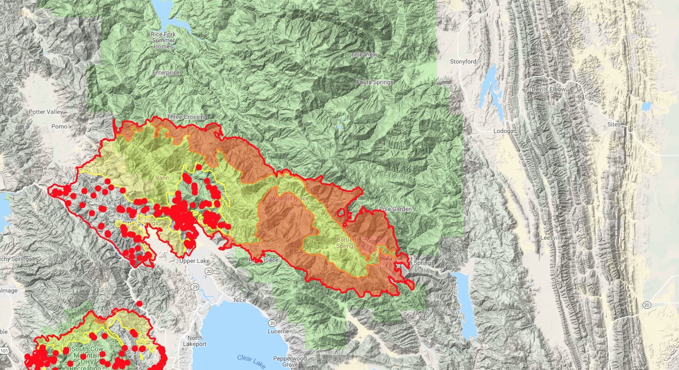
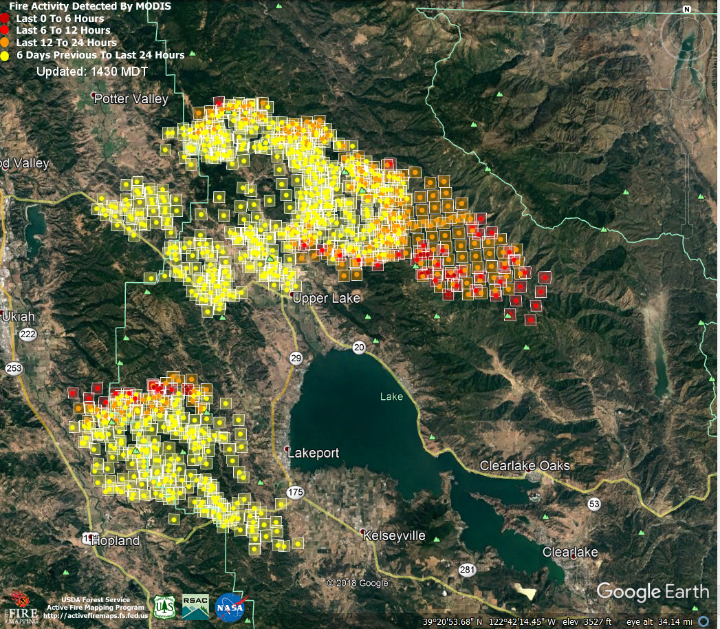
Ranch fire took off last night and raced eastward 8-10 miles, blowing right through Bartlett Springs and getting aligned with Hough Springs area and the upper end of Indian Valley Reservoir. Significant fire wx watch from today through Sunday for 35mph W-NW gusts through the passes and gaps of the Coastal Range into the valley. The entire area of this fire inside the forest, along with last night’s 8-10mile spread to the east, is within the 1996 Fork Fire footprint, which stopped at Indian Valley Reservoir.
The slopes on both sides of the creek coming into Indian Valley Res. have recent fire history, southern slopes was the 2016-Reservoir Fire. The northern end you can see slightly discolored on sat view and was significantly smaller, just from road to ridge, and took place last year if I recall. Pawnee never made it this far north - it progressed south.
High Glade Lookout took the fire front at 6pm Tuesday night. Unsure if the lookout stands but the RAWS station is still spitting data! That will be crucial in painting the picture of what winds are doing these next 4 afternoons. 2-7pm roughly for historical highs.
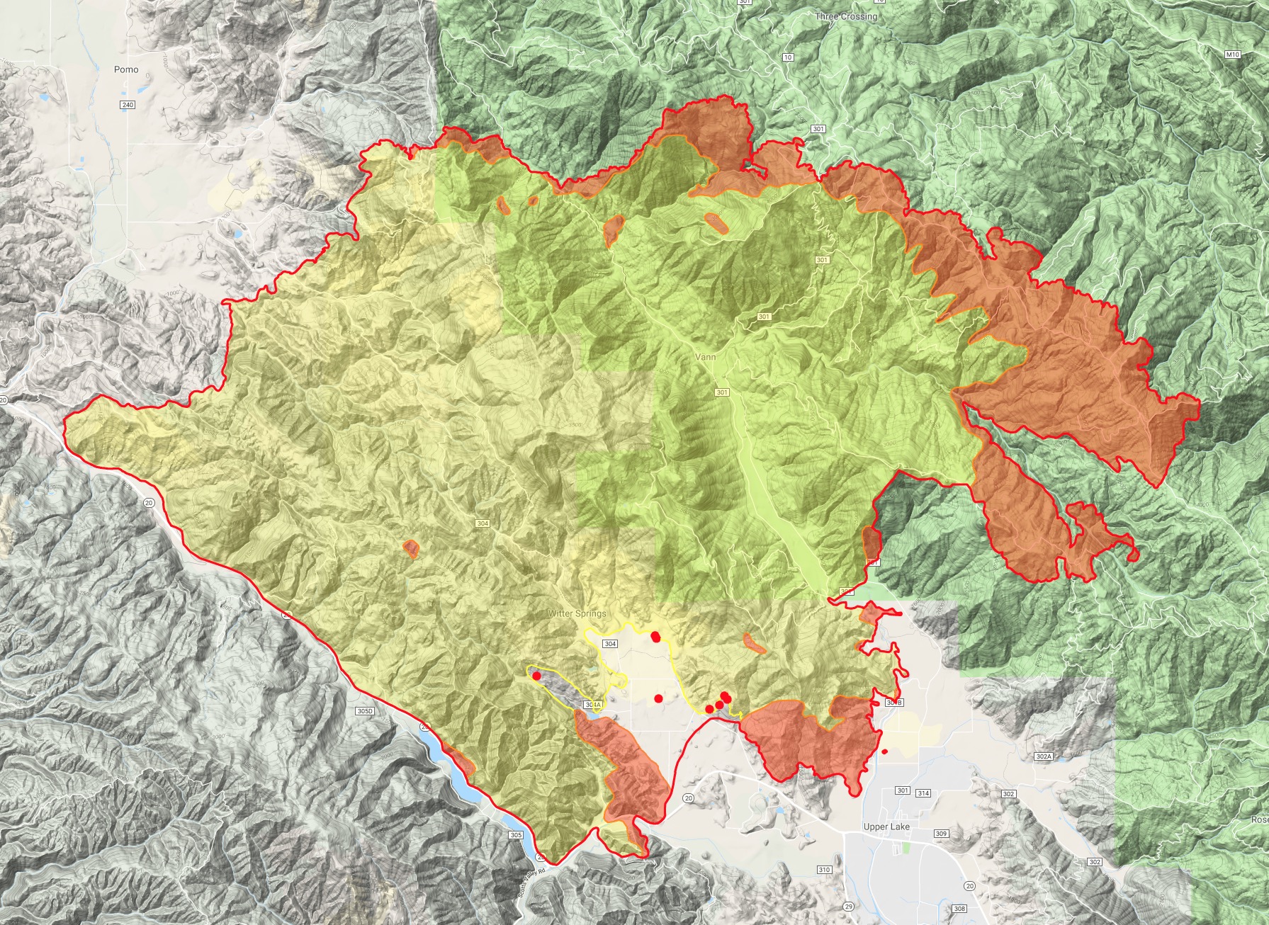
The entire ridge of Goat Mtn which defines the boundary of Lake and Colusa Counties will be tested hard these next couple days. If the visibility allows, this ridge is one of those perfect VLAT-designed ridges, just a long straight line to paint that could do a lot of benefit. However local intel sounded like MNF just can’t get the resources needed to prep that ridge though due to all the other fires.
The northern side of Goat Mtn and the entire Little Stony Creek drainage has not seen wild fire for a long time. Some controlled burns have gone through along Goat Mtn Road and Pine Needle Point and Green Flat area so the understory is healthy in some areas. The southern edge of the 2012 Mill Fire was stopped along Sullivan Ridge, with a contingency line along Pine Ridge, but those will do nothing with western-aligned winds. If fire crests over Goat Mtn into this area, with resources spread thin and forecasted fire weather, this can run right into Lodoga, or if it skirts the northern end of Indian Valley Reservoir, into Leesville. Both in the 24-48hr period.
16 Likes
Holy moly!
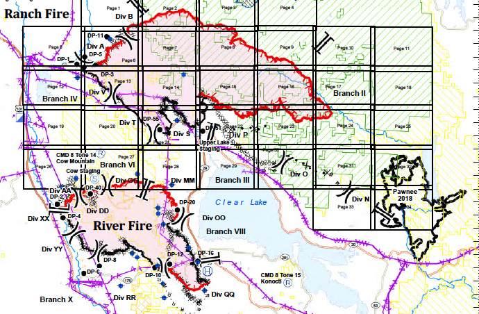
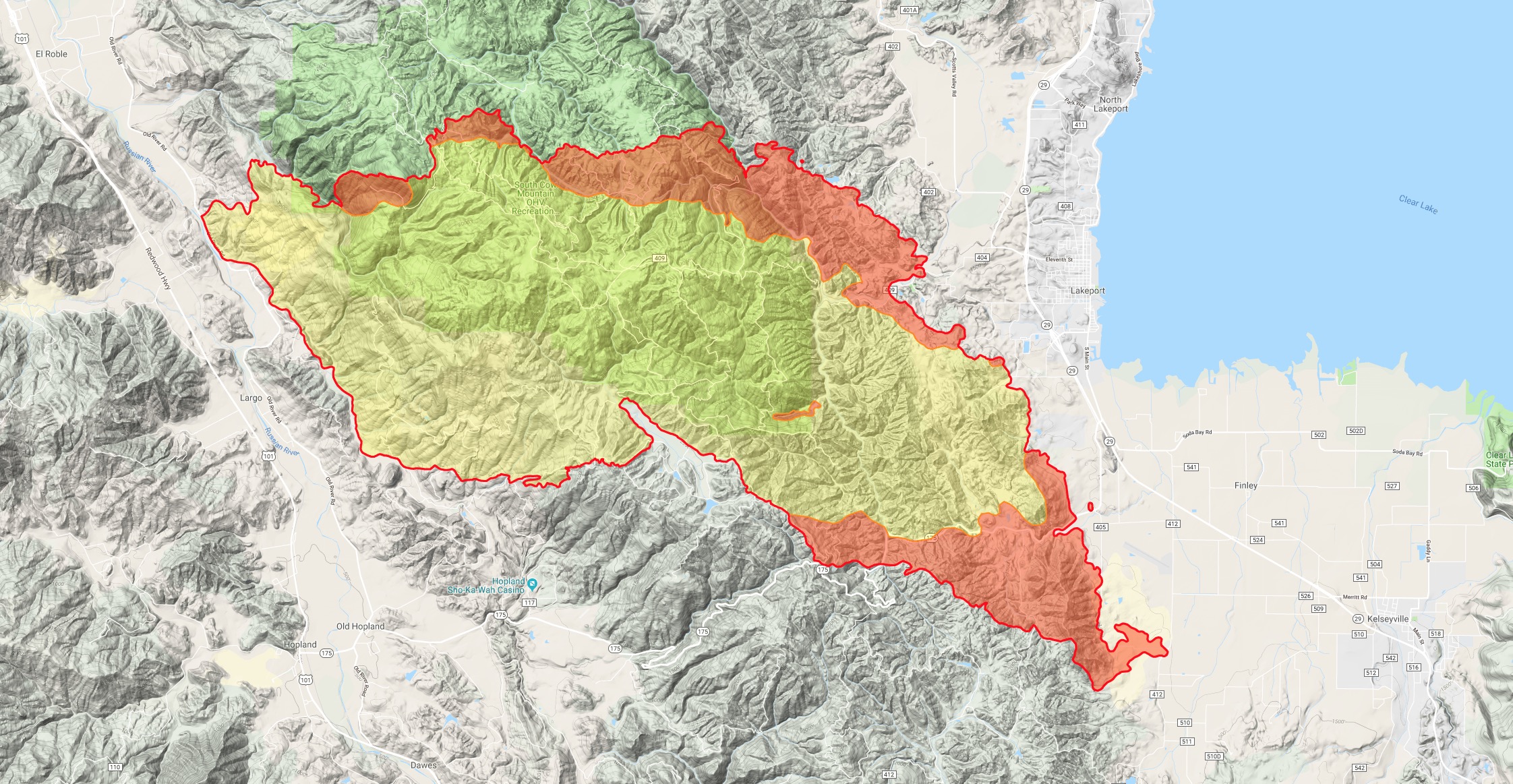
Latest Ranch Ops Map here:
1 Like
Updated to a red flag warning…
https://forecast.weather.gov/wwamap/wwatxtget.php?cwa=sto&wwa=red%20flag%20warning
A bit scary wording saying “rapid irregular spread”
2 Likes
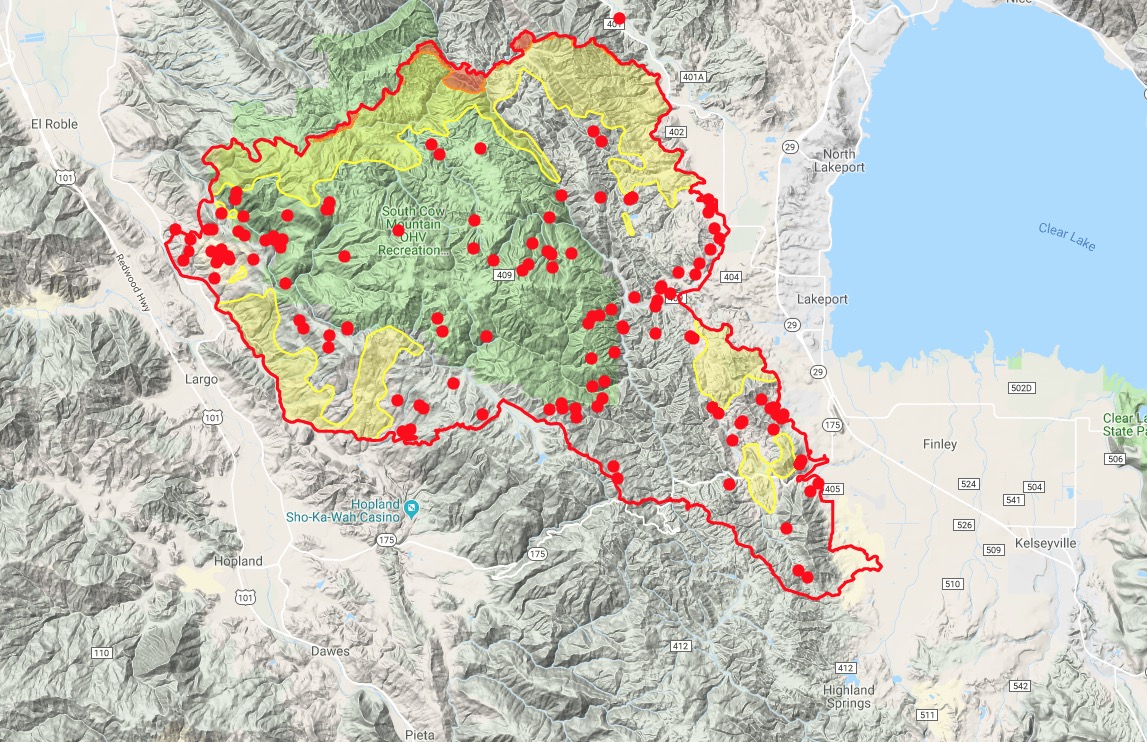
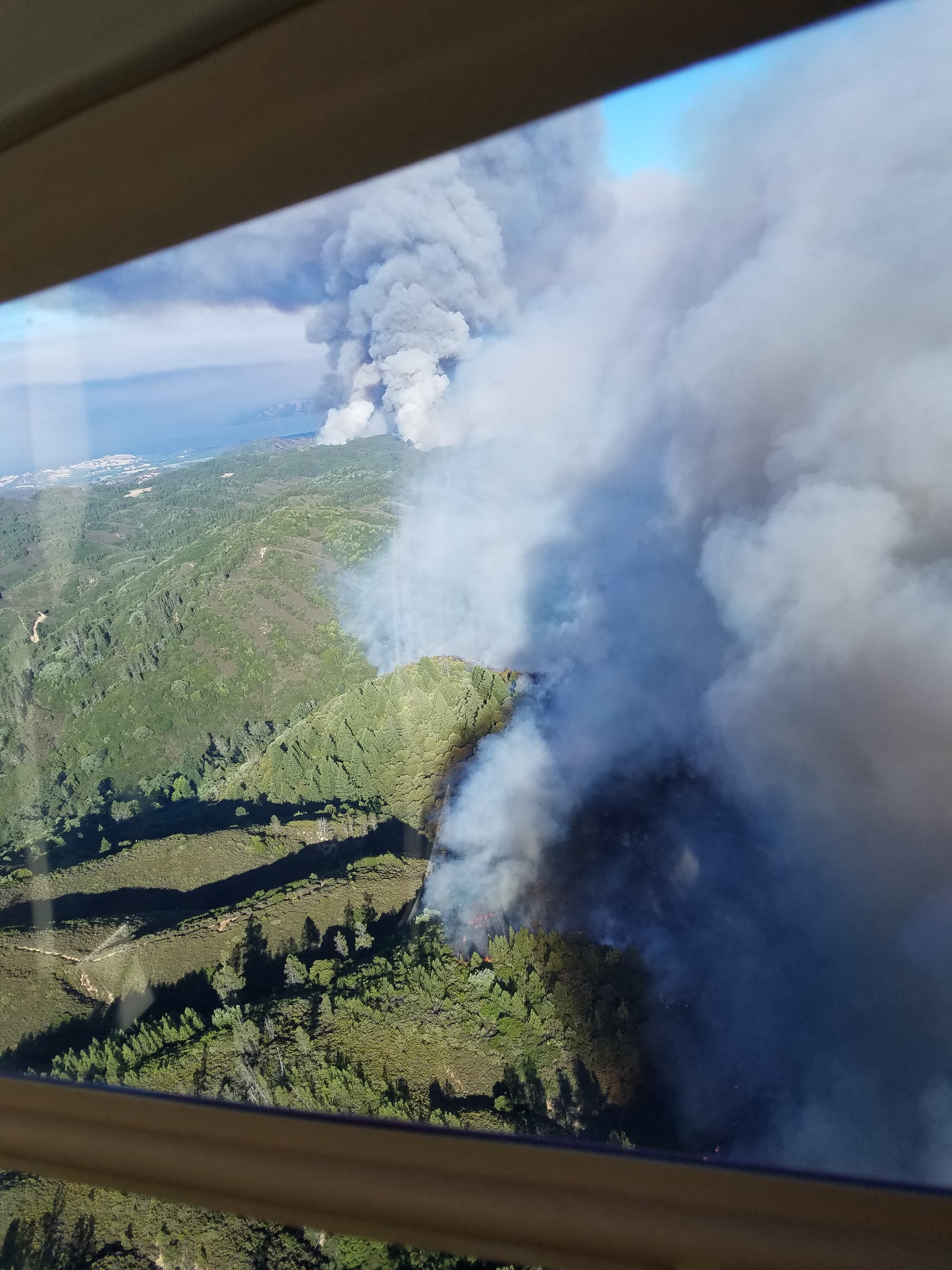
The Ranch Fire appears to have had significant recent activity towards the East. Marching towards the Pawnee burn scar.
The VLAT GST944 just got diverted to the complex from the SHU-Carr fire. There were a couple S2’s up earlier on the northwestern head east of Potter Valley. No other aircraft over the Ranch other than Air Attack. CalFire copter was on Goat Mtn earlier today - possibly emergency prep of the radio site.
High Glade showing winds picking up. 2pm had 14 G21 out of SW.
2 Likes
Dozers ordered to “High Blade it to the Safety Zones”
3 Likes
MAFFS 8, 9, 6, T944, T118 inbound
3 Likes
No divert all tankers for imminent life threat
all three headers just capped out and collapsed. no divert. looking nasty
A post was merged into an existing topic: CA-MEU-Mendocino Complex???
Right about the time you posted this, I was watching the visible sat and saw the plume shift significantly from a westerly influence to strong N-NW influence. In a matter of 20 minutes the entire thing leans over to the SE. High Glade RAWS shows westerly push most of the day up to 2pm. 3pm it changes interestingly from the south, then at 4pm on it quickly swings back to westerly, and now NW. Quite the afternoon.
1 Like
def saw three different column shifts with another one just happening about 30 min ago. pretty good fire activity on the river fire as we speak.
2 Likes
Hubby ( div A/B?) called a few hours after all this went down… “yup lost our SH$?, came from underneath… luckily only a few ( ?)away from Black, winds now in their favor” is what I was able to make out. Regrouping ready to do another round.
5 Likes
Glad to hear they are ok.!
1 Like