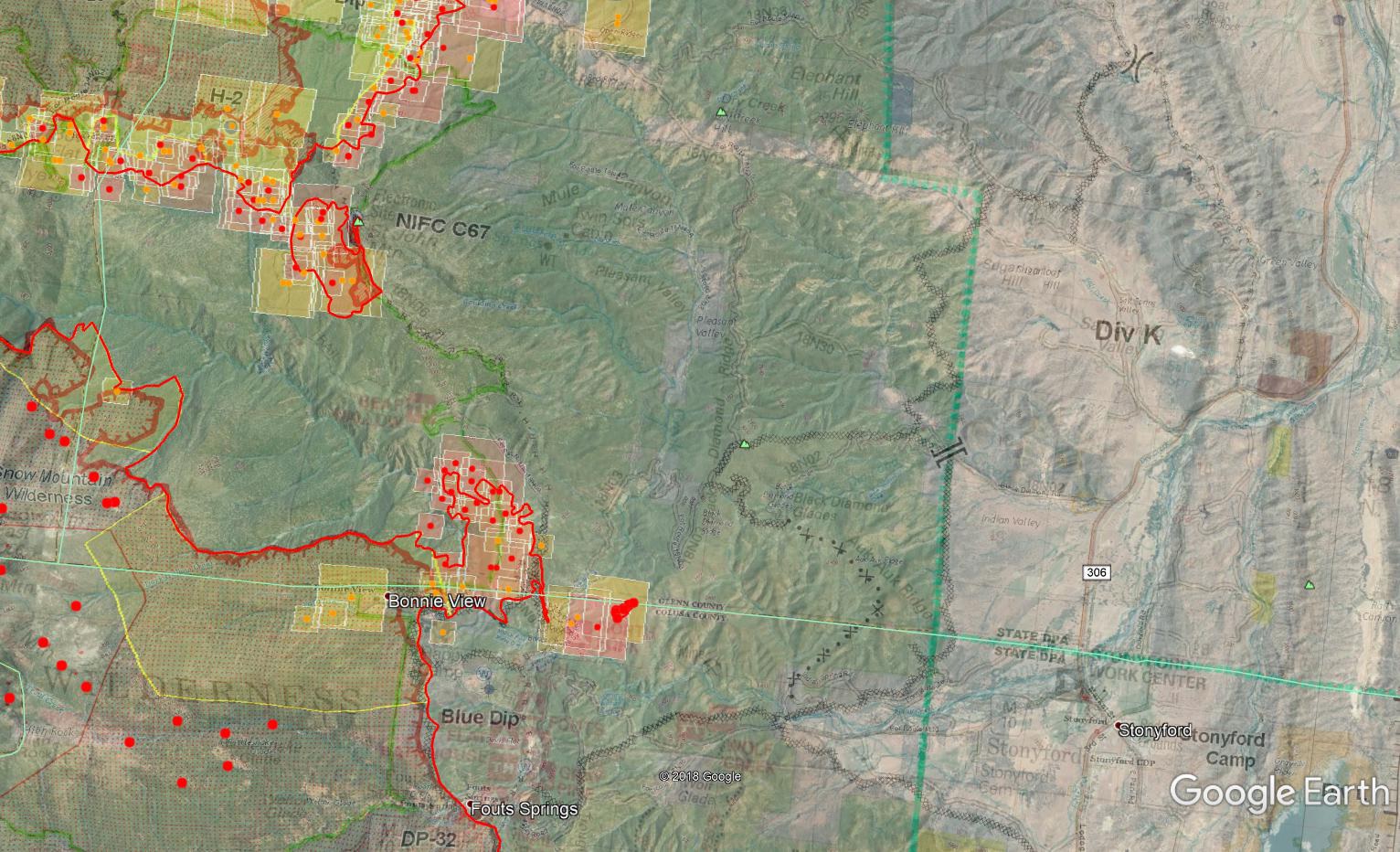
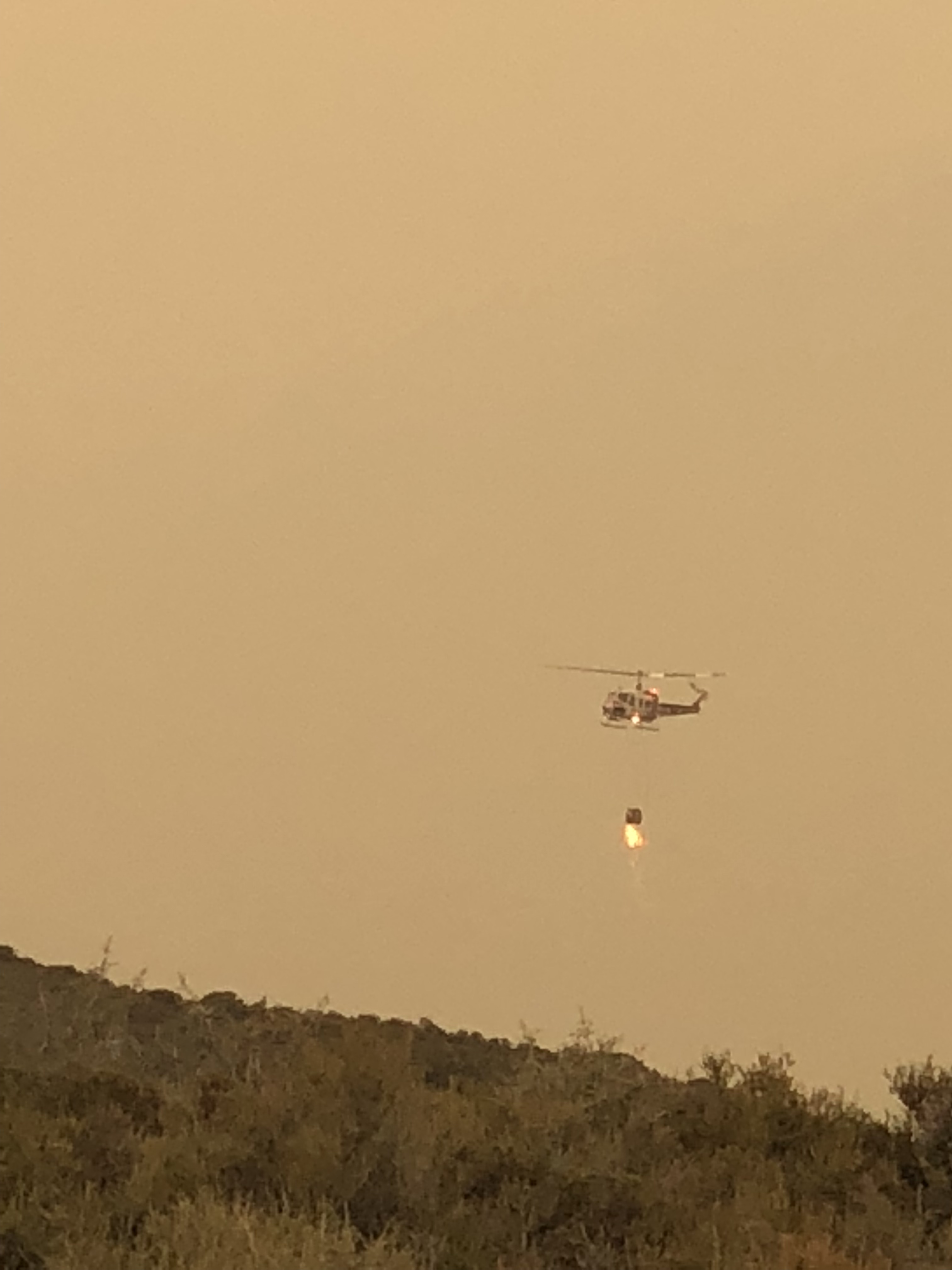
They were able to get some good firing started on the east side with a lot of fixed wing retardant to backup the dozer lines. Copters this morning are on heavy patrol and cleanup since it sounds like they had a lot of firebrands across the line into the green. The small fire yesterday down off the St. John Mtn Road has picked up and heading up the road along the dozer line. There’s also some significant heat on both IR and MODIS well east of the road. Not sure if a spot or an intentional burn. Well within additional control lines, just not sure how to interpret their plan on either keeping it west of the St John Road, or controlled strips of fire into the final control lines east off Auk Auk towards Stonyford. The firing at the top of St. John has just about tied into the main fire to the north.
On the north end, have a completed fired line from shores of Lake Pillsbury on up through F and G to DP69, what will likely be the final NW corner of this fire. Also completed fire from that DP69 corner east along H and I just into the SRA of the Tehama Glenn Unit at DP80 (not on that map). A separate burn op was started in Div J north south along Brushy Ridge and the 19N29 road toward the existing firing near DP80 in what should hopefully become the final NE corner of the fire.
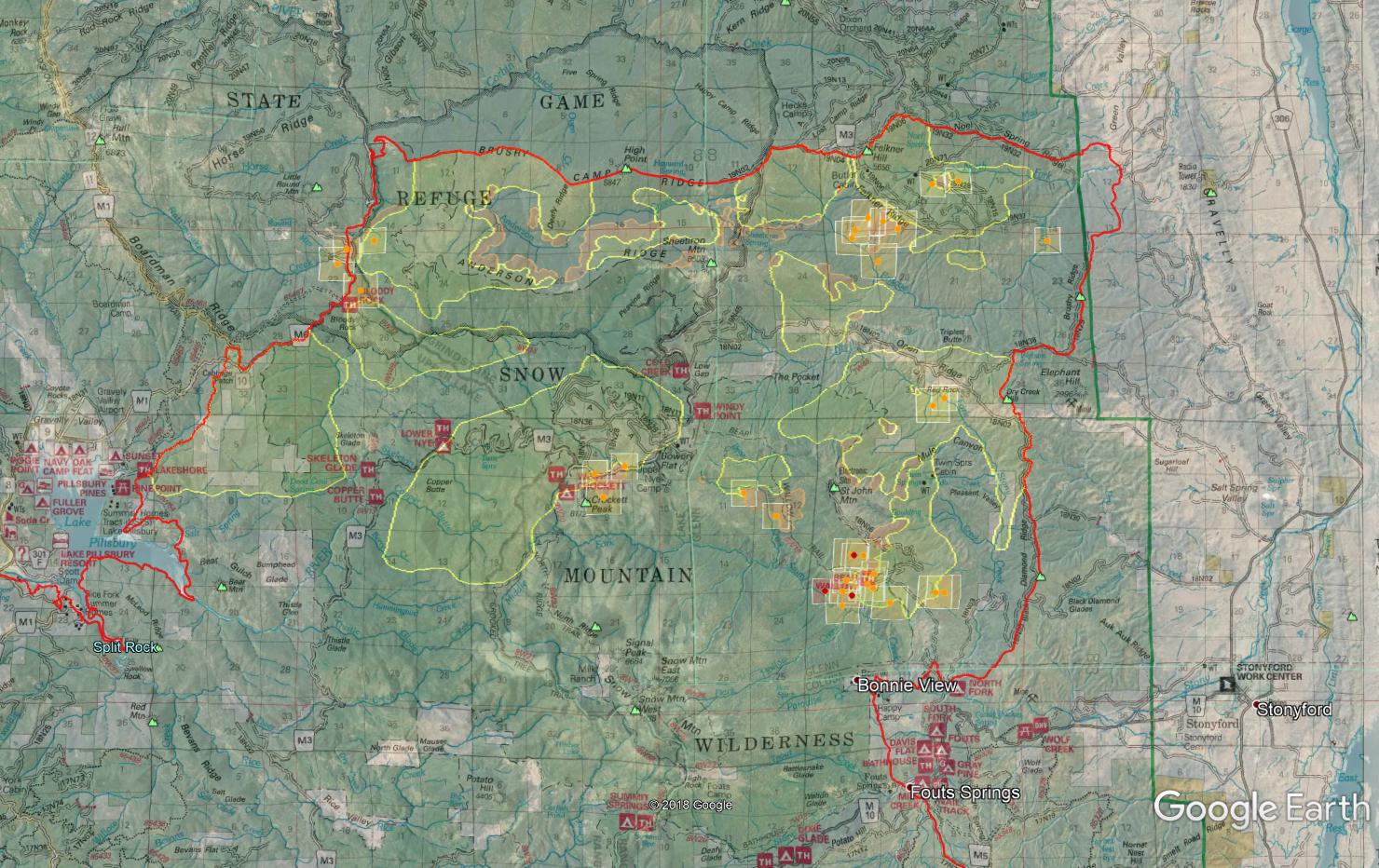
Maps are combination of Tuesday’s Ops map so ignore the feint red perimeter line, MNF Forest map, last night’s IR mission which flew early around 2030 over the fire, and the latest MODIS/VIIRS hits of the last 24 hours.
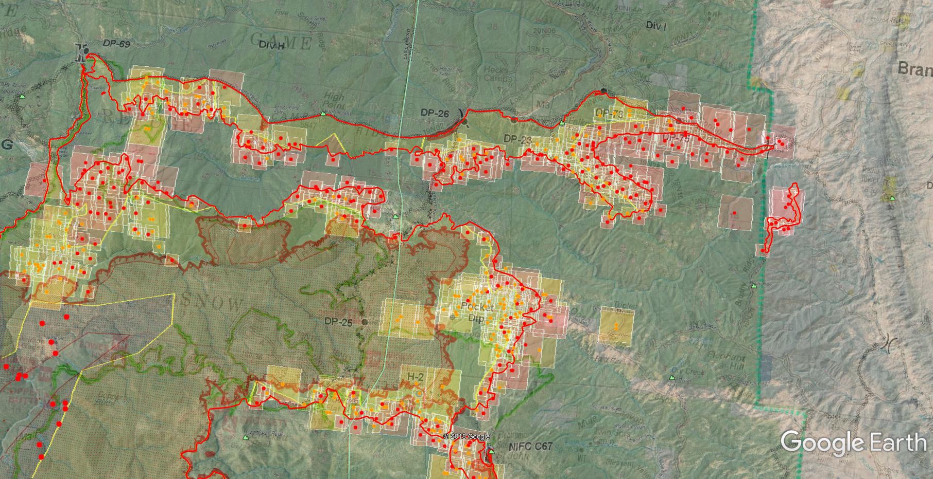
1400 Saturday: Firing has been progressing pretty well on J and K, and heavy patrol on the G/H break (the northwest corner, upper left of map below) as that head of the fire approaches their fired off line. MODIS/VIIRS shows plenty of heat in there this morning. They’re looking to get the Firewatch Cobra up for some IR intel as it approached the line.
On J and K it’s nice to see the the firing ops on the ridges further in from what appeared to be their earlier primary line. Running north south along Brushy Ridge and Black Diamond Ridge. Tightens things up and adds plenty of contingency.
Also, a lot more black perimeter line elsewhere on the Ranch Ops map. Strong work out there!
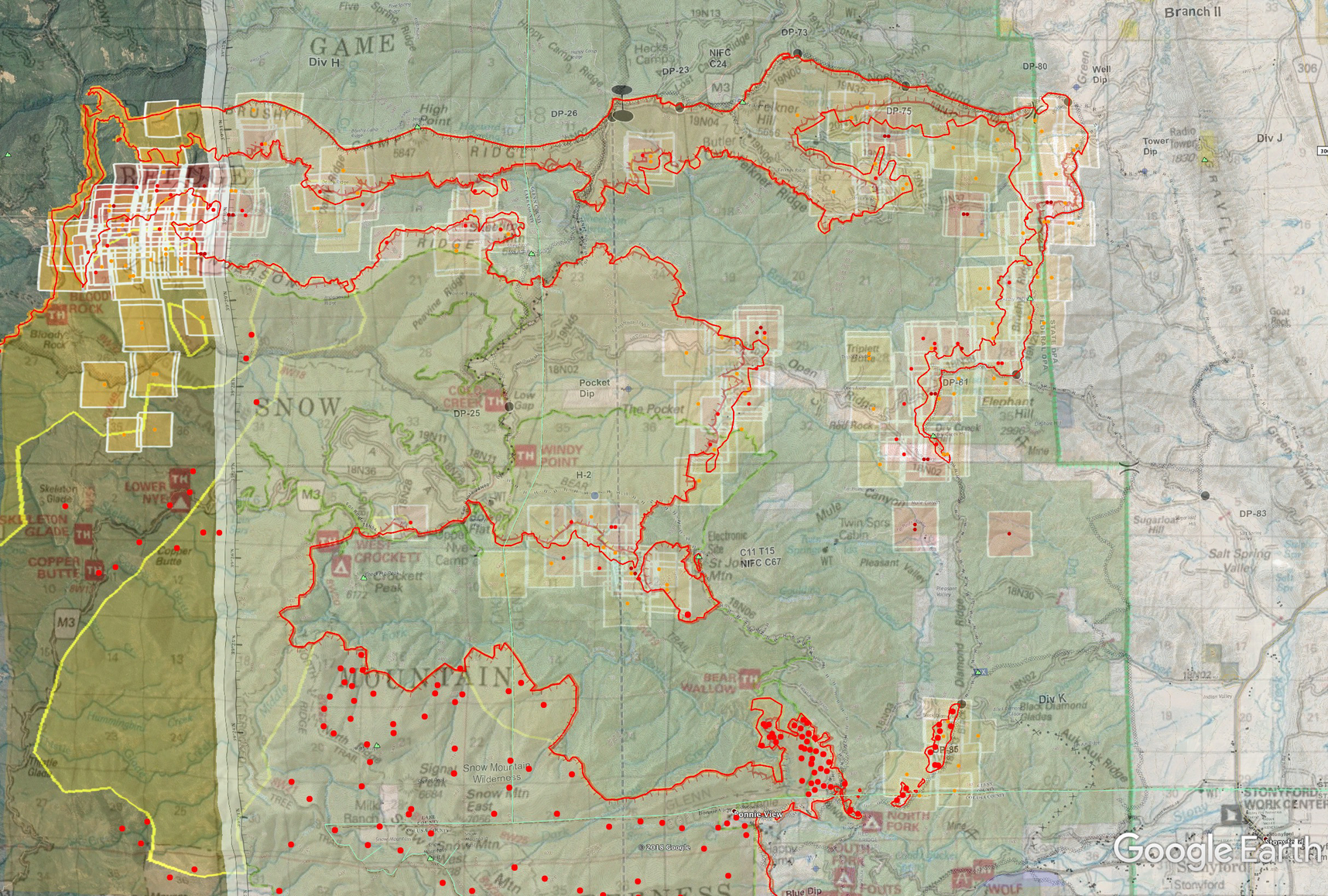
Map Data: All current, Branch II Ops Map from 8/25, IR from last night, MNF Forest Map, MODIS/VIIRS as of 8/25 1400.
Excellent firing ops yesterday and last night, the entire east side is tied in, with helitorch operations helping burn off the bulk of the unburnt fuel in one fell swoop. Not much else to interpret here. My brother has been on Div J supporting the firing ops, says it pretty much just needs to burn into itself and the beast is done.
The last week has been a perfect example of excellent indirect firefighting. Letting fire work for you, not against you.
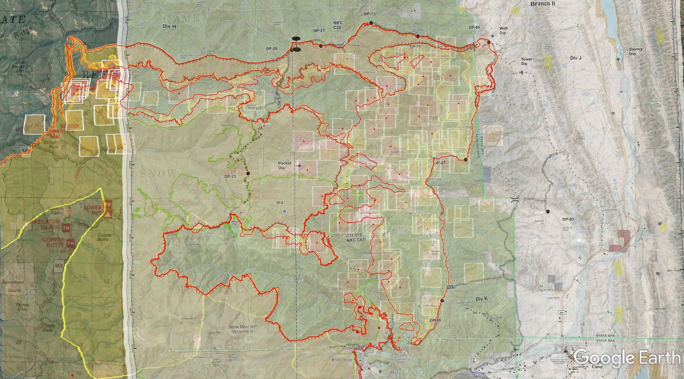
Map: Ops Branch II map from 0825, IR from last night, MODIS from 0826 morning, MNF Forest map.
I’m sticking a fork in my map updates for this one. What a wild ride. Had a brother chasing this thing on west and east sides, had a home-built family log cabin somehow survive up on Goat Mtn that had everything around it burnt, up to the charred pine needles on the front step, had some harrowing moments hearing some IWI over the radio and silently rooting for Mountain Medics, Howard Forest having a voice over the Sac Valley (and the radio work COMT’s had to do to make that happen) etc. Strong work by everyone on the team. A LOT more work and repair to follow. Stony and Cache Creek watersheds, along with the upper Eel River will need a lot of love and care before the rains hit.
For the map, focusing on the northern half, I turned off the Ops layer to show our Forest underneath. IR from last night, looks like the bulk of interior islands are burned off. MODIS/VIIRS as of Tuesday morning.
Wednesday morning can see the coastal range from Red Bluff for the first time in a month.
CalFire CMD11 was terminated this morning for the east zone. All comms now back on the NIFC system. Today will be the last day I have the NIFC system on priority on my live scanner. Elk Creek Helibase is disbanded. A lot of heat in Briscoe Creek this morning still in the NE corner of fire. It appears the IR flights aren’t defining any islands within the burn anymore, focusing only on the perimeter. One day they were there and the next, sometime this weekend, they were gone; either burned off or not recorded. I was looking more at the middle fork stony creek drainage on the north side of the Snow Mtns. Fire never made it down into the canyon off the NE slopes of the Snow Mtns, stayed about 1/3 upslope. I’m sure being Wilderness they’ll just let it do its thing, but that would be a big plus for that watershed if it makes it through. MODIS doesn’t show anything yet ever reaching into the canyon.
Thanks for the updates @norcalscan. You and @pyrogeography are going to get bored returning to the " regularly" scheduled game
Your guys Intel and propeller head mapping skills offered most of us images of the mendo and Carr fires and understanding for knowledge and /
or decision making , all the while based on your guys daily updates.
Thank you
You gentlemen uphold the intent of this website ️
Howdy from Lakeport
Weds night, I watched a splendid moonrise and was able to see constellations, not just the planets and brightest stars. I took a few minutes to sit outside with a glass of wine to enjoy the peace and night sky.
We still have haze, but nothing like the previous few weeks. The “summer snow” is mostly blown away or hiding in cracks and crevasses and the tang from the smell is still there. I don’t know how Lake County is going to recover from this- local resources and sites for relief are hanging on a thread. Going forward, Lake County government is going to need a reset. They can’t go on the way they have been. We have so many job openings in LE and County offices! I want to thank everyone who posted here to keep me informed on how this plays out and for the future. October winds are still to come.
I agree, without their updates we were at a loss for information. I live on the northeast side of the Ranch Fire and copied and pasted their posts to shared with the locals…Thank you
NorCal Team 1 taking the complex tomorrow after SoCal Team 3 who completes their 14 day assignment. Still ongoing suppression repair of roads and surrounding areas. Not sure exactly when it will go back to the forest at this point.
I have been watching the progress of this fire since it developed into a major fire. However over last week maybe 10 days I have noted that the containment has not grown more that 98%. It is my suspicion that the fire commanders are using the opportunity to maintain federal funding to support rehab of the fire damaged areas on the FMAG. Am I wrong in this assumption? This appears to be a wise decision in getting the feds to pay 75% of the rehab costs for a state fire. However is it not a bit disingenuous to ask the Feds to pay for something that is not really in the scope of the FMAG? Is there not another route to get Fed dollars to assist in the rehab to reduce the calamity of the fire once the rain starts?
I’m pretty sure that most of the acreage in the complex is federal (USFS) land. Can’t disagree if we are talking areas within the River Fire, but otherwise it’s just a matter of which federal agency is paying.
The last 2% on “unconfined” line is an area with some smoldering fire in vegetation among large rocks at the bottom of a cliff. Can’t put crews into it so it is going to have to wait for a mother nature to mop up that chunk of line.
Right. So, the River Fire component of the complex used FMAG, the USFS piece (mainly the Ranch Fire) used USFS funds. Either way, the federal government picks up a majority of the costs.
157 homes
459,123 acres (math says River Fire 48,920 acres, making Ranch 410,203 acres)
720 square miles (I’ve measured this thing 35 miles both north to south and east to west without going over unburnt land)
1 firefighter fatality
Is this both fires (Ranch and River) combined acreage? I think it was bad business to combine the acreage of both fires since they had two different ignition sources and were unrelated except that they started on the same day. I don’t understand their logic and totally skews the records now and in the future.
Good call, I agree. It has been a mess with stats, unified command, MEU administrative, and what numbers are what? I do remember this incident starting and it was noon on Friday; and the night before the Carr fire had just blown through 1000+ homes so Northern Region was stunned, MEU and surrounding areas had a lot of resources already out of the area helping Carr. With drawn down overhead and aircraft, what little overhead they had left in MEU they complexed the two starts under one IC.
According to http://www.fire.ca.gov/current_incidents/incidentdetails/Index/2178
River Fire has been 48,920 acres
Ranch Fire Calfire isn’t giving the acreage and instead directs me to theInciweb page, which is where I got the 459,123 number. Their latest NIROPS IR map also lists “459,124 heat acres” and only for the Ranch it appears.
HOWEVER I did a “rough” perimeter check of the Ranch IR perimeter in Google Earth and it’s actually about 411,000 acres (~162 miles of perimeter!), or ~642 sq miles. Funny how you can add River’s 48,920 to the 411,000 number and I get 459,920. So they are combining the two fires on Inciweb and in all the press releases. Subtract the known River acres 48920, and that gives us 410,203 acres for the Ranch.
I guess you could also do the same with structure loss, since CalFire appears to have River Fire stats on their own…
 ️
️