State ID: CA
3 letter designator: MEU
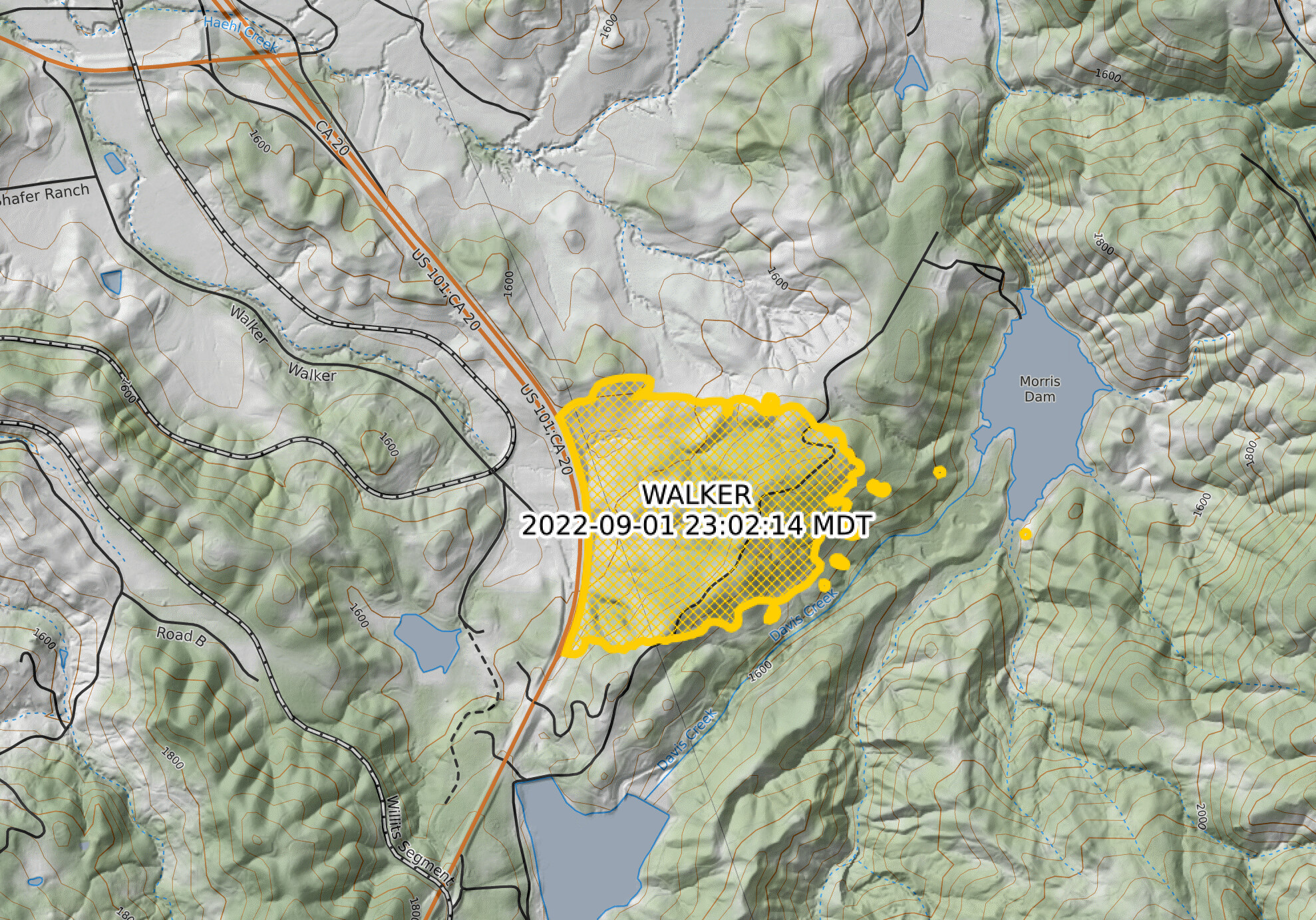
Fire name: Walker
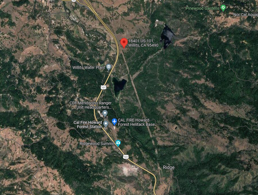
Location: 18401 Highway 101
Reported acres: 15
Rate of spread: MROS
Report on Conditions: Slope driven grass and brush moving into timber.
Structure threat: yes
Resources:
Hazards:
Weather: 91* RH 25% Wind West 8
Radio channels:
Scanner link:
Webcam link: ALERT Wildfire
Agency Website:
4 Likes
3 Likes
Partial closure of U.S. 101. Fire possibly on both sides of the roadway. Evacuation warning to Pine Mountain Subdivision.
3 Likes
25 acres still MROS
3 Likes
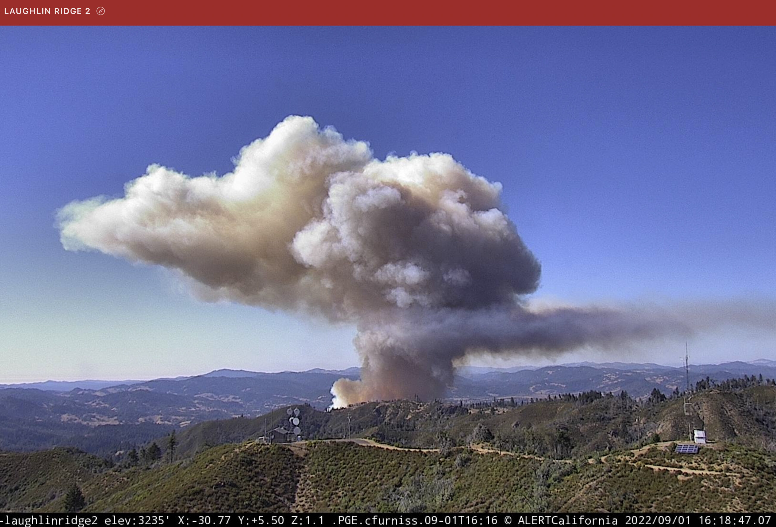
Intel aircraft lifted off MCC headed that way
3 Likes
Scanner feed here
3 Likes
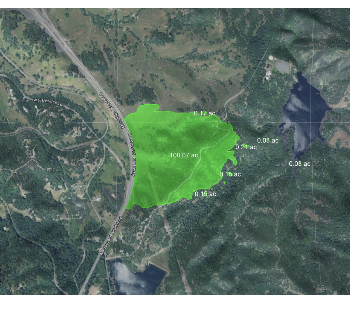
Per IC, 100 acres, grass oak woodland, forward progress slowed.
4 Likes
Per intel fire mapped at 109 acres.
5 Likes
Nice Stop!
Per CALFIRE MEU:
109 Acres @ 25% Containment this morning. Forward progress has been stopped. Mop up and patrol operations will continue throughout the day.
9 Likes
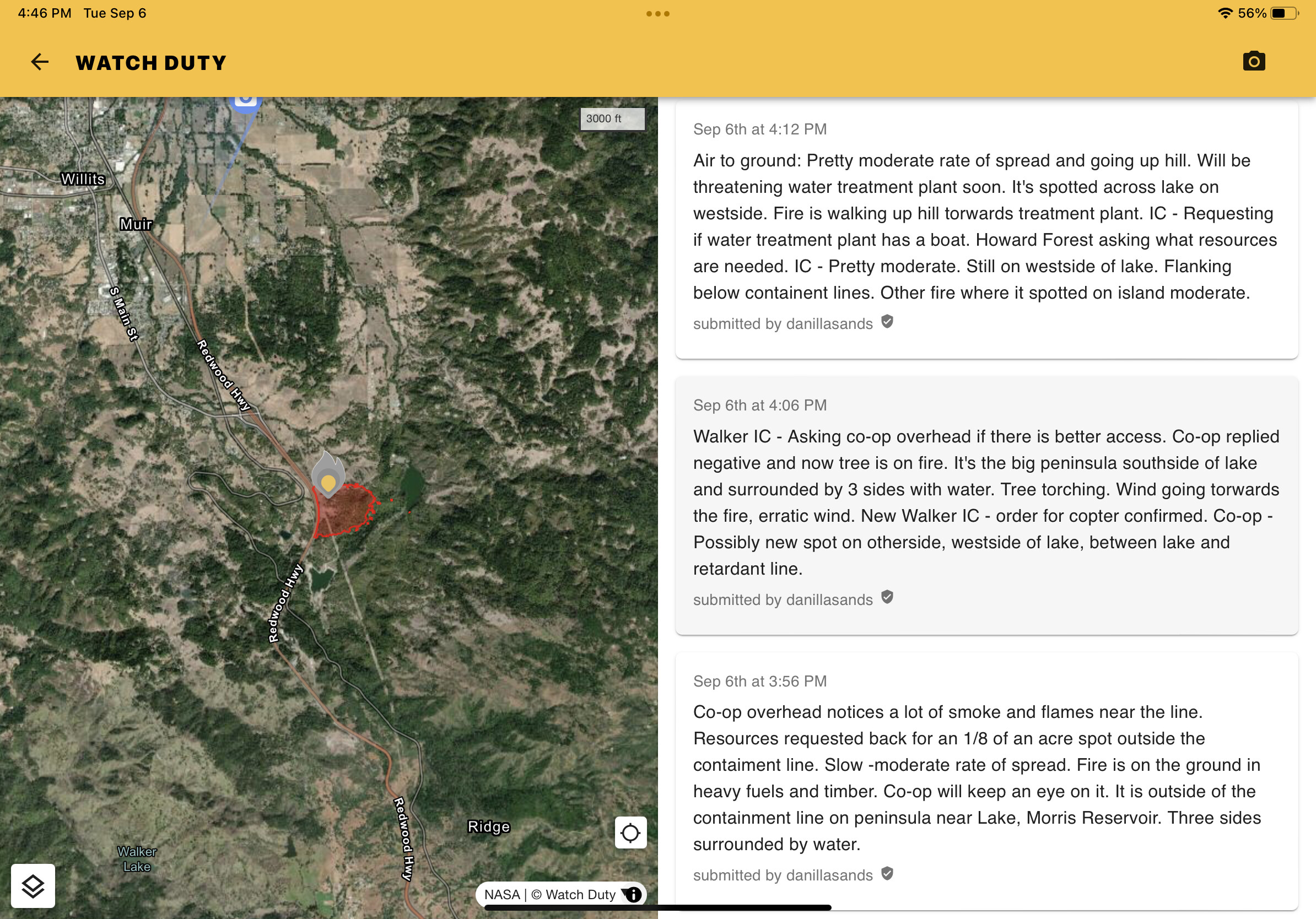
Spot outside of containment lines.
2 Likes
Here’s to hoping it’s just an island torching off, if not at least helitack is rather close by
3 Likes
2 spot fires good view on cams…
3 Likes
AA and copter on scene, tankers a couple minutes out
1 Like