Ty! We are working on the Central Sierra Fire Tactical Feed again to make it work for this fire.
Folks are forgetting about the Timberlodge fire in August 2nd, 1962 that had 4 FF deaths. this specific ground has a fire history.
Completely agree! Yesterday I noted that the address given to evacuate some folks was just about a half mile from the burnover you speak of. Your point is well taken and should be considered. I tend to focus on the Harlow fire not just because of its rate of spread, but it is one of the very few large fires experienced in the “Oakhurst proper” area… and because my house is sitting inside what was the perimeter of that the fire. I’ll look at its perimeter too.
We have talked about this in TCU and a lot of our fires burn from North/Northwest to the South/Southeast. The Local winds and the heating of the day with the terrain. You get up in a ship or AA you can see this on old fire scars… Butte fire had a little north wind behind it.
What really stuck out to me yesterday when watching live feed from the news chopper. Was the amount of dead trees laying on the ground and still standing. Plus when it made that initial run across that ridge of several ridges. The amount of small side drainages the fire was creeping into. Combine that with structure scatted all over. By what I see from my house this morning these folks have a very long day ahead of them.
There was a few recues I also heard yesterday. Hats off to the engines of whoever went to get those folks. That also throws a monkey wrench in the plans when your tying to fight fire.
yep, I use to live in Ahwahnee and worked at the station there. we had a big Ops map of the Harlow fire in the mess and it was a constant reminder anytime we got a fire call in the Metcalf Gap area.
The people in this area have had huge issues with pg&e contractors coming in and taking a lot of trees down and then leaving them for the property owners to deal with and as was mentioned before the type of people in these areas don’t have the resources to deal with this. I’ve watched countless discussions about this over the years. They’ve had no luck getting assistance. I’ve personally seen the ramifications as well on my friends properties. I’ve also watched my friends who owned tree companies close their businesses because it’s gotten too costly to run those anymore due to things I won’t bring up in this discussion.
That’s a problem we have been addressing in Tuolumne County for a long time. But what I’m talking about is the casualty from the drought. It was just a massive amount on the ground and standing on fire.
Bark beetle too
Don’t forget we had low snow in late Dec. that took down a lot of trees or broke branches that hung up in the canopy taking a species of trees “oaks” that are resistant to crown fire and now we have a high potential for crowning
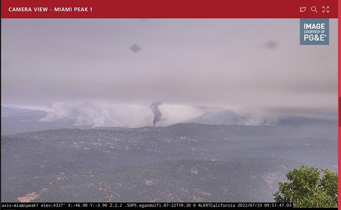
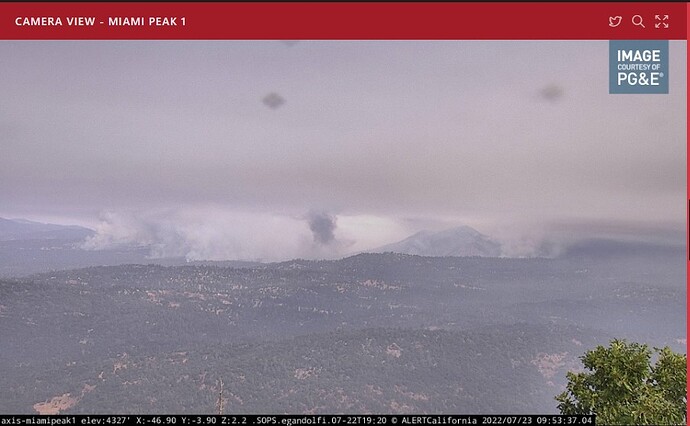
Screenshots taken moments ago (07/22/2022-9:55am) of the Oak Fire from the MiamiPeak1 cam. Note the imbedded dark smoke. Structure burning?
You can never know the actual conditions on the ground from aerial photos so this is situational dependant. When assigned to “structure defense” never pass up an opportunity for perimeter control. Several areas showing slopes or spots just over a roadway that was holding for the most parts are visible in various aerial footage. Lots of red lights back at structures but not at the slop or spot. Putting those out can go a long way in defending your structures and may help secure some line.
The low elevation, snow broken branches have been on my mind also. Also there was a late freeze up here (Grass Valley) that froze the new tender leaves on the black and blue oaks but they did not drop. Then a new crop of leaves came a month later but it was warm and dry by then so the new leaves do not look so hot either. I suspect that adds a layer of light flashy fuel to the canopy. Are others seeing this?
I manage fuels for radio sites from Auburn, Mt. Bullion and Auberry/Meadow lakes and I haven’t noticed that oak damage.
Does anyone know where I can find an updated link for current evacuation orders?
Thanks  much appreciated for family friends
What concerns me is this is a Mariposa county maintained site. Notice the information drops off at the county line and is grayed out. Madera county needs to step up and get theirs going.
MadCo is more than ready to act, when necessary. Unfortunately thwy have had multiple incidents of large inciden†s annually since 2015.
Latest spot weather shows South to Southwest winds and eye level and transport. This may change my initial assumption for a northwest push today.
https://www.weather.gov/spot/php/forecast.php?snumunum=2215581.0&lat=37.68725102021804&lon=-119.70933709643491&z=9


