
West side
Buckingham Mtn/Ridge was used as a containment line
7 Likes
The 2013 Carstens Fire was in the vicinity on Buckingham Mountain, the 2018 Ferguson Fire was about ± 3 miles to the east of the Oaks current location, but varies.
7 Likes
Not for tactical decision making, for discussion only. This is a fire history map with the area of the Oak Fire Circled.
7 Likes
One hour until it impacts Darrah Rd and Jerseydale rds
3 Likes
The Ferguson burned all the way up Jerseydale Rd. We staged at Triangle and Darrah for the recovery of HFEO Braden Varney when his dozer rolled off the hill he was cutting. There were a ton of engines staged in the huge field to the east of Jerseydale Fire Station
6 Likes
Needs to be moved to the E/SE and enlarged. One hour until it impacts the Darrah Road and Jerseydale road system.
2 Likes
This thing not slowing down until shadows hit or night fall. And the way it’s burning it might keep going then. This is the first fire in the Motherlode that looks like it wants to burn.
5 Likes
We used Buckingham Ridge as a control line from where it co.es up from the river through what we called the “JUNK YARD” all the way to the SE over Buckingham. But in 6-10 blades with Dozers except for the NW end the shots tied off and the SE end about 10 chains through some of the heaviest oaks that T2 Dozers couldn’t push thru. A golf finished the line. It was never needed as it was held to the Triangle Rd. But the flowing year, we reopened everything that was put in on the Ferguson to the west off Feleciana Mt and tied that in to Buckingham Ridge.
2018 was Ferguson
2019 was Briceburg if memory serves me.
5 Likes
Phone’s blowing up… Per Mariposa County Sheriff’s Office
OAK FIRE- Evacuation Order issued for Triangle Rd from Hwy 140 to Darrah Rd, All of Jerseydale Rd
Map of the area- https://arcg.is/jKqD5
This gives us an idea of how rapidly the situation is unfolding…
Road Closures-
Carstens Rd
Triangle Rd from Hwy 140 to Carter Rd
Buckingham Mt. Rd
Plumbar Creek Rd.
Jerseydale Rd and all side roads off of Jerseydale Rd
2 Likes
Heat is showing on GOES satellite:
Can zoom in only so much…
2 Likes
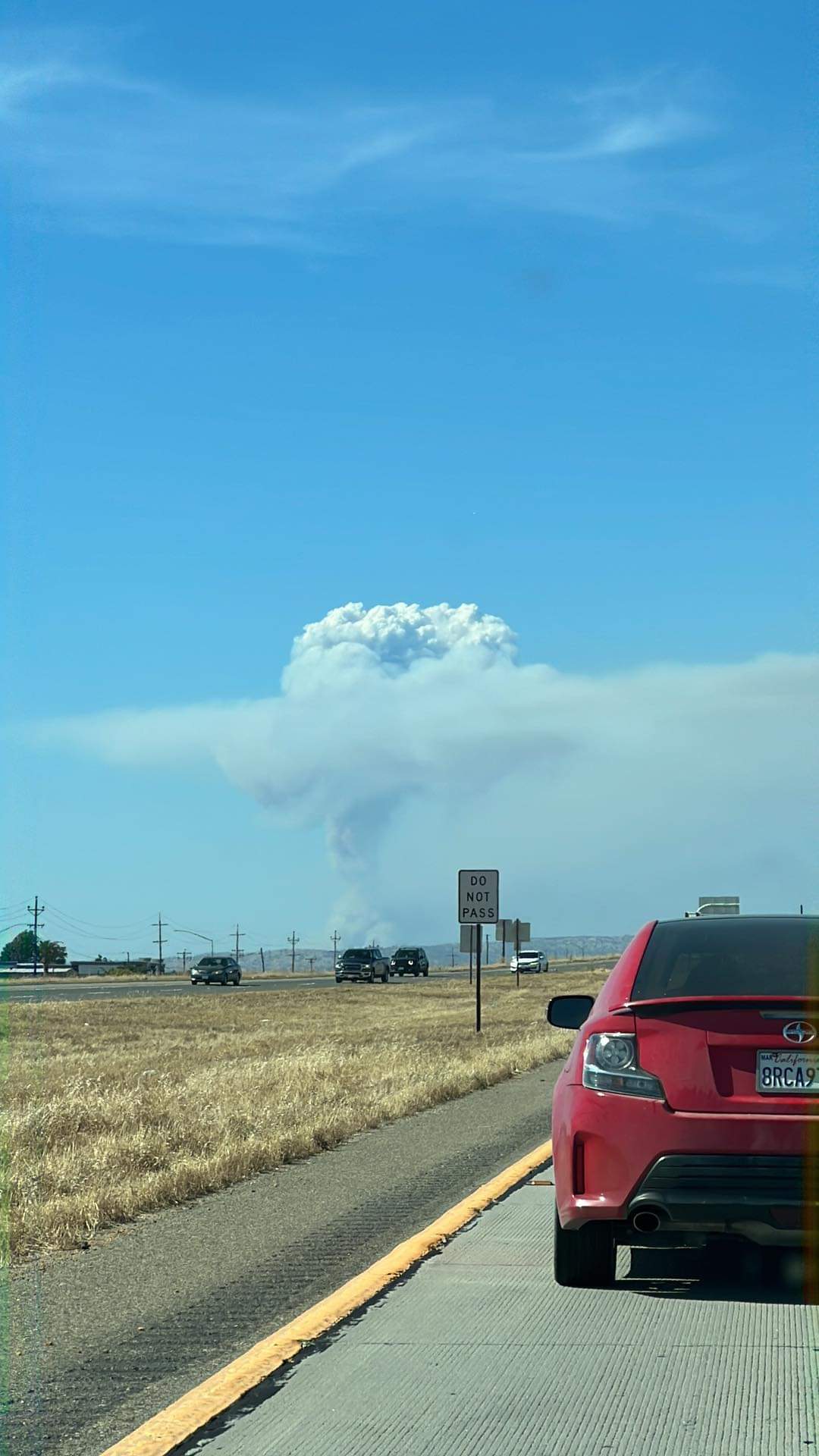
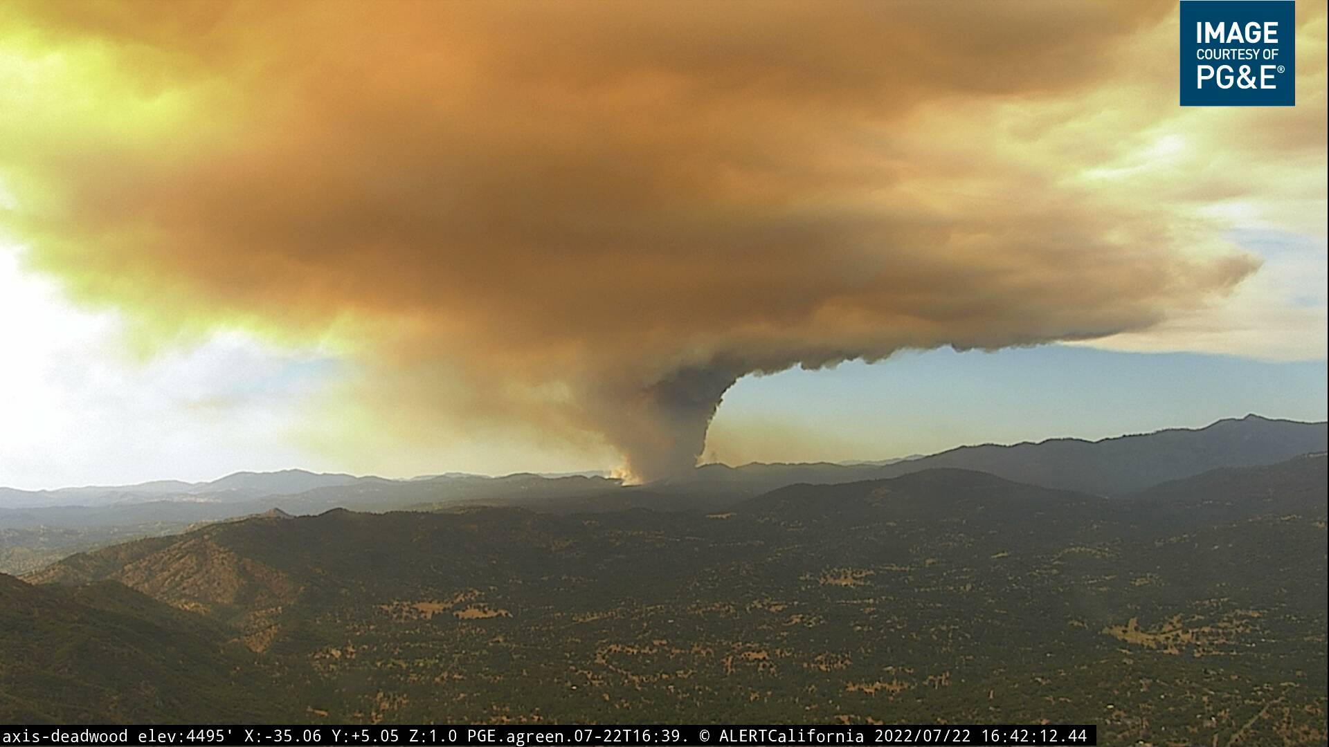
Looks like it just punched through the inversion layer.
6 Likes
Cannot remember the name of the saddle above Triangle Road… but I remember that winds can pour down through there every night. Unsure if that will be an issue tonight? It was a huge concern during the Ferguson.
5 Likes
IMT on order??
2 Likes
State or Fed?
1 Like
i believe its MMU but also on the SNF boundary.
3 Likes
It’s about 90 SRA and it’s current path S/W is all SRA
4 Likes
I know it’s quite a ways east of Lake McClure, but this initial intensity and aggressive push southest is eerily reminisent of Detwiler back in 2017. Could indicate the kind of fire we’ll likely expect for the week.
6 Likes