Phone’s blowing up… Per Mariposa County Sheriff’s Office
OAK FIRE- Evacuation Order issued for Triangle Rd from Hwy 140 to Darrah Rd, All of Jerseydale Rd
Map of the area- https://arcg.is/jKqD5
This gives us an idea of how rapidly the situation is unfolding…
Road Closures-
Carstens Rd
Triangle Rd from Hwy 140 to Carter Rd
Buckingham Mt. Rd
Plumbar Creek Rd.
Jerseydale Rd and all side roads off of Jerseydale Rd
Cannot remember the name of the saddle above Triangle Road… but I remember that winds can pour down through there every night. Unsure if that will be an issue tonight? It was a huge concern during the Ferguson.
I know it’s quite a ways east of Lake McClure, but this initial intensity and aggressive push southest is eerily reminisent of Detwiler back in 2017. Could indicate the kind of fire we’ll likely expect for the week.
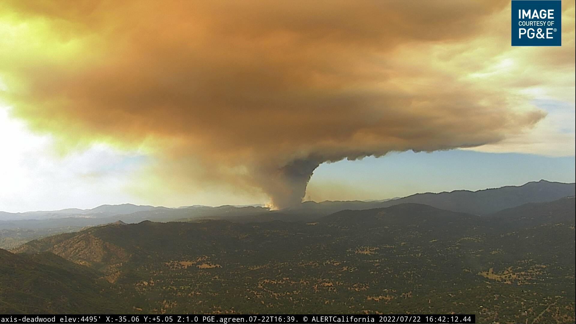
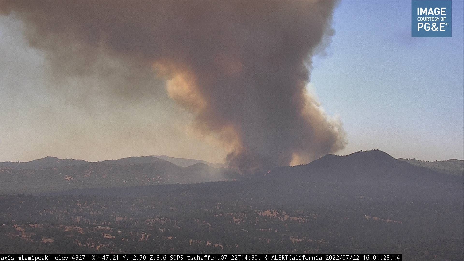
Hardly an hour apart and the fireline has already crested the peak of the ridgeline and appears to be spotting down near Triangle Road. Dont take that as fact, that’s just what appears to be happening anyway.
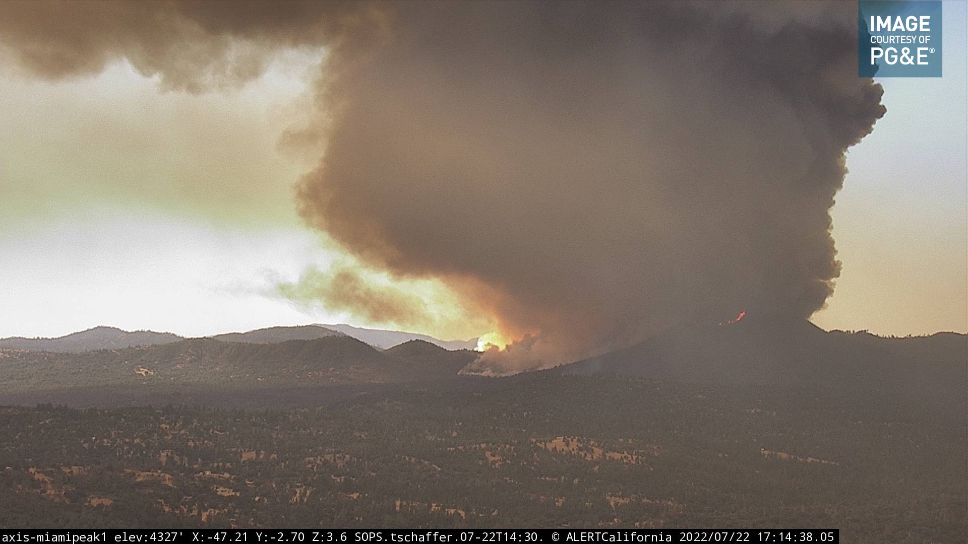
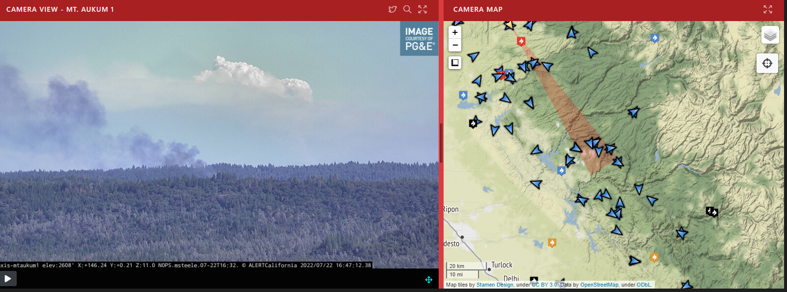
It’s past that area now and and will be playing a factor, right now it’s on Buckingham mountain which is just barely visible at the base of the column.
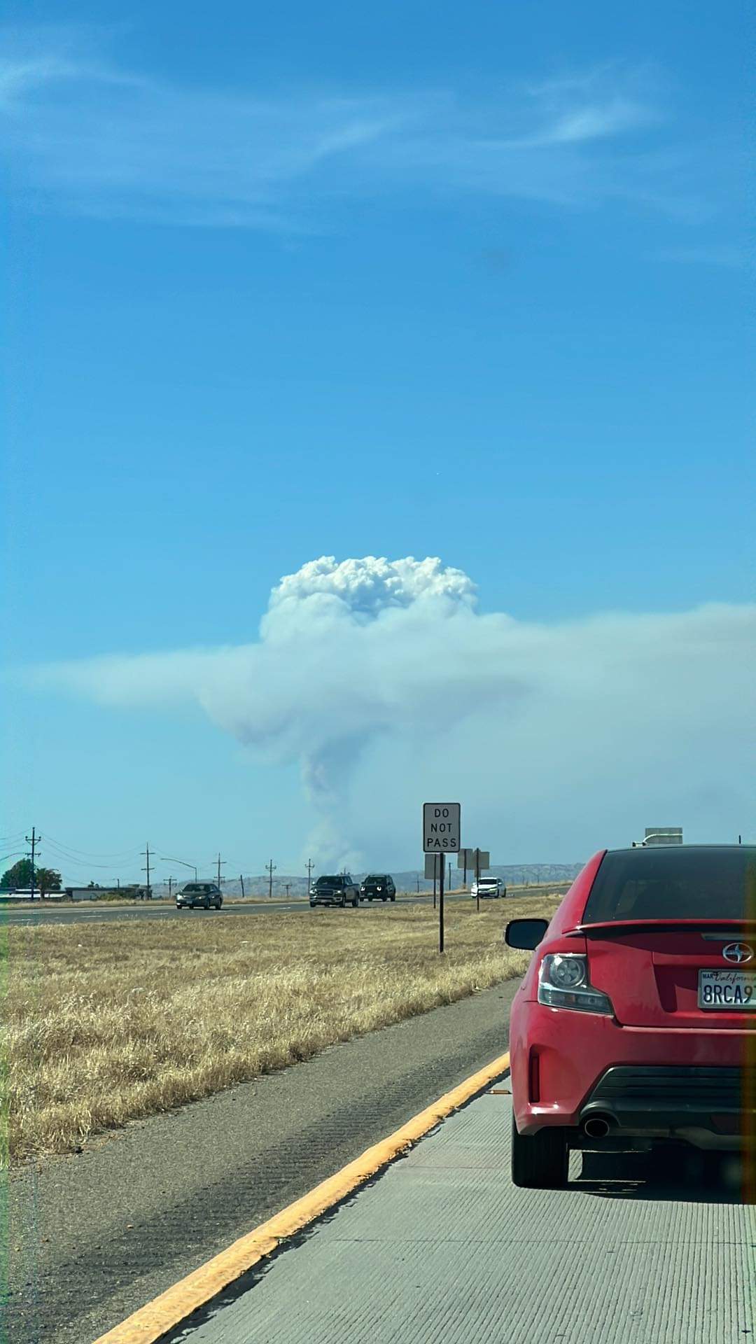
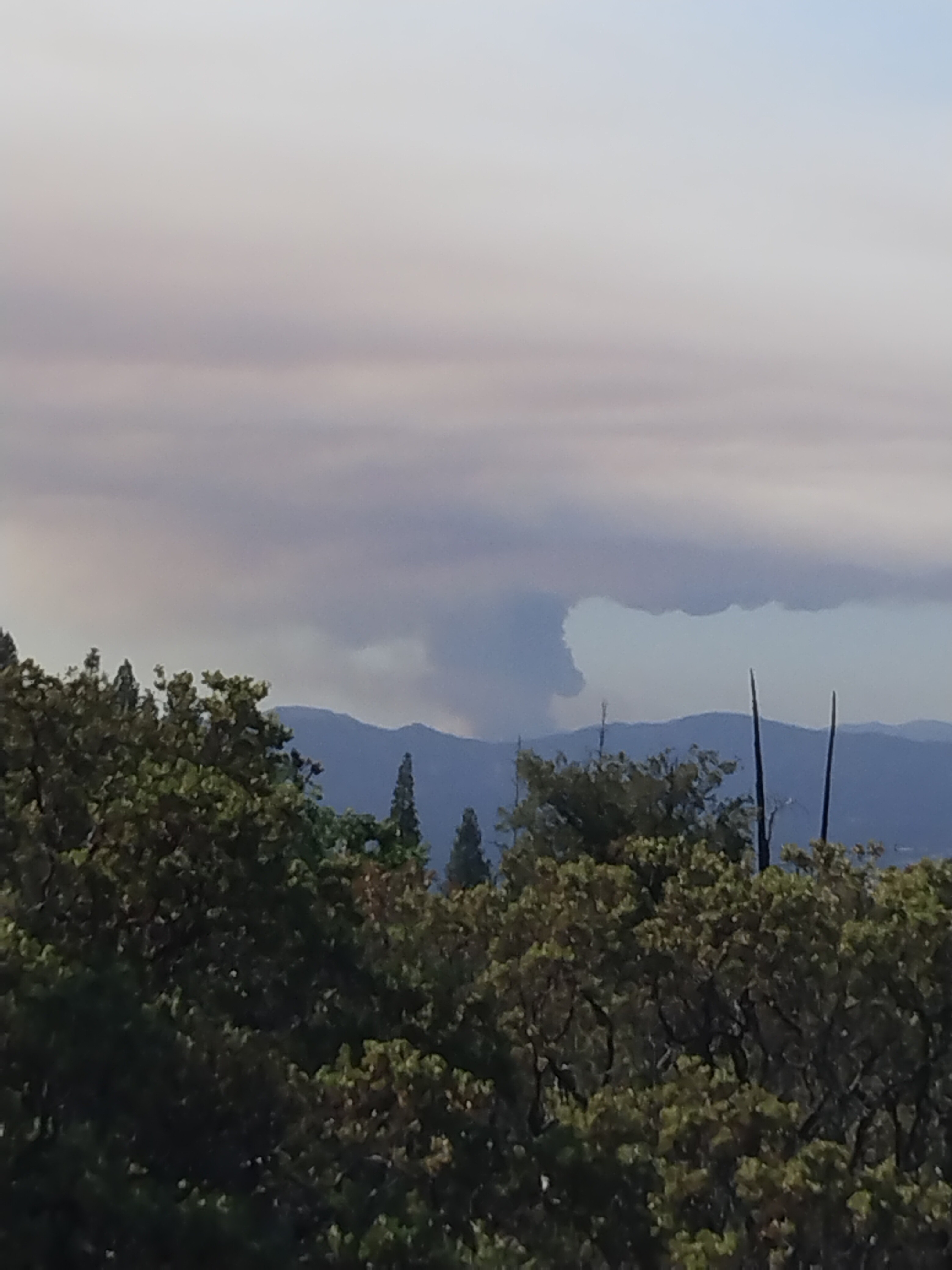
You can see it much further away too from El Dorado County. The fire in the forefront is in Amador County…you can just make out the column of the Oak Fire…at first it looks like clouds.
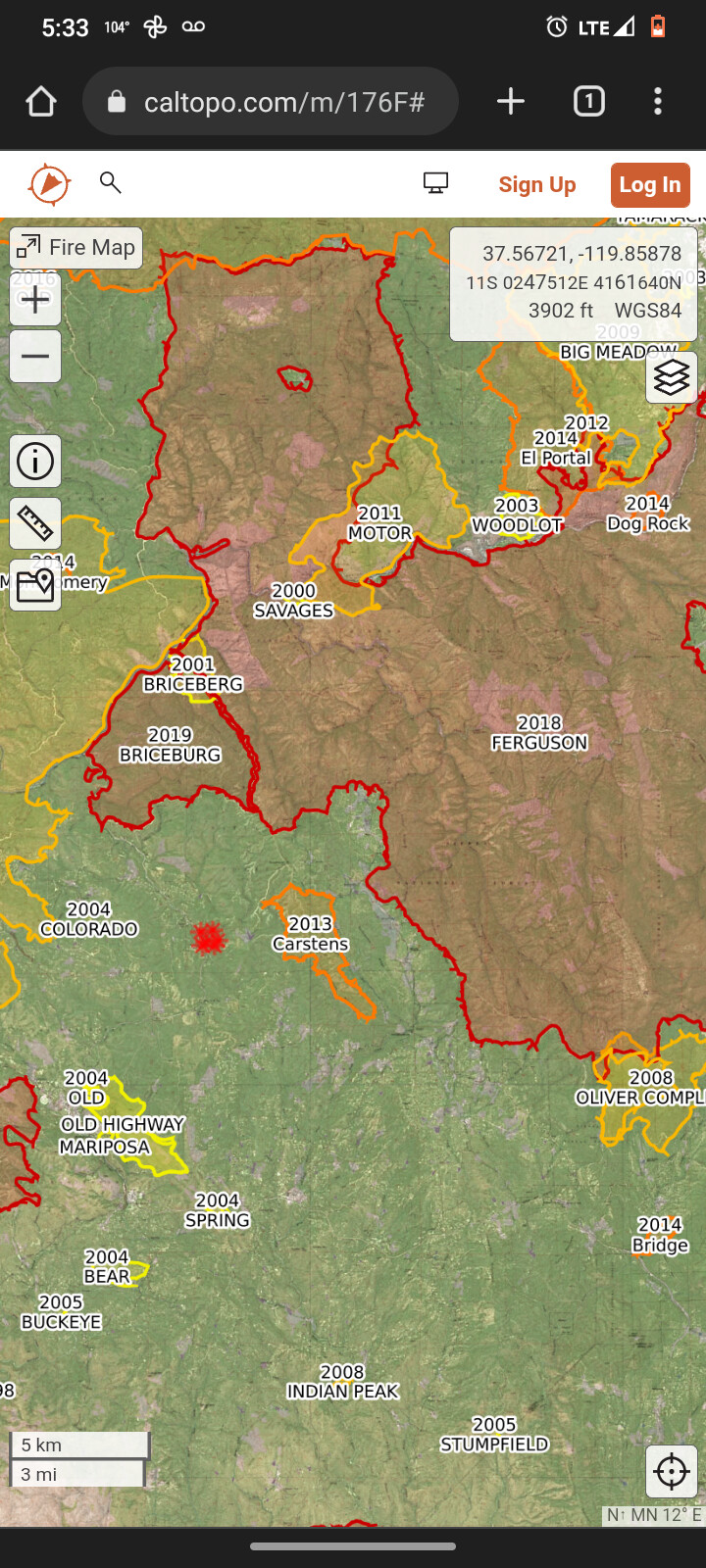
The Ferguson fire was pretty much all on the sierra and Stanislaus national forest except where they held it at highway 41 which isn’t far from the western boundary of the park.