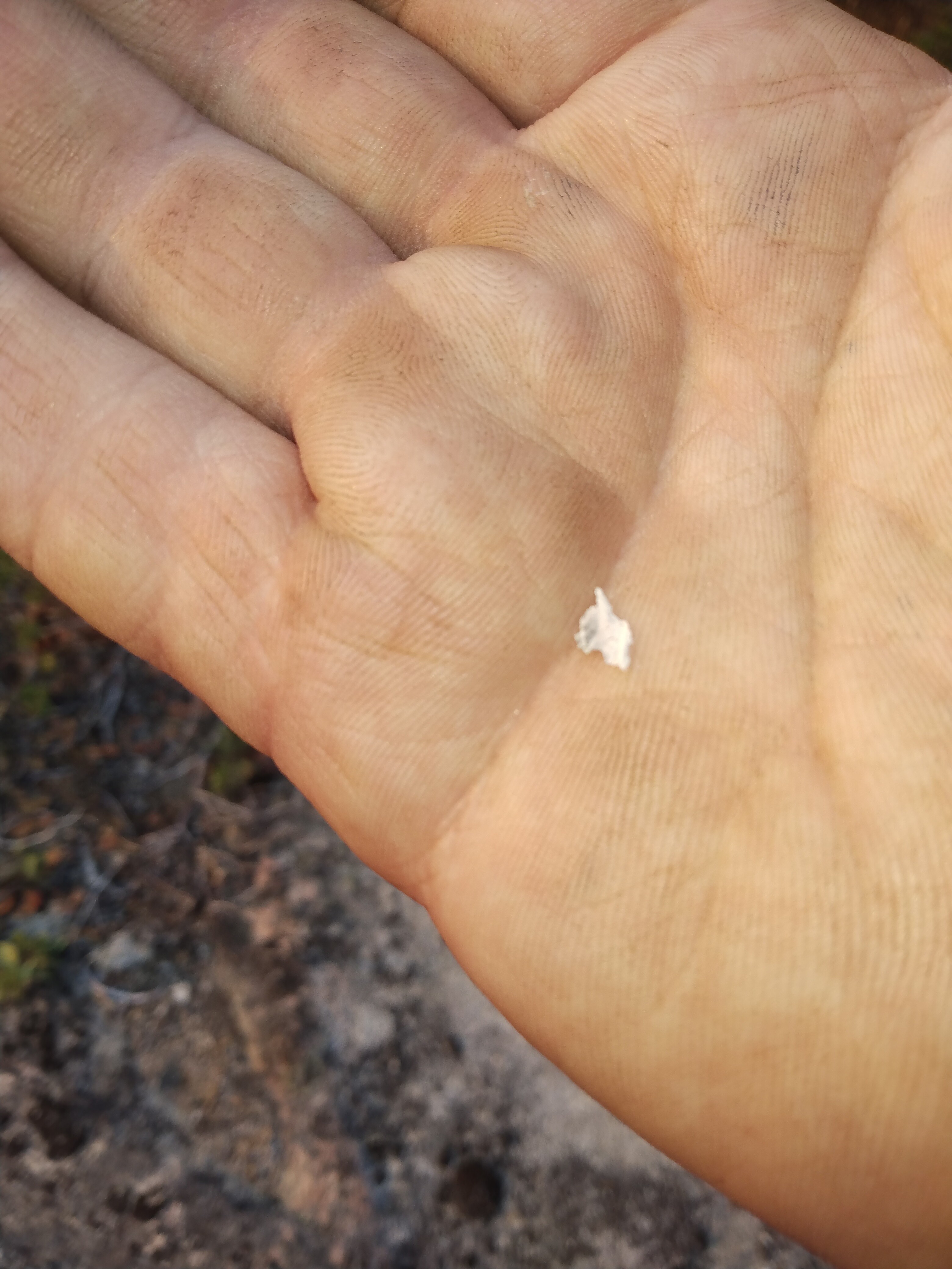
Ash falling in FKU.
6 Likes
Lots of regrowth and a lot of grass in the Ferguson, at least on the Stanislaus
3 Likes
Same way on the sierra side.
2 Likes
Not good…ice cap is visible from Sacramento…be safe
12 Likes
Column definitely dropped quick and is leaning back over triangle road area.
3 Likes
They make there “big resource” order that they were working on yet?
1 Like
Region 5 OES’s being called
9 Likes
Going to impact Lushmeadows soon. crossed snow crk multiple locations. Fire is established on the S side of triangle. Spot across Triangle toward Jerseydale. All unotunit Darrah and Triangle Rd keep heads on a swivel
3 Likes
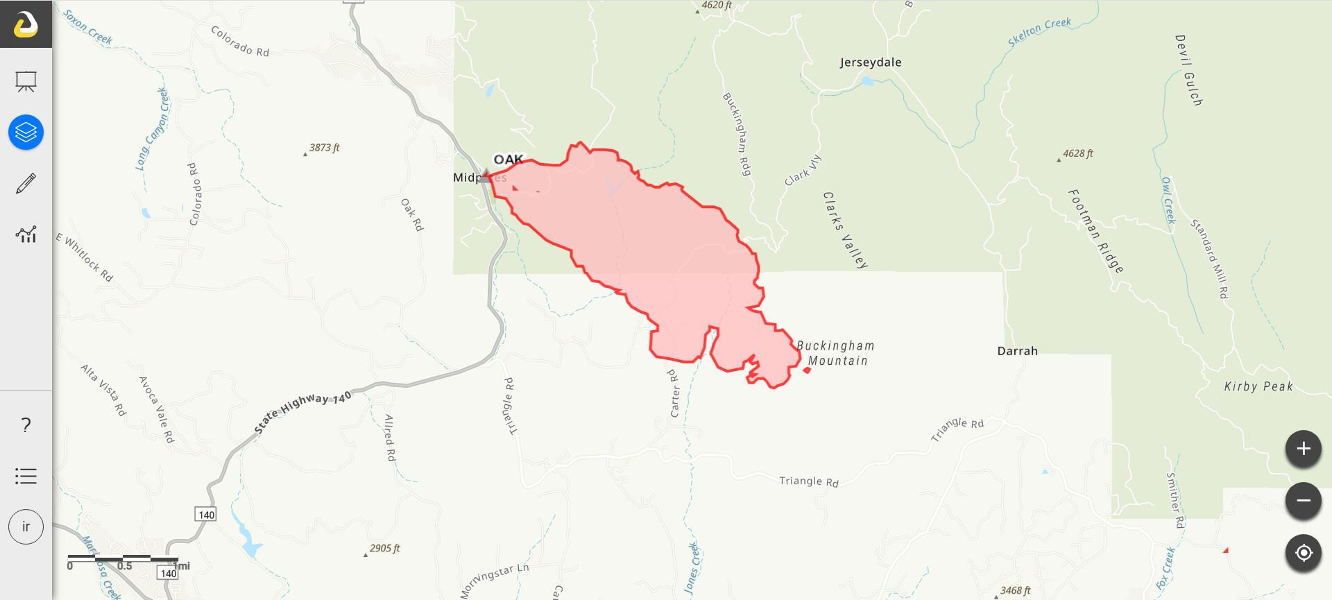
What time was this created? Based on the information from @trishaswcfirewx and what I’m hearing on the scanner the fire is well beyond what your map is showing. It might be good to indicate the time maps are created or when the intel was gathered - particularly when a fire is moving as fast as this one is.
7 Likes
Multiple spots across the Oak creek drainage
2 Likes
@capt9110 that was at 17:10
4 Likes
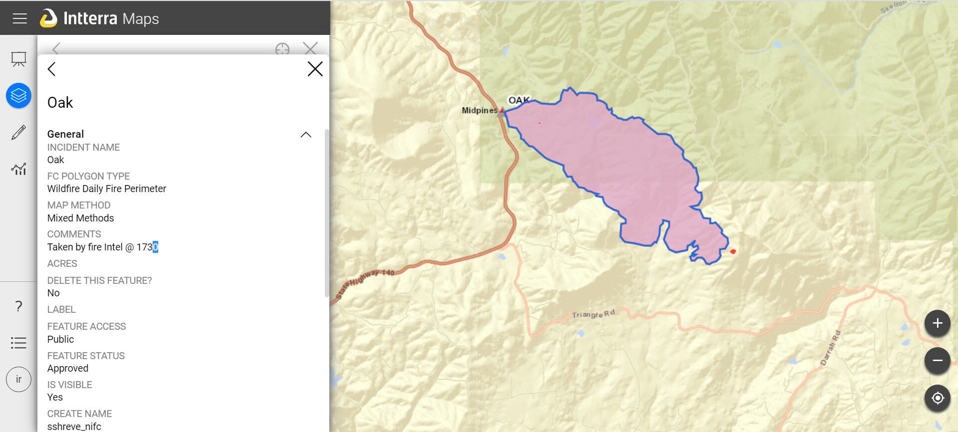
Here is some info on when it was taken. It was taken by fire intel @ 17:30 on 7/22/22. This info is taken from Interra Map, which is from the incident.
3 Likes
Multiple spots on both sides of Carter Rd. Trying to get the heel buttoned up.
U.S. Forest Service - Sierra National Forest is responding in unified command with Cal Fire to the Oak Fire which started on Carstens Road near Highway 140 in the Midpines area of Mariposa County.
All local resources as well as resources from the Wahsburn Incident are responding
Residents are encouraged to sign up for emergency notifications at MSOAlert.com
For updates visit: Oak Fire Incident | Mariposa County, CA - Official Website
Photos of Oak Fire (by Daniel R. Patterson, USFS)
https://www.facebook.com/100064754623337/posts/422262429942241/
3 Likes
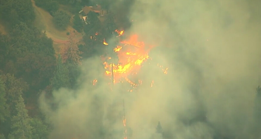
ABC7NEWS is over the fire
3 Likes
For those wanting the perimeters produced by both FIRIS patforms Intel 12 & 24 use this KML Link.
https://atak.s3.us-west-1.amazonaws.com/FIRIS_inputs.kml
This can be put in the geospatial tool of your preference; atak, google earth, caltopo, agol etc etc.
In the meta data of the perimeter is the time it was collected.
5 Likes
Spotting a mile ahead again
Darrah Rd has structures down… Trying to hold Darrah but not much hope for that. Now have multiple spots on the S side of Darrah
All type 1 helos have timed out
No divert has been lifted
6 Likes
Current evac map:
Mariposa County: PUBLIC INFORMATION MAP (arcgis.com)
2 Likes
Ya know I never have been in the fire service (many years LE - and spent many days on the evac routes), but I have been on these groups for decades now (before this one the Hotlist and before that the Yahoo Groups) - and watching this video it STILL amazes me that people in these areas do not keep defensible space around their structures.
ESPECIALLY given the last few years of fire activity in CA.
Wow.
14 Likes