Cal Fire IMT 5 being Activated
10 Likes
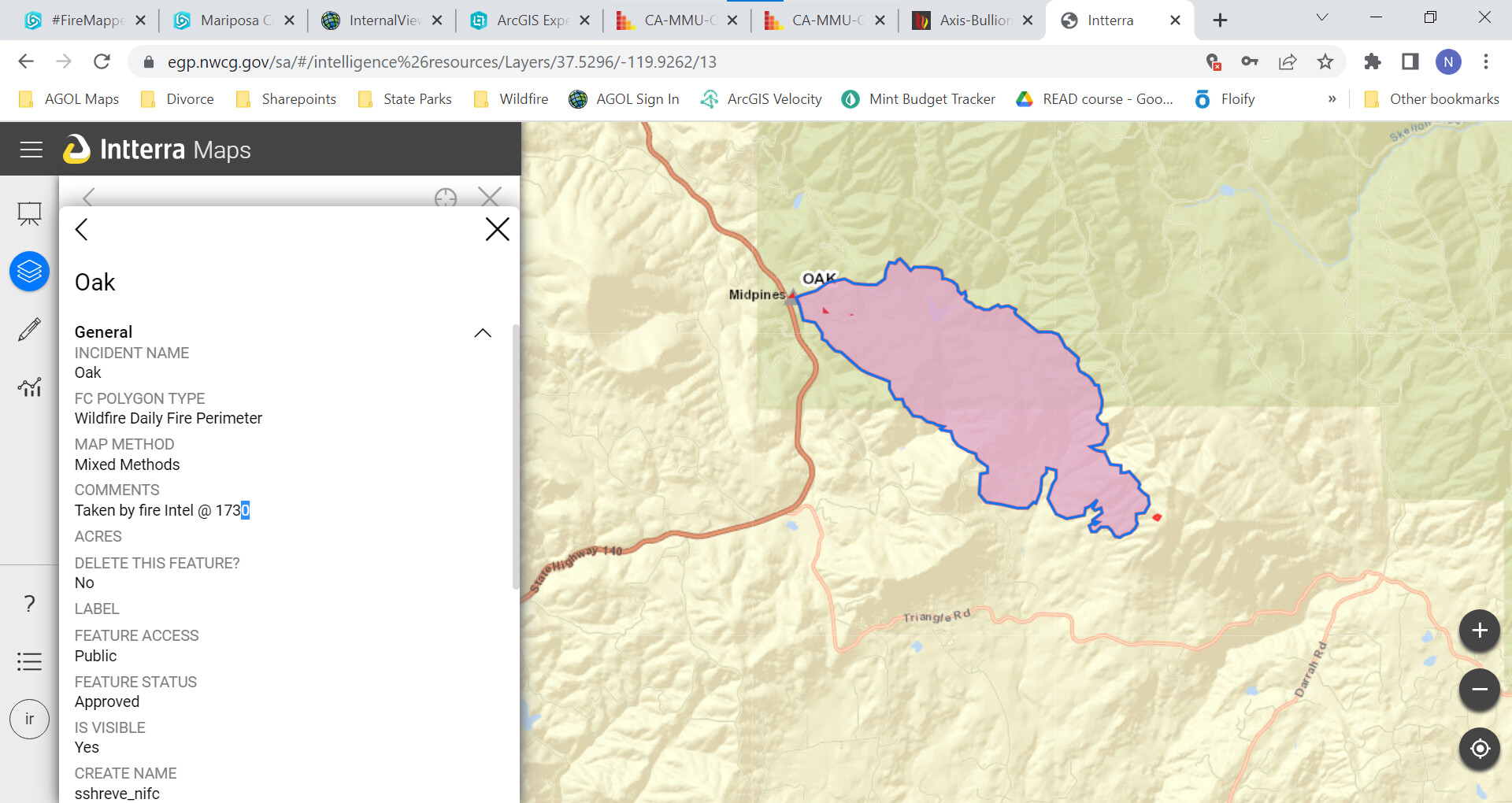
Here is some info on when it was taken. It was taken by fire intel @ 17:30 on 7/22/22. This info is taken from Interra Map, which is from the incident.
3 Likes
ABC Live: Redirecting...
6 Likes
Wind gusting to 20 now.
5 Likes
U.S. Forest Service - Sierra National Forest is responding in unified command with Cal Fire to the Oak Fire which started on Carstens Road near Highway 140 in the Midpines area of Mariposa County.
All local resources as well as resources from the Wahsburn Incident are responding
Residents are encouraged to sign up for emergency notifications at MSOAlert.com
For updates visit: Oak Fire Incident | Mariposa County, CA - Official Website
Photos of Oak Fire (by Daniel R. Patterson, USFS)
https://www.facebook.com/100064754623337/posts/422262429942241/
5 Likes
Spot fire Clouds Rest road being reported by ground crews… tankers see a spot, coming around to check fire eating through drops. Not sure air and ground are seeing the same issues…
2 Likes
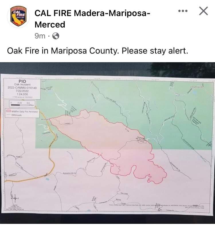
CAL FIRE Incident Management Team (IMT) 5 has been activated to the #OakFire in the CAL FIRE Madera-Mariposa-Merced Unit (MMU).
6 Likes
All aircraft off the incident… Heel is well established… Right flank is the problem area… Moisture coming in tonight will help but still in for a long fight
From AA504
3 Likes
all aircraft off fire…not a real positive view from AA…his hope incoming temp/moist will help…heel of fire is backing down and right shoulder with spots are an issue to deal with.
be safe tonight
6 Likes
Jerseydale RAWS: 1900 7mph out of NW at 328 degrees. Air Temp: 84. Fuel moisture: 3.2. RH: 16%. Recovery: 32%rh in early morning hours. Not much of a recovery.
4 Likes
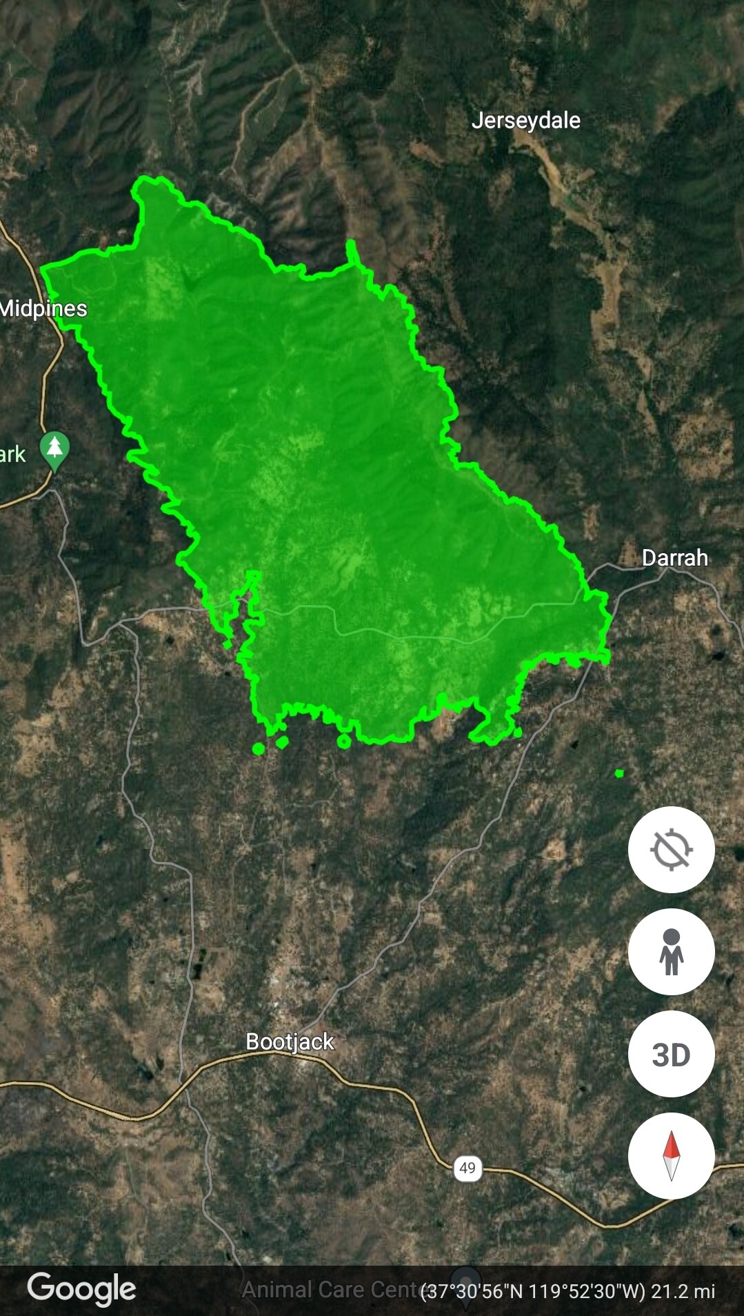
4350 acres
9 Likes
Latest evac map touching Highway 49 just south of Bootjack https://www.arcgis.com/apps/webappviewer/index.html?id=9cdac8da837f4ef3b9abd8d0a67ec7d4&extent=-13361262.4101%2C4505252.4658%2C-13324572.6365%2C4523004.9656%2C102100
4 Likes
Evacuation order issued for Cole and Silva road to 49(bootjack). The fire is established in snow creek/west fork Chowchilla river.
4 Likes
4 Likes


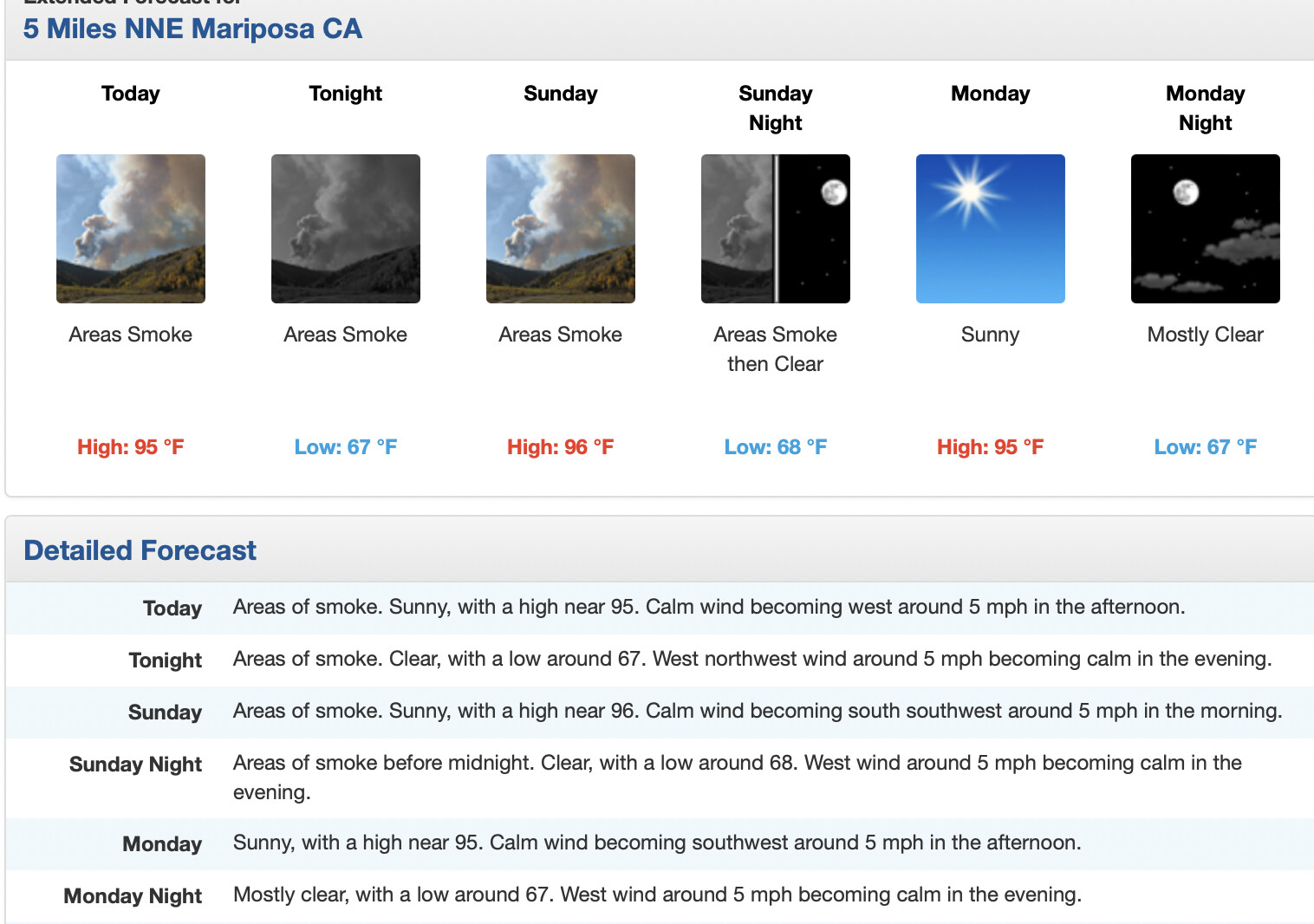
NWS Hanford: Conditions remain warmer than normal across central California but we are not experiencing the widespread excessive heat from earlier this week. A trough of low pressure along the coast has helped to lessen impacts for our area from the high pressure ridge centered near the Four Corners region. Model solutions keep our area on the edge of the high pressure ridge through early next week while a weak cyclonic circulation meanders near the California coast. Dry and warmer than normal conditions will continue in this pattern with temperatures running around 2-6 degrees above normal. This will mean a continuation of widespread triple digit highs in the San Joaquin Valley. Although not as extreme as our recent temperatures, these conditions can still pose a moderate risk of heat related illness for sensitive groups. There is little change in temperature forecasts from Tuesday through the end of next week, as we remain under the influence of the nearby ridge
5 Likes
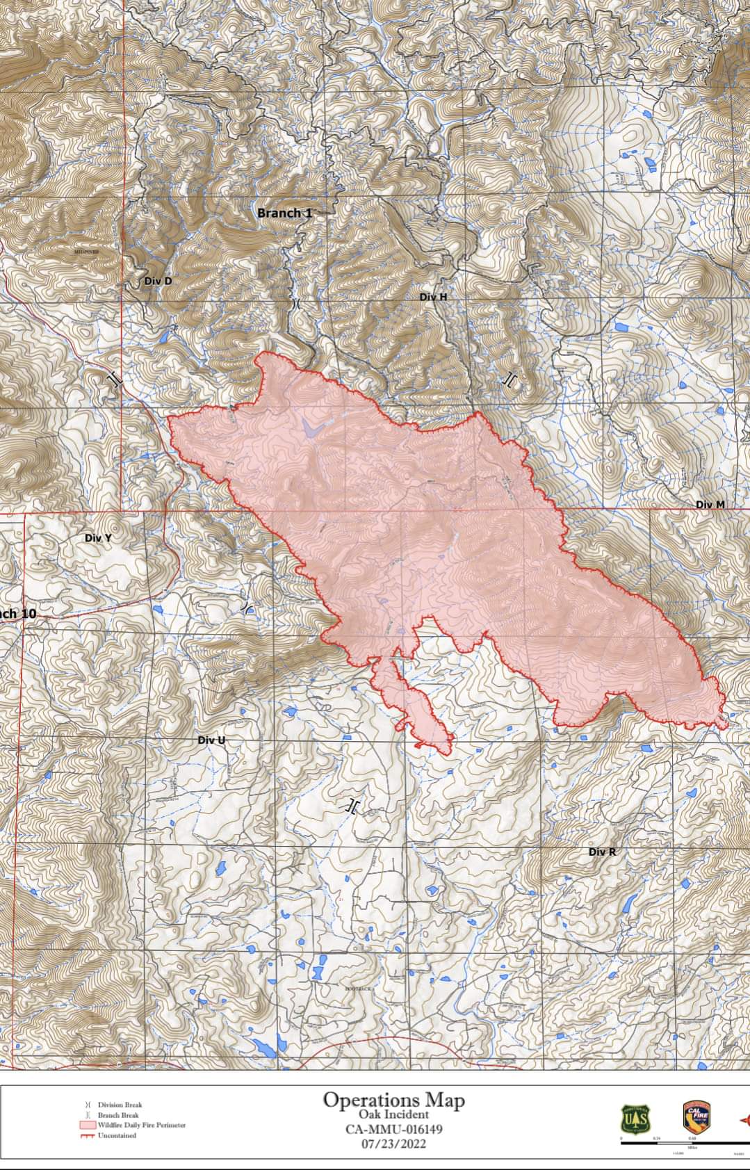
At 7:23 Intel 24 put it at 6,555 acres with a slight run on the right flank towards Triangle Road area.
5 Likes