New fire in MMU, 15 plus acres with structures immediately threatened. Near Lonesome Oak and Rd 620.
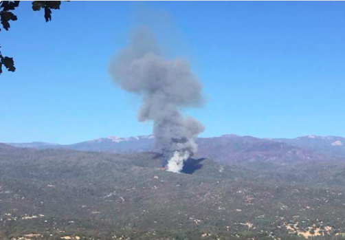
New fire in MMU, 15 plus acres with structures immediately threatened. Near Lonesome Oak and Rd 620.
There’s a lot of fuel out there
Big burn scar to the North.
Is that last year’s Railroad Fire??
Is there an IA post? Can’t find one but system wouldn’t let me post one saying there’s already one posted.
To the East and North in that picture is the Railroad fire scar.
Is it closer to 49 or 41?
I posted one, but can’t find it myself.
Mods, can you find it or delete it, so NBChief can start a new one?
There is but I’m not sure where to see it, by following the lists… here’s a link: CA-MMU-Oak
A little closer to SR 41, but pretty much in the middle of the two highways
Okay, Try now, I found and deleted a post that was in the wrong spot.
Have they closed 620 on either side?
The Fire is now 100 acres.
150 Ac per AA now
Which direction is it moving?
Not sure near 628 was discussion about slope reversal
Any structural damage?
IA thread started. May have missed some info so please update as necessary.
Thats a good sized header.