State ID:CA
3 letter designator:MMU
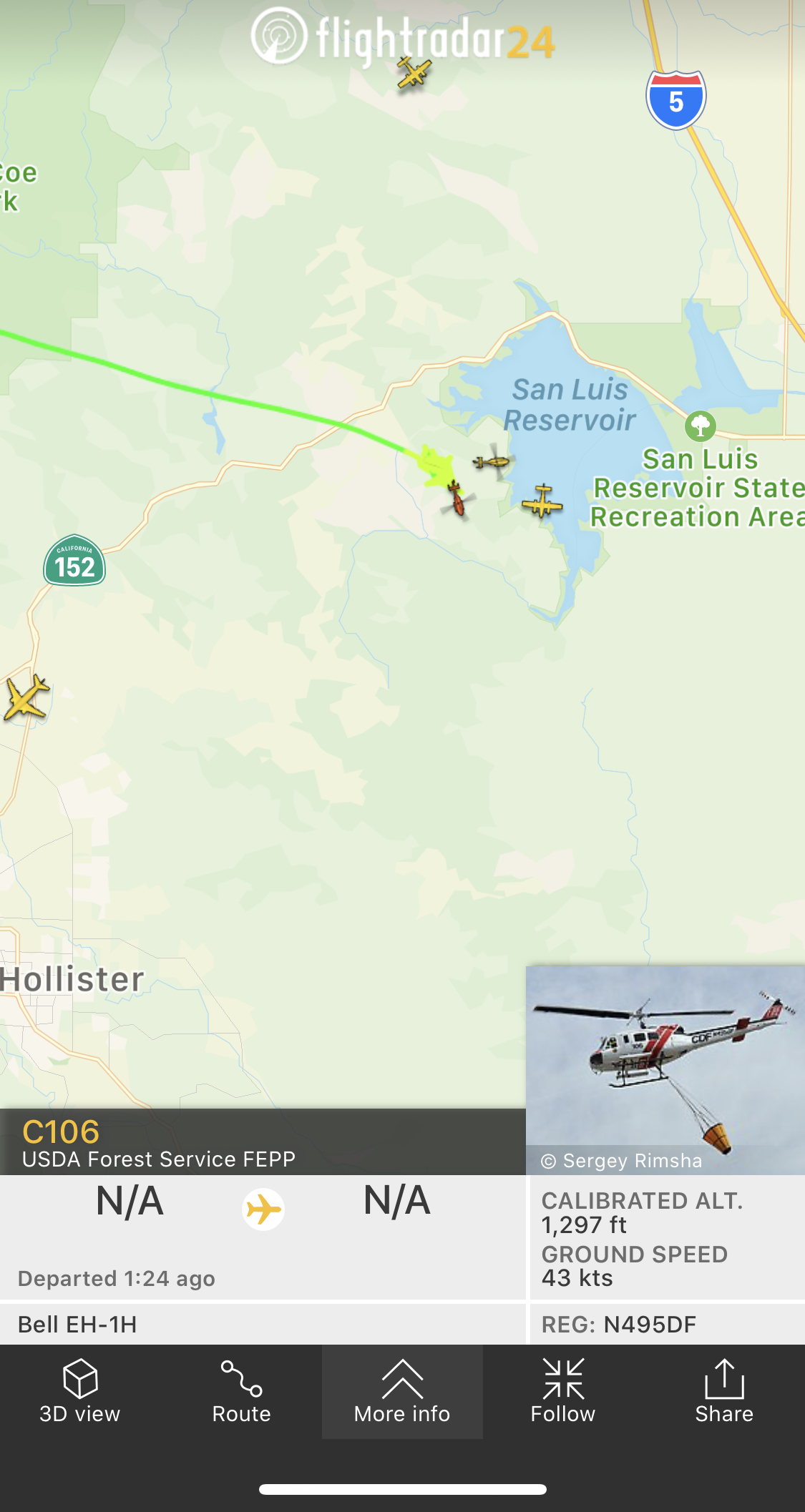
Fire name:Point
Location:14100 Dinosaur Point Rd. x of hwy. 152
Reported acres:20
Rate of spread: rapid
Report on Conditions: 20 in light grass
Structure threat:
Resources: Wildland assignment + 10 type 3 engines and 2 additional dozers
Hazards:
Weather: wind driven out of the west, speed not given
Radio channels: CDF Cmd2
Scanner link:
Webcam link:
Agency Website:
I have heard both “pass ic” and “point ic”.
C406, engines and dozer from BEU enroute.
1 Like
Los Banos raws station:
15mph average and gusts to 38mph
air temp is 69 fuel temp 82
humidity 49%
Acreage up to 40 per AA
Its called the “pass” incident.
2 Likes
4 tankers assigned.
1 Like
Fire is 1,000 acres
5 Likes
Aircraft are still actively flying this incident.
1 Like
1900 acers and 25% containment.
Command has had very light traffic.
1 Like
Los Banos raws station:
15mph average and gusts to 36mph
air temp is 70 fuel temp 78
humidity 46%
or this link: https://wrcc.dri.edu/cgi-bin/rawMAIN.pl?caCLAB
click “daily summary” then “submit” for this days record.
for all raws stations California: https://raws.dri.edu/
2 Likes
The smoke has made it to Tulare county.
http://www.alertwildfire.org/sierra/index.html?camera=Axis-BlueRidge2&v=81e003f
Id say.
Is it out yet?
1 Like
Good chance that is from a fire Kings County is working on the I-5 corridor. Several hundred acres with a hard west wind on it.
Update: KCF incident is now contained at 2040 Acres.
it is very smoky in Fresno so it is making its way down