Awesome, thank you very much 
2 Likes
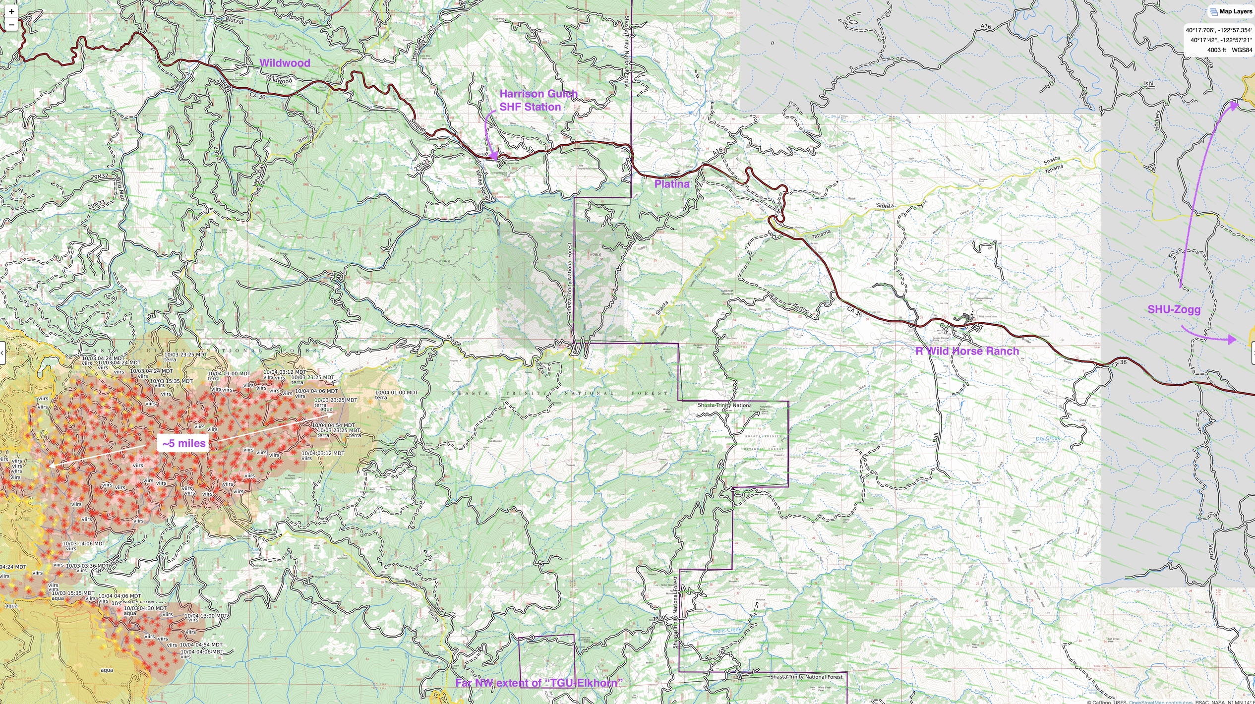
Where is this thing going. Heard rumors it ran over 4 miles toward Platina
4 Likes
That’s what I’m trying to figure out also. Red Bluff woke up to thick smoke and very fresh and heavy ash fall over night. It appears it ran east right through the middle fork of Beegum Creek and has reentered Tehama County (sigh). I was hearing references to Beegum Creek at Beegum Creek Road.
Helco tried getting up and over the fire from Hayfork but had to turn back before reaching 36, can’t fly in the soup. DIV I reporting calm winds and tiny dot for the sun, visibility 0.5 to 0.25 mile visibility.
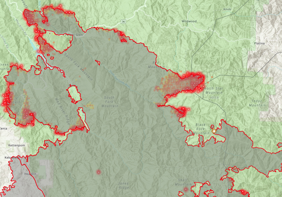
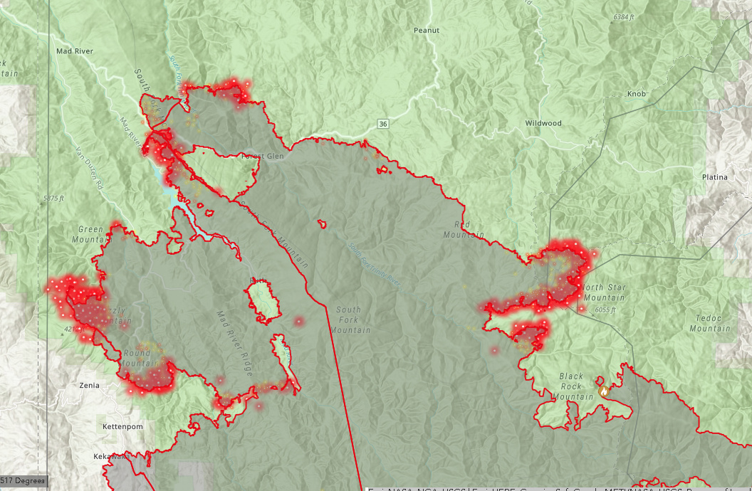
The August has rezoned it appears, South, Northwest and Northeast. The east/west divide is roughly the Southfork Mountain divide (one of the longest continuous ridgelines in North America) with the Trinity River watershed in the NE. Ruth, Mad River and Van Duzen are in the Northwest Zone. South hasn’t changed, nor the CalFire West Zone.
This thing is one south wind event away from a mess at the moment.
5 Likes
There does not appear to be southern wind event in the near future. This may Change as a SW flow starts weekend with a arriving weather front
Onshore flow will bring gradually cooler conditions early this week. Temperatures will start the week largely near normal at the coast, slightly above normal for the immediate coastal valleys and above normal for interior valleys; by Wednesday most of the territory will be near normal, except for the far interior which will be slightly above normal. Onshore flow could be strong enough on Wednesday to bring some drizzle to the coast. By Friday, a shift in the pattern will occur as a front moving into the North will merge with remnant tropical moisture; it is beginning to appear like a good portion of the territory will get some precipitation, especially the North and along the higher elevations of the Sierra, which would significantly reduce fire danger for some time.
11 Likes
High pressure has broken down and onshore flow will continue through the end of the week. This will result in some possible mist or drizzle near the coast tomorrow morning, while dry conditions will exist everywhere else for the next two days. Temperatures will also cool with this flow pattern, and near to slightly below normal temperatures are expected today through Saturday. A weather system is then expected to bring unsettled weather this weekend, with the threat of rain on Friday decreasing, and the threat on Saturday exiting mainly across northern Humboldt and the Shasta Trinity region. As the system exits the region Sunday, breezy northerly winds will develop, and may become offshore Sunday night into Monday. Meteorology will continue to closely monitor this wind threat. Fire danger remains seasonably high as live fuel moisture values are at critical levels in the lower and middle elevations and dead fuel moisture values are at seasonal minimums.
3 Likes
No one’s posted on August complex lately.
Here’s 10/16 update culled from inciweb and others:
Size: 1,030,182 acres (All Zones)
Containment: 78% (All Zones)
Personnel: 3,130 (All Zones
PIO Map NE and NW Zones (10/16)
no PIO map for So Zone on 10/16 (yet). Here is 10/15 map for overall - all 3 zones
Interesting to note: This is Day #61 of this fire (or these fires/complex)! Total acres/60 days = roughly 17,000 per day, for 60 days! Sweet mother of vaporized biomass! 
17 Likes
11 posts were split to a new topic: Post Fire-Salvage Harvest