State ID: CA
3 letter designator: MRN
Fire name: IRVING
Location: Samuel P Taylor State Park, area of Mt Barnabe
Reported acres: 5-7
Rate of spread: MOD
Report on Conditions: 5-7 acres difficult access requiring a long hosely into the fire.
Structure threat: Yes
Resources: MRN/ Local/ CAL Fire
Hazards: Powerlines down
Weather: Costal West Wind 10
Radio channels: MRN LOCAL, VFire 24
Scanner link: https://www.broadcastify.com/listen/feed/13274/web
Webcam link:
Agency Website:
1 Like
It’s MRN-IRVING and on Mt. Barnabe below the lookout in a drainage. Another IA thread started.
Evacuation order Portola Ave, Alamo Way, and I believe Mountain King Road but unsure.
20-30 acres now, Structure threat along Div Z
Addional - 1 Charlie Strike Team, 2 Golfs, 1 Dozer, 2 Div groups.
An evacuation order is in place for Mountain King Rd, Portola Ave and Alamo down to Barranca. Residents in that area should evacuate immediately to the Lagunitas School and wait for further information. Alamo Rd. will be closed until further notice.
Getting hoselays into the base of the fire. Difficult access.
Update, now 30-40 acres.
IC requesting five additional engines, closest available, for structure defense.
IC requesting 15,000’ hose cache. Engines making way in for structure defense.
Air craft order for tomorrow- 1 Air Attack, 2 Tankers, 1 Copter early up if possible 0900
Addional tactical VF25, CDF Tac 1
Strike team 9145C entering the unit.
100 acres 10%
115 acres. 25% contained.
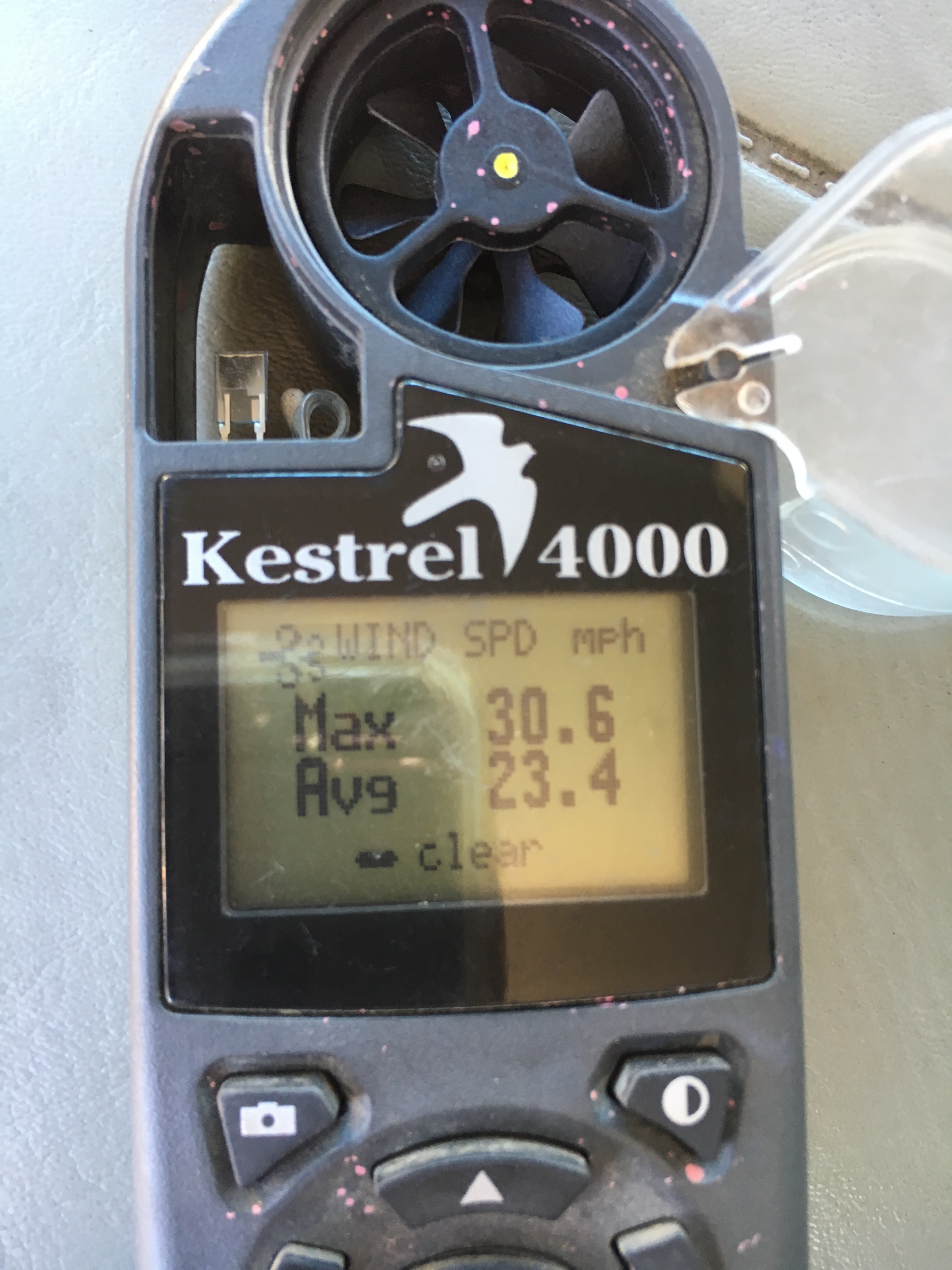
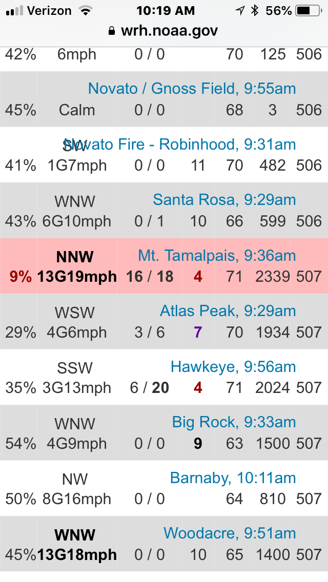
Barnabe RAWS at the bottom of the screen. MT Tam 9 miles to the South has Red Flag conditions but sits at a higher elevation.
.
152 acres. 65% contained. Great stop.