
State ID: CA
3 letter designator: MVU
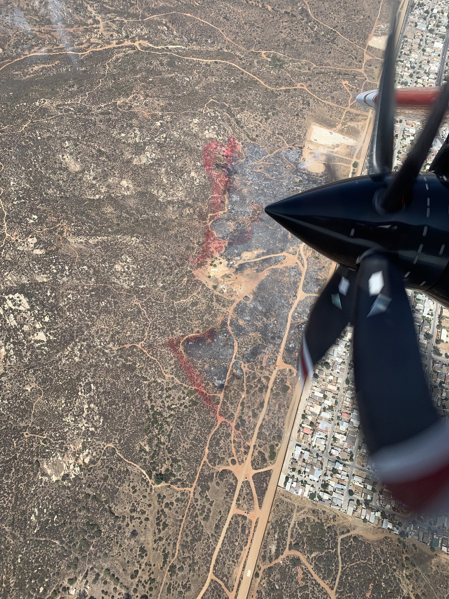
Fire name: BORDER
Location: 23000 blk of Tecate Mission Rd.
Reported acres: 2-3
Rate of spread: moderate
Report on Conditions: IC advising fire is 20 acres and still has a moderate rate of spread. Fire is burning east towards Tecate and along the border.
Structure threat:
Resources:
Hazards:
Weather:
Radio channels:
Scanner link:
Webcam link: ALERTWildfire | SDGE
Agency Website:
3 Likes
Time for some modified fuel suppression, we used to burn the strip between the border and the truck trail.
2 Likes
Multiple vehicles and trailers on fire. It also appears the fire spotted or there is a second fire in the area per some live video.
1 Like
Ongoing problem.if there are kids in area starting new fires then running back across border. 63 please take action
1 Like
Sounds like its just below the Tecate Mission where the yards are. Fire sail report to ECC!!

Fire is boxed in with Retardant, looks like lots of mop up in and around a couple destroyed out buildings and vehicles. Last size update was 60 acres.
2 Likes
Can’t upload the pic, 2 separate fires above the truck trail.
2 Likes
Fire was caused by electrical failure (powerlines down) in Mexico right along the border fence that quickly spread to vegetation on the U.S. side of the border per Cal Fire San Diego on Twitter.
2 Likes
Thats funny since its nothing but dirt 50 feet north of the border fence (dirtroad) .
4 Likes
Kinda looks like you’re slightly over the international border…
2 Likes
Just West of Pilgrams Grove!!
1 Like