State ID: CA
3 letter designator: MVU
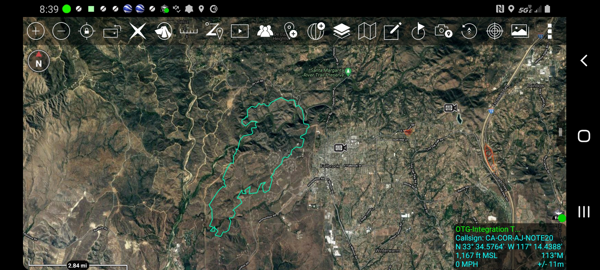
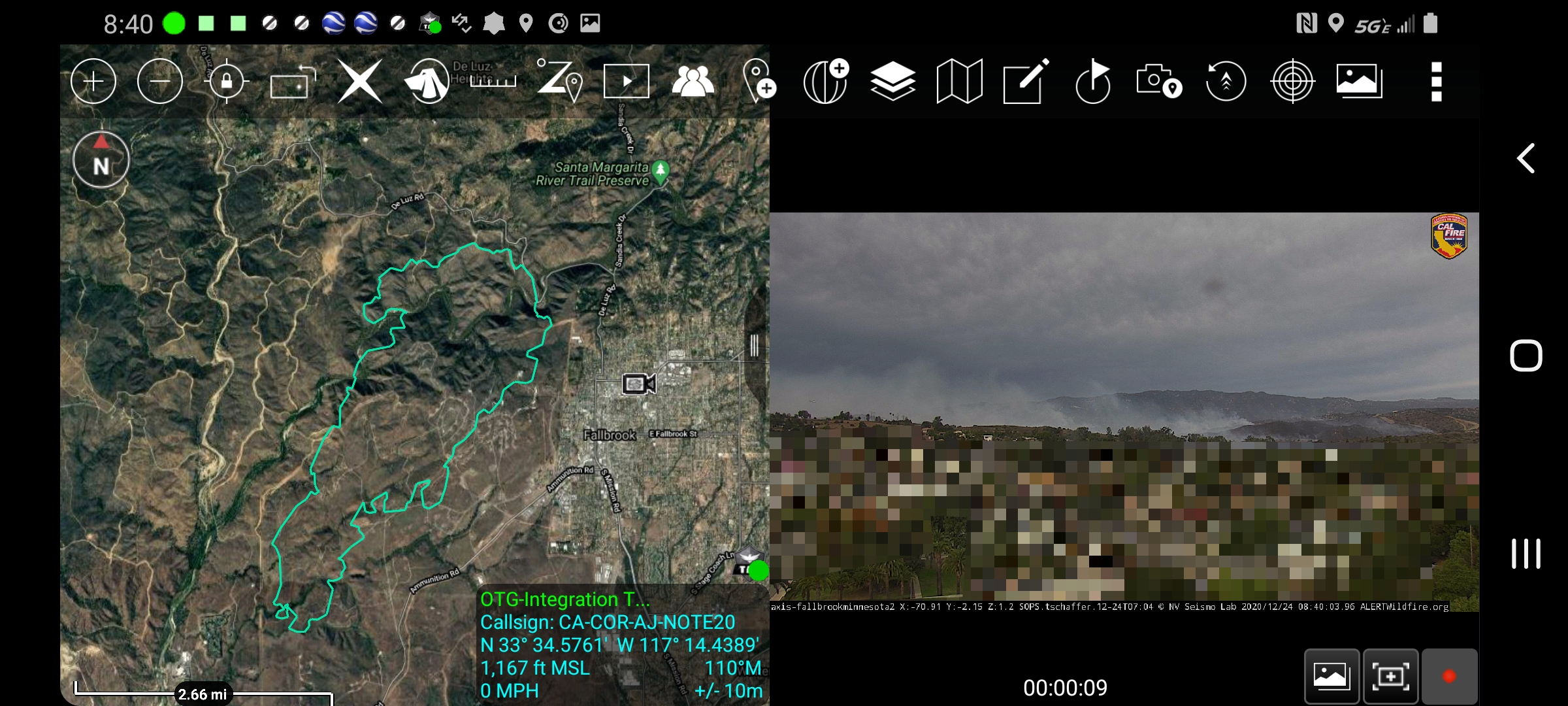
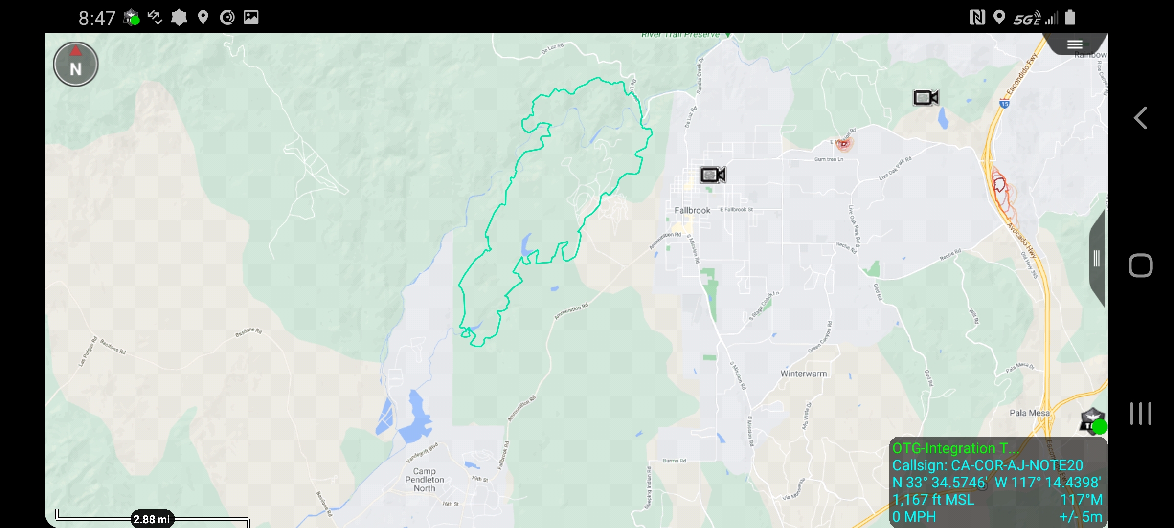
Fire name: Creek
Location: Started at De Luz Rd x Sandia Creek, now on Camp Pendleton Military Base
Reported acres: 3,100
Rate of spread: Critical
Report on Conditions: Brush and grass, CROS, extended attack
Structure threat: Numerous
Resources: CAL FIRE, Camp Pendleton Fire, Multiple agencies throughout SD
Hazards: Powerlines
Weather: 58 degrees, NNE 9 gusts to 16, 12% RH
Radio channels: MVU 2, VFire 22, CDF A/G 1
Scanner link:
Webcam link: http://www.alertwildfire.org/sdge/?camera=Axis-MinnesotaHill1
http://www.alertwildfire.org/sdge/?camera=Axis-RedMtn
http://www.alertwildfire.org/sdge/index.html?camera=-BoucherWest&v=7a7f1bd
http://hpwren.ucsd.edu/cameras/I/rm-w-mobo-c.html
Agency Website: https://mobile.twitter.com/CALFIRESANDIEGO?ref_src=twsrc^google|twcamp^serp|twgr^author