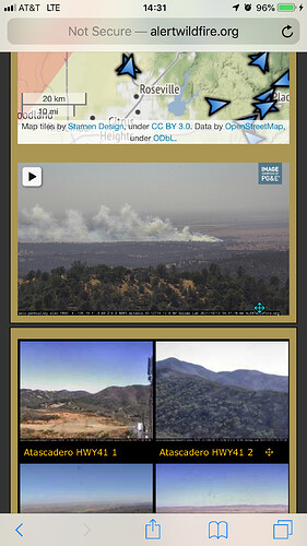
Location: BEALE AIRFORCE BASE with a Rate of spread: RAPID
Where is this? If it on Beale, it’s not NEU jurisdiction. What was the initial size-up? Who is responding?
retweeted by CALFIRE NEU from Beale Air Force Base Twitter Feed:
FIRE NEAR BASE HOUSING UPDATE 2 | OCT 12, 2021 2:42
Parents of Lone Tree Elementary school students are directed to pick up their children.
FIRE NEAR BASE HOUSING UPDATE 1 | OCT 12, 2021 2:35
All children attending the Youth Center have been evacuated to the CAC.
FIRE NEAR BASE HOUSING | OCT. 12, 2021 1:55 P.M.
There’s a fire near base housing. Homes West of Camp Beale Hwy are being evacuated.
Evacuation points are the Harris Fitness Center and Recce Point Club.
Location appears to be ‘Beale Heights’ on base, Spencerville Rd aka Camp Beale HIghway, cross Gavin Mandery. Approximate GPS for area is 39.10003, -121.33617 (Google: Google Maps CalTopo: CalTopo - Backcountry Mapping Evolved )
Per Beale Air Attack spread has moderated. Forward progress should be stopped here soon. 2 dozers and the two Beale graders making good progress.
Per ops. Forward progress stopped.

