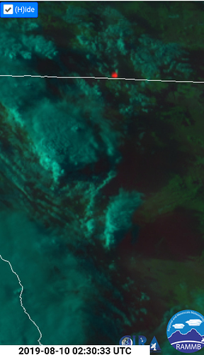
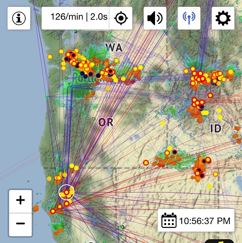
Looks like this is just the start. More cells moving north and forming. All night long and into tomorrow. Where is the T-shirt guy at 2019 Lx siege lololol
I heard west of Dorris one mile into Oregon. So that’s probably it.
Yep AA said NE wind pushing part back towards Cal border
The next wave of convective moisture made landfall from Point Arena( meu) to Southern Humboldt.
Based on satellite ,radar and multiple lightning detection formats. Ukiah valley is taking the brunt with nocturnals beginning to generate.
If the wave continues on same path and stays together. MNF from covelo over into the sac valley will be impacted… Again, if it stays together, TGU and SHU will be in the cross hairs.
Various other independent nocturnal cells generating in the north.
Per Cal Fire Siskiyou Unit’s Facebook page:
CAL FIRE is responding to a lightning fire up highway 3 near the mill creek. Fire is very visible from Yreka. #CALFIRESKU2019 #ReadyForWildfires
Looks like they canceled the response to that. HUU also has Strike team in SKU
A post was merged into an existing topic: CA-SHU Early August Lightning
A post was merged into an existing topic: CA-MEU-August Lightning??
10 KNF fires from yesterday in Wildcad this morning, and I’ve heard them responding to 2 more this morning - Cedar and Grouse. The lightning map shows lots of strikes in the Marble Mountains wilderness, it will be interesting to see if there are more fires up there that no one has eyes on yet. I would imagine they will get air attack up this morning for a recon once the fog clears out. The good news is that the area received quite a bit of rain last night. More thunder predicted for today as well.
Looking on the map. Appears that LMU and LNF are currently under some strong cells.

