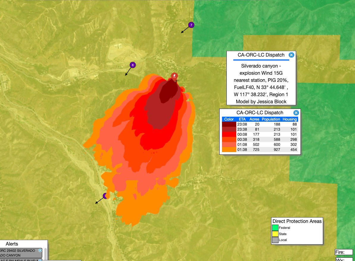
State ID: CA
3 letter designator: CNF
Fire name: Bond
Location: 29402 Silverado Canyon; Silverado, CA
Reported acres: 1
Rate of spread: rapid
Report on Conditions: structure fire extended into the brush.
Structure threat:
Resources: CNF, ORC, HT47
Hazards:
Weather: Red Flag Warning
Radio channels:
Live Video: https://www.nbclosangeles.com/news/local/house-fire-in-silverado-canyon-threatens-nearby-brush/2475948/
Scanner link: https://www.broadcastify.com/webPlayer/23313
Webcam link: http://www.alertwildfire.org/orangecoca/index.html?camera=Axis-PleasantsWest1&v=7a7f1b9
http://www.alertwildfire.org/orangecoca/index.html?camera=Axis-SantiagoWest&v=7a7f1b9
Agency Website:
2 Likes
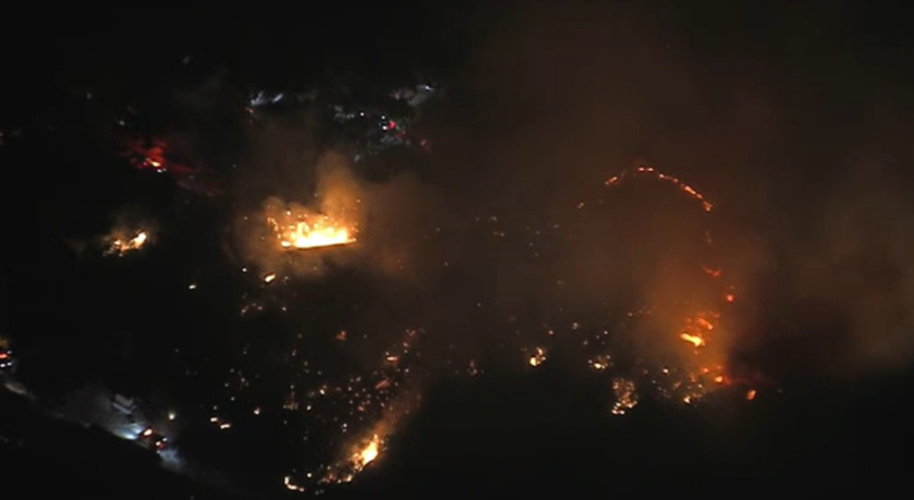
The fire just hit the steep slope and its gone and spotting. Looks to be 100+ nightime acres
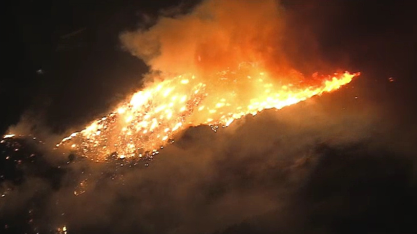
Fire is now moving into Williams Canyon. Will hit the Silverado Fire scar. Extreme fire behavior.
7 Likes
Bond IC: Immediate Need:
4 - Type 3 S/T’s
3 - Type 1 S/T’s
4 - Crew S/T’s
3 additional dozers (5 total)
4 Likes
Immediate structure threat on Jackson Ranch Rd off Santiago Canyon Rd - about a mile & a half south of the original structure fire location.
1 Like
1,070 acres
3 Likes
500 acres per d4
1 Like
2 Likes
Changed this to be a OCFA fire. OCFA and CNF are in Unified Command, however, OCFA is the UOP. Additionally, CNF Wildcad shows this to be a Mutual Aid fire for them
02:00 Update OCFA Management Team 3 is now in control of the fire.
4 Likes
XLC-1205A ENROUTE E71 (ALH) E106 (ARC) E61 (MPK) E101 (MRV) E91 (SNM) STEN BC105 (ARC) STEN-T BC9 (SNM)
XLC-1202A ENROUTE E12 (BRK) E16 (BRK) E22 (GLN) E31 (PAS) E34 (PAS) STEN BC1 (BRK) STEN-T BC3 (PAS)
1 Like
Reported around 1500 acres 5 hours ago.
1 Like
Per aircraft mapping, roughly 3,600 acres
6 Likes
Rumor has it that CALFIRE Team 4 is headed South.
3 Likes
That makes sense
Type 1 Long Team on order.
Gone from a Type 3 AH Orange County team to a Type 1 team in less than 8hr😳
5 Likes
Fire on both sides of Hwy 241 now - not sure how much of this is in the footprint from last fire in this area.
2 Likes
Patio is covered in ash about 13 air miles SSW from the fire this morning. Thick haze permeates the OC coastal plain, AQI at 100+ in many areas. I measured an AQI of 220 in Irvine at 0400.
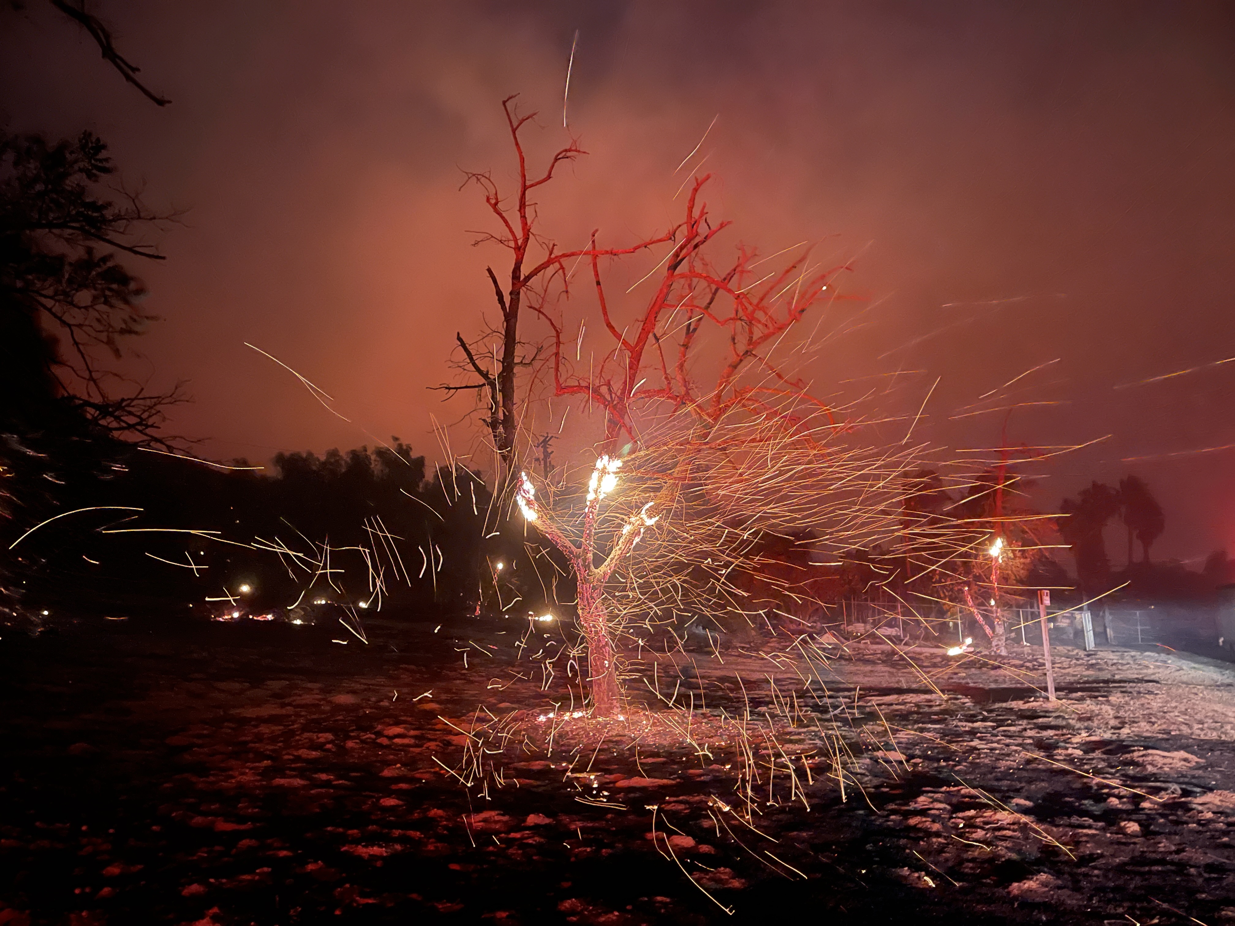
Quick image from last night on a property off Santiago Canyon, near intersection of Williams Canyon, showing the strong winds and ember cast/spotting potential. Huntington Beach FD engine did work protecting a hardened home with fantastic brush clearance, likely saving it. Saw numerous vehicles and minor outbuildings destroyed, but no structures (there are reports of damage).
IMG_3343.JPG
8 Likes
7200 acres per OCFA PIO. Fire jumped the 241, but sounds like they picked up the spots that jumped over 241.
6 Likes
AA ordered 2 additional tankers as well as relief AA and lead.
4 Likes
Tankers 12, 15, 22, 41, 78, 85, 103 are the aircraft I believe that are working this incident.
Tankers 94, and 95 just returned to Hemet and I suspect one of them will fill the type 3 order placed by air attack not long ago.
Copter 404 from Columbia is heading to Southern California, Not sure if to this fire or prepo.
3 Likes
Bravo 55, and AA 12 are the relief AA for the Bond Incident.
AA still hasn’t gotten a fill on the 2 tankers he ordered at around 13:00, 50 minutes ago. The order was for 1 LAT and 1 Type 3.
South Ops stating there is a LAT is Fresno. AA confirming he wants the LAT from Fresno.
3 Likes